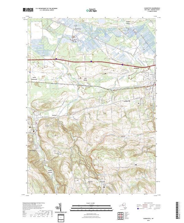
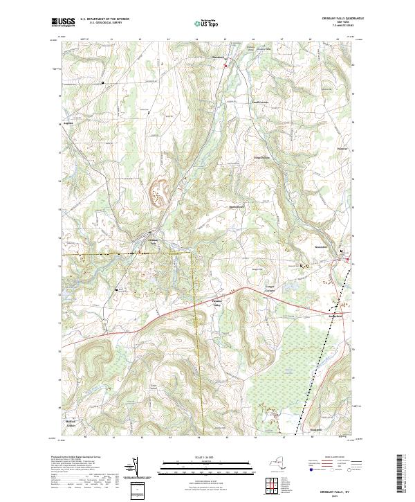
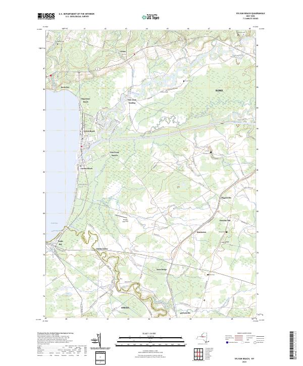
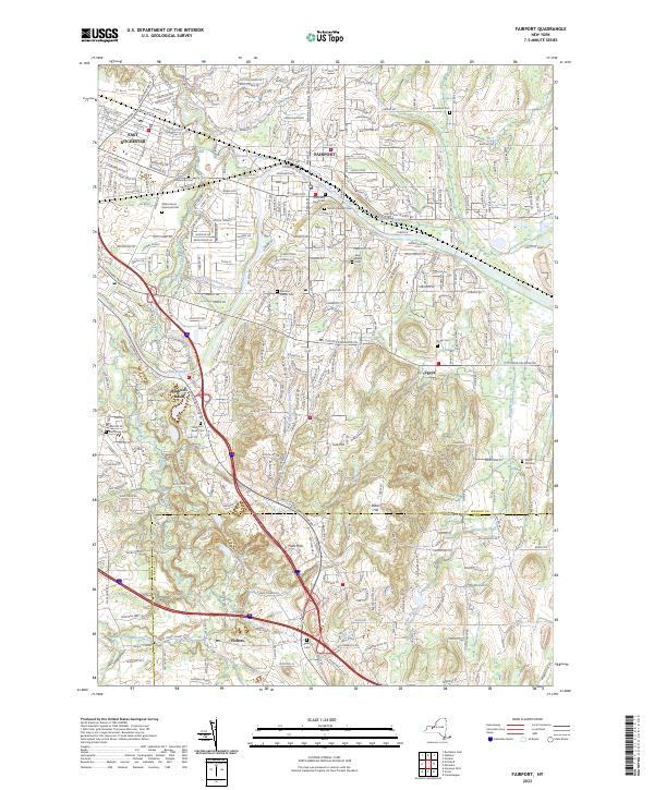
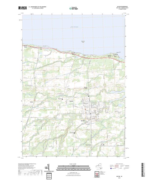
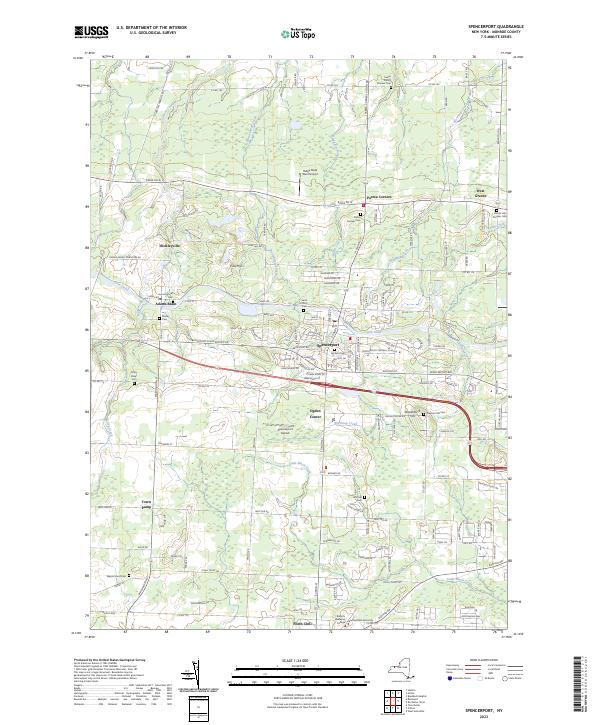
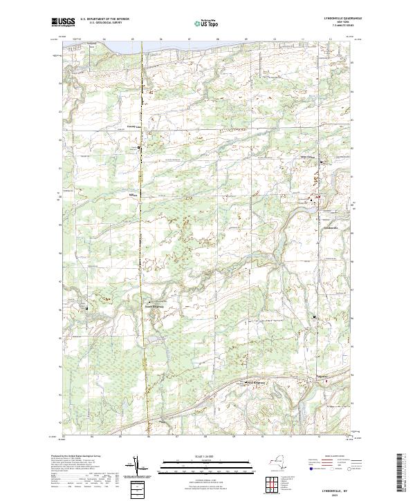
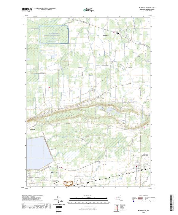
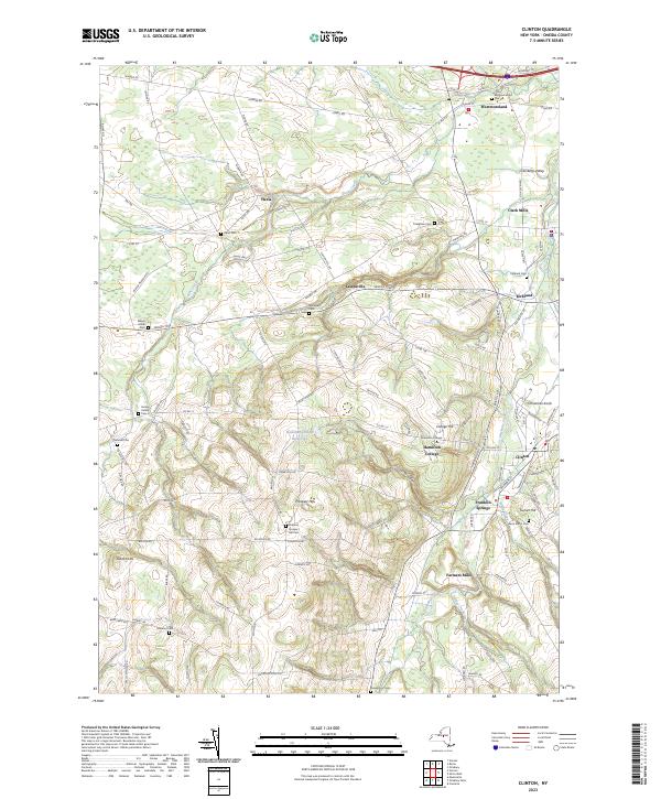
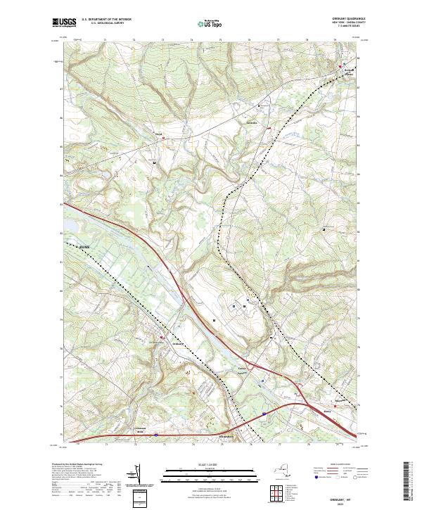
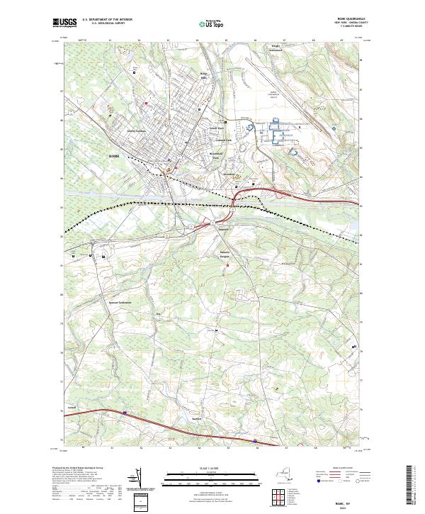
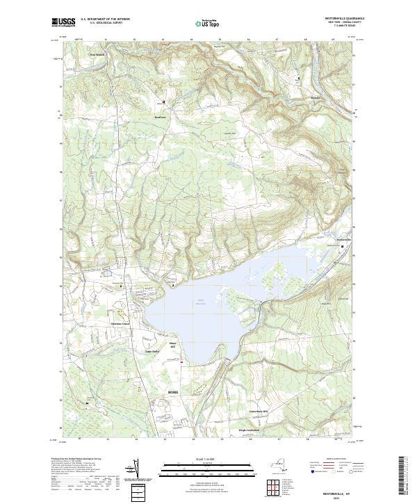
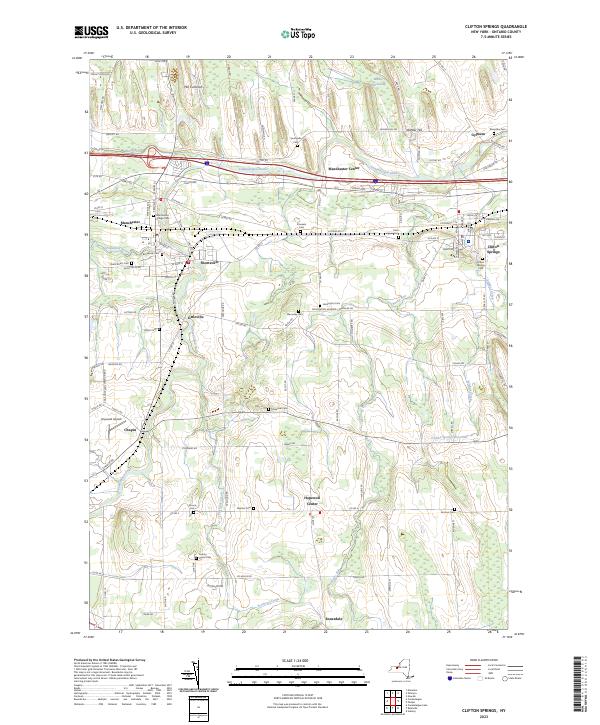
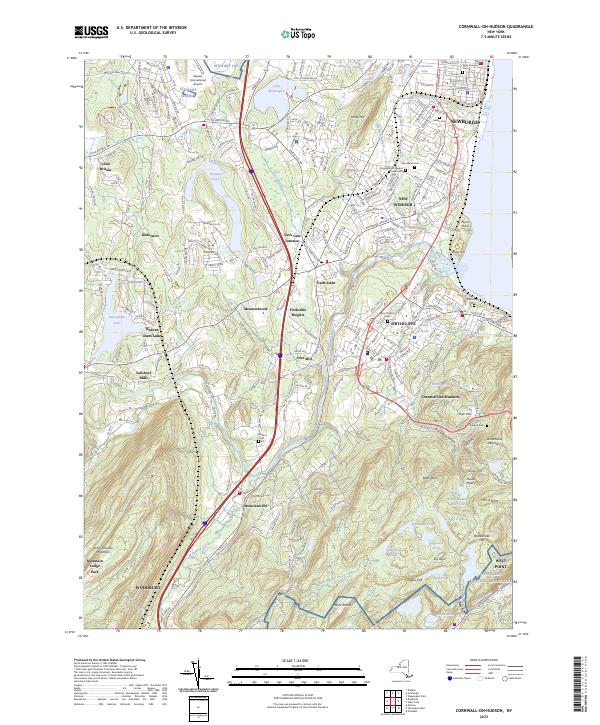
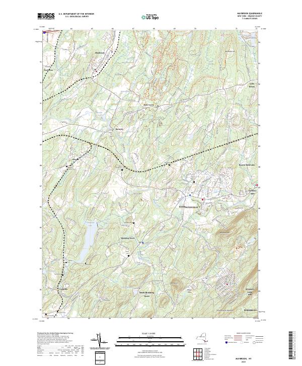
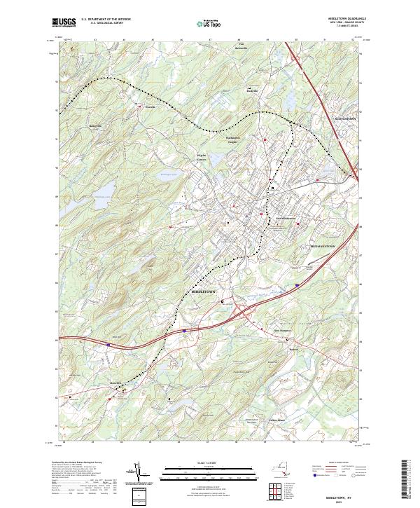
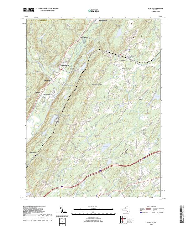
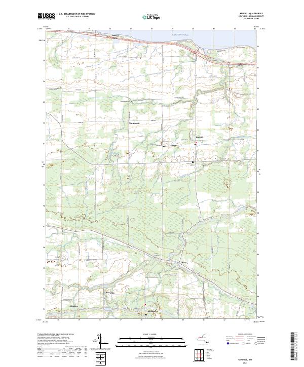
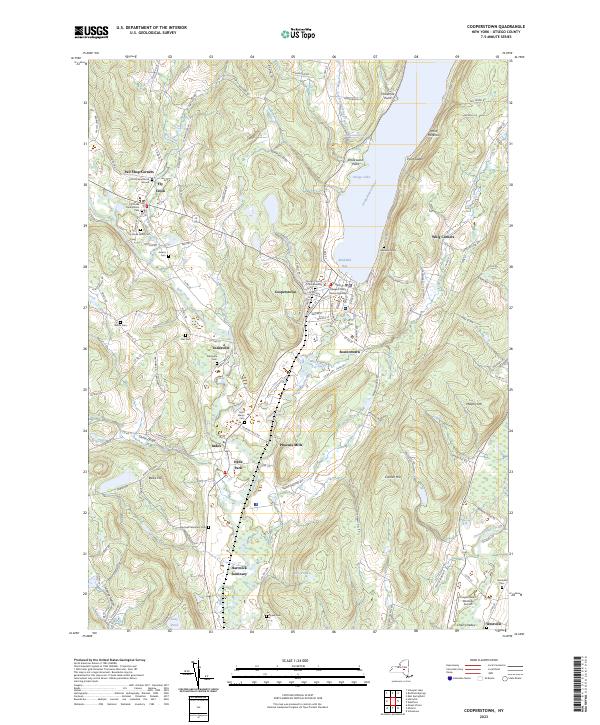
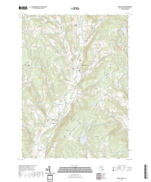
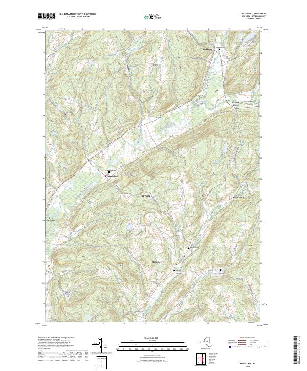
Search Results for: johnstown new york

Boards of Cooperative Education Services (BOCES)

Boards of Cooperative Education Services (BOCES)
BOCES Districts
Broome-Delaware-Tioga Binghamton City, Chenango Forks, Chenango Valley, Deposit, Harpursville, Johnson City, Maine-Endwell, Newark Valley, Owego-Apalachin, Susquehanna Valley, Tioga, Union-Endicott, Vestal, Whitney Point, Windsor
Capital Region Albany City, Berne-Knox-Westerlo, Bethlehem, Burnt Hills-Ballston Lake, Cobleskill-Richmondville, Cohoes City, Duanesburg, Green Island, Guilderland, Menands, Middleburgh, Niskayuna, North Colonie, Ravena-Coeymans-Selkirk, Rotterdam-Mohonasen, Schalmont, Schenectady City, Schoharie, Scotia-Glenville, Sharon Springs, Shenendehowa, South Colonie, Voorheesville, Watervliet City
Cattar-Allegany-Erie-Wyoming Allegany-Limestone, Andover, Belfast, Bolivar-Richburg, Cattaraugus-Little Valley, Cuba-Rushford, Ellicottville, Fillmore, Franklinville, Friendship, Genesee Valley, Hinsdale, Olean City, Portville, Randolph, Salamanca City, Scio, Wellsville, West Valley, Whitesville, Yorkshire-Pioneer
Cayuga-Onondaga Auburn City, Cato-Meridian, Jordan-Elbridge, Moravia, Port Byron, Skaneateles, Southern Cayuga, Union Springs, Weedsport
Clinton-Essex-Warren-Washing Ausable Valley, Beekmantown, Boquet Valley, Chazy, Crown Point, Keene, Moriah, Northeastern Clinton, Northern Adirondack, Peru, Plattsburgh City, Putnam, Saranac, Schroon Lake, Ticonderoga, Willsboro
Delaw-Chenango-Madison-Otsego Afton, Bainbridge-Guilford, Delaware Academy Csd At, Downsville, Franklin, Georgetown-South Otselic, Gilbertsville-Mount Upton, Greene, Hancock, Norwich City, Otego-Unadilla, Oxford Academy &, Sherburne-Earlville, Sidney, Unadilla Valley, Walton
Dutchess Arlington, Beacon City, Dover, Hyde Park, Millbrook, Northeast, Pawling, Pine Plains, Poughkeepsie City, Red Hook, Rhinebeck, Spackenkill, Wappingers
Eastern Suffolk Amagansett, Bay Shore, Bayport-Blue Point, Brentwood, Bridgehampton, Brookhaven-Comsewogue, Center Moriches, Central Islip, Connetquot, East Hampton, East Islip, East Moriches, East Quogue, Eastport-South Manor, Fire Island, Fishers Island, Greenport, Hampton Bays, Hauppauge, Islip, Longwood, Mattituck-Cutchogue, Middle Country, Miller Place, Montauk, Mt Sinai, New Suffolk Comn, Oysterponds, Patchogue-Medford, Port Jefferson, Quogue, Remsenburg-Speonk, Riverhead, Rocky Point, Sachem, Sag Harbor, Sagaponack Comn, Sayville, Shelter Island, Shoreham-Wading River, South Country, Southampton, Southold, Springs, Three Village, Tuckahoe Comn, Wainscott Comn, West Islip, Westhampton Beach, William Floyd
Erie 1 Akron, Alden, Amherst, Buffalo City, Cheektowaga, Cheektowaga-Maryvale, Clarence, Cleveland Hill, Depew, Frontier, Grand Island, Hamburg, Hopevale Ufsd At, Kenmore-Tonawanda, Lackawanna City, Lancaster, Sweet Home, Tonawanda City, West Seneca, Williamsville
Erie 2-Chautauqua-Cattaraugus Bemus Point, Brocton, Cassadaga Valley, Chautauqua Lake, Clymer, Dunkirk City, East Aurora, Eden, Evans-Brant Csd (Lake Shore), Falconer, Forestville, Fredonia, Frewsburg, Gowanda, Holland, Iroquois, Jamestown City, North Collins, Orchard Park, Panama, Pine Valley Csd (South Dayton), Ripley, Sherman, Silver Creek, Southwestern Csd At, Springville-Griffith Inst, Westfield
Franklin-Essex-Hamilton Brushton-Moira, Chateaugay, Lake Placid, Long Lake, Malone, Raquette Lake, Salmon River, Saranac Lake, St Regis Falls, Tupper Lake
Genesee Valley Alexander, Attica, Avon, Batavia City, Byron-Bergen, Caledonia-Mumford, Dalton-Nunda Csd (Keshequa), Dansville, Elba, Geneseo, Le Roy, Letchworth, Livonia, Mt Morris, Oakfield-Alabama, Pavilion, Pembroke, Perry, Warsaw, Wayland-Cohocton, Wyoming, York
Hamilton-Fulton-Montgomery Amsterdam City, Broadalbin-Perth, Canajoharie, Edinburg Common, Fonda-Fultonville, Fort Plain, Gloversville City, Johnstown City, Lake Pleasant, Mayfield, Northville, Oppenheim-Ephratah-St. Johnsville, Piseco Comn, Wells, Wheelerville
Herk-Fulton-Hamilton-Otsego Central Valley Csd At Ilion-, Dolgeville, Frankfort-Schuyler, Herkimer, Little Falls City, Mount Markham, Oppenheim-Ephratah-St. Johnsville, Poland, Richfield Springs, Van Hornesville-Owen D Young, West Canada Valley
Jeffer-Lewis-Hamil-Herk-Oneida Adirondack, Alexandria, Beaver River, Belleville-Henderson, Carthage, Copenhagen, General Brown, Indian River, Inlet Comn, La Fargeville, Lowville Academy &, Lyme, Sackets Harbor, South Jefferson, South Lewis, Thousand Islands, Town Of Webb, Watertown City
Madison-Oneida Camden, Canastota, Hamilton, Madison, Morrisville-Eaton, Oneida City, Rome City, Sherrill City, Stockbridge Valley
Monroe 1 Brighton, East Irondequoit, East Rochester, Fairport, Honeoye Falls-Lima, Penfield, Pittsford, Rochester City, Rush-Henrietta, Webster, West Irondequoit
Monroe 2-Orleans Brockport, Churchville-Chili, Gates-Chili, Greece, Hilton, Holley, Kendall, Spencerport, Wheatland-Chili
Nassau Baldwin, Bellmore, Bellmore-Merrick Central School, Bethpage, Carle Place, East Meadow, East Rockaway, East Williston, Elmont, Farmingdale, Floral Park-Bellerose, Franklin Square, Freeport, Garden City, Glen Cove City, Great Neck, Hempstead, Herricks, Hewlett-Woodmere, Hicksville, Island Park, Island Trees, Jericho, Lawrence, Levittown, Locust Valley, Long Beach City, Lynbrook, Malverne, Manhasset, Massapequa, Merrick, Mineola, New Hyde Park-Garden City Park, North Bellmore, North Merrick, North Shore, Oceanside, Oyster Bay-East Norwich, Plainedge, Plainview-Old Bethpage, Port Washington, Rockville Centre, Roosevelt, Roslyn, Seaford, Sewanhaka Central School, Syosset, Uniondale, Valley Stream 13, Valley Stream 24, Valley Stream 30, Valley Stream Central School, Wantagh, West Hempstead, Westbury
Oneida-Herkimer-Madison Brookfield, Clinton, Holland Patent, New Hartford, Ny Mills, Oriskany, Remsen, Sauquoit Valley, Utica City, Waterville, Westmoreland, Whitesboro
Onondaga-Cortland-Madison Baldwinsville, Cazenovia, Chittenango, Cincinnatus, Cortland City, Deruyter, East Syracuse Minoa, Fabius-Pompey, Fayetteville-Manlius, Homer, Jamesville-Dewitt, Lafayette, Liverpool, Lyncourt, Marathon, Marcellus, Mcgraw, North Syracuse, Onondaga, Solvay, Syracuse City, Tully, West Genesee, Westhill
Orange-Ulster Chester, Cornwall, Florida, Goshen, Greenwood Lake, Highland Falls, Kiryas Joel Village, Marlboro, Middletown City, Minisink Valley, Monroe-Woodbury, Newburgh City, Pine Bush, Port Jervis City, Tuxedo, Valley Csd (Montgomery), Warwick Valley, Washingtonville
Orleans-Niagara Albion, Barker, Lewiston-Porter, Lockport City, Lyndonville, Medina, Newfane, Niagara Falls City, Niagara-Wheatfield, North Tonawanda City, Royalton-Hartland, Starpoint, Wilson
Oswego Altmar-Parish-Williamstown, Central Square, Fulton City, Hannibal, Mexico, Oswego City, Phoenix, Pulaski, Sandy Creek
Otsego-Delaw-Schoharie-Greene Andes, Charlotte Valley, Cherry Valley-Springfield, Cooperstown, Edmeston, Gilboa-Conesville, Hunter-Tannersville, Jefferson, Laurens, Margaretville, Milford, Morris, Oneonta City, Roxbury, Schenevus, South Kortright, Stamford, Windham-Ashland-Jewett, Worcester
Putnam-Northern Westchester Bedford, Brewster, Briarcliff Manor, Carmel, Chappaqua, Croton-Harmon, Garrison, Haldane, Hendrick Hudson, Katonah-Lewisboro, Lakeland, Mahopac, North Salem, Ossining, Peekskill City, Putnam Valley, Somers, Yorktown
Questar Iii (R-C-G) Averill Park, Berkshire, Berlin, Brunswick Csd (Brittonkill), Cairo-Durham, Catskill, Chatham, Coxsackie-Athens, East Greenbush, Germantown, Greenville, Hoosic Valley, Hoosick Falls, Hudson City, Kinderhook, Lansingburgh, New Lebanon, North Greenbush Comn Sd (Williams), Rensselaer City, Schodack, Taconic Hills, Troy City, Wynantskill
Rockland Clarkstown, East Ramapo Csd (Spring Valley), Haverstraw-Stony Point Csd (North, Nanuet, Nyack, Pearl River, Ramapo Csd (Suffern), South Orangetown
Schuy-Steub-Chem-Tioga-Alleg Addison, Alfred-Almond, Arkport, Avoca, Bath, Bradford, Campbell-Savona, Canaseraga, Canisteo-Greenwood, Corning City, Elmira City, Elmira Heights, Hammondsport, Hornell City, Horseheads, Jasper-Troupsburg, Odessa-Montour, Prattsburgh, Spencer-Van Etten, Watkins Glen, Waverly
St Lawrence-Lewis Brasher Falls, Canton, Clifton-Fine, Colton-Pierrepont, Edwards-Knox, Gouverneur, Hammond, Harrisville, Hermon-Dekalb, Heuvelton, Lisbon, Madrid-Waddington, Massena, Morristown, Norwood-Norfolk, Ogdensburg City, Parishville-Hopkinton, Potsdam
Sullivan Eldred, Fallsburg, Liberty, Livingston Manor, Monticello, Roscoe, Sullivan West, Tri-Valley
Tompkins-Seneca-Tioga Candor, Dryden, Groton, Ithaca City, Lansing, Newfield, South Seneca, Trumansburg
Ulster Ellenville, Highland, Kingston City, New Paltz, Onteora, Rondout Valley, Saugerties, Wallkill
Washing-Sara-War-Hamltn-Essex Argyle, Ballston Spa, Bolton, Cambridge, Corinth, Fort Ann, Fort Edward, Galway, Glens Falls City, Glens Falls Comn, Granville, Greenwich, Hadley-Luzerne, Hartford, Hudson Falls, Indian Lake, Johnsburg, Lake George, Mechanicville City, Minerva, Newcomb, North Warren, Queensbury, Salem, Saratoga Springs City, Schuylerville, South Glens Falls, Stillwater, Warrensburg, Waterford-Halfmoon, Whitehall
Wayne-Finger Lakes Canandaigua City, Clyde-Savannah, Dundee, East Bloomfield, Gananda, Geneva City, Gorham-Middlesex Csd (Marcus, Honeoye, Lyons, Manchester-Shortsville Csd (Red, Marion, Naples, Newark, North Rose-Wolcott, Palmyra-Macedon, Penn Yan, Phelps-Clifton Springs, Red Creek, Romulus, Seneca Falls, Sodus, Victor, Waterloo, Wayne, Williamson
Westchester Ardsley, Blind Brook-Rye, Bronxville, Byram Hills, Dobbs Ferry, Eastchester, Edgemont, Elmsford, Greenburgh, Harrison, Hastings-On-Hudson, Irvington, Mamaroneck, Mt Pleasant, Mt Vernon School, New Rochelle City, Pelham, Pleasantville, Pocantico Hills, Port Chester-Rye, Rye City, Rye Neck, Scarsdale, Tuckahoe, Ufsd-, Valhalla, White Plains City, Yonkers City
Western Suffolk Amityville, Babylon, Cold Spring Harbor, Commack, Copiague, Deer Park, Elwood, Half Hollow Hills, Harborfields, Huntington, Kings Park, Lindenhurst, North Babylon, Northport-East Northport, Smithtown, South Huntington, West Babylon, Wyandanch
Andy Arthur, 3/31/23
Data Source: NYS Education Department.

USGS Topographic Maps – Dutchess to Livingston Counties

Counties: Albany to Delaware / Dutchess to Livingston / Madison to Otsego / Putnam to Suffolk / Sullivan to Yates

Browse Topographic Maps: Full State / Historical USGS Topographic Maps

Dutchess County

PDF (50-60 MB Download) Historical USGS Topo Maps State Lands (Links to DEC Website) Towns (Percent of Town’s Area)
Current Amenia GeoPDF Map
1958 Map No. 136605, 1958 Map No. 136606, 1958 Map No. 136607, 1958 Map No. 136608, 1958 Map No. 137065 Wassaic Multiple Use Area, Wassaic Creek Fishing Access Amenia (91%), Dover (2%), Stanford (3%), Washington (18%)
Current Ancram GeoPDF Map
1948 Map No. 136625, 1948 Map No. 710141, 1960 Map No. 136626, 1960 Map No. 136627, 1960 Map No. 137076, 1960 Map No. 710139 Roeliff Jansenkill Multiple Use Area, New Forge State Forest, Doodletown Wildlife Management Area Ancram (16%), Gallatin (80%), Milan (3%), Pine Plains (3%), Taghkanic (36%)
Current Clermont GeoPDF Map
1963 Map No. 137177, 1963 Map No. 137654, 1963 Map No. 137655, 1963 Map No. 137656 NA Clermont (63%), Gallatin (19%), Germantown (21%), Livingston (31%), Milan (21%), Red Hook (30%), Taghkanic (2%)
Current Copake GeoPDF Map
1953 Map No. 137709, 1953 Map No. 137710, 1953 Map No. 137711, 1953 Map No. 137712 Doodletown Wildlife Management Area Ancram (71%), Copake (46%), North East (14%), Taghkanic (3%)
Current Dover Plains GeoPDF Map
1944 Map No. 137886, 1958 Map No. 137890, 1958 Map No. 137891, 1958 Map No. 137892, 1958 Map No. 137893, 1998 Map No. 137336 Swamp River Fishing Access, Swamp River Waterway Access, West Mountain State Forest Amenia (0%), Dover (85%), Washington (1%)
Current Hopewell Junction GeoPDF Map
1957 Map No. 129768, 1957 Map No. 129769, 1957 Map No. 129770, 1981 Map No. 129767 NA Beekman (1%), East Fishkill (74%), Fishkill (14%), Kent (2%), Wappinger (27%)
Current Hyde Park GeoPDF Map
1963 Map No. 130048, 1963 Map No. 130049, 1980 Map No. 130050, 1980 Map No. 130051 Black Creek Waterway Access, Chodikee Lake Wetlands, Crum Elbow Creek Waterway Access, Black Creek State Forest, Crum Elbow Creek Fishing Access Clinton (2%), Esopus (44%), Hyde Park (79%), Lloyd (14%), Rhinebeck (0%)
Current Kingston East GeoPDF Map
1963 Map No. 130035, 1963 Map No. 130036, 1963 Map No. 130037, 1963 Map No. 137296, 1963 Map No. 137298 NA Clinton (0%), Esopus (16%), Hyde Park (1%), Kingston city (52%), Red Hook (15%), Rhinebeck (71%), Ulster (35%)
Current Millbrook GeoPDF Map
1947 Map No. 130580, 1960 Map No. 130583, 1960 Map No. 130584, 1960 Map No. 137450, 1960 Map No. 137451 Wappinger Creek Fishing Access Pleasant Valley (0%), Stanford (28%), Washington (70%)
Current Millerton GeoPDF Map
1955 Map No. 130590, 1955 Map No. 130591, 1955 Map No. 137452, 1955 Map No. 137453 NA Amenia (9%), Ancram (12%), North East (86%), Pine Plains (31%), Stanford (3%)
Current Pawling GeoPDF Map
1945 Map No. 135979, 1958 Map No. 135980, 1958 Map No. 135981, 1958 Map No. 135982, 1958 Map No. 136773, 1998 Map No. 136774 West Mountain State Forest, Great Swamp WMA, Cranberry Mountain WMA Dover (7%), Patterson (26%), Pawling (70%)
Current Pine Plains GeoPDF Map
1948 Map No. 129004, 1960 Map No. 129005, 1960 Map No. 129006, 1960 Map No. 136805, 1960 Map No. 136806 Shekomeko Creek Parking Fishing Access, Lafayetteville Multiple Use Area, Stissing Mountain Multiple Use Area Ancram (1%), Gallatin (1%), Milan (20%), North East (0%), Pine Plains (66%), Stanford (54%)
Current Pleasant Valley GeoPDF Map
1957 Map No. 129049, 1957 Map No. 129050, 1957 Map No. 129051 Taconic Hereford Multiple Use Area Beekman (2%), East Fishkill (1%), Hyde Park (3%), LaGrange (94%), Pleasant Valley (26%), Poughkeepsie (13%), Wappinger (11%)
Current Poughkeepsie GeoPDF Map
1957 Map No. 129158, 1957 Map No. 129159, 1957 Map No. 136830, 1995 Map No. 136831 NA Hyde Park (8%), LaGrange (0%), Lloyd (43%), Marlborough (39%), Poughkeepsie city (100%), Poughkeepsie (70%), Wappinger (2%)
Current Poughquag GeoPDF Map
1948 Map No. 129160, 1948 Map No. 129161, 1960 Map No. 129162, 1960 Map No. 129163, 1960 Map No. 129164, 1960 Map No. 136833 White Pond Multiple Use Area, Depot Hill Multiple Use Area, West Mountain State Forest, Big Buck Mountain Multiple Use Area, Sylvan Lake Waterway Access Beekman (72%), Dover (0%), East Fishkill (24%), Kent (10%), Patterson (5%), Pawling (30%)
Current Rock City GeoPDF Map
1963 Map No. 136098, 1963 Map No. 136099, 1963 Map No. 136866 NA Clinton (35%), Hyde Park (0%), Milan (55%), Red Hook (15%), Rhinebeck (29%), Stanford (8%)
Current Salt Point GeoPDF Map
1963 Map No. 129336, 1963 Map No. 129337, 1963 Map No. 136881 Taconic Hereford Multiple Use Area Clinton (63%), Hyde Park (10%), Pleasant Valley (73%), Stanford (4%), Washington (2%)
Current Saugerties GeoPDF Map
1963 Map No. 129404, 1963 Map No. 136889, 1963 Map No. 136890, 1963 Map No. 136891, 1963 Map No. 136892, 1997 Map No. 136893 Turkey Point State Forest, Tivoli Bays WMA Clermont (33%), Germantown (15%), Red Hook (39%), Saugerties (41%), Ulster (12%)
Current Verbank GeoPDF Map
1946 Map No. 139478, 1960 Map No. 136984, 1960 Map No. 139482, 1960 Map No. 139483 West Mountain State Forest, Taconic Hereford Multiple Use Area Beekman (25%), Dover (5%), LaGrange (6%), Pleasant Valley (1%), Union Vale (100%), Washington (9%)
Current Wappingers Falls GeoPDF Map
1956 Map No. 140039, 1956 Map No. 140040, 1956 Map No. 140041 Stonykill Environmental Education Center, Baxtertown Woods WMA Beacon city (64%), Fishkill (56%), Marlborough (24%), Newburgh city (3%), Newburgh (12%), Poughkeepsie (17%), Wappinger (60%)
Current West Point GeoPDF Map
1941 Map No. 140199, 1947 Map No. 140198, 1957 Map No. 137014, 1957 Map No. 140200, 1957 Map No. 140201, 1957 Map No. 140202 NA Beacon city (36%), Cornwall (8%), Fishkill (29%), Highlands (21%), New Windsor (0%), Newburgh city (4%), Philipstown (63%), Putnam Valley (7%)

Erie County

PDF (50-60 MB Download) Historical USGS Topo Maps State Lands (Links to DEC Website) Towns (Percent of Town’s Area)
Current Akron GeoPDF Map
1949 Map No. 136539, 1951 Map No. 136540, 1951 Map No. 710097 Onondaga Escarpment Unique Area, John White WMA, Tonawanda WMA Alabama (46%), Newstead (17%), Pembroke (24%), Royalton (6%), Tonawanda Reservation (100%), Tonawanda Reservation (100%), Tonawanda Reservation (100%)
Current Angola GeoPDF Map
1960 Map No. 136649, 1960 Map No. 136650 NA Evans (39%)
Current Arcade GeoPDF Map
1966 Map No. 136682, 1966 Map No. 136683 NA Arcade (57%), Freedom (12%), Holland (7%), Java (12%), Sardinia (19%), Yorkshire (14%)
Current Ashford Hollow GeoPDF Map
1964 Map No. 136700, 1964 Map No. 136701, 1964 Map No. 136702, 1964 Map No. 710169 NA Ashford (64%), Concord (9%), East Otto (36%), Ellicottville (2%)
Current Buffalo NE GeoPDF Map
1948 Map No. 123033, 1950 Map No. 123034, 1965 Map No. 123035 NA Amherst (23%), Buffalo city (52%), Cheektowaga (43%), Tonawanda (37%)
Current Buffalo NW GeoPDF Map
1950 Map No. 123036, 1950 Map No. 123038, 1965 Map No. 123039, 1965 Map No. 123040 Motor Island WMA Buffalo city (22%), Grand Island (25%), Tonawanda city (3%), Tonawanda (47%)
Current Buffalo SE GeoPDF Map
1948 Map No. 123041, 1950 Map No. 123042, 1965 Map No. 123043 NA Buffalo city (26%), Cheektowaga (2%), Hamburg (34%), Lackawanna city (100%), Orchard Park (22%), West Seneca (53%)
Current Clarence GeoPDF Map
1950 Map No. 137629, 1965 Map No. 137630 Tillman Road WMA Alden (63%), Clarence (14%), Lancaster (35%), Newstead (24%)
Current Clarence Center GeoPDF Map
1950 Map No. 137625, 1950 Map No. 137626, 1965 Map No. 137627 Great Baehre Swamp WMA Amherst (28%), Clarence (41%), Lockport (21%), Pendleton (29%)
Current Colden GeoPDF Map
1955 Map No. 137679, 1955 Map No. 137680, 1955 Map No. 137681, 1955 Map No. 137806 NA Aurora (38%), Boston (37%), Colden (49%), Orchard Park (26%)
Current Collins Center GeoPDF Map
1963 Map No. 137682, 1963 Map No. 137683, 1963 Map No. 137684 Cattaraugus Creek Waterway Access, Zoar Valley Multiple Use Area, Zoar Valley Unique Area, East Otto State Forest Collins (35%), Concord (5%), East Otto (37%), Otto (61%)
Current Corfu GeoPDF Map
1950 Map No. 137814, 1950 Map No. 137815 NA Alden (29%), Darien (53%), Newstead (11%), Pembroke (33%)
Current Cowlesville GeoPDF Map
1949 Map No. 137726, 1951 Map No. 137727 NA Alden (3%), Bennington (62%), Darien (5%), Marilla (14%), Sheldon (20%), Wales (11%)
Current East Aurora GeoPDF Map
1950 Map No. 137994, 1965 Map No. 137996, 1965 Map No. 137997 NA Alden (5%), Aurora (15%), Elma (40%), Lancaster (5%), Marilla (86%), Wales (24%)
Current Eden GeoPDF Map
1949 Map No. 138035, 1965 Map No. 138036 Eighteen Mile Creek Access Eden (43%), Evans (40%), Hamburg (31%)
Current Farnham GeoPDF Map
1960 Map No. 138142, 1960 Map No. 138143 NA Brant (61%), Cattaraugus Reservation (54%), Cattaraugus Reservation (49%), Cattaraugus Reservation (100%), Evans (13%), Hanover (20%), Perrysburg (17%)
Current Gowanda GeoPDF Map
1963 Map No. 129589, 1963 Map No. 129590 Zoar Valley Multiple Use Area, Zoar Valley Unique Area Cattaraugus Reservation (39%), Cattaraugus Reservation (8%), Collins (25%), Dayton (33%), Otto (11%), Perrysburg (30%), Persia (69%)
Current Hamburg GeoPDF Map
1948 Map No. 129666, 1965 Map No. 129667, 1965 Map No. 129668, 1965 Map No. 129669 Hampton Brook Woods WMA Boston (45%), Eden (38%), Hamburg (36%), Orchard Park (23%)
Current Holland GeoPDF Map
1955 Map No. 129880, 1955 Map No. 129881, 1979 Map No. 129879 NA Aurora (25%), Colden (30%), Holland (53%), Wales (44%)
Current Lancaster GeoPDF Map
1950 Map No. 130212, 1965 Map No. 130213 Reinstein Woods Nature Preserve And Environmental Education Center Amherst (17%), Cheektowaga (47%), Clarence (21%), Lancaster (54%)
Current Langford GeoPDF Map
1960 Map No. 130218, 1960 Map No. 130219 Clear Lake WMA Boston (10%), Collins (23%), Concord (18%), Eden (9%), North Collins (57%)
Current Niagara Falls GeoPDF Map
1949 Map No. 128711, 1965 Map No. 128712 NA Grand Island (9%), Niagara Falls city (67%), Niagara (10%)
Current North Collins GeoPDF Map
1960 Map No. 128742, 1960 Map No. 128743 NA Brant (39%), Cattaraugus Reservation (7%), Cattaraugus Reservation (41%), Collins (17%), Eden (10%), Evans (8%), North Collins (43%), Perrysburg (4%)
Current Orchard Park GeoPDF Map
1950 Map No. 128935, 1965 Map No. 128936, 1965 Map No. 128937, 1965 Map No. 137486, 1965 Map No. 137487 Cazenovia Creek Fwma Aurora (22%), Cheektowaga (7%), Elma (60%), Lancaster (7%), Orchard Park (29%), West Seneca (47%)
Current Sardinia GeoPDF Map
1957 Map No. 129402, 1957 Map No. 129403, 1957 Map No. 136888 Cattaraugus Creek Fishing Access Parking Ashford (2%), Colden (8%), Holland (15%), Sardinia (80%), Yorkshire (14%)
Current Silver Creek GeoPDF Map
1943 Map No. 136171, 1960 Map No. 136168, 1960 Map No. 136172 NA Brant (0%), Cattaraugus Reservation (3%), Hanover (22%), Sheridan (27%)
Current Springville GeoPDF Map
1954 Map No. 139842, 1954 Map No. 139843 NA Ashford (0%), Boston (8%), Colden (12%), Concord (68%), Sardinia (1%)
Current Strykersville GeoPDF Map
1957 Map No. 139925, 1957 Map No. 139926 NA Holland (25%), Java (45%), Sheldon (37%), Wales (20%)
Current Tonawanda East GeoPDF Map
1950 Map No. 139339, 1950 Map No. 139340, 1965 Map No. 139341, 1980 Map No. 139342 NA Amherst (31%), North Tonawanda city (64%), Pendleton (57%), Tonawanda city (41%), Tonawanda (13%), Wheatfield (39%)
Current Tonawanda West GeoPDF Map
1948 Map No. 139343, 1948 Map No. 139344, 1950 Map No. 139345, 1965 Map No. 139347 Spicer Creek WMA Grand Island (66%), Niagara Falls city (30%), Niagara (65%), North Tonawanda city (36%), Tonawanda city (57%), Tonawanda (3%), Wheatfield (51%)
Current Wolcottsville GeoPDF Map
1950 Map No. 140363, 1965 Map No. 140364 Tonawanda WMA, Tonawanda Creek Fishing Access Clarence (25%), Lockport (2%), Newstead (47%), Royalton (23%)

Essex County

PDF (50-60 MB Download) Historical USGS Topo Maps State Lands (Links to DEC Website) Towns (Percent of Town’s Area)
Current Ampersand Lake GeoPDF Map
NA Saranac Lakes Wild Forest, High Peaks Wilderness Harrietstown (24%), Newcomb (1%)
Current Au Sable Forks GeoPDF Map
NA Taylor Pond Wild Forest, Wilmington Wild Forest Au Sable (2%), Black Brook (17%), Chesterfield (1%), Jay (43%), Wilmington (0%)
Current Bad Luck Mountain GeoPDF Map
NA Unclassified, Hudson Gorge Wilderness, Blue Mountain Wild Forest, Jessup River Wild Forest, Vanderwhacker Mountain Wild Forest, Siamese Ponds Wilderness, Essex Chain Lakes Primitive Area, Pine Lake Primitive Area Indian Lake (12%), Minerva (10%), Newcomb (3%)
Current Bloomingdale GeoPDF Map
NA Mckenzie Mountain Wilderness, Taylor Pond Wild Forest, Debar Mountain Wild Forest, Saranac Lakes Wild Forest, Buck Pond Campground Franklin (21%), St. Armand (30%)
Current Blue Ridge GeoPDF Map
NA Hammond Pond Wild Forest, Vanderwhacker Mountain Wild Forest, Hoffman Notch Primitive Area, Hoffman Notch Wilderness, High Peaks Wilderness North Hudson (19%), Schroon (13%)
Current Charlotte GeoPDF Map
NA Split Rock Wild Forest Essex (35%), Westport (1%), Willsboro (11%)
Current Cheney Pond GeoPDF Map
NA Vanderwhacker Mountain Wild Forest, Hoffman Notch Wilderness, High Peaks Wilderness Minerva (11%), Newcomb (2%), North Hudson (15%), Schroon (3%)
Current Clintonville GeoPDF Map
NA Taylor Pond Wild Forest, Poke-O-Moonshine Day Use Area Au Sable (26%), Chesterfield (35%), Jay (4%), Lewis (3%)
Current Colchester Point GeoPDF Map
NA Schuyler Island Primitive Area Au Sable (4%), Chesterfield (8%), Peru (0%)
Current Crown Point GeoPDF Map
1950 Map No. 137752, 1950 Map No. 137753, 1950 Map No. 137754, 1950 Map No. 137755 Putnam Creek Access, Putnam Creek Fishing Access, Sheepshead Island, Signal Buoy Island, Hammond Pond Wild Forest, Putts Creek WMA Crown Point (32%), Ticonderoga (18%)
Current Dix Mountain GeoPDF Map
NA High Peaks Wilderness Keene (12%), North Hudson (19%)
Current Dun Brook Mountain GeoPDF Map
NA Blue Mountain Wild Forest, High Peaks Wilderness, Essex Chain Lakes Primitive Area Indian Lake (5%), Long Lake (5%), Minerva (11%), Newcomb (1%)
Current Dutton Mountain GeoPDF Map
NA Hudson Gorge Primitive Area, Hudson Gorge Wilderness, Ok Slip Pond Primitive Area, Vanderwhacker Mountain Wild Forest, Vanderwhacker Mountain Wild Forest, Siamese Ponds Wilderness Chester (0%), Indian Lake (5%), Minerva (25%)
Current Eagle Lake GeoPDF Map
1973 Map No. 137988 Pharaoh Lake Wilderness, Hammond Pond Wild Forest Crown Point (54%), Moriah (2%), North Hudson (0%), Ticonderoga (9%)
Current Elizabethtown GeoPDF Map
NA Giant Mountain Wilderness, Taylor Pond Wild Forest, Hammond Pond Wild Forest, Pauline Murdock WMA, Lincoln Pond Campground Elizabethtown (45%), Lewis (6%), Westport (16%)
Current Franklin Falls GeoPDF Map
NA Mckenzie Mountain Wilderness, Taylor Pond Wild Forest, Wilmington Wild Forest, Whiteface Mountain Ski Center Black Brook (7%), Franklin (12%), St. Armand (25%), Wilmington (12%)
Current Gabriels GeoPDF Map
NA Debar Mountain Wild Forest, Saranac Lakes Wild Forest Brighton (37%), Franklin (4%), Harrietstown (6%), St. Armand (3%)
Current Gore Mountain GeoPDF Map
NA Vanderwhacker Mountain Wild Forest, Chatiemac Lake Primitive Area, Siamese Ponds Wilderness, North Creek Parking Fishing Access, Gore Mountain Ski Center Chester (3%), Indian Lake (1%), Johnsburg (24%), Minerva (0%)
Current Graphite GeoPDF Map
1973 Map No. 129606, 1973 Map No. 129607 Bald Ledge Primitive Area, Gooseneck Pond Primitive Area, Pharaoh Lake Wilderness, Hammond Pond Wild Forest, Lake George Wild Forest, Putnam Pond Campground Hague (23%), Schroon (1%), Ticonderoga (39%)
Current Jay Mountain GeoPDF Map
NA Hurricane Mountain Primitive Area, Hurricane Mountain Wilderness, Taylor Pond Wild Forest, Wilmington Wild Forest, Jay Mountain Wilderness Chesterfield (3%), Elizabethtown (1%), Jay (39%), Keene (5%), Lewis (19%)
Current Juniper Island GeoPDF Map
NA Schuyler Island Primitive Area Chesterfield (8%), Willsboro (30%)
Current Keene GeoPDF Map
NA Hurricane Mountain Primitive Area, Hurricane Mountain Wilderness, Bartlett Primitive Area, Sentinel Range Wilderness, Mckenzie Mountain Wilderness, Hammond Pond Wild Forest, Wilmington Wild Forest, High Peaks Wilderness, Wilmington Notch Campground, Whiteface Mountain Ski Center Jay (12%), Keene (15%), Wilmington (33%)
Current Keene Valley GeoPDF Map
NA Giant Mountain Wilderness, Sentinel Range Wilderness, Hammond Pond Wild Forest, High Peaks Wilderness, Johns Brook Primitive Area Keene (34%), North Elba (0%)
Current Keeseville GeoPDF Map
1966 Map No. 130007, 1966 Map No. 130008 Unclassified, Valcour Island Primitive Area, Garden Island, Schuyler Island Primitive Area, Taylor Pond Wild Forest, Peru Dock Boat Launch, Ausable Marsh WMA, Wickham Marsh WMA, Ausable Point Campground Au Sable (24%), Chesterfield (12%), Peru (31%), Plattsburgh (0%)
Current Kempshall Mountain GeoPDF Map
NA Sargent Ponds Wild Forest, High Peaks Wilderness Harrietstown (1%), Long Lake (9%), Newcomb (4%)
Current Lake Placid GeoPDF Map
NA Sentinel Range Wilderness, Mckenzie Mountain Wilderness, Saranac Lakes Wild Forest, Wilmington Wild Forest, John Browns Farm Historic Site, Mirror Lake Boat Launch, Whiteface Mountain Ski Center Keene (1%), North Elba (22%), St. Armand (11%), Wilmington (16%)
Current Lewis GeoPDF Map
NA Taylor Pond Wild Forest, Jay Mountain Wilderness Chesterfield (2%), Lewis (60%)
Current Mckenzie Mountain GeoPDF Map
NA Unclassified, Mckenzie Mountain Wilderness, Saranac Lakes Wild Forest, High Peaks Wilderness, Meadowbrook Campground Harrietstown (1%), North Elba (22%), St. Armand (30%)
Current Minerva GeoPDF Map
NA Vanderwhacker Mountain Wild Forest, Hoffman Notch Wilderness Chester (3%), Minerva (25%), Schroon (7%)
Current Mount Adams GeoPDF Map
NA Vanderwhacker Mountain Wild Forest, High Peaks Wilderness, Macintyre Primitive Area, Tahawas Primitive Area Newcomb (23%)
Current Mount Marcy GeoPDF Map
NA Vanderwhacker Mountain Wild Forest, Boreas Ponds Primitive Area, High Peaks Wilderness Keene (11%), Newcomb (7%), North Hudson (11%)
Current Newcomb GeoPDF Map
NA Hudson Gorge Wilderness, Blue Mountain Wild Forest, Vanderwhacker Mountain Wild Forest, Camp Santanoni Historic Area, High Peaks Wilderness, Essex Chain Lakes Primitive Area, Lake Harris Campground Minerva (1%), Newcomb (22%)
Current North Elba GeoPDF Map
NA Mount Van Hoevenberg Winter Recreation Area, Sentinel Range Wilderness, Saranac Lakes Wild Forest, High Peaks Wilderness Keene (5%), Newcomb (1%), North Elba (29%)
Current Paradox Lake GeoPDF Map
1973 Map No. 135965, 1973 Map No. 136771 Pharaoh Lake Wilderness, Hammond Pond Wild Forest, Vanderwhacker Mountain Wild Forest, Hoffman Notch Wilderness, High Peaks Wilderness, Paradox Lake Campground Crown Point (7%), North Hudson (14%), Schroon (16%), Ticonderoga (0%)
Current Pharaoh Mountain GeoPDF Map
1973 Map No. 128968 Pharaoh Lake Wilderness, Hammond Pond Wild Forest, Lake George Wild Forest Hague (2%), Horicon (16%), Schroon (29%), Ticonderoga (1%)
Current Port Douglass GeoPDF Map
NA Unclassified, Schuyler Island Primitive Area, Taylor Pond Wild Forest, Port Douglass Boat Launch, Willsboro Bay Boat Launch Au Sable (1%), Chesterfield (32%), Lewis (0%), Willsboro (26%)
Current Port Henry GeoPDF Map
NA Crown Point Historic Area, Port Henry Boat Launch, Crown Point Campground Crown Point (7%), Moriah (34%), Westport (7%)
Current Rock Lake GeoPDF Map
NA Unclassified, Blue Ridge Wilderness, Blue Mountain Wild Forest, Jessup River Wild Forest, Essex Chain Lakes Primitive Area, Pine Lake Primitive Area Indian Lake (20%), Minerva (1%)
Current Rocky Peak Ridge GeoPDF Map
NA Giant Mountain Wilderness, Hurricane Mountain Fire Tower Historic Area, Hurricane Mountain Primitive Area, Hurricane Mountain Wilderness, Hammond Pond Wild Forest, High Peaks Wilderness Elizabethtown (38%), Keene (13%), Lewis (3%)
Current Santanoni Peak GeoPDF Map
NA Vanderwhacker Mountain Wild Forest, Camp Santanoni Historic Area, High Peaks Wilderness Harrietstown (0%), Newcomb (23%)
Current Saranac Lake GeoPDF Map
NA Saranac Lakes Wild Forest, Saranac Lakes Wild Forest, High Peaks Wilderness, Lake Flower Boat Launch, Lower Saranac Lake Boat Launch, Saranac Lake Islands Campground Harrietstown (25%), North Elba (0%), St. Armand (2%)
Current Schroon Lake GeoPDF Map
NA Pharaoh Lake Wilderness, Hammond Pond Wild Forest, Vanderwhacker Mountain Wild Forest, Scaroon Manor Campground, Lake George Wild Forest, Hoffman Notch Wilderness, Eagle Point Campground Chester (6%), Horicon (4%), Minerva (1%), Schroon (31%)
Current Street Mountain GeoPDF Map
NA Saranac Lakes Wild Forest, High Peaks Wilderness Harrietstown (4%), Newcomb (2%), North Elba (26%)
Current Ticonderoga GeoPDF Map
1950 Map No. 136965, 1950 Map No. 140023, 1950 Map No. 140024, 1950 Map No. 140025, 1950 Map No. 140026, 1950 Map No. 140027, 1950 Map No. 140028, 1950 Map No. 140029, 1950 Map No. 140030 Pharaoh Lake Wilderness, Lake George Wild Forest, Mossy Point State Boat Launch, Lake George Islands Campground, Rogers Rock Campground Hague (9%), Putnam (52%), Ticonderoga (33%)
Current Underwood GeoPDF Map
NA Boquet River Primtive Area, Giant Mountain Wilderness, Hammond Pond Wild Forest, High Peaks Wilderness, Sharp Bridge Campground Elizabethtown (8%), Keene (4%), Moriah (1%), North Hudson (21%)
Current Vanderwhacker Mountain GeoPDF Map
NA Vanderwhacker Mountain Wild Forest, High Peaks Wilderness, Lake Harris Campground Minerva (14%), Newcomb (13%), North Hudson (0%)
Current Vergennes West GeoPDF Map
NA Split Rock Wild Forest Westport (6%)
Current Westport GeoPDF Map
NA Cole Island, Hammond Pond Wild Forest, Split Rock Wild Forest, Westport Boat Launch Essex (3%), Lewis (1%), Westport (68%)
Current Willsboro GeoPDF Map
NA Wilsboro Dam Fish Dam, Boquet River Fishing Access, Taylor Pond Wild Forest, Split Rock Wild Forest Essex (62%), Lewis (7%), Westport (0%), Willsboro (33%)
Current Wilmington GeoPDF Map
NA Taylor Pond Wild Forest, Wilmington Wild Forest, Taylor Pond Campground, Whiteface Mountain Ski Center Black Brook (20%), Jay (2%), Wilmington (39%)
Current Witherbee GeoPDF Map
NA Hammond Pond Wild Forest Crown Point (0%), Elizabethtown (9%), Moriah (63%), North Hudson (0%), Westport (2%)

Franklin County

PDF (50-60 MB Download) Historical USGS Topo Maps State Lands (Links to DEC Website) Towns (Percent of Town’s Area)
Current Alder Brook GeoPDF Map
1968 Map No. 136574 Taylor Pond Wild Forest, Chazy Highlands Wild Forest Black Brook (12%), Franklin (16%), Saranac (8%)
Current Ampersand Lake GeoPDF Map
NA Saranac Lakes Wild Forest, High Peaks Wilderness Harrietstown (24%), Newcomb (1%)
Current Augerhole Falls GeoPDF Map
1970 Map No. 136744 Raquette-Jordan Boreal Primitive Area Hopkinton (13%), Tupper Lake (2%), Waverly (20%)
Current Bangor GeoPDF Map
1964 Map No. 123403, 1964 Map No. 123404 Deer River State Forest, Little Salmon River Access Bangor (82%), Brandon (33%), Dickinson (4%), Moira (5%)
Current Bay Pond GeoPDF Map
NA Debar Mountain Wild Forest, Madawaska Flow – Quebec Brook Primitive Area, Saint Regis Canoe Area Santa Clara (14%), Tupper Lake (3%), Waverly (17%)
Current Bloomingdale GeoPDF Map
NA Mckenzie Mountain Wilderness, Taylor Pond Wild Forest, Debar Mountain Wild Forest, Saranac Lakes Wild Forest, Buck Pond Campground Franklin (21%), St. Armand (30%)
Current Bombay GeoPDF Map
1964 Map No. 123356, 1964 Map No. 137121 Bombay State Forest Bombay (83%), Fort Covington (33%), Moira (5%), St. Regis Mohawk Reservation (39%)
Current Brainardsville GeoPDF Map
1964 Map No. 123115, 1964 Map No. 123116 Chazy Highlands Wild Forest Bellmont (29%), Burke (0%), Chateaugay (6%), Ellenburg (1%)
Current Brushton GeoPDF Map
1964 Map No. 123031, 1964 Map No. 123032 Deer River State Forest, Bombay State Forest Brasher (0%), Dickinson (26%), Lawrence (3%), Moira (89%)
Current Burke GeoPDF Map
1964 Map No. 123057, 1993 Map No. 137137 NA Burke (89%), Chateaugay (6%), Constable (15%), Malone (2%)
Current Chasm Falls GeoPDF Map
1964 Map No. 122921, 1964 Map No. 137168 Chazy Highlands Wild Forest Bellmont (19%), Burke (11%), Malone (16%)
Current Chateaugay GeoPDF Map
1964 Map No. 122927, 1964 Map No. 122928, 1964 Map No. 137169, 1993 Map No. 137170 Valley View State Forest, Chateaugay Fish Hatchery Burke (0%), Chateaugay (88%), Clinton (10%), Ellenburg (0%)
Current Constable GeoPDF Map
1964 Map No. 137702, 1964 Map No. 137703, 1993 Map No. 137187 Salmon River Waterway Access, Trout River State Forest Bangor (0%), Constable (85%), Malone (8%), Westville (38%)
Current Debar Mountain GeoPDF Map
1968 Map No. 137199, 1968 Map No. 137200, 1968 Map No. 137941 Debar Mountain Wild Forest, Chazy Highlands Wild Forest Brighton (20%), Duane (23%), Franklin (11%)
Current Derrick GeoPDF Map
NA Saranac Lakes Wild Forest, Saint Regis Canoe Area, Fish Creek Pond Campground, Rollins Pond Campground Harrietstown (0%), Santa Clara (10%), Tupper Lake (27%)
Current Ellenburg Center GeoPDF Map
1964 Map No. 138065 Chazy Highlands Wild Forest, Chazy Highlands State Forest, Upper Chateaugay Lake Boat Launch Bellmont (0%), Dannemora (8%), Ellenburg (44%)
Current Fort Covington GeoPDF Map
1993 Map No. 137210 NA Bangor (12%), Bombay (0%), Fort Covington (67%), Moira (0%), Westville (62%)
Current Franklin Falls GeoPDF Map
NA Mckenzie Mountain Wilderness, Taylor Pond Wild Forest, Wilmington Wild Forest, Whiteface Mountain Ski Center Black Brook (7%), Franklin (12%), St. Armand (25%), Wilmington (12%)
Current Gabriels GeoPDF Map
NA Debar Mountain Wild Forest, Saranac Lakes Wild Forest Brighton (37%), Franklin (4%), Harrietstown (6%), St. Armand (3%)
Current Grampus Lake GeoPDF Map
NA Sargent Ponds Wild Forest, High Peaks Wilderness Harrietstown (0%), Long Lake (10%), Tupper Lake (5%)
Current Hogansburg GeoPDF Map
1964 Map No. 129877, 1964 Map No. 129878, 1964 Map No. 137253 Bombay State Forest, Brasher State Forest Bombay (17%), Brasher (32%), Massena (7%), Moira (0%), St. Regis Mohawk Reservation (61%)
Current Kempshall Mountain GeoPDF Map
NA Sargent Ponds Wild Forest, High Peaks Wilderness Harrietstown (1%), Long Lake (9%), Newcomb (4%)
Current Lake Ozonia GeoPDF Map
1964 Map No. 130178, 1964 Map No. 130179 Debar Mountain Wild Forest, Lake Ozonia Fishing Access Site Hopkinton (9%), Waverly (29%)
Current Lake Titus GeoPDF Map
1964 Map No. 130203, 1964 Map No. 130204 Deer River State Forest, Franklin FP Detached Parcel, Lake Titus Boat Launch, Titusville Mountain State Forest, Debar Mountain Wild Forest, Deer River Primitive Area, Chazy Highlands Wild Forest Brandon (10%), Duane (30%), Malone (18%), Santa Clara (4%)
Current Little Tupper Lake GeoPDF Map
NA Sargent Ponds Wild Forest, Horseshoe Lake Wild Forest, Round Lake Wilderness, William C. Whitney Wilderness, Winding Falls Primitive Area Long Lake (9%), Piercefield (8%), Tupper Lake (2%)
Current Loon Lake GeoPDF Map
1968 Map No. 130357, 1968 Map No. 137380 Taylor Pond Wild Forest, Debar Mountain Wild Forest, Chazy Highlands Wild Forest, Buck Pond Campground Bellmont (0%), Franklin (30%)
Current Lyon Mountain GeoPDF Map
1968 Map No. 130400 Chazy Highlands Wild Forest, Chazy Highlands WMA Bellmont (7%), Dannemora (27%), Franklin (0%), Saranac (19%)
Current Malone GeoPDF Map
1964 Map No. 130433, 1964 Map No. 130434, 1964 Map No. 137426, 1964 Map No. 137427 Deer River State Forest Bangor (6%), Brandon (5%), Malone (47%)
Current Mckenzie Mountain GeoPDF Map
NA Unclassified, Mckenzie Mountain Wilderness, Saranac Lakes Wild Forest, High Peaks Wilderness, Meadowbrook Campground Harrietstown (1%), North Elba (22%), St. Armand (30%)
Current Meacham Lake GeoPDF Map
1964 Map No. 130509, 1964 Map No. 130510, 1964 Map No. 130511 Debar Mountain Wild Forest, Madawaska Flow – Quebec Brook Primitive Area, Meacham Lake Campground Brighton (16%), Duane (28%), Santa Clara (9%)
Current Meno GeoPDF Map
1964 Map No. 130535, 1964 Map No. 137442 Debar Mountain Wild Forest, Madawaska Flow – Quebec Brook Primitive Area Santa Clara (18%), Waverly (14%)
Current Mount Matumbla GeoPDF Map
1968 Map No. 130710, 1968 Map No. 130711 Raquette-Jordan Boreal Primitive Area Hopkinton (3%), Piercefield (25%), Tupper Lake (16%)
Current Owls Head GeoPDF Map
1968 Map No. 135953, 1968 Map No. 135954, 1968 Map No. 136758 Titusville Mountain State Forest, Debar Mountain Wild Forest, Chazy Highlands Wild Forest Bellmont (14%), Duane (20%), Franklin (3%), Malone (8%)
Current Piercefield GeoPDF Map
NA Dead Creek Primitive Area, Horseshoe Lake Wild Forest, Raquette-Jordan Boreal Primitive Area Piercefield (35%), Tupper Lake (11%)
Current Ragged Lake GeoPDF Map
1968 Map No. 136004, 1968 Map No. 136843 Chazy Highlands Wild Forest Bellmont (29%), Franklin (2%)
Current Saint Regis Falls GeoPDF Map
NA Deer River State Forest, St. Regis River State Forest, Debar Mountain Wild Forest Dickinson (59%), Hopkinton (3%), Lawrence (7%), Waverly (15%)
Current Saint Regis Mountain GeoPDF Map
NA Debar Mountain Wild Forest, Madawaska Flow – Quebec Brook Primitive Area, Saranac Lakes Wild Forest, Saint Regis Canoe Area, Saint Regis Mountain Fire Tower Historic Area Brighton (27%), Harrietstown (2%), Santa Clara (14%)
Current Santa Clara GeoPDF Map
1964 Map No. 129356, 1964 Map No. 136882 Deer River State Forest, Unclassified, Debar Mountain Wild Forest, Deer River Primitive Area Brandon (52%), Dickinson (12%), Santa Clara (10%), Waverly (5%)
Current Saranac Lake GeoPDF Map
NA Saranac Lakes Wild Forest, Saranac Lakes Wild Forest, High Peaks Wilderness, Lake Flower Boat Launch, Lower Saranac Lake Boat Launch, Saranac Lake Islands Campground Harrietstown (25%), North Elba (0%), St. Armand (2%)
Current Stony Creek Mountain GeoPDF Map
NA Saranac Lakes Wild Forest, Ampersand Primitive Area, High Peaks Wilderness, Middle Saranac Lake Boat Launch Harrietstown (25%)
Current Street Mountain GeoPDF Map
NA Saranac Lakes Wild Forest, High Peaks Wilderness Harrietstown (4%), Newcomb (2%), North Elba (26%)
Current Tupper Lake GeoPDF Map
NA Tupper Lake Boat Launch, Saranac Lakes Wild Forest, Horseshoe Lake Wild Forest, Raquette River Boat Launch Harrietstown (5%), Tupper Lake (34%)
Current Upper Saranac Lake GeoPDF Map
NA Saranac Lakes Wild Forest, Saranac Lakes Wild Forest, Saint Regis Canoe Area, Fish Creek Pond Campground, Saranac Lake Boat Launch Harrietstown (7%), Santa Clara (20%)

Fulton County

PDF (50-60 MB Download) Historical USGS Topo Maps State Lands (Links to DEC Website) Towns (Percent of Town’s Area)
Current Amsterdam GeoPDF Map
1954 Map No. 136622, 1954 Map No. 136623, 1954 Map No. 136624, 1954 Map No. 137071 NA Amsterdam city (100%), Amsterdam (56%), Duanesburg (0%), Florida (47%), Perth (28%), Princetown (0%)
Current Broadalbin GeoPDF Map
1945 Map No. 123095, 1946 Map No. 123096, 1970 Map No. 123099 Wilcox Lake Wild Forest, Broadalbin Boat Launch Broadalbin (76%), Mayfield (22%), Perth (38%)
Current Canada Lake GeoPDF Map
1945 Map No. 123087, 1945 Map No. 123088, 1945 Map No. 123089, 1945 Map No. 123090, 1946 Map No. 123091, 1946 Map No. 123092, 1997 Map No. 137147 Unclassified, Silver Lake Wilderness, Shaker Mountain Wild Forest, Ferris Lake Wild Forest Arietta (1%), Caroga (37%), Stratford (39%)
Current Canajoharie GeoPDF Map
1944 Map No. 123405, 1944 Map No. 123406 NA Canajoharie (28%), Ephratah (9%), Minden (1%), Palatine (84%), Root (3%), St. Johnsville (9%)
Current Caroga Lake GeoPDF Map
1945 Map No. 122816, 1945 Map No. 122817, 1970 Map No. 122818, 1997 Map No. 137156 Silver Lake Wilderness, Shaker Mountain Wild Forest, Ferris Lake Wild Forest, Caroga Lake Campground Arietta (1%), Benson (5%), Bleecker (49%), Caroga (34%)
Current Galway GeoPDF Map
1945 Map No. 138100, 1970 Map No. 138101 Saratoga FP Detached Parcel, Wilcox Lake Wild Forest Broadalbin (15%), Galway (59%), Perth (3%), Providence (48%)
Current Gloversville GeoPDF Map
1945 Map No. 129557, 1946 Map No. 129558, 1963 Map No. 129563, 1970 Map No. 129564 Johnstown FP Detached Parcel, Shaker Mountain Wild Forest Bleecker (5%), Gloversville city (100%), Johnstown city (47%), Johnstown (31%), Mayfield (27%), Perth (16%)
Current Jackson Summit GeoPDF Map
1945 Map No. 129959, 1946 Map No. 129960, 1970 Map No. 129961, 1970 Map No. 129962 Silver Lake Wilderness, Shaker Mountain Wild Forest Benson (12%), Bleecker (39%), Mayfield (33%)
Current Lassellsville GeoPDF Map
1945 Map No. 130223, 1945 Map No. 130224, 1945 Map No. 130225, 1946 Map No. 130228 Fulton FP Detached Parcel, Shaker Mountain Wild Forest, Rockwood State Forest, Lassellsville State Forest, Ferris Lake Wild Forest, Zimmerman Creek Fishing Access Caroga (13%), Ephratah (88%), Johnstown (0%), Oppenheim (11%), Palatine (0%), St. Johnsville (3%), Stratford (8%)
Current Little Falls GeoPDF Map
1943 Map No. 130279, 1943 Map No. 130280 NA Danube (27%), Fairfield (6%), Little Falls city (95%), Little Falls (14%), Manheim (97%), Oppenheim (8%), Salisbury (3%), St. Johnsville (1%)
Current Morehouse Lake GeoPDF Map
NA Ferris Lake Wild Forest Arietta (6%), Morehouse (11%), Salisbury (5%), Stratford (9%)
Current Northville GeoPDF Map
1945 Map No. 128798, 1946 Map No. 128799, 1970 Map No. 128800, 1970 Map No. 128801 Shaker Mountain Wild Forest, Wilcox Lake Wild Forest, Sacandaga River State Boat Launch, Northampton Beach Campground Benson (3%), Broadalbin (9%), Edinburg (3%), Hope (0%), Mayfield (18%), Northampton (99%)
Current Oppenheim GeoPDF Map
1945 Map No. 128927, 1945 Map No. 128928 Fulton FP Detached Parcel, Lassellsville State Forest, Ferris Lake Wild Forest Danube (0%), Manheim (3%), Oppenheim (75%), Salisbury (0%), St. Johnsville (62%), Stratford (1%)
Current Pattersonville GeoPDF Map
1954 Map No. 135974, 1954 Map No. 135975 NA Amsterdam (30%), Charlton (37%), Duanesburg (0%), Florida (5%), Galway (13%), Glenville (40%), Perth (6%), Princetown (7%), Rotterdam (5%)
Current Peck Lake GeoPDF Map
1946 Map No. 135991, 1962 Map No. 135992, 1970 Map No. 135993 Shaker Mountain Wild Forest, Peck Hill State Forest, Rockwood State Forest, Caroga Lake Campground Bleecker (7%), Caroga (16%), Ephratah (2%), Gloversville city (0%), Johnstown city (17%), Johnstown (56%)
Current Randall GeoPDF Map
1944 Map No. 136007, 1944 Map No. 136008, 1944 Map No. 136009 Yatesville Falls State Forest Ephratah (1%), Glen (28%), Johnstown city (27%), Johnstown (7%), Mohawk (62%), Palatine (14%), Root (18%)
Current Stratford GeoPDF Map
1945 Map No. 139921, 1945 Map No. 139922, 1945 Map No. 139923, 1945 Map No. 139924 Herkimer FP Detached Parcel, Ferris Lake Wild Forest, North Creek Fishing Access Oppenheim (6%), Salisbury (16%), Stratford (43%)
Current Tribes Hill GeoPDF Map
1944 Map No. 139361, 1944 Map No. 139363 NA Amsterdam (13%), Florida (17%), Glen (56%), Johnstown city (8%), Johnstown (6%), Mohawk (38%), Perth (8%)

Genesee County

PDF (50-60 MB Download) Historical USGS Topo Maps State Lands (Links to DEC Website) Towns (Percent of Town’s Area)
Current Akron GeoPDF Map
1949 Map No. 136539, 1951 Map No. 136540, 1951 Map No. 710097 Onondaga Escarpment Unique Area, John White WMA, Tonawanda WMA Alabama (46%), Newstead (17%), Pembroke (24%), Royalton (6%), Tonawanda Reservation (100%), Tonawanda Reservation (100%), Tonawanda Reservation (100%)
Current Albion GeoPDF Map
1950 Map No. 136565, 1950 Map No. 136566, 1950 Map No. 137062, 1952 Map No. 136570 NA Albion (64%), Barre (64%), Elba (7%), Oakfield (1%)
Current Alexander GeoPDF Map
1949 Map No. 136585, 1949 Map No. 136586, 1951 Map No. 136587 NA Alexander (47%), Batavia (18%), Darien (40%), Pembroke (24%)
Current Attica GeoPDF Map
1949 Map No. 136721, 1949 Map No. 136725, 1951 Map No. 136724 NA Alexander (3%), Attica (49%), Bennington (38%), Darien (3%), Orangeville (18%), Sheldon (15%)
Current Batavia North GeoPDF Map
1950 Map No. 123190, 1950 Map No. 123192, 1951 Map No. 123191 NA Batavia city (45%), Batavia (33%), Elba (84%), Oakfield (21%), Stafford (4%)
Current Batavia South GeoPDF Map
1950 Map No. 123193, 1950 Map No. 123194, 1950 Map No. 710214 Groveland Secondary Trailway Alexander (47%), Batavia city (55%), Batavia (30%), Bethany (54%), Stafford (4%)
Current Brockport GeoPDF Map
1934 Map No. 123100, 1952 Map No. 123101, 1952 Map No. 123102, 1952 Map No. 123103, 1971 Map No. 123104, 1971 Map No. 123106 NA Bergen (9%), Clarendon (2%), Clarkson (38%), Murray (1%), Ogden (11%), Riga (1%), Sweden (99%)
Current Byron GeoPDF Map
1950 Map No. 123063, 1950 Map No. 123065, 1950 Map No. 123134, 1952 Map No. 123064 NA Bergen (17%), Byron (93%), Elba (7%), Le Roy (11%), Stafford (40%)
Current Churchville GeoPDF Map
1935 Map No. 122736, 1950 Map No. 122738, 1950 Map No. 122739 NA Bergen (72%), Le Roy (32%), Riga (48%), Wheatland (13%)
Current Corfu GeoPDF Map
1950 Map No. 137814, 1950 Map No. 137815 NA Alden (29%), Darien (53%), Newstead (11%), Pembroke (33%)
Current Cowlesville GeoPDF Map
1949 Map No. 137726, 1951 Map No. 137727 NA Alden (3%), Bennington (62%), Darien (5%), Marilla (14%), Sheldon (20%), Wales (11%)
Current Dale GeoPDF Map
1949 Map No. 137942, 1949 Map No. 137944, 1949 Map No. 137945, 1951 Map No. 137943 Carlton Hill Mua Alexander (3%), Attica (51%), Bethany (3%), Middlebury (56%), Orangeville (19%), Warsaw (21%)
Current Holley GeoPDF Map
1950 Map No. 129882, 1950 Map No. 129883, 1950 Map No. 137254 NA Albion (5%), Barre (5%), Bergen (2%), Byron (7%), Clarendon (98%), Elba (1%), Murray (43%)
Current Knowlesville GeoPDF Map
1950 Map No. 130142, 1950 Map No. 130143, 1950 Map No. 255469 Oak Orchard WMA Alabama (3%), Albion (26%), Barre (31%), Oakfield (6%), Ridgeway (17%), Shelby (42%)
Current Le Roy GeoPDF Map
1950 Map No. 130235, 1950 Map No. 130236, 1950 Map No. 130237, 1950 Map No. 137314 Groveland Secondary Trailway Caledonia (24%), Le Roy (40%), Pavilion (39%), Wheatland (5%), York (23%)
Current Leicester GeoPDF Map
1951 Map No. 130247, 1951 Map No. 130248, 1951 Map No. 130249 Groveland Secondary Trailway Covington (37%), Leicester (50%), Pavilion (5%), Perry (22%), York (37%)
Current Medina GeoPDF Map
1949 Map No. 130524, 1951 Map No. 130527 Tonawanda WMA Alabama (4%), Hartland (9%), Ridgeway (20%), Royalton (16%), Shelby (58%)
Current Oakfield GeoPDF Map
1950 Map No. 128850, 1952 Map No. 128851 Oak Orchard WMA, Oak Orchard WMA Alabama (47%), Batavia (19%), Oakfield (72%), Pembroke (19%)
Current Stafford GeoPDF Map
1950 Map No. 139858, 1950 Map No. 139859, 1950 Map No. 139860 Groveland Secondary Trailway Bethany (41%), Le Roy (16%), Pavilion (48%), Stafford (52%)
Current Wyoming GeoPDF Map
1951 Map No. 137048, 1951 Map No. 137049, 1951 Map No. 140389, 1951 Map No. 140390 NA Bethany (2%), Covington (63%), Middlebury (44%), Pavilion (8%), Perry (37%), Warsaw (16%)

Greene County

PDF (50-60 MB Download) Historical USGS Topo Maps State Lands (Links to DEC Website) Towns (Percent of Town’s Area)
Current Alcove GeoPDF Map
1953 Map No. 136571, 1953 Map No. 136572, 1953 Map No. 136573 Coxsackie FP Detached Parcel, Greenville FP Detached Parcel Coeymans (33%), Coxsackie (6%), Greenville (30%), New Baltimore (39%), Westerlo (12%)
Current Ashland GeoPDF Map
1945 Map No. 136704, 1945 Map No. 136705, 1945 Map No. 136707, 1946 Map No. 136706 Huntersfield State Forest, Ashland Pinnacle State Forest, South Mountain State Forest, Mount Pisgah State Forest Ashland (91%), Conesville (13%), Jewett (21%), Lexington (6%), Prattsville (7%), Windham (24%)
Current Bearsville GeoPDF Map
1945 Map No. 123225, 1945 Map No. 123226, 1945 Map No. 137092, 1946 Map No. 123228, 1997 Map No. 137094 Overlook Mountain Wild Forest, Phoenicia – Mt. Tobias Wild Forest, Indian Head Wilderness, Mink Hollow Primitive Bicycle Corridor, Kenneth L. Wilson Campground Hunter (10%), Hurley (8%), Olive (2%), Woodstock (62%)
Current Cementon GeoPDF Map
1963 Map No. 122882, 1963 Map No. 122883, 1963 Map No. 122884, 1963 Map No. 137143 Seward’s Island, Catskill FP Detatched Parcel, Great Vly WMA Athens (0%), Cairo (0%), Catskill (68%), Germantown (29%), Saugerties (12%)
Current Durham GeoPDF Map
1945 Map No. 137938, 1946 Map No. 137933, 1946 Map No. 137934, 1967 Map No. 137937 Catskill Creek Fishing Access, Mount Hayden State Forest, Mount Pisgah State Forest, Scott Patent State Forest, Rensselaerville State Forest Broome (4%), Conesville (0%), Durham (36%), Rensselaerville (57%), Windham (0%)
Current Fleischmanns GeoPDF Map
1945 Map No. 138238, 1945 Map No. 138239, 1945 Map No. 138241, 1945 Map No. 138242, 1946 Map No. 138240 Belleayre Mountain Ski Center, Greene County FP Detached Parcel, Big Indian Wilderness, Dry Brook Ridge Wild Forest Halcott (19%), Hardenburgh (0%), Middletown (36%), Roxbury (15%), Shandaken (2%)
Current Freehold GeoPDF Map
1943 Map No. 138174, 1943 Map No. 138175, 1945 Map No. 138177 Cairo Lockwood State Forest, Colgate Lake Wild Forest, Windham-Blackhead Range Wilderness Cairo (57%), Durham (21%), Greenville (14%), Jewett (5%), Windham (6%)
Current Greenville GeoPDF Map
1945 Map No. 129624, 1945 Map No. 129625, 1946 Map No. 129626, 1980 Map No. 129627 NA Durham (16%), Greenville (42%), Rensselaerville (11%), Westerlo (41%)
Current Hensonville GeoPDF Map
1945 Map No. 129900, 1946 Map No. 129902, 1946 Map No. 129904, 1980 Map No. 129898, 1980 Map No. 129899 Mount Hayden State Forest, Mount Pisgah State Forest, Colgate Lake Wild Forest, Elm Ridge Wild Forest, Windham-Blackhead Range Wilderness Cairo (1%), Durham (27%), Jewett (20%), Windham (69%)
Current Hudson North GeoPDF Map
1953 Map No. 129935, 1953 Map No. 129936, 1953 Map No. 129937, 1980 Map No. 129938 Brandow Point Unique Area, Charles Flood WMA At The Empire Brickyard, Middle Ground Flats Unique Area, Stockport Flats Estuarine Sanctuary, Nutten Hook State Tidal Wetland, Stockport WMA, Vosburgh Swamp WMA, Athens State Boat Launch Athens (59%), Claverack (1%), Coxsackie (56%), Greenport (17%), Hudson city (58%), Stockport (56%), Stuyvesant (15%)
Current Hudson South GeoPDF Map
1963 Map No. 129939, 1963 Map No. 129940, 1963 Map No. 129942, 1980 Map No. 129941 Brandow Point Unique Area, Livingston State Forest, Rogers Island WMA Athens (5%), Catskill (8%), Claverack (3%), Clermont (4%), Germantown (34%), Greenport (82%), Hudson city (42%), Livingston (61%), Taghkanic (0%)
Current Hunter GeoPDF Map
1945 Map No. 129946, 1945 Map No. 129947, 1946 Map No. 129949, 1980 Map No. 129950, 1997 Map No. 137269 Colgate Lake Wild Forest, Kaaterskill Wild Forest, Rusk Mountain Wild Forest, Phoenicia – Mt. Tobias Wild Forest, Hunter-West Kill Wilderness, Indian Head Wilderness, Mink Hollow Primitive Bicycle Corridor, Windham-Blackhead Range Wilderness, Devil’s Tombstone Campground Hunter (49%), Jewett (21%), Lexington (1%)
Current Kaaterskill Clove GeoPDF Map
1946 Map No. 130114, 1997 Map No. 130115 Colgate Lake Wild Forest, Kaaterskill Wild Forest, Indian Head Wilderness, Overlook Turnpike Primitive Bicycle Corridor, Dutcher Notch Primitive Bicycle Corridor, Windham-Blackhead Range Wilderness, North/South Lake Campground Cairo (7%), Catskill (16%), Hunter (32%), Jewett (9%), Saugerties (11%)
Current Leeds GeoPDF Map
1953 Map No. 130243, 1953 Map No. 130244, 1953 Map No. 130245, 1953 Map No. 137315 Athens FP Detached Parcel Athens (36%), Cairo (35%), Catskill (8%), Coxsackie (34%), Greenville (14%)
Current Lexington GeoPDF Map
1946 Map No. 130258, 1960 Map No. 130260, 1960 Map No. 130261, 1960 Map No. 130262 Rusk Mountain Wild Forest, Shandaken Wild Forest, Phoenicia – Mt. Tobias Wild Forest, Diamond Notch Primitive Bicycle Corridor, Hunter-West Kill Wilderness Hunter (2%), Jewett (24%), Lexington (50%), Shandaken (1%)
Current Phoenicia GeoPDF Map
1946 Map No. 128986, 1960 Map No. 128990, 1960 Map No. 128991, 1960 Map No. 128992, 1960 Map No. 128993, 1960 Map No. 136793, 1997 Map No. 136794 Simpson Ski Slope, Unclassified, Esopus Creek Fishing Access, Woodland Valley Stream Parking, Shandaken Wild Forest, Phoenicia – Mt. Tobias Wild Forest, Hunter-West Kill Wilderness, Slide Mountain Wilderness, Woodland Valley Campground Hunter (2%), Lexington (2%), Olive (5%), Shandaken (36%), Woodstock (8%)
Current Prattsville GeoPDF Map
1945 Map No. 129181, 1945 Map No. 129182, 1945 Map No. 129183, 1946 Map No. 129184 Huntersfield State Forest, Bearpen Mountain State Forest Ashland (9%), Conesville (5%), Gilboa (4%), Halcott (12%), Lexington (13%), Prattsville (93%), Roxbury (18%)
Current Ravena GeoPDF Map
1953 Map No. 136024, 1953 Map No. 136025, 1953 Map No. 136026 Bronck Island, Hannacroix Unique Area, Van Schaak Unique Area, New Baltimore FP Detached Parcel, Nutten Hook State Tidal Wetland, Coeymans Creek WMA Coeymans (25%), Coxsackie (3%), New Baltimore (61%), Schodack (7%), Stuyvesant (38%)
Current West Kill GeoPDF Map
1945 Map No. 140167, 1960 Map No. 137008, 1960 Map No. 140169, 1960 Map No. 140170 Belleayre Mountain Ski Center, Belleayre Mountain Day Use Area, Greene County FP Detached Parcel, Halcott Mountain Wild Forest, Bearpen Mountain State Forest, Rusk Mountain Wild Forest, Shandaken Wild Forest, Hunter-West Kill Wilderness, Vinegar Hill WMA Halcott (69%), Lexington (28%), Middletown (4%), Shandaken (11%)
Current Woodstock GeoPDF Map
1945 Map No. 140378, 1945 Map No. 140379, 1945 Map No. 140380, 1945 Map No. 140381 High Woods Multiple Use Area, Kaaterskill Wild Forest, Overlook Mountain Wild Forest, Bluestone Wild Forest, Indian Head Wilderness, Overlook Turnpike Primitive Bicycle Corridor Hunter (6%), Hurley (7%), Kingston (11%), Saugerties (36%), Ulster (11%), Woodstock (28%)

Hamilton County

PDF (50-60 MB Download) Historical USGS Topo Maps State Lands (Links to DEC Website) Towns (Percent of Town’s Area)
Current Bad Luck Mountain GeoPDF Map
NA Unclassified, Hudson Gorge Wilderness, Blue Mountain Wild Forest, Jessup River Wild Forest, Vanderwhacker Mountain Wild Forest, Siamese Ponds Wilderness, Essex Chain Lakes Primitive Area, Pine Lake Primitive Area Indian Lake (12%), Minerva (10%), Newcomb (3%)
Current Blue Mountain Lake GeoPDF Map
NA Blue Ridge Wilderness, Blue Mountain Wild Forest, West Canada Lake Wilderness, Sargent Ponds Wild Forest, Jessup River Wild Forest, Lake Durant Campground Indian Lake (19%), Lake Pleasant (1%)
Current Brandreth Lake GeoPDF Map
NA Pigeon Lake Wilderness, Sargent Ponds Wild Forest, William C. Whitney Wilderness Long Lake (12%)
Current Bullhead Mountain GeoPDF Map
NA Jessup River Wild Forest, Siamese Ponds Wilderness Indian Lake (6%), Johnsburg (15%), Wells (4%)
Current Canada Lake GeoPDF Map
1945 Map No. 123087, 1945 Map No. 123088, 1945 Map No. 123089, 1945 Map No. 123090, 1946 Map No. 123091, 1946 Map No. 123092, 1997 Map No. 137147 Unclassified, Silver Lake Wilderness, Shaker Mountain Wild Forest, Ferris Lake Wild Forest Arietta (1%), Caroga (37%), Stratford (39%)
Current Caroga Lake GeoPDF Map
1945 Map No. 122816, 1945 Map No. 122817, 1970 Map No. 122818, 1997 Map No. 137156 Silver Lake Wilderness, Shaker Mountain Wild Forest, Ferris Lake Wild Forest, Caroga Lake Campground Arietta (1%), Benson (5%), Bleecker (49%), Caroga (34%)
Current Cathead Mountain GeoPDF Map
NA Cathead Mountain Primitive Area, Sacandaga Primitive Area, Silver Lake Wilderness, Shaker Mountain Wild Forest, Jessup River Wild Forest, Wilcox Lake Wild Forest, Sacandaga Campground Benson (42%), Hope (17%), Wells (7%)
Current Deerland GeoPDF Map
NA Blue Mountain Wild Forest, Sargent Ponds Wild Forest, High Peaks Wilderness, Lake Eaton Campground, Long Lake State Boat Launch Arietta (1%), Indian Lake (6%), Long Lake (8%)
Current Dun Brook Mountain GeoPDF Map
NA Blue Mountain Wild Forest, High Peaks Wilderness, Essex Chain Lakes Primitive Area Indian Lake (5%), Long Lake (5%), Minerva (11%), Newcomb (1%)
Current Dutton Mountain GeoPDF Map
NA Hudson Gorge Primitive Area, Hudson Gorge Wilderness, Ok Slip Pond Primitive Area, Vanderwhacker Mountain Wild Forest, Vanderwhacker Mountain Wild Forest, Siamese Ponds Wilderness Chester (0%), Indian Lake (5%), Minerva (25%)
Current Eagle Bay GeoPDF Map
NA Pigeon Lake Wilderness, Moose River Plains Wild Forest, Fulton Chain Wild Forest, Fourth Lake Boat Launch Inlet (13%), Long Lake (5%), Webb (5%)
Current Forked Lake GeoPDF Map
NA Sargent Ponds Wild Forest, William C. Whitney Wilderness, Forked Lake Campground Arietta (3%), Indian Lake (0%), Long Lake (10%)
Current Gore Mountain GeoPDF Map
NA Vanderwhacker Mountain Wild Forest, Chatiemac Lake Primitive Area, Siamese Ponds Wilderness, North Creek Parking Fishing Access, Gore Mountain Ski Center Chester (3%), Indian Lake (1%), Johnsburg (24%), Minerva (0%)
Current Grampus Lake GeoPDF Map
NA Sargent Ponds Wild Forest, High Peaks Wilderness Harrietstown (0%), Long Lake (10%), Tupper Lake (5%)
Current Griffin GeoPDF Map
NA Jessup River Wild Forest, Wilcox Lake Wild Forest, Forks Mountain Primitive Area, Siamese Ponds Wilderness Stony Creek (14%), Thurman (8%), Wells (19%)
Current Hoffmeister GeoPDF Map
NA West Canada Lake Wilderness, West Canada Mountain Primitive Area, Wilmurt Club Road Primitive Area, Ferris Lake Wild Forest Arietta (1%), Morehouse (25%)
Current Honnedaga Lake GeoPDF Map
NA West Canada Lake Wilderness, West Canada Mountain Primitive Area, Moose River Plains Wild Forest, Black River Wild Forest Morehouse (8%), Ohio (13%)
Current Hope Falls GeoPDF Map
NA Silver Lake Wilderness, Shaker Mountain Wild Forest, Wilcox Lake Wild Forest Benson (3%), Day (9%), Edinburg (7%), Hope (83%), Northampton (1%), Stony Creek (0%), Wells (3%)
Current Indian Lake GeoPDF Map
NA West Canada Lake Wilderness, Jessup River Wild Forest, Siamese Ponds Wilderness Indian Lake (17%), Lake Pleasant (2%), Wells (2%)
Current Jackson Summit GeoPDF Map
1945 Map No. 129959, 1946 Map No. 129960, 1970 Map No. 129961, 1970 Map No. 129962 Silver Lake Wilderness, Shaker Mountain Wild Forest Benson (12%), Bleecker (39%), Mayfield (33%)
Current Jerseyfield Lake GeoPDF Map
NA Ferris Lake Wild Forest Morehouse (11%), Ohio (2%), Salisbury (25%)
Current Kempshall Mountain GeoPDF Map
NA Sargent Ponds Wild Forest, High Peaks Wilderness Harrietstown (1%), Long Lake (9%), Newcomb (4%)
Current Kunjamuk River GeoPDF Map
NA Jessup River Wild Forest, Dug Mountain Primitive Area, Siamese Ponds Wilderness Indian Lake (0%), Lake Pleasant (12%), Wells (17%)
Current Lake Pleasant GeoPDF Map
NA Silver Lake Wilderness, Jessup River Wild Forest, Moffitt Beach Campground Arietta (2%), Lake Pleasant (22%), Wells (2%)
Current Limekiln Lake GeoPDF Map
NA West Canada Lake Wilderness, Moose River Plains Camping Area, Moose River Plains Wild Forest, Fulton Chain Wild Forest, Alger Island Campground, Limekiln Lake Campground Inlet (27%), Morehouse (2%), Ohio (8%), Webb (2%)
Current Little Tupper Lake GeoPDF Map
NA Sargent Ponds Wild Forest, Horseshoe Lake Wild Forest, Round Lake Wilderness, William C. Whitney Wilderness, Winding Falls Primitive Area Long Lake (9%), Piercefield (8%), Tupper Lake (2%)
Current Morehouse Lake GeoPDF Map
NA Ferris Lake Wild Forest Arietta (6%), Morehouse (11%), Salisbury (5%), Stratford (9%)
Current Morehouseville GeoPDF Map
NA West Canada Lake Wilderness, West Canada Mountain Primitive Area, Ferris Lake Wild Forest, Black River Wild Forest Morehouse (13%), Ohio (10%)
Current Mount Tom GeoPDF Map
NA West Canada Lake Wilderness, Little Moose Wilderness, Moose River Plains Camping Area, Moose River Plains Wild Forest, Fulton Chain Boat Launch Arietta (5%), Inlet (39%), Long Lake (0%), Morehouse (6%)
Current Nehasane Lake GeoPDF Map
NA Pigeon Lake Wilderness, Five Ponds Wilderness, Partlow Lake Primitive Area, Independence River Wild Forest, Nehasane Primitive Area, William C. Whitney Wilderness Long Lake (8%), Webb (3%)
Current Northville GeoPDF Map
1945 Map No. 128798, 1946 Map No. 128799, 1970 Map No. 128800, 1970 Map No. 128801 Shaker Mountain Wild Forest, Wilcox Lake Wild Forest, Sacandaga River State Boat Launch, Northampton Beach Campground Benson (3%), Broadalbin (9%), Edinburg (3%), Hope (0%), Mayfield (18%), Northampton (99%)
Current Page Mountain GeoPDF Map
NA West Canada Lake Wilderness, Jessup River Wild Forest, Siamese Ponds Wilderness Arietta (0%), Lake Pleasant (27%)
Current Piseco Lake GeoPDF Map
NA Silver Lake Wilderness, West Canada Lake Wilderness, Ferris Lake Wild Forest, Jessup River Wild Forest, Little Sand Point Campground, Point Comfort Campground, Poplar Point Day Use Area Arietta (16%)
Current Raquette Lake GeoPDF Map
NA Blue Ridge Wilderness, Pigeon Lake Wilderness, Sargent Ponds Wild Forest, Moose River Plains Wild Forest, Brown Tract Pond Campground, Eighth Lake Campground, Tioga Point Campground Arietta (0%), Inlet (21%), Long Lake (9%)
Current Rock Lake GeoPDF Map
NA Unclassified, Blue Ridge Wilderness, Blue Mountain Wild Forest, Jessup River Wild Forest, Essex Chain Lakes Primitive Area, Pine Lake Primitive Area Indian Lake (20%), Minerva (1%)
Current Sabattis GeoPDF Map
NA Eastern Five Ponds Access Primitive Area, Five Ponds Wilderness, Horseshoe Lake Wild Forest, Nehasane Primitive Area, Round Lake Wilderness, William C. Whitney Wilderness Colton (5%), Long Lake (8%), Piercefield (3%)
Current Sargent Ponds GeoPDF Map
NA Blue Ridge Wilderness, Sargent Ponds Wild Forest, Moose River Plains Wild Forest, Golden Beach Campground Arietta (10%), Indian Lake (3%), Lake Pleasant (3%), Long Lake (1%)
Current Snowy Mountain GeoPDF Map
NA Blue Ridge Wilderness, West Canada Lake Wilderness, Jessup River Wild Forest, Moose River Plains Camping Area, Moose River Plains Wild Forest, Indian Lake Islands Campground, Lewey Lake Campground Indian Lake (5%), Lake Pleasant (21%)
Current South Pond Mountain GeoPDF Map
NA Wilcox Lake Wild Forest, Siamese Ponds Wilderness Johnsburg (11%), Thurman (5%), Wells (15%)
Current Spruce Lake GeoPDF Map
NA West Canada Lake Wilderness, Jessup River Wild Forest Arietta (16%), Lake Pleasant (1%)
Current Spruce Lake Mountain GeoPDF Map
NA West Canada Lake Wilderness, West Canada Mountain Primitive Area, Moose River Plains Wild Forest Arietta (3%), Morehouse (23%)
Current Tomany Mountain GeoPDF Map
NA Silver Lake Wilderness, Ferris Lake Wild Forest Arietta (16%), Stratford (1%)
Current Wakely Mountain GeoPDF Map
NA Blue Ridge Wilderness, Wakely Mountain Primitive Area, West Canada Lake Wilderness, Little Moose Wilderness, Moose River Plains Camping Area, Moose River Plains Wild Forest Arietta (14%), Lake Pleasant (4%), Long Lake (0%)
Current Wells GeoPDF Map
NA Silver Lake Wilderness, Jessup River Wild Forest, Wilcox Lake Wild Forest, Forks Mountain Primitive Area, Siamese Ponds Wilderness Lake Pleasant (7%), Wells (23%)
Current Whitehouse GeoPDF Map
NA Sacandaga Primitive Area, Silver Lake Wilderness Arietta (4%), Benson (34%), Wells (7%)
Current Wolf Mountain GeoPDF Map
1968 Map No. 140367, 1968 Map No. 140368, 1999 Map No. 137042 Eastern Five Ponds Access Primitive Area, Five Ponds Wilderness, Partlow Lake Primitive Area, Nehasane Primitive Area, William C. Whitney Wilderness Clifton (12%), Colton (1%), Long Lake (6%), Webb (1%)

Herkimer County

PDF (50-60 MB Download) Historical USGS Topo Maps State Lands (Links to DEC Website) Towns (Percent of Town’s Area)
Current Beaver River GeoPDF Map
NA Pigeon Lake Wilderness, Five Ponds Wilderness, Independence River Wild Forest Webb (11%)
Current Big Moose GeoPDF Map
NA Pigeon Lake Wilderness, Twitchell Lake Primitive Area, Independence River Wild Forest, Fulton Chain Wild Forest, Ha-De-Ron-Dah Wilderness Webb (11%)
Current Bisby Lakes GeoPDF Map
NA West Canada Lake Wilderness, Black River Wild Forest Ohio (12%), Webb (3%)
Current Black Creek Lake GeoPDF Map
NA Ferris Lake Wild Forest, Black River Wild Forest Ohio (18%)
Current Eagle Bay GeoPDF Map
NA Pigeon Lake Wilderness, Moose River Plains Wild Forest, Fulton Chain Wild Forest, Fourth Lake Boat Launch Inlet (13%), Long Lake (5%), Webb (5%)
Current East Springfield GeoPDF Map
1943 Map No. 138023, 1943 Map No. 138024 NA Cherry Valley (34%), Middlefield (19%), Minden (1%), Otsego (0%), Roseboom (4%), Springfield (57%), Stark (3%)
Current Five Ponds GeoPDF Map
1969 Map No. 138155, 1969 Map No. 138156, 1999 Map No. 137329 Cranberry Lake Wild Forest, Buck Pond Primitive Area, Five Ponds Wilderness, Wanakena Primitive Area Clifton (2%), Fine (14%), Webb (6%)
Current Fort Plain GeoPDF Map
1944 Map No. 138157, 1944 Map No. 138280 NA Canajoharie (9%), Danube (4%), Manheim (0%), Minden (87%), Palatine (2%), St. Johnsville (25%)
Current Herkimer GeoPDF Map
1943 Map No. 129905, 1943 Map No. 129906 Plantation Island WMA, West Canada Creek Fishing Access Fairfield (43%), German Flatts (17%), Herkimer (55%), Little Falls city (5%), Little Falls (55%), Newport (1%)
Current Hinckley GeoPDF Map
1946 Map No. 129856, 1946 Map No. 129857, 1946 Map No. 137252 Hinckley State Forest, Ferris Lake Wild Forest, Black River Wild Forest, Hinckley Day Use Area Norway (2%), Ohio (2%), Remsen (23%), Russia (66%), Trenton (1%)
Current Honnedaga Lake GeoPDF Map
NA West Canada Lake Wilderness, West Canada Mountain Primitive Area, Moose River Plains Wild Forest, Black River Wild Forest Morehouse (8%), Ohio (13%)
Current Ilion GeoPDF Map
1943 Map No. 130052, 1982 Map No. 130056 Steuben Hill State Forest Frankfort (37%), German Flatts (12%), Herkimer (43%), Litchfield (0%), Newport (0%), Schuyler (58%)
Current Jerseyfield Lake GeoPDF Map
NA Ferris Lake Wild Forest Morehouse (11%), Ohio (2%), Salisbury (25%)
Current Jordanville GeoPDF Map
1943 Map No. 130104, 1943 Map No. 130105 Herkimer FP Detached Parcel Columbia (13%), German Flatts (48%), Little Falls (23%), Springfield (1%), Stark (7%), Warren (67%)
Current Limekiln Lake GeoPDF Map
NA West Canada Lake Wilderness, Moose River Plains Camping Area, Moose River Plains Wild Forest, Fulton Chain Wild Forest, Alger Island Campground, Limekiln Lake Campground Inlet (27%), Morehouse (2%), Ohio (8%), Webb (2%)
Current Little Falls GeoPDF Map
1943 Map No. 130279, 1943 Map No. 130280 NA Danube (27%), Fairfield (6%), Little Falls city (95%), Little Falls (14%), Manheim (97%), Oppenheim (8%), Salisbury (3%), St. Johnsville (1%)
Current Mckeever GeoPDF Map
NA Black River Wild Forest Forestport (11%), Lyonsdale (1%), Ohio (6%), Webb (5%)
Current Middleville GeoPDF Map
1943 Map No. 130565, 1943 Map No. 130566, 1943 Map No. 130567 Former Dairy Hill Firetower Site, Black Creek State Forest, Ferris Lake Wild Forest Fairfield (47%), Newport (14%), Norway (83%), Ohio (0%), Salisbury (0%)
Current Millers Mills GeoPDF Map
1943 Map No. 130585, 1943 Map No. 130586 Herkimer FP Detached Parcel Columbia (86%), Frankfort (3%), German Flatts (23%), Litchfield (24%), Richfield (19%), Winfield (9%)
Current Morehouse Lake GeoPDF Map
NA Ferris Lake Wild Forest Arietta (6%), Morehouse (11%), Salisbury (5%), Stratford (9%)
Current Morehouseville GeoPDF Map
NA West Canada Lake Wilderness, West Canada Mountain Primitive Area, Ferris Lake Wild Forest, Black River Wild Forest Morehouse (13%), Ohio (10%)
Current Nehasane Lake GeoPDF Map
NA Pigeon Lake Wilderness, Five Ponds Wilderness, Partlow Lake Primitive Area, Independence River Wild Forest, Nehasane Primitive Area, William C. Whitney Wilderness Long Lake (8%), Webb (3%)
Current Newport GeoPDF Map
1943 Map No. 130848, 1943 Map No. 130849, 1943 Map No. 130850, 1982 Map No. 130852 West Canada Creek Fishing Access Deerfield (24%), Herkimer (2%), Newport (85%), Norway (0%), Russia (14%), Schuyler (24%)
Current North Wilmurt GeoPDF Map
1946 Map No. 128775, 1946 Map No. 128777 Forestport FP Detached Parcel, Woodhull Detached Parcel, Black River Wild Forest, Black River Fishing Access Forestport (14%), Ohio (10%), Remsen (12%), Russia (11%)
Current Number Four GeoPDF Map
NA Pepperbox Wilderness, Independence River Wild Forest Greig (7%), Watson (37%), Webb (1%)
Current Ohio GeoPDF Map
NA Black Creek State Forest, Ferris Lake Wild Forest, Black River Wild Forest Norway (14%), Ohio (16%), Salisbury (0%)
Current Old Forge GeoPDF Map
NA Fourth Lake Day Use Area, Fulton Chain Wild Forest, Black River Wild Forest, Ha-De-Ron-Dah Wilderness, Alger Island Campground, Nicks Lake Campground Ohio (4%), Webb (9%)
Current Oppenheim GeoPDF Map
1945 Map No. 128927, 1945 Map No. 128928 Fulton FP Detached Parcel, Lassellsville State Forest, Ferris Lake Wild Forest Danube (0%), Manheim (3%), Oppenheim (75%), Salisbury (0%), St. Johnsville (62%), Stratford (1%)
Current Oswegatchie SE GeoPDF Map
1966 Map No. 135918, 1966 Map No. 135920 Buck Pond Primitive Area, Five Ponds Wilderness, Pepperbox Wilderness, Aldrich Pond Wild Forest, Watson’s East Triangle Wild Forest Fine (17%), Webb (5%)
Current Oswegatchie SW GeoPDF Map
1966 Map No. 135921 Five Ponds Wilderness, Aldrich Pond Wild Forest, Watson’s East Triangle Wild Forest Croghan (8%), Diana (13%), Fine (5%), Webb (2%)
Current Remsen GeoPDF Map
1955 Map No. 136052, 1955 Map No. 136053, 1955 Map No. 136054, 1955 Map No. 136855 Cincinnati Creek Waterway Access, Penn Mountain State Forest Floyd (1%), Remsen (41%), Russia (9%), Steuben (29%), Trenton (48%)
Current Richfield Springs GeoPDF Map
1943 Map No. 136062, 1943 Map No. 136063 Maumee Swamp Columbia (0%), Middlefield (2%), Otsego (34%), Richfield (15%), Springfield (35%), Warren (33%)
Current Salisbury GeoPDF Map
1945 Map No. 129330, 1945 Map No. 129331, 1945 Map No. 129332 Herkimer FP Detached Parcel, Ferris Lake Wild Forest Fairfield (4%), Norway (0%), Salisbury (49%)
Current Soft Maple Reservoir GeoPDF Map
NA Alder Creek Primitive Area, Pepperbox Wilderness, Independence River Wild Forest, Watson’s East Triangle Wild Forest Croghan (11%), New Bremen (1%), Watson (19%), Webb (2%)
Current South Trenton GeoPDF Map
1955 Map No. 136206, 1955 Map No. 136207, 1983 Map No. 136208 NA Deerfield (72%), Marcy (31%), Russia (0%), Schuyler (4%), Trenton (41%), Utica city (2%)
Current Stillwater GeoPDF Map
NA Alder Creek Primitive Area, Bear Pond Primitive Area, Five Ponds Wilderness, Pepperbox Wilderness, Raven Lake Road Primitive Area, Tied Lake Primitive Area, Independence River Wild Forest, Watson’s East Triangle Wild Forest, Stillwater Boat Launch Webb (11%)
Current Stillwater Mountain GeoPDF Map
NA Independence River Wild Forest, Ha-De-Ron-Dah Wilderness Webb (11%)
Current Stratford GeoPDF Map
1945 Map No. 139921, 1945 Map No. 139922, 1945 Map No. 139923, 1945 Map No. 139924 Herkimer FP Detached Parcel, Ferris Lake Wild Forest, North Creek Fishing Access Oppenheim (6%), Salisbury (16%), Stratford (43%)
Current Thendara GeoPDF Map
NA Independence River Wild Forest, Black River Wild Forest, Ha-De-Ron-Dah Wilderness Greig (1%), Lyonsdale (2%), Webb (11%)
Current Unadilla Forks GeoPDF Map
1943 Map No. 139435, 1943 Map No. 139436 Plainfield State Forest, Basswood Pond State Forest Bridgewater (0%), Brookfield (1%), Burlington (18%), Edmeston (16%), Exeter (15%), Plainfield (97%), Richfield (2%), Winfield (19%)
Current Utica East GeoPDF Map
1943 Map No. 139462, 1955 Map No. 139464, 1955 Map No. 139465, 1983 Map No. 139466 Herkimer FP Detached Parcel, Utica Marsh WMA Deerfield (3%), Frankfort (60%), Litchfield (12%), Marcy (2%), New Hartford (24%), Paris (8%), Schuyler (15%), Utica city (74%)
Current Van Hornesville GeoPDF Map
1943 Map No. 139474, 1943 Map No. 139475 Otsquago State Forest, Ohisa State Forest, Van Hornesville Fish Hatchery Danube (69%), Little Falls (7%), Minden (2%), Springfield (6%), Stark (90%), Warren (0%)
Current West Winfield GeoPDF Map
1943 Map No. 137017, 1943 Map No. 140225, 1943 Map No. 140226 NA Bridgewater (41%), Litchfield (63%), Paris (27%), Plainfield (1%), Richfield (0%), Winfield (72%)
Current Wolf Mountain GeoPDF Map
1968 Map No. 140367, 1968 Map No. 140368, 1999 Map No. 137042 Eastern Five Ponds Access Primitive Area, Five Ponds Wilderness, Partlow Lake Primitive Area, Nehasane Primitive Area, William C. Whitney Wilderness Clifton (12%), Colton (1%), Long Lake (6%), Webb (1%)

Jefferson County

PDF (50-60 MB Download) Historical USGS Topo Maps State Lands (Links to DEC Website) Towns (Percent of Town’s Area)
Current Adams GeoPDF Map
1959 Map No. 136529, 1959 Map No. 136530, 1959 Map No. 136531 NA Adams (60%), Ellisburg (22%), Henderson (12%), Lorraine (13%)
Current Alexandria Bay GeoPDF Map
1958 Map No. 136582, 1958 Map No. 136583 Collins Landing WMA, Cranberry Creek WMA Alexandria (45%), Orleans (11%)
Current Antwerp GeoPDF Map
1949 Map No. 136656, 1949 Map No. 136662, 1951 Map No. 136661 NA Antwerp (44%), Diana (1%), Fowler (0%), Philadelphia (1%), Rossie (0%), Wilna (5%)
Current Barnes Corners GeoPDF Map
1943 Map No. 123178, 1959 Map No. 123183, 1959 Map No. 123184, 1959 Map No. 137090 Tug Hill State Forest, Sears Pond State Forest, Pinckney State Forest, Lookout State Forest, Granger State Forest Montague (7%), Pinckney (69%), Rodman (20%), Worth (29%)
Current Black River GeoPDF Map
1948 Map No. 123314, 1958 Map No. 123315, 1958 Map No. 123316, 1958 Map No. 123317, 1958 Map No. 137112 NA Le Ray (64%), Pamelia (9%), Philadelphia (0%), Rutland (7%)
Current Boylston Center GeoPDF Map
1959 Map No. 123366, 1959 Map No. 123367, 1959 Map No. 123368 Winona State Forest, Littlejohn WMA Boylston (67%), Lorraine (40%), Redfield (7%), Worth (13%)
Current Brownville GeoPDF Map
1958 Map No. 123028, 1958 Map No. 123029, 1958 Map No. 123030 Perch River WMA Brownville (27%), Clayton (1%), Hounsfield (0%), Orleans (11%), Pamelia (79%), Watertown (0%)
Current Cape Vincent North GeoPDF Map
NA NA Cape Vincent (30%)
Current Cape Vincent South GeoPDF Map
NA Eastern Ontario Waterway Access, Lake Ontario Waterway Access, Point Peninsula WMA Cape Vincent (34%), Lyme (13%)
Current Carthage GeoPDF Map
1943 Map No. 122823, 1943 Map No. 122824, 1943 Map No. 137157 Beartown State Forest, Black River Fishing Access, Black River Waterway Access Champion (2%), Croghan (10%), Denmark (51%), New Bremen (0%), Wilna (10%)
Current Chaumont GeoPDF Map
1958 Map No. 122935, 1958 Map No. 122937 Lake Ontario Waterway Access, Ashland Flats WMA, Point Peninsula WMA Brownville (3%), Cape Vincent (5%), Lyme (52%)
Current Chippewa Bay GeoPDF Map
1948 Map No. 122977, 1948 Map No. 122978, 1958 Map No. 122980, 1958 Map No. 122981, 1958 Map No. 122982 NA Alexandria (6%), Hammond (38%)
Current Clayton GeoPDF Map
1942 Map No. 137649, 1958 Map No. 137651, 1958 Map No. 137653 French Creek WMA Clayton (50%), Lyme (1%), Orleans (2%)
Current Copenhagen GeoPDF Map
1942 Map No. 137713, 1942 Map No. 137714 Pinckney State Forest Champion (72%), Denmark (38%), Harrisburg (0%), Pinckney (1%), Rutland (3%), Wilna (0%)
Current Deferiet GeoPDF Map
1949 Map No. 137971, 1949 Map No. 137973, 1950 Map No. 137972 NA Champion (24%), Le Ray (20%), Philadelphia (21%), Rutland (3%), Wilna (23%)
Current Dexter GeoPDF Map
1958 Map No. 137883, 1958 Map No. 137884, 1958 Map No. 137885 Brownville WMA, Dexter Marsh WMA, Perch River WMA Brownville (51%), Clayton (11%), Hounsfield (1%), Lyme (18%)
Current Ellisburg GeoPDF Map
1958 Map No. 137320, 1958 Map No. 138208 North Pond Sandy Creek Waterway Access, Little Sandy Creek Fishing Access, Lakeview WMA Ellisburg (23%), Sandy Creek (29%)
Current Galloo Island GeoPDF Map
1958 Map No. 138094, 1958 Map No. 138095 Lake Ontario Islands WMA Hounsfield (7%)
Current Gananoque GeoPDF Map
1958 Map No. 138103 NA Clayton (5%)
Current Henderson GeoPDF Map
1959 Map No. 129890, 1959 Map No. 129891, 1959 Map No. 129892 Ontario Lake Boat Launch, Stony Creek Fishing Access, Crystal Lake Waterway Access, Black Pond WMA, Lakeview WMA Ellisburg (24%), Henderson (59%)
Current Henderson Bay GeoPDF Map
1959 Map No. 129895, 1980 Map No. 129894 Point Peninsula WMA, Lake Ontario Islands WMA Brownville (15%), Henderson (8%), Hounsfield (2%), Lyme (3%)
Current La Fargeville GeoPDF Map
1958 Map No. 130144, 1982 Map No. 130145 Coyote Flats State Forest, Perch River WMA Alexandria (3%), Clayton (0%), Le Ray (0%), Orleans (61%), Pamelia (4%), Theresa (2%)
Current Lake Bonaparte GeoPDF Map
1951 Map No. 130158, 1951 Map No. 130159, 1951 Map No. 130160, 1951 Map No. 137301, 1951 Map No. 137302 St. Lawrence FP Detached Parcel, Sand Bay State Forest, Bonaparte’s Cave State Forest, California Road State Forest Antwerp (7%), Diana (21%), Fowler (19%), Pitcairn (6%)
Current Muskellunge Lake GeoPDF Map
1961 Map No. 130739, 1961 Map No. 130740 Lake Of The Woods Waterway Access, Moon Lake Fishing Access, South Hammond State Forest, Pulpit Rock State Forest, Indian River WMA, Grass Lake Fishing Access Antwerp (14%), Hammond (4%), Macomb (0%), Rossie (47%), Theresa (23%)
Current Natural Bridge GeoPDF Map
1951 Map No. 130767, 1951 Map No. 130768, 1951 Map No. 130769, 1951 Map No. 130770 Onjebonge State Forest, Frank E. Jadwin Memorial State Forest, Hogsback State Forest, Beartown State Forest Croghan (9%), Diana (26%), Wilna (1%)
Current Natural Dam GeoPDF Map
1951 Map No. 130771, 1961 Map No. 130772, 1961 Map No. 130773, 1961 Map No. 130774 Pleasant Lake State Forest, Yellow Lake State Forest, Oswegatchie River At Oxbow Fishing Access, Yellow Lake Waterway Access Antwerp (8%), Fowler (3%), Gouverneur (30%), Macomb (8%), Rossie (42%)
Current North Wilna GeoPDF Map
1949 Map No. 128781, 1949 Map No. 128783, 1951 Map No. 128782 Onjebonge State Forest Antwerp (0%), Croghan (1%), Diana (3%), Wilna (60%)
Current Philadelphia GeoPDF Map
1949 Map No. 128975, 1949 Map No. 128976, 1949 Map No. 128978, 1951 Map No. 128977 NA Antwerp (25%), Philadelphia (65%), Theresa (2%), Wilna (1%)
Current Point Peninsula GeoPDF Map
1958 Map No. 129059, 1958 Map No. 129060 Point Peninsula WMA Henderson (1%), Hounsfield (5%), Lyme (5%)
Current Redwood GeoPDF Map
1958 Map No. 136044, 1958 Map No. 136045, 1958 Map No. 136046 Hyde Lake Fishing Access, Millsite Lake Fishing Access, Butterfield Lake Waterway Access, Sixberry Lake Fishing Access, Indian River WMA Alexandria (43%), Hammond (2%), Theresa (21%)
Current Rodman GeoPDF Map
1959 Map No. 136100, 1959 Map No. 136101, 1959 Map No. 136868 South Sandy Creek Fishing Access, Tug Hill State Forest, Gould’s Corners State Forest, Winona State Forest, Honeyville WMA Adams (15%), Lorraine (37%), Rodman (65%), Worth (13%)
Current Rutland Center GeoPDF Map
1959 Map No. 129268, 1959 Map No. 129269 Pinckney State Forest, Black River At Huntingtonville Waterway Access Champion (2%), Denmark (0%), Le Ray (2%), Pamelia (3%), Pinckney (5%), Rodman (3%), Rutland (87%), Watertown city (5%), Watertown (20%)
Current Sackets Harbor GeoPDF Map
1959 Map No. 129277, 1959 Map No. 129278 Dexter Marsh WMA Adams (20%), Brownville (5%), Henderson (6%), Hounsfield (71%)
Current Saint Lawrence GeoPDF Map
1958 Map No. 129291, 1958 Map No. 129292 Ashland Flats WMA, French Creek WMA Cape Vincent (31%), Clayton (15%), Lyme (9%)
Current Sandy Creek GeoPDF Map
1942 Map No. 129339, 1958 Map No. 129341, 1958 Map No. 129342, 1958 Map No. 129343, 1958 Map No. 129344 Lindsey Creek Fishing Access, Little Sandy Creek Fishing Access, Winona State Forest Boylston (16%), Ellisburg (31%), Lorraine (10%), Sandy Creek (37%)
Current Stony Point GeoPDF Map
1958 Map No. 139914, 1958 Map No. 139915 Henderson Shores Unique Area Henderson (15%), Hounsfield (0%)
Current Theresa GeoPDF Map
1948 Map No. 139992, 1958 Map No. 139990, 1958 Map No. 139991 Hyde Lake Fishing Access, Coyote Flats State Forest, Indian River Fishing Access Alexandria (2%), Antwerp (0%), Le Ray (13%), Pamelia (0%), Philadelphia (14%), Theresa (52%)
Current Thousand Island Park GeoPDF Map
NA NA Clayton (18%), Orleans (15%)
Current Watertown GeoPDF Map
1959 Map No. 140051, 1959 Map No. 140052, 1959 Map No. 140053 NA Adams (5%), Brownville (0%), Hounsfield (14%), Pamelia (5%), Rodman (12%), Watertown city (95%), Watertown (80%)
Current Worth Center GeoPDF Map
1960 Map No. 137044, 1960 Map No. 137045, 1960 Map No. 140382, 1960 Map No. 140383 Tug Hill State Forest, Sears Pond State Forest, Littlejohn WMA Montague (14%), Osceola (1%), Redfield (26%), Worth (44%)

Kings County

Lewis County

PDF (50-60 MB Download) Historical USGS Topo Maps State Lands (Links to DEC Website) Towns (Percent of Town’s Area)
Current Antwerp GeoPDF Map
1949 Map No. 136656, 1949 Map No. 136662, 1951 Map No. 136661 NA Antwerp (44%), Diana (1%), Fowler (0%), Philadelphia (1%), Rossie (0%), Wilna (5%)
Current Barnes Corners GeoPDF Map
1943 Map No. 123178, 1959 Map No. 123183, 1959 Map No. 123184, 1959 Map No. 137090 Tug Hill State Forest, Sears Pond State Forest, Pinckney State Forest, Lookout State Forest, Granger State Forest Montague (7%), Pinckney (69%), Rodman (20%), Worth (29%)
Current Belfort GeoPDF Map
1966 Map No. 123234, 1966 Map No. 123235 Frank E. Jadwin Memorial State Forest, Balsam Creek State Forest Croghan (24%), New Bremen (17%), Watson (0%)
Current Brantingham GeoPDF Map
1966 Map No. 122985, 1966 Map No. 137124, 1966 Map No. 137125 Greig FP Detached Parcel, Lyonsdale FP Detached Parcel, Independence River Wild Forest, Otter Creek State Forest, Independence River State Forest, High Towers State Forest, Burdicks Crossing Fishing Access Greig (45%), Lyonsdale (13%), Turin (4%), Watson (1%), West Turin (0%)
Current Carthage GeoPDF Map
1943 Map No. 122823, 1943 Map No. 122824, 1943 Map No. 137157 Beartown State Forest, Black River Fishing Access, Black River Waterway Access Champion (2%), Croghan (10%), Denmark (51%), New Bremen (0%), Wilna (10%)
Current Constableville GeoPDF Map
1966 Map No. 137700, 1966 Map No. 137701 Mohawk Springs State Forest, Lesser Wilderness State Forest Lewis (0%), Leyden (39%), Turin (2%), West Turin (39%)
Current Copenhagen GeoPDF Map
1942 Map No. 137713, 1942 Map No. 137714 Pinckney State Forest Champion (72%), Denmark (38%), Harrisburg (0%), Pinckney (1%), Rutland (3%), Wilna (0%)
Current Copper Lake GeoPDF Map
NA Independence River Wild Forest, Ha-De-Ron-Dah Wilderness Greig (44%), Lyonsdale (18%), Webb (0%)
Current Croghan GeoPDF Map
1966 Map No. 137196, 1966 Map No. 137743 Beartown State Forest Croghan (26%), Denmark (1%), New Bremen (11%)
Current Crystal Dale GeoPDF Map
1966 Map No. 137756, 1966 Map No. 137757, 1966 Map No. 137758 Independence River Wild Forest, Indian Pipe State Forest, Crystal Creek Fishing Access, Independence River State Forest, Crystal Creek Fishing Access Greig (0%), New Bremen (33%), Watson (31%)
Current Florence GeoPDF Map
1955 Map No. 138243, 1955 Map No. 138244, 1955 Map No. 138245 Lewis FP Detached Parcel, Lot 127 FP Detached Parcel, Lot 134 FP Detached Parcel, Salmon River Fishing Access, Big Brook State Forest, Swancott Hill State Forest, Tri-County State Forest, Fall Brook State Forest, Furnace Creek State Forest, Mad River State Forest, West Osceola State Forest, Swancott Mill State Forest, East Osceola State Forest, Salmon River East Branch Fishing Access Annsville (10%), Camden (0%), Florence (51%), Lewis (13%), Osceola (13%)
Current Glenfield GeoPDF Map
1966 Map No. 129534, 1966 Map No. 129535, 1966 Map No. 129536 Gomer Hill Radio Facility, Turin FP Detached Parcel, Lesser Wilderness State Forest, Black River At Glenfield Fishing Access, Black River Fishing Access Greig (3%), Martinsburg (25%), Turin (94%), Watson (1%), West Turin (2%)
Current Harrisville GeoPDF Map
1951 Map No. 129808, 1951 Map No. 129809, 1951 Map No. 129810, 1951 Map No. 137245 Diana FP Detached Parcel, Pitcairn FP Detached Parcel, St. Lawrence FP Detached Parcel, Cold Spring Brook State Forest, Toothaker Creek State Forest, Aldrich Pond Wild Forest, Frank E. Jadwin Memorial State Forest, Bonaparte’s Cave State Forest, California Road State Forest Diana (10%), Edwards (6%), Fine (0%), Fowler (4%), Pitcairn (56%)
Current High Market GeoPDF Map
1943 Map No. 129921, 1943 Map No. 129922, 1943 Map No. 137249 Lewis FP Detached Parcel, East Br Fish/Big Alder Creek Fishing Access, East Branch Fish Creek Fishing Access, Lesser Wilderness State Forest, East Branch Fish Creek State Forest Lewis (22%), Osceola (6%), West Turin (34%)
Current Lake Bonaparte GeoPDF Map
1951 Map No. 130158, 1951 Map No. 130159, 1951 Map No. 130160, 1951 Map No. 137301, 1951 Map No. 137302 St. Lawrence FP Detached Parcel, Sand Bay State Forest, Bonaparte’s Cave State Forest, California Road State Forest Antwerp (7%), Diana (21%), Fowler (19%), Pitcairn (6%)
Current Lowville GeoPDF Map
1966 Map No. 130369, 1966 Map No. 137381 Lowville Office, Indian Pipe State Forest, Lowville Demonstration Area, Black River At Beeches Bridge Fishing Access, Black River At Lowville Fishing Access Denmark (1%), Lowville (30%), Martinsburg (10%), New Bremen (38%), Watson (11%)
Current Mckeever GeoPDF Map
NA Black River Wild Forest Forestport (11%), Lyonsdale (1%), Ohio (6%), Webb (5%)
Current Natural Bridge GeoPDF Map
1951 Map No. 130767, 1951 Map No. 130768, 1951 Map No. 130769, 1951 Map No. 130770 Onjebonge State Forest, Frank E. Jadwin Memorial State Forest, Hogsback State Forest, Beartown State Forest Croghan (9%), Diana (26%), Wilna (1%)
Current New Boston GeoPDF Map
1943 Map No. 130798, 1943 Map No. 130799, 1943 Map No. 137406 Sears Pond State Forest, Pinckney State Forest, Lookout State Forest, Grant Powell State Forest, Cobb Creek State Forest Denmark (1%), Harrisburg (70%), Martinsburg (3%), Montague (20%), Pinckney (26%)
Current North Osceola GeoPDF Map
1943 Map No. 128758, 1943 Map No. 128759, 1943 Map No. 128760 Lewis FP Detached Parcel, Lot 38 FP Detached Parcel, Lot 50 FP Detached Parcel, Lot 69 FP Detached Parcel, Lot 74 FP Detached Parcel, Lot 98 FP Detached Parcel, West Osceola State Forest, Line Brook State Forest, East Osceola State Forest Lewis (2%), Osceola (61%), West Turin (0%)
Current North Wilna GeoPDF Map
1949 Map No. 128781, 1949 Map No. 128783, 1951 Map No. 128782 Onjebonge State Forest Antwerp (0%), Croghan (1%), Diana (3%), Wilna (60%)
Current Number Four GeoPDF Map
NA Pepperbox Wilderness, Independence River Wild Forest Greig (7%), Watson (37%), Webb (1%)
Current Oswegatchie SW GeoPDF Map
1966 Map No. 135921 Five Ponds Wilderness, Aldrich Pond Wild Forest, Watson’s East Triangle Wild Forest Croghan (8%), Diana (13%), Fine (5%), Webb (2%)
Current Page GeoPDF Map
1943 Map No. 135958, 1943 Map No. 136768 West Martinsburg Radio Facility, Lesser Wilderness State Forest, Grant Powell State Forest, East Branch Fish Creek State Forest Martinsburg (43%), Turin (1%), West Turin (21%)
Current Point Rock GeoPDF Map
1955 Map No. 129062, 1955 Map No. 129063, 1955 Map No. 136814, 1955 Map No. 136815 Lewis FP Detached Parcel, East Branch Fish Creek Fishing Access, Fish Creek Fishing Access, Fall Brook State Forest, Point Rock State Forest, Raywood Unique Area, Swancott Mill State Forest, East Branch Fish Creek State Forest, Cottrell State Forest, Kotary Road Fishing Access Annsville (23%), Ava (21%), Lee (4%), Lewis (47%)
Current Port Leyden GeoPDF Map
1966 Map No. 129118, 1966 Map No. 129119 Boonville FP Detached Parcel, Lyonsdale FP Detached Parcel, Popple Pond State Forest, Independence River Wild Forest, Black River Wild Forest, Sand Flats State Forest, Black River Fishing Access Boonville (14%), Leyden (48%), Lyonsdale (38%), West Turin (1%)
Current Redfield GeoPDF Map
1942 Map No. 136039, 1960 Map No. 136040, 1960 Map No. 136041, 1960 Map No. 136042, 1960 Map No. 136854 Stave Mill State Forest, Salmon River North Branch Fishing Access, Salmon River Fishing Access, Battle Hill State Forest, Hall Island State Forest, O’hara State Forest, Salmon River State Forest, West Osceola State Forest, Line Brook State Forest, Mill Stream Fishing Access, Mill Stream Fishing Access Osceola (6%), Redfield (52%)
Current Remington Corners GeoPDF Map
1951 Map No. 136047, 1951 Map No. 136048, 1951 Map No. 136049, 1951 Map No. 136051 Aldrich Pond Wild Forest, Frank E. Jadwin Memorial State Forest Croghan (10%), Diana (25%)
Current Rutland Center GeoPDF Map
1959 Map No. 129268, 1959 Map No. 129269 Pinckney State Forest, Black River At Huntingtonville Waterway Access Champion (2%), Denmark (0%), Le Ray (2%), Pamelia (3%), Pinckney (5%), Rodman (3%), Rutland (87%), Watertown city (5%), Watertown (20%)
Current Sears Pond GeoPDF Map
1943 Map No. 136127, 1943 Map No. 136128, 1943 Map No. 136129, 1943 Map No. 136906 Sears Pond State Forest, Grant Powell State Forest, Tug Hill WMA Martinsburg (4%), Montague (60%), Osceola (12%), West Turin (1%)
Current Soft Maple Reservoir GeoPDF Map
NA Alder Creek Primitive Area, Pepperbox Wilderness, Independence River Wild Forest, Watson’s East Triangle Wild Forest Croghan (11%), New Bremen (1%), Watson (19%), Webb (2%)
Current Thendara GeoPDF Map
NA Independence River Wild Forest, Black River Wild Forest, Ha-De-Ron-Dah Wilderness Greig (1%), Lyonsdale (2%), Webb (11%)
Current West Leyden GeoPDF Map
1955 Map No. 137009, 1955 Map No. 140171 Buck Hill State Forest, Webster Hill State Forest, Point Rock State Forest, Jackson Hill State Forest, Mohawk Springs State Forest Ava (77%), Boonville (4%), Lee (3%), Lewis (16%), Leyden (13%), West Turin (0%), Western (10%)
Current West Lowville GeoPDF Map
1943 Map No. 137010, 1943 Map No. 140178 Grant Powell State Forest Denmark (7%), Harrisburg (30%), Lowville (70%), Martinsburg (15%)
Current Westdale GeoPDF Map
1946 Map No. 140228, 1959 Map No. 137018, 1959 Map No. 140230, 1959 Map No. 140231 West Branch Fish Creek Fishing Access, Florence Hill State Forest, Tri-County State Forest, Mad River State Forest, O’hara State Forest, Orton Hollow State Forest, West Osceola State Forest Amboy (5%), Camden (12%), Florence (46%), Osceola (1%), Redfield (7%), Williamstown (33%)
Current Woodgate GeoPDF Map
NA Boonville FP Detached Parcel, Hogsback State Forest, Popple Pond State Forest, Black River Wild Forest, Sand Flats State Forest Boonville (8%), Forestport (36%), Lyonsdale (28%)
Current Worth Center GeoPDF Map
1960 Map No. 137044, 1960 Map No. 137045, 1960 Map No. 140382, 1960 Map No. 140383 Tug Hill State Forest, Sears Pond State Forest, Littlejohn WMA Montague (14%), Osceola (1%), Redfield (26%), Worth (44%)

Livingston County

PDF (50-60 MB Download) Historical USGS Topo Maps State Lands (Links to DEC Website) Towns (Percent of Town’s Area)
Current Arkport GeoPDF Map
1965 Map No. 136691, 1965 Map No. 136692, 1965 Map No. 136693 NA Almond (4%), Burns (22%), Dansville (62%), Fremont (24%), Hornell city (10%), Hornellsville (14%), Ossian (7%)
Current Bristol Springs GeoPDF Map
1943 Map No. 123020, 1943 Map No. 123021, 1943 Map No. 123022, 1943 Map No. 123023 Honeoye Inlet WMA, High Tor WMA, Stid Hill Mua Canadice (2%), Naples (44%), Richmond (13%), South Bristol (69%), Springwater (3%)
Current Caledonia GeoPDF Map
1950 Map No. 123137, 1950 Map No. 123138, 1950 Map No. 123139, 1950 Map No. 123142 Caledonia Fish Hatchery Avon (22%), Caledonia (68%), Rush (0%), Wheatland (17%), York (21%)
Current Canaseraga GeoPDF Map
1964 Map No. 122771 Ossian State Forest, Canaseraga State Forest, Hiltonville State Forest, Klipnocky State Forest, Gas Springs State Forest, Slader Creek State Forest, Rattlesnake Hill WMA, Keeney Swamp WMA Almond (21%), Birdsall (21%), Burns (78%), Grove (24%), Ossian (22%)
Current Conesus GeoPDF Map
1957 Map No. 137692, 1964 Map No. 137693 Hemlock-Canadice State Forest, Conesus Inlet WMA Conesus (70%), Groveland (26%), Sparta (52%), Springwater (9%), West Sparta (0%)
Current Dansville GeoPDF Map
1942 Map No. 137198, 1942 Map No. 137957, 1942 Map No. 137958, 1942 Map No. 137961 NA Dansville (20%), North Dansville (100%), Ossian (17%), Sparta (44%), Springwater (8%), Wayland (20%), West Sparta (13%)
Current Geneseo GeoPDF Map
1950 Map No. 129485, 1950 Map No. 129486, 1950 Map No. 129487, 1950 Map No. 129488 NA Avon (14%), Geneseo (73%), Groveland (2%), Leicester (19%), Mount Morris (0%), York (19%)
Current Honeoye GeoPDF Map
1951 Map No. 129741, 1951 Map No. 129742, 1951 Map No. 129743 Hemlock-Canadice State Forest, Honeoye Creek WMA Canadice (14%), Conesus (2%), Lima (17%), Livonia (29%), Richmond (65%), West Bloomfield (15%)
Current Honeoye Falls GeoPDF Map
1934 Map No. 129754, 1951 Map No. 129752, 1951 Map No. 129753, 1971 Map No. 129750, 1971 Map No. 129751, 1971 Map No. 137256 NA Lima (49%), Mendon (58%), Rush (4%), West Bloomfield (57%)
Current Le Roy GeoPDF Map
1950 Map No. 130235, 1950 Map No. 130236, 1950 Map No. 130237, 1950 Map No. 137314 Groveland Secondary Trailway Caledonia (24%), Le Roy (40%), Pavilion (39%), Wheatland (5%), York (23%)
Current Leicester GeoPDF Map
1951 Map No. 130247, 1951 Map No. 130248, 1951 Map No. 130249 Groveland Secondary Trailway Covington (37%), Leicester (50%), Pavilion (5%), Perry (22%), York (37%)
Current Livonia GeoPDF Map
1951 Map No. 130303, 1951 Map No. 130304, 1951 Map No. 130305, 1951 Map No. 137366 Hemlock-Canadice State Forest, Conesus Lake Waterway Access Avon (11%), Conesus (12%), Geneseo (27%), Groveland (1%), Lima (12%), Livonia (71%)
Current Mount Morris GeoPDF Map
1943 Map No. 130712, 1943 Map No. 130713, 1972 Map No. 130716, 1972 Map No. 130717 NA Castile (28%), Leicester (29%), Mount Morris (57%), Perry (16%)
Current Naples GeoPDF Map
1942 Map No. 130756, 1942 Map No. 130761, 1942 Map No. 137395 High Tor WMA Cohocton (47%), Naples (49%), Prattsburgh (15%), Springwater (3%)
Current Nunda GeoPDF Map
1943 Map No. 128828, 1972 Map No. 128834, 1972 Map No. 137474 Rattlesnake Hill WMA Castile (1%), Granger (9%), Grove (15%), Mount Morris (12%), Nunda (70%), Portage (54%)
Current Ossian GeoPDF Map
1943 Map No. 135910, 1972 Map No. 135911 Ossian State Forest, Canaseraga State Forest, Rattlesnake Hill WMA Grove (6%), Mount Morris (3%), Nunda (30%), Ossian (54%), West Sparta (55%)
Current Portageville GeoPDF Map
1943 Map No. 129125, 1972 Map No. 129128, 1972 Map No. 129129, 1972 Map No. 129131 East Koy Creek Fishing Access, Wiscoy Creek Fishing Access, Genesee Valley WMA Castile (11%), Gainesville (8%), Genesee Falls (100%), Granger (10%), Hume (15%), Mount Morris (0%), Pike (36%), Portage (46%)
Current Rush GeoPDF Map
1931 Map No. 148375, 1934 Map No. 129251, 1934 Map No. 129252, 1951 Map No. 129253, 1951 Map No. 129254, 1971 Map No. 129255, 1971 Map No. 129256, 1971 Map No. 136877 Avon Regional Office, Genesee River Waterway Access, Twin Cedars Environmental Area, Rush Oak Openings Unique Area Avon (52%), Caledonia (8%), Lima (22%), Mendon (1%), Rush (70%), Wheatland (3%)
Current Sonyea GeoPDF Map
1943 Map No. 136191, 1972 Map No. 136192, 1972 Map No. 136925 Sonyea State Forest Groveland (72%), Leicester (3%), Mount Morris (27%), Sparta (4%), West Sparta (32%)
Current Springwater GeoPDF Map
1942 Map No. 136931, 1942 Map No. 139848, 1942 Map No. 139849, 1942 Map No. 139850 Hemlock-Canadice State Forest, Honeoye Inlet WMA Canadice (84%), Conesus (16%), Richmond (3%), Springwater (38%)
Current Wayland GeoPDF Map
1943 Map No. 140081, 1953 Map No. 140079 Mill Creek Fishing Access Cohocton (20%), Dansville (1%), Springwater (38%), Wayland (59%)

USGS Topographic Maps – Madison to Otsego Counties

Counties: Albany to Delaware / Dutchess to Livingston / Madison to Otsego / Putnam to Suffolk / Sullivan to Yates

Browse Topographic Maps: Full State / Historical USGS Topographic Maps

Madison County

PDF (50-60 MB Download) Historical USGS Topo Maps State Lands (Links to DEC Website) Towns (Percent of Town’s Area)
Current Brookfield GeoPDF Map
1943 Map No. 123110, 1943 Map No. 123111 Mount Hunger State Forest, Gorton Lake State Forest, Charles E. Baker State Forest, Brookfield Railroad State Forest, Beaver Creek State Forest Bridgewater (4%), Brookfield (63%), Edmeston (6%), Plainfield (0%), Sangerfield (5%)
Current Canastota GeoPDF Map
1957 Map No. 122776, 1957 Map No. 122777, 1957 Map No. 137151 NA Cazenovia (1%), Fenner (8%), Lenox (36%), Lincoln (38%), Sullivan (40%)
Current Cazenovia GeoPDF Map
1943 Map No. 122876, 1943 Map No. 122877, 1943 Map No. 122878, 1943 Map No. 137162 Chittenango Creek Fishing Access, Stoney Pond State Forest, Nelson Swamp Unique Area Cazenovia (41%), Fenner (65%), Nelson (29%)
Current Cleveland GeoPDF Map
1941 Map No. 137657, 1941 Map No. 137658, 1957 Map No. 137662, 1957 Map No. 137663, 1973 Map No. 137178, 1973 Map No. 137664, 1973 Map No. 137665 Training Academy, Unclassifed, Oneida Lake Boat Launch, Cicero Swamp WMA, Oneida Fish Hatchery Cicero (11%), Constantia (34%), Sullivan (19%), Vienna (1%)
Current Cuyler GeoPDF Map
1943 Map No. 137763, 1943 Map No. 137850, 1943 Map No. 137853, 1943 Map No. 137854 East Branch Tioughnioga River Fishing Access, Cuyler Hill State Forest, Dog Hollow State Forest, Maxon Creek State Forest, Taylor Valley State Forest, Morgan Hill State Forest, Mariposa State Forest Cuyler (66%), DeRuyter (5%), Lincklaen (13%), Pitcher (1%), Solon (7%), Taylor (31%), Truxton (21%)
Current Deruyter GeoPDF Map
1943 Map No. 137206 Morgan Hill State Forest, Deruyter State Forest, Fabius Brook Fishing Access Cazenovia (8%), Cuyler (33%), DeRuyter (18%), Fabius (55%), Pompey (8%)
Current Earlville GeoPDF Map
1943 Map No. 137989, 1943 Map No. 137990 Sherburne Sub-Office, Rogers Environmental Education Center, Pigeon Hill State Forest, Lebanon State Forest, Earlville State Forest Hamilton (4%), Lebanon (7%), North Norwich (14%), Plymouth (14%), Sherburne (37%), Smyrna (57%)
Current Erieville GeoPDF Map
1943 Map No. 138236, 1943 Map No. 138237 Three Springs State Forest, Muller Hill State Forest, Morrow Mountain State Forest, Deruyter State Forest, Tioughnioga WMA Cazenovia (20%), DeRuyter (59%), Georgetown (38%), Nelson (24%)
Current Hamilton GeoPDF Map
1943 Map No. 129672, 1943 Map No. 129673, 1943 Map No. 137238 Chenango River Fishing Access, Earlville State Forest, Lebanon Reservoir Fishing Access, Madison Reservoir Fishing Access Eaton (21%), Hamilton (41%), Lebanon (46%), Madison (21%)
Current Hubbardsville GeoPDF Map
1943 Map No. 129928, 1943 Map No. 129929 Gorton Lake State Forest, Charles E. Baker State Forest Brookfield (30%), Hamilton (51%), Madison (20%), Sangerfield (7%)
Current Jewell GeoPDF Map
1941 Map No. 129994, 1957 Map No. 130091, 1957 Map No. 130092, 1957 Map No. 137285 Stone Barn State Forest, Oneida Lake At Jewell Fishing Access Constantia (0%), Lenox (23%), Sullivan (9%), Vienna (41%)
Current Manlius GeoPDF Map
1957 Map No. 130446, 1957 Map No. 130447, 1973 Map No. 130448, 1973 Map No. 137429, 1973 Map No. 137430, 1973 Map No. 137431 Cicero Swamp WMA, Limestone Creek Fishing Access Cazenovia (2%), Cicero (2%), Manlius (59%), Sullivan (32%)
Current Morrisville GeoPDF Map
1943 Map No. 130686, 1943 Map No. 130687 Stoney Pond State Forest Eaton (30%), Fenner (24%), Nelson (25%), Smithfield (91%), Stockbridge (1%)
Current Munnsville GeoPDF Map
1943 Map No. 130731, 1943 Map No. 130732 Chenango River Fishing Access, Leland Pond Fishing Access Augusta (39%), Eaton (26%), Madison (31%), Smithfield (0%), Stockbridge (60%)
Current New Berlin North GeoPDF Map
NA Charles E. Baker State Forest Brookfield (3%), Columbus (56%), Edmeston (43%), New Berlin (8%), Pittsfield (23%)
Current Oneida GeoPDF Map
1947 Map No. 128908, 1955 Map No. 128909, 1955 Map No. 128910, 1955 Map No. 128911, 1955 Map No. 137484 NA Fenner (3%), Lenox (28%), Lincoln (62%), Oneida city (84%), Smithfield (9%), Stockbridge (9%), Vernon (3%), Verona (5%)
Current Oran GeoPDF Map
1942 Map No. 128929, 1943 Map No. 128930, 1973 Map No. 128933, 1973 Map No. 137488 Chittenango Creek Fishing Access, Limestone Creek Fishing Access Parking, Limestone Creek Fishing Access Cazenovia (27%), Manlius (8%), Pompey (55%)
Current Oriskany Falls GeoPDF Map
1943 Map No. 135895, 1943 Map No. 135896, 1943 Map No. 137490, 1944 Map No. 135898 NA Augusta (36%), Kirkland (1%), Madison (29%), Marshall (57%), Sangerfield (44%)
Current Otselic GeoPDF Map
1943 Map No. 135937, 1943 Map No. 135940, 1943 Map No. 136760 Texas Hill State Forest, Pigeon Hill State Forest, Perkins Pond State Forest, Otselic State Forest, Muller Hill State Forest, Lebanon State Forest, Beaver Meadow State Forest, Pharsalia WMA Georgetown (10%), Lebanon (7%), Otselic (58%), Pharsalia (11%), Plymouth (8%), Smyrna (43%)
Current Sherburne GeoPDF Map
1943 Map No. 136155, 1943 Map No. 136156, 1943 Map No. 136914, 1943 Map No. 136915 Skinner Hill State Forest, Pine Ridge State Forest, Charles E. Baker State Forest Brookfield (3%), Columbus (44%), Hamilton (4%), New Berlin (7%), North Norwich (14%), Sherburne (63%)
Current South Otselic GeoPDF Map
1943 Map No. 136928 Perkins Pond State Forest, Otselic State Forest, Muller Hill State Forest, Mariposa State Forest, Lincklaen State Forest, Bucks Brook State Forest, South Otselic Fish Hatchery DeRuyter (19%), Georgetown (10%), Lincklaen (87%), Otselic (42%), Pharsalia (6%), Pitcher (14%)
Current Sylvan Beach GeoPDF Map
1947 Map No. 139931, 1955 Map No. 136943, 1955 Map No. 139933, 1955 Map No. 139934, 1955 Map No. 139935 NA Lenox (13%), Oneida city (4%), Rome city (5%), Verona (39%), Vienna (19%)
Current Unadilla Forks GeoPDF Map
1943 Map No. 139435, 1943 Map No. 139436 Plainfield State Forest, Basswood Pond State Forest Bridgewater (0%), Brookfield (1%), Burlington (18%), Edmeston (16%), Exeter (15%), Plainfield (97%), Richfield (2%), Winfield (19%)
Current Vernon GeoPDF Map
1955 Map No. 139488, 1955 Map No. 139489 NA Augusta (13%), Oneida city (12%), Stockbridge (30%), Vernon (73%), Verona (13%), Westmoreland (0%)
Current West Eaton GeoPDF Map
1943 Map No. 140153, 1943 Map No. 140154 Texas Hill State Forest, Morrow Mountain State Forest, Lebanon State Forest, Eaton Reservoir Boat Launch Eaton (23%), Georgetown (42%), Lebanon (41%), Nelson (22%)

Monroe County

PDF (50-60 MB Download) Historical USGS Topo Maps State Lands (Links to DEC Website) Towns (Percent of Town’s Area)
Current Braddock Heights GeoPDF Map
1934 Map No. 123371, 1934 Map No. 123372, 1934 Map No. 123373, 1952 Map No. 123374, 1952 Map No. 123375, 1952 Map No. 123376, 1952 Map No. 123377, 1971 Map No. 123378, 1971 Map No. 123379 Slater Creek Waterway Access, Braddock Bay WMA Greece (45%), Parma (0%)
Current Brockport GeoPDF Map
1934 Map No. 123100, 1952 Map No. 123101, 1952 Map No. 123102, 1952 Map No. 123103, 1971 Map No. 123104, 1971 Map No. 123106 NA Bergen (9%), Clarendon (2%), Clarkson (38%), Murray (1%), Ogden (11%), Riga (1%), Sweden (99%)
Current Caledonia GeoPDF Map
1950 Map No. 123137, 1950 Map No. 123138, 1950 Map No. 123139, 1950 Map No. 123142 Caledonia Fish Hatchery Avon (22%), Caledonia (68%), Rush (0%), Wheatland (17%), York (21%)
Current Churchville GeoPDF Map
1935 Map No. 122736, 1950 Map No. 122738, 1950 Map No. 122739 NA Bergen (72%), Le Roy (32%), Riga (48%), Wheatland (13%)
Current Clifton GeoPDF Map
1934 Map No. 137669, 1934 Map No. 137670, 1950 Map No. 137671, 1950 Map No. 137672, 1950 Map No. 137673, 1971 Map No. 137674, 1971 Map No. 137675, 1971 Map No. 137676 Cedar Springs Fish Hatchery Chili (54%), Riga (49%), Wheatland (53%)
Current Fairport GeoPDF Map
1932 Map No. 139532, 1934 Map No. 138126, 1952 Map No. 138129, 1952 Map No. 138130, 1952 Map No. 138131, 1952 Map No. 138132, 1971 Map No. 138133, 1971 Map No. 138134, 1971 Map No. 138135 NA East Rochester (98%), Mendon (5%), Penfield (2%), Perinton (97%), Pittsford (16%), Victor (37%)
Current Hamlin GeoPDF Map
1932 Map No. 139631, 1935 Map No. 129677, 1935 Map No. 129678, 1952 Map No. 129679, 1952 Map No. 129680, 1971 Map No. 129681, 1978 Map No. 129682 Sandy Creek Fishing Access Parking, Sandy Creek Wetlands Clarkson (44%), Hamlin (73%), Kendall (4%), Murray (2%)
Current Hilton GeoPDF Map
1934 Map No. 129854, 1934 Map No. 129855, 1952 Map No. 129851, 1952 Map No. 129852, 1952 Map No. 129853, 1971 Map No. 129849, 1971 Map No. 129850 Braddock Bay WMA Clarkson (12%), Greece (0%), Hamlin (27%), Parma (59%)
Current Honeoye Falls GeoPDF Map
1934 Map No. 129754, 1951 Map No. 129752, 1951 Map No. 129753, 1971 Map No. 129750, 1971 Map No. 129751, 1971 Map No. 137256 NA Lima (49%), Mendon (58%), Rush (4%), West Bloomfield (57%)
Current Le Roy GeoPDF Map
1950 Map No. 130235, 1950 Map No. 130236, 1950 Map No. 130237, 1950 Map No. 137314 Groveland Secondary Trailway Caledonia (24%), Le Roy (40%), Pavilion (39%), Wheatland (5%), York (23%)
Current Macedon GeoPDF Map
1951 Map No. 130414, 1951 Map No. 130415, 1951 Map No. 130416, 1951 Map No. 130417 NA Farmington (37%), Macedon (98%), Marion (0%), Penfield (0%), Perinton (3%), Victor (1%), Walworth (2%)
Current Ninemile Point GeoPDF Map
1934 Map No. 128722, 1934 Map No. 128725, 1952 Map No. 128723, 1952 Map No. 128724, 1952 Map No. 128726, 1971 Map No. 128727, 1971 Map No. 137422 NA Ontario (0%), Webster (18%)
Current Pittsford GeoPDF Map
1971 Map No. 129031, 1971 Map No. 129032, 1971 Map No. 129033, 1994 Map No. 136811 NA Brighton (47%), East Rochester (2%), Henrietta (38%), Mendon (29%), Penfield (0%), Pittsford (84%), Rochester city (2%), Rush (5%)
Current Rochester East GeoPDF Map
1931 Map No. 148332, 1935 Map No. 136081, 1935 Map No. 136082, 1935 Map No. 136083, 1952 Map No. 136084, 1952 Map No. 136085, 1952 Map No. 136086, 1971 Map No. 136087, 1971 Map No. 136088, 1971 Map No. 136089 NA Brighton (33%), Greece (1%), Irondequoit (100%), Penfield (15%), Rochester city (54%), Webster (15%)
Current Rochester West GeoPDF Map
1931 Map No. 148335, 1935 Map No. 136091, 1935 Map No. 136092, 1952 Map No. 136093, 1952 Map No. 136094, 1952 Map No. 136095, 1971 Map No. 136096, 1971 Map No. 136097, 1971 Map No. 136860, 1971 Map No. 136861, 1994 Map No. 136862 NA Chili (0%), Gates (95%), Greece (53%), Rochester city (37%)
Current Rush GeoPDF Map
1931 Map No. 148375, 1934 Map No. 129251, 1934 Map No. 129252, 1951 Map No. 129253, 1951 Map No. 129254, 1971 Map No. 129255, 1971 Map No. 129256, 1971 Map No. 136877 Avon Regional Office, Genesee River Waterway Access, Twin Cedars Environmental Area, Rush Oak Openings Unique Area Avon (52%), Caledonia (8%), Lima (22%), Mendon (1%), Rush (70%), Wheatland (3%)
Current Spencerport GeoPDF Map
1932 Map No. 148525, 1934 Map No. 139834, 1934 Map No. 139835, 1952 Map No. 139836, 1952 Map No. 139837, 1952 Map No. 139838, 1971 Map No. 139839, 1971 Map No. 139840 NA Chili (1%), Clarkson (6%), Gates (5%), Greece (1%), Ogden (89%), Parma (41%), Riga (2%), Sweden (1%)
Current Victor GeoPDF Map
1951 Map No. 139496, 1951 Map No. 139497, 1951 Map No. 139498, 1971 Map No. 139499, 1971 Map No. 139500, 1971 Map No. 139501 NA East Bloomfield (74%), Mendon (8%), Victor (59%), West Bloomfield (21%)
Current Webster GeoPDF Map
1932 Map No. 144023, 1934 Map No. 140091, 1934 Map No. 140092, 1934 Map No. 140093, 1952 Map No. 140094, 1952 Map No. 140095, 1952 Map No. 140096, 1971 Map No. 136996, 1971 Map No. 140097, 1971 Map No. 140098 NA Ontario (0%), Penfield (82%), Walworth (0%), Webster (67%)
Current West Henrietta GeoPDF Map
1971 Map No. 140165, 1971 Map No. 140166 Black Creek Waterway Access Brighton (20%), Chili (45%), Henrietta (62%), Rochester city (6%), Rush (20%), Wheatland (10%)

Montgomery County

PDF (50-60 MB Download) Historical USGS Topo Maps State Lands (Links to DEC Website) Towns (Percent of Town’s Area)
Current Amsterdam GeoPDF Map
1954 Map No. 136622, 1954 Map No. 136623, 1954 Map No. 136624, 1954 Map No. 137071 NA Amsterdam city (100%), Amsterdam (56%), Duanesburg (0%), Florida (47%), Perth (28%), Princetown (0%)
Current Canajoharie GeoPDF Map
1944 Map No. 123405, 1944 Map No. 123406 NA Canajoharie (28%), Ephratah (9%), Minden (1%), Palatine (84%), Root (3%), St. Johnsville (9%)
Current Carlisle GeoPDF Map
1943 Map No. 122809, 1943 Map No. 122810 Rural Grove State Forest, Yatesville Falls State Forest Carlisle (36%), Charleston (28%), Glen (5%), Root (56%)
Current Duanesburg GeoPDF Map
1954 Map No. 137906, 1954 Map No. 137907, 1954 Map No. 137909 Featherstonhaugh State Forest Duanesburg (59%), Esperance (0%), Florida (24%)
Current East Springfield GeoPDF Map
1943 Map No. 138023, 1943 Map No. 138024 NA Cherry Valley (34%), Middlefield (19%), Minden (1%), Otsego (0%), Roseboom (4%), Springfield (57%), Stark (3%)
Current Esperance GeoPDF Map
1943 Map No. 138118, 1943 Map No. 138120 Lost Valley State Forest, Charleston State Forest Carlisle (9%), Charleston (72%), Duanesburg (3%), Esperance (54%), Florida (7%), Glen (11%)
Current Fort Plain GeoPDF Map
1944 Map No. 138157, 1944 Map No. 138280 NA Canajoharie (9%), Danube (4%), Manheim (0%), Minden (87%), Palatine (2%), St. Johnsville (25%)
Current Oppenheim GeoPDF Map
1945 Map No. 128927, 1945 Map No. 128928 Fulton FP Detached Parcel, Lassellsville State Forest, Ferris Lake Wild Forest Danube (0%), Manheim (3%), Oppenheim (75%), Salisbury (0%), St. Johnsville (62%), Stratford (1%)
Current Pattersonville GeoPDF Map
1954 Map No. 135974, 1954 Map No. 135975 NA Amsterdam (30%), Charlton (37%), Duanesburg (0%), Florida (5%), Galway (13%), Glenville (40%), Perth (6%), Princetown (7%), Rotterdam (5%)
Current Randall GeoPDF Map
1944 Map No. 136007, 1944 Map No. 136008, 1944 Map No. 136009 Yatesville Falls State Forest Ephratah (1%), Glen (28%), Johnstown city (27%), Johnstown (7%), Mohawk (62%), Palatine (14%), Root (18%)
Current Sharon Springs GeoPDF Map
1943 Map No. 136148, 1943 Map No. 136149, 1943 Map No. 136150 NA Canajoharie (39%), Carlisle (8%), Root (23%), Seward (0%), Sharon (61%)
Current Sprout Brook GeoPDF Map
1943 Map No. 136932, 1943 Map No. 139853, 1943 Map No. 139854 Cherry Valley State Forest, Honey Hill State Forest Canajoharie (24%), Cherry Valley (66%), Minden (9%), Roseboom (9%), Sharon (26%)
Current Tribes Hill GeoPDF Map
1944 Map No. 139361, 1944 Map No. 139363 NA Amsterdam (13%), Florida (17%), Glen (56%), Johnstown city (8%), Johnstown (6%), Mohawk (38%), Perth (8%)
Current Van Hornesville GeoPDF Map
1943 Map No. 139474, 1943 Map No. 139475 Otsquago State Forest, Ohisa State Forest, Van Hornesville Fish Hatchery Danube (69%), Little Falls (7%), Minden (2%), Springfield (6%), Stark (90%), Warren (0%)

Nassau County

PDF (50-60 MB Download) Historical USGS Topo Maps State Lands (Links to DEC Website) Towns (Percent of Town’s Area)
Current Amityville GeoPDF Map
1947 Map No. 136609, 1954 Map No. 136610, 1969 Map No. 136611, 1969 Map No. 136612, 1994 Map No. 137067 Babylon Marsh-Elder And Petteanger Isl Stw Babylon (34%), Hempstead (4%), Oyster Bay (23%)
Current Bayville GeoPDF Map
1954 Map No. 123220, 1954 Map No. 123221, 1967 Map No. 123222, 1967 Map No. 123223, 1967 Map No. 123224 Oyster Bay Western Waterfront Waterway Glen Cove city (9%), Oyster Bay (10%)
Current Far Rockaway GeoPDF Map
1947 Map No. 138136, 1954 Map No. 138137, 1969 Map No. 138139, 1969 Map No. 138140 Norton Basin Natural Resource Area Brooklyn borough (7%), Hempstead (1%), Queens borough (11%)
Current Flushing GeoPDF Map
1947 Map No. 138246, 1947 Map No. 138247, 1955 Map No. 138248, 1955 Map No. 138249, 1966 Map No. 137330, 1966 Map No. 138250, 1966 Map No. 138251, 1966 Map No. 138252, 1995 Map No. 137332 Bronx River Trail Bronx borough (42%), North Hempstead (2%), Queens borough (17%)
Current Freeport GeoPDF Map
1947 Map No. 138178, 1955 Map No. 138179, 1969 Map No. 138180, 1969 Map No. 138181, 1994 Map No. 137214 NA Hempstead (40%), North Hempstead (1%), Oyster Bay (1%)
Current Hicksville GeoPDF Map
1947 Map No. 129919, 1954 Map No. 129917, 1954 Map No. 129918, 1967 Map No. 129914, 1967 Map No. 129915, 1967 Map No. 129916 Old Westbury Unique Area, Underhill Unique Area Glen Cove city (29%), Hempstead (0%), North Hempstead (19%), Oyster Bay (39%)
Current Huntington GeoPDF Map
1947 Map No. 129952, 1954 Map No. 129954, 1954 Map No. 129955, 1967 Map No. 130047, 1967 Map No. 137270 NA Babylon (3%), Huntington (33%), Oyster Bay (20%)
Current Jones Inlet GeoPDF Map
1947 Map No. 129875, 1954 Map No. 130099, 1954 Map No. 130100, 1967 Map No. 130101, 1967 Map No. 130103 Lido Beach State Tidal Wetland Hempstead (12%)
Current Lawrence GeoPDF Map
1947 Map No. 130229, 1954 Map No. 130230, 1966 Map No. 130231, 1966 Map No. 130232, 1966 Map No. 130233 NA Hempstead (11%), Long Beach city (100%), Queens borough (1%)
Current Lloyd Harbor GeoPDF Map
1954 Map No. 130306, 1954 Map No. 130307, 1967 Map No. 130308, 1967 Map No. 137367 NA Huntington (21%), Oyster Bay (1%)
Current Lynbrook GeoPDF Map
1947 Map No. 130380, 1954 Map No. 130381, 1954 Map No. 130382, 1969 Map No. 130383, 1969 Map No. 191791 Oceanside Landing Waterway Access Site, Inwood Bay State Tidal Wetland Hempstead (30%), North Hempstead (7%), Queens borough (9%)
Current Mamaroneck GeoPDF Map
1947 Map No. 130436, 1955 Map No. 130438, 1955 Map No. 130439, 1967 Map No. 130440, 1967 Map No. 137428 NA Glen Cove city (27%), Harrison (30%), Mamaroneck (52%), Rye city (100%), Rye (31%), Scarsdale (3%), White Plains city (9%)
Current Sea Cliff GeoPDF Map
1947 Map No. 136120, 1954 Map No. 136115, 1954 Map No. 136116, 1968 Map No. 136117, 1968 Map No. 136118 Udall’s Cove And Ravine Natural Resource Area, Udall’s Cove And Ravine Natural Resource Area Glen Cove city (36%), North Hempstead (70%), Oyster Bay (2%), Queens borough (2%)
Current West Gilgo Beach GeoPDF Map
NA Babylon Marsh-Elder And Petteanger Isl Stw Babylon (2%), Hempstead (1%), Oyster Bay (4%)

New York County

PDF (50-60 MB Download) Historical USGS Topo Maps State Lands (Links to DEC Website) Towns (Percent of Town’s Area)
Current Brooklyn GeoPDF Map
1947 Map No. 123124, 1956 Map No. 123127, 1956 Map No. 123128, 1967 Map No. 123129, 1967 Map No. 123130, 1967 Map No. 123131, 1967 Map No. 123132, 1995 Map No. 137132 NA Brooklyn borough (47%), Manhattan borough (18%), Queens borough (10%)
Current Central Park GeoPDF Map
1947 Map No. 122894, 1956 Map No. 122895, 1956 Map No. 122896, 1966 Map No. 122897, 1966 Map No. 122898, 1966 Map No. 122899, 1966 Map No. 122900, 1995 Map No. 137165 Bronx River Trail Bronx borough (31%), Manhattan borough (68%), Queens borough (7%)
Current Jersey City GeoPDF Map
NA NA Brooklyn borough (7%), Manhattan borough (12%), Staten Island borough (7%)

Niagara County

PDF (50-60 MB Download) Historical USGS Topo Maps State Lands (Links to DEC Website) Towns (Percent of Town’s Area)
Current Akron GeoPDF Map
1949 Map No. 136539, 1951 Map No. 136540, 1951 Map No. 710097 Onondaga Escarpment Unique Area, John White WMA, Tonawanda WMA Alabama (46%), Newstead (17%), Pembroke (24%), Royalton (6%), Tonawanda Reservation (100%), Tonawanda Reservation (100%), Tonawanda Reservation (100%)
Current Barker GeoPDF Map
1949 Map No. 123175, 1965 Map No. 123176 Hartland Swamp WMA Hartland (45%), Somerset (73%)
Current Cambria GeoPDF Map
1949 Map No. 123146, 1965 Map No. 123148 NA Cambria (92%), Lockport (3%), Newfane (1%), Pendleton (8%), Wheatfield (5%), Wilson (25%)
Current Clarence Center GeoPDF Map
1950 Map No. 137625, 1950 Map No. 137626, 1965 Map No. 137627 Great Baehre Swamp WMA Amherst (28%), Clarence (41%), Lockport (21%), Pendleton (29%)
Current Fort Niagara GeoPDF Map
NA NA Porter (13%)
Current Gasport GeoPDF Map
1950 Map No. 129475, 1965 Map No. 129476 NA Hartland (27%), Lockport (4%), Royalton (55%)
Current Lewiston GeoPDF Map
1950 Map No. 130254, 1965 Map No. 130255 NA Lewiston (37%), Niagara Falls city (3%), Niagara (10%), Porter (17%)
Current Lockport GeoPDF Map
1950 Map No. 130317, 1965 Map No. 130318 NA Hartland (2%), Lockport city (100%), Lockport (69%), Newfane (24%), Pendleton (5%)
Current Lyndonville GeoPDF Map
1951 Map No. 130384, 1951 Map No. 130385 NA Hartland (13%), Ridgeway (34%), Somerset (22%), Yates (59%)
Current Medina GeoPDF Map
1949 Map No. 130524, 1951 Map No. 130527 Tonawanda WMA Alabama (4%), Hartland (9%), Ridgeway (20%), Royalton (16%), Shelby (58%)
Current Newfane GeoPDF Map
1950 Map No. 130845, 1965 Map No. 130846 NA Hartland (4%), Newfane (73%), Somerset (5%)
Current Niagara Falls GeoPDF Map
1949 Map No. 128711, 1965 Map No. 128712 NA Grand Island (9%), Niagara Falls city (67%), Niagara (10%)
Current Ransomville GeoPDF Map
1950 Map No. 136015, 1965 Map No. 136016 NA Cambria (8%), Lewiston (63%), Niagara (15%), Porter (31%), Tuscarora Nation Reservation (100%), Wheatfield (6%), Wilson (5%)
Current Sixmile Creek GeoPDF Map
1949 Map No. 136173, 1965 Map No. 136174, 1973 Map No. 136175 NA Porter (38%), Wilson (10%)
Current Tonawanda East GeoPDF Map
1950 Map No. 139339, 1950 Map No. 139340, 1965 Map No. 139341, 1980 Map No. 139342 NA Amherst (31%), North Tonawanda city (64%), Pendleton (57%), Tonawanda city (41%), Tonawanda (13%), Wheatfield (39%)
Current Tonawanda West GeoPDF Map
1948 Map No. 139343, 1948 Map No. 139344, 1950 Map No. 139345, 1965 Map No. 139347 Spicer Creek WMA Grand Island (66%), Niagara Falls city (30%), Niagara (65%), North Tonawanda city (36%), Tonawanda city (57%), Tonawanda (3%), Wheatfield (51%)
Current Wilson GeoPDF Map
1949 Map No. 140342, 1965 Map No. 140343 NA Newfane (3%), Wilson (60%)
Current Wolcottsville GeoPDF Map
1950 Map No. 140363, 1965 Map No. 140364 Tonawanda WMA, Tonawanda Creek Fishing Access Clarence (25%), Lockport (2%), Newstead (47%), Royalton (23%)

Oneida County

PDF (50-60 MB Download) Historical USGS Topo Maps State Lands (Links to DEC Website) Towns (Percent of Town’s Area)
Current Boonville GeoPDF Map
1945 Map No. 123359, 1955 Map No. 123361, 1955 Map No. 123362, 1955 Map No. 137122 Hogsback State Forest, Buck Hill State Forest, Clark Hill State Forest, Penn Mountain State Forest, Jackson Hill State Forest, Black River Fishing Access Ava (3%), Boonville (59%), Leyden (0%), Steuben (16%), Western (7%)
Current Brookfield GeoPDF Map
1943 Map No. 123110, 1943 Map No. 123111 Mount Hunger State Forest, Gorton Lake State Forest, Charles E. Baker State Forest, Brookfield Railroad State Forest, Beaver Creek State Forest Bridgewater (4%), Brookfield (63%), Edmeston (6%), Plainfield (0%), Sangerfield (5%)
Current Camden East GeoPDF Map
1955 Map No. 123164, 1955 Map No. 123165, 1955 Map No. 137141 Oneida FP Detached Parcel, Fish Creek State Forest, Cobb Brook State Forest, Furnace Creek State Forest, West Branch Fish Creek Fishing Access Annsville (36%), Camden (33%), Florence (3%), Rome city (0%), Vienna (14%)
Current Camden West GeoPDF Map
1943 Map No. 123170, 1960 Map No. 123168, 1960 Map No. 123169, 1960 Map No. 137142 Oneida FP Detached Parcel, Stone Barn State Forest Amboy (1%), Camden (54%), Constantia (2%), Vienna (24%)
Current Cassville GeoPDF Map
1943 Map No. 122832, 1943 Map No. 122833 Sauquoit Creek Fishing Access, Mount Hunger State Forest, Gorton Lake State Forest, Beaver Creek State Forest, Albert J. Woodford Memorial State Forest Bridgewater (55%), Marshall (40%), Paris (48%), Sangerfield (43%)
Current Cleveland GeoPDF Map
1941 Map No. 137657, 1941 Map No. 137658, 1957 Map No. 137662, 1957 Map No. 137663, 1973 Map No. 137178, 1973 Map No. 137664, 1973 Map No. 137665 Training Academy, Unclassifed, Oneida Lake Boat Launch, Cicero Swamp WMA, Oneida Fish Hatchery Cicero (11%), Constantia (34%), Sullivan (19%), Vienna (1%)
Current Clinton GeoPDF Map
1949 Map No. 137768, 1955 Map No. 137769, 1955 Map No. 137770 NA Augusta (11%), Kirkland (58%), Marshall (0%), Vernon (24%), Westmoreland (51%), Whitestown (0%)
Current Florence GeoPDF Map
1955 Map No. 138243, 1955 Map No. 138244, 1955 Map No. 138245 Lewis FP Detached Parcel, Lot 127 FP Detached Parcel, Lot 134 FP Detached Parcel, Salmon River Fishing Access, Big Brook State Forest, Swancott Hill State Forest, Tri-County State Forest, Fall Brook State Forest, Furnace Creek State Forest, Mad River State Forest, West Osceola State Forest, Swancott Mill State Forest, East Osceola State Forest, Salmon River East Branch Fishing Access Annsville (10%), Camden (0%), Florence (51%), Lewis (13%), Osceola (13%)
Current Forestport GeoPDF Map
1945 Map No. 138257, 1945 Map No. 138258, 1945 Map No. 138259, 1945 Map No. 138260 Forestport FP Detached Parcel, Woodhull Creek Fishing Access, Hogsback State Forest, Punkeyville State Forest, Woodhull State Forest, Penn Mountain State Forest, Black River Fishing Access Boonville (16%), Forestport (39%), Remsen (24%), Steuben (7%)
Current Hinckley GeoPDF Map
1946 Map No. 129856, 1946 Map No. 129857, 1946 Map No. 137252 Hinckley State Forest, Ferris Lake Wild Forest, Black River Wild Forest, Hinckley Day Use Area Norway (2%), Ohio (2%), Remsen (23%), Russia (66%), Trenton (1%)
Current Hubbardsville GeoPDF Map
1943 Map No. 129928, 1943 Map No. 129929 Gorton Lake State Forest, Charles E. Baker State Forest Brookfield (30%), Hamilton (51%), Madison (20%), Sangerfield (7%)
Current Jewell GeoPDF Map
1941 Map No. 129994, 1957 Map No. 130091, 1957 Map No. 130092, 1957 Map No. 137285 Stone Barn State Forest, Oneida Lake At Jewell Fishing Access Constantia (0%), Lenox (23%), Sullivan (9%), Vienna (41%)
Current Lee Center GeoPDF Map
1955 Map No. 130240, 1955 Map No. 130241, 1955 Map No. 130242 West Branch State Forest, Canada Creek State Forest, Point Rock State Forest, Rome Sand Plains Unique Area Annsville (30%), Lee (61%), Rome city (10%), Vienna (1%)
Current Mckeever GeoPDF Map
NA Black River Wild Forest Forestport (11%), Lyonsdale (1%), Ohio (6%), Webb (5%)
Current Munnsville GeoPDF Map
1943 Map No. 130731, 1943 Map No. 130732 Chenango River Fishing Access, Leland Pond Fishing Access Augusta (39%), Eaton (26%), Madison (31%), Smithfield (0%), Stockbridge (60%)
Current Newport GeoPDF Map
1943 Map No. 130848, 1943 Map No. 130849, 1943 Map No. 130850, 1982 Map No. 130852 West Canada Creek Fishing Access Deerfield (24%), Herkimer (2%), Newport (85%), Norway (0%), Russia (14%), Schuyler (24%)
Current North Western GeoPDF Map
1955 Map No. 128773, 1955 Map No. 128774 Buck Hill State Forest, South Hill State Forest, Clark Hill State Forest, Penn Mountain State Forest Floyd (43%), Steuben (48%), Trenton (2%), Western (32%)
Current North Wilmurt GeoPDF Map
1946 Map No. 128775, 1946 Map No. 128777 Forestport FP Detached Parcel, Woodhull Detached Parcel, Black River Wild Forest, Black River Fishing Access Forestport (14%), Ohio (10%), Remsen (12%), Russia (11%)
Current Oneida GeoPDF Map
1947 Map No. 128908, 1955 Map No. 128909, 1955 Map No. 128910, 1955 Map No. 128911, 1955 Map No. 137484 NA Fenner (3%), Lenox (28%), Lincoln (62%), Oneida city (84%), Smithfield (9%), Stockbridge (9%), Vernon (3%), Verona (5%)
Current Oriskany GeoPDF Map
1949 Map No. 135899, 1955 Map No. 135900, 1955 Map No. 135902 Mohawk River Fishing Access, Oriskany Flats WMA Floyd (45%), Marcy (66%), Rome city (2%), Trenton (7%), Whitestown (45%)
Current Oriskany Falls GeoPDF Map
1943 Map No. 135895, 1943 Map No. 135896, 1943 Map No. 137490, 1944 Map No. 135898 NA Augusta (36%), Kirkland (1%), Madison (29%), Marshall (57%), Sangerfield (44%)
Current Panther Lake GeoPDF Map
1959 Map No. 135963, 1959 Map No. 135964, 1959 Map No. 136770 Klondike State Forest, Oneida Fish Hatchery Amboy (42%), Camden (1%), Constantia (38%)
Current Point Rock GeoPDF Map
1955 Map No. 129062, 1955 Map No. 129063, 1955 Map No. 136814, 1955 Map No. 136815 Lewis FP Detached Parcel, East Branch Fish Creek Fishing Access, Fish Creek Fishing Access, Fall Brook State Forest, Point Rock State Forest, Raywood Unique Area, Swancott Mill State Forest, East Branch Fish Creek State Forest, Cottrell State Forest, Kotary Road Fishing Access Annsville (23%), Ava (21%), Lee (4%), Lewis (47%)
Current Port Leyden GeoPDF Map
1966 Map No. 129118, 1966 Map No. 129119 Boonville FP Detached Parcel, Lyonsdale FP Detached Parcel, Popple Pond State Forest, Independence River Wild Forest, Black River Wild Forest, Sand Flats State Forest, Black River Fishing Access Boonville (14%), Leyden (48%), Lyonsdale (38%), West Turin (1%)
Current Remsen GeoPDF Map
1955 Map No. 136052, 1955 Map No. 136053, 1955 Map No. 136054, 1955 Map No. 136855 Cincinnati Creek Waterway Access, Penn Mountain State Forest Floyd (1%), Remsen (41%), Russia (9%), Steuben (29%), Trenton (48%)
Current Rome GeoPDF Map
1949 Map No. 136103, 1955 Map No. 136104, 1955 Map No. 136105, 1955 Map No. 136869, 1955 Map No. 136870 Rome WMA Floyd (5%), Rome city (42%), Westmoreland (39%), Whitestown (17%)
Current South Trenton GeoPDF Map
1955 Map No. 136206, 1955 Map No. 136207, 1983 Map No. 136208 NA Deerfield (72%), Marcy (31%), Russia (0%), Schuyler (4%), Trenton (41%), Utica city (2%)
Current Sylvan Beach GeoPDF Map
1947 Map No. 139931, 1955 Map No. 136943, 1955 Map No. 139933, 1955 Map No. 139934, 1955 Map No. 139935 NA Lenox (13%), Oneida city (4%), Rome city (5%), Verona (39%), Vienna (19%)
Current Utica East GeoPDF Map
1943 Map No. 139462, 1955 Map No. 139464, 1955 Map No. 139465, 1983 Map No. 139466 Herkimer FP Detached Parcel, Utica Marsh WMA Deerfield (3%), Frankfort (60%), Litchfield (12%), Marcy (2%), New Hartford (24%), Paris (8%), Schuyler (15%), Utica city (74%)
Current Utica West GeoPDF Map
1949 Map No. 139468, 1955 Map No. 136980, 1955 Map No. 139470 NA Kirkland (41%), Marcy (1%), Marshall (2%), New Hartford (76%), Paris (17%), Utica city (24%), Westmoreland (0%), Whitestown (38%)
Current Vernon GeoPDF Map
1955 Map No. 139488, 1955 Map No. 139489 NA Augusta (13%), Oneida city (12%), Stockbridge (30%), Vernon (73%), Verona (13%), Westmoreland (0%)
Current Verona GeoPDF Map
1948 Map No. 139490, 1955 Map No. 139491, 1955 Map No. 139492, 1955 Map No. 139493 Rome WMA, Rome Sand Plains Unique Area Rome city (28%), Verona (42%), Vienna (0%), Westmoreland (9%)
Current West Leyden GeoPDF Map
1955 Map No. 137009, 1955 Map No. 140171 Buck Hill State Forest, Webster Hill State Forest, Point Rock State Forest, Jackson Hill State Forest, Mohawk Springs State Forest Ava (77%), Boonville (4%), Lee (3%), Lewis (16%), Leyden (13%), West Turin (0%), Western (10%)
Current West Winfield GeoPDF Map
1943 Map No. 137017, 1943 Map No. 140225, 1943 Map No. 140226 NA Bridgewater (41%), Litchfield (63%), Paris (27%), Plainfield (1%), Richfield (0%), Winfield (72%)
Current Westdale GeoPDF Map
1946 Map No. 140228, 1959 Map No. 137018, 1959 Map No. 140230, 1959 Map No. 140231 West Branch Fish Creek Fishing Access, Florence Hill State Forest, Tri-County State Forest, Mad River State Forest, O’hara State Forest, Orton Hollow State Forest, West Osceola State Forest Amboy (5%), Camden (12%), Florence (46%), Osceola (1%), Redfield (7%), Williamstown (33%)
Current Westernville GeoPDF Map
1955 Map No. 140237, 1955 Map No. 140238, 1955 Map No. 140239, 1955 Map No. 140241, 1955 Map No. 140242 Buck Hill State Forest, Rome Fish Hatchery Floyd (5%), Lee (32%), Rome city (14%), Western (51%)
Current Woodgate GeoPDF Map
NA Boonville FP Detached Parcel, Hogsback State Forest, Popple Pond State Forest, Black River Wild Forest, Sand Flats State Forest Boonville (8%), Forestport (36%), Lyonsdale (28%)

Onondaga County

PDF (50-60 MB Download) Historical USGS Topo Maps State Lands (Links to DEC Website) Towns (Percent of Town’s Area)
Current Baldwinsville GeoPDF Map
1948 Map No. 123393, 1957 Map No. 123394, 1957 Map No. 123395, 1973 Map No. 123400, 1973 Map No. 123401, 1973 Map No. 123402 Peter Scott Swamp Freshwater Wetlands, Three Rivers WMA, Seneca River Boat Launch Clay (11%), Granby (6%), Lysander (47%), Salina (0%), Schroeppel (18%), Van Buren (23%)
Current Brewerton GeoPDF Map
1940 Map No. 122993, 1957 Map No. 122998, 1957 Map No. 122999, 1973 Map No. 123000, 1973 Map No. 123001 Seneca River Waterway Access, Hamlin Marsh WMA Cicero (11%), Clay (81%), Hastings (3%), Lysander (2%), Salina (5%), Schroeppel (14%), West Monroe (1%)
Current Camillus GeoPDF Map
1943 Map No. 123173, 1943 Map No. 123174, 1955 Map No. 123068, 1955 Map No. 123069 Split Rock Unique Area, Nine Mile Creek Fishing Access, Camillus Forest Unique Area Camillus (90%), Elbridge (1%), Geddes (14%), Lysander (0%), Marcellus (11%), Onondaga (7%), Salina (0%), Skaneateles (0%), Van Buren (38%)
Current Central Square GeoPDF Map
1956 Map No. 122904, 1956 Map No. 122906, 1956 Map No. 122907, 1956 Map No. 122908, 1956 Map No. 122909 Three Mile Bay WMA Clay (4%), Hastings (76%), Palermo (24%), Schroeppel (17%), West Monroe (1%)
Current Cicero GeoPDF Map
1940 Map No. 137611, 1957 Map No. 137615, 1957 Map No. 137616, 1973 Map No. 137617, 1973 Map No. 137618, 1973 Map No. 137619, 1973 Map No. 137620 Unclassifed, Cicero Swamp WMA, Three Mile Bay WMA Cicero (72%), Constantia (14%), West Monroe (15%)
Current Cleveland GeoPDF Map
1941 Map No. 137657, 1941 Map No. 137658, 1957 Map No. 137662, 1957 Map No. 137663, 1973 Map No. 137178, 1973 Map No. 137664, 1973 Map No. 137665 Training Academy, Unclassifed, Oneida Lake Boat Launch, Cicero Swamp WMA, Oneida Fish Hatchery Cicero (11%), Constantia (34%), Sullivan (19%), Vienna (1%)
Current Deruyter GeoPDF Map
1943 Map No. 137206 Morgan Hill State Forest, Deruyter State Forest, Fabius Brook Fishing Access Cazenovia (8%), Cuyler (33%), DeRuyter (18%), Fabius (55%), Pompey (8%)
Current Jamesville GeoPDF Map
1943 Map No. 129980, 1955 Map No. 129985, 1955 Map No. 129986, 1973 Map No. 129988 Butternut Creek Fishing Access De Witt (15%), LaFayette (60%), Manlius (2%), Onondaga (6%), Pompey (32%), Syracuse city (0%)
Current Jordan GeoPDF Map
1955 Map No. 130109, 1955 Map No. 130110, 1978 Map No. 130111, 1978 Map No. 130112 Cold Brook Parking Area, Carpenter’s Creek Fishing Access, Cross Lake Islands WMA, Cross Lake Waterway Access Brutus (5%), Camillus (0%), Cato (5%), Elbridge (99%), Lysander (4%), Sennett (3%), Skaneateles (5%), Van Buren (19%)
Current Lysander GeoPDF Map
1955 Map No. 130408, 1955 Map No. 130409, 1955 Map No. 137424 Three Rivers WMA Cato (13%), Granby (16%), Ira (15%), Lysander (47%), Van Buren (20%)
Current Manlius GeoPDF Map
1957 Map No. 130446, 1957 Map No. 130447, 1973 Map No. 130448, 1973 Map No. 137429, 1973 Map No. 137430, 1973 Map No. 137431 Cicero Swamp WMA, Limestone Creek Fishing Access Cazenovia (2%), Cicero (2%), Manlius (59%), Sullivan (32%)
Current Marcellus GeoPDF Map
1955 Map No. 130455, 1955 Map No. 130456, 1955 Map No. 130457, 1955 Map No. 130458 Otisco Lake Waterway Access Marcellus (89%), Onondaga (21%), Otisco (14%), Skaneateles (8%), Spafford (13%)
Current Oran GeoPDF Map
1942 Map No. 128929, 1943 Map No. 128930, 1973 Map No. 128933, 1973 Map No. 137488 Chittenango Creek Fishing Access, Limestone Creek Fishing Access Parking, Limestone Creek Fishing Access Cazenovia (27%), Manlius (8%), Pompey (55%)
Current Otisco Valley GeoPDF Map
1955 Map No. 135933, 1955 Map No. 135934, 1955 Map No. 135935, 1955 Map No. 136759 Hewitt State Forest, Tully Lake Fishing Access LaFayette (8%), Otisco (52%), Preble (24%), Scott (20%), Spafford (23%), Tully (59%)
Current Owasco GeoPDF Map
1943 Map No. 135945, 1955 Map No. 135946, 1955 Map No. 135947, 1955 Map No. 135948 Dutch Hollow Brook Parking Area, Frozen Ocean State Forest, Owasco Lake Water Access Moravia (35%), Niles (64%), Owasco (23%), Scipio (7%), Skaneateles (14%), Spafford (1%), Venice (3%)
Current Skaneateles GeoPDF Map
1955 Map No. 136178, 1955 Map No. 136179, 1955 Map No. 136180 Skaneateles Lake Boat Launch Owasco (36%), Sennett (35%), Skaneateles (72%), Spafford (4%)
Current South Onondaga GeoPDF Map
1955 Map No. 136195, 1955 Map No. 136196, 1955 Map No. 136197, 1973 Map No. 136198 NA LaFayette (18%), Onondaga Nation Reservation (100%), Onondaga (50%), Otisco (24%), Syracuse city (8%)
Current Spafford GeoPDF Map
1955 Map No. 139819, 1955 Map No. 139820 Grout Brook Fishing Access, Carpenter Falls Unique Area, Bear Swamp State Forest, Otisco Lake Waterway Access Site Moravia (1%), Niles (33%), Otisco (10%), Scott (8%), Sempronius (39%), Skaneateles (1%), Spafford (60%)
Current Syracuse East GeoPDF Map
1938 Map No. 139939, 1938 Map No. 139940, 1957 Map No. 139943, 1957 Map No. 139944, 1957 Map No. 139945, 1957 Map No. 139947, 1977 Map No. 139946 NA Cicero (4%), De Witt (85%), Manlius (31%), Onondaga (1%), Salina (8%), Syracuse city (25%)
Current Syracuse West GeoPDF Map
1939 Map No. 139950, 1939 Map No. 139952, 1958 Map No. 139953, 1958 Map No. 139954, 1973 Map No. 139955, 1973 Map No. 139956 Onondaga Lake Access, Split Rock Unique Area Camillus (10%), Cicero (0%), Clay (5%), Geddes (86%), Onondaga (14%), Salina (86%), Syracuse city (67%)
Current Tully GeoPDF Map
1943 Map No. 139399, 1955 Map No. 136971, 1955 Map No. 139401, 1955 Map No. 139402, 1955 Map No. 139403 Labrador Hollow Unique Area, Morgan Hill State Forest, Kettlebail State Forest Cuyler (1%), Fabius (45%), LaFayette (14%), Pompey (5%), Preble (17%), Truxton (20%), Tully (41%)

Ontario County

PDF (50-60 MB Download) Historical USGS Topo Maps State Lands (Links to DEC Website) Towns (Percent of Town’s Area)
Current Bristol Center GeoPDF Map
1951 Map No. 123015, 1951 Map No. 123016, 1951 Map No. 123017, 1951 Map No. 137130 Stid Hill Mua Bristol (95%), East Bloomfield (21%), Richmond (18%), South Bristol (7%), West Bloomfield (7%)
Current Bristol Springs GeoPDF Map
1943 Map No. 123020, 1943 Map No. 123021, 1943 Map No. 123022, 1943 Map No. 123023 Honeoye Inlet WMA, High Tor WMA, Stid Hill Mua Canadice (2%), Naples (44%), Richmond (13%), South Bristol (69%), Springwater (3%)
Current Canandaigua GeoPDF Map
1951 Map No. 122761, 1951 Map No. 122762, 1951 Map No. 122764 NA Canandaigua city (89%), Canandaigua (40%), East Bloomfield (3%), Farmington (60%), Victor (2%)
Current Canandaigua Lake GeoPDF Map
1951 Map No. 122751, 1951 Map No. 122752, 1951 Map No. 122753, 1951 Map No. 122754 Bare Hill Unique Area, Skenoh Island WMA, Canandaigua Lake Access Bristol (5%), Canandaigua city (11%), Canandaigua (58%), East Bloomfield (1%), Gorham (21%), Middlesex (8%), South Bristol (4%)
Current Clifton Springs GeoPDF Map
1951 Map No. 137666, 1951 Map No. 137667, 1951 Map No. 137668 Canandaigua Outlet Boat Launch Canandaigua (2%), Farmington (2%), Hopewell (78%), Manchester (58%), Phelps (4%), Seneca (1%)
Current Fairport GeoPDF Map
1932 Map No. 139532, 1934 Map No. 138126, 1952 Map No. 138129, 1952 Map No. 138130, 1952 Map No. 138131, 1952 Map No. 138132, 1971 Map No. 138133, 1971 Map No. 138134, 1971 Map No. 138135 NA East Rochester (98%), Mendon (5%), Penfield (2%), Perinton (97%), Pittsford (16%), Victor (37%)
Current Geneva North GeoPDF Map
1953 Map No. 129490, 1953 Map No. 129491, 1953 Map No. 129492, 1953 Map No. 129493 Junius Pond Unique Area Fayette (6%), Geneva city (29%), Geneva (12%), Junius (65%), Phelps (19%), Waterloo (81%)
Current Geneva South GeoPDF Map
1953 Map No. 129495, 1953 Map No. 129496, 1953 Map No. 129497, 1953 Map No. 129498, 1953 Map No. 129499 NA Benton (6%), Fayette (34%), Geneva city (56%), Geneva city (100%), Geneva (36%), Romulus (0%), Varick (39%), Waterloo (1%)
Current Honeoye GeoPDF Map
1951 Map No. 129741, 1951 Map No. 129742, 1951 Map No. 129743 Hemlock-Canadice State Forest, Honeoye Creek WMA Canadice (14%), Conesus (2%), Lima (17%), Livonia (29%), Richmond (65%), West Bloomfield (15%)
Current Honeoye Falls GeoPDF Map
1934 Map No. 129754, 1951 Map No. 129752, 1951 Map No. 129753, 1971 Map No. 129750, 1971 Map No. 129751, 1971 Map No. 137256 NA Lima (49%), Mendon (58%), Rush (4%), West Bloomfield (57%)
Current Lyons GeoPDF Map
1953 Map No. 130403, 1953 Map No. 130404, 1953 Map No. 130405 Galen WMA Galen (56%), Junius (18%), Lyons (38%), Phelps (3%), Rose (1%)
Current Macedon GeoPDF Map
1951 Map No. 130414, 1951 Map No. 130415, 1951 Map No. 130416, 1951 Map No. 130417 NA Farmington (37%), Macedon (98%), Marion (0%), Penfield (0%), Perinton (3%), Victor (1%), Walworth (2%)
Current Middlesex GeoPDF Map
1942 Map No. 130556, 1942 Map No. 130558, 1942 Map No. 130559 Bare Hill Unique Area, Italy Hill State Forest, High Tor WMA – Clark Gully, High Tor WMA – Parrish Gully, High Tor WMA, Woodville Boat Launch Italy (45%), Middlesex (80%), Naples (3%), Potter (1%), South Bristol (19%)
Current Naples GeoPDF Map
1942 Map No. 130756, 1942 Map No. 130761, 1942 Map No. 137395 High Tor WMA Cohocton (47%), Naples (49%), Prattsburgh (15%), Springwater (3%)
Current Newark GeoPDF Map
1952 Map No. 130822, 1952 Map No. 130823, 1952 Map No. 130824, 1952 Map No. 130825 NA Arcadia (67%), Lyons (37%), Phelps (9%)
Current Palmyra GeoPDF Map
1952 Map No. 135960, 1952 Map No. 135961 NA Arcadia (8%), Farmington (1%), Macedon (2%), Manchester (42%), Marion (0%), Palmyra (98%), Phelps (1%)
Current Phelps GeoPDF Map
1953 Map No. 128973, 1953 Map No. 128974 NA Geneva city (2%), Geneva (12%), Phelps (66%), Seneca (19%)
Current Prattsburg GeoPDF Map
1942 Map No. 129177, 1942 Map No. 129178 Italy Hill State Forest, High Tor WMA – Parrish Gully, High Tor WMA Italy (50%), Naples (4%), Prattsburgh (65%)
Current Rushville GeoPDF Map
1952 Map No. 129258, 1952 Map No. 129259, 1952 Map No. 129260 NA Canandaigua (1%), Gorham (78%), Hopewell (22%), Middlesex (2%), Potter (12%), Seneca (1%)
Current Springwater GeoPDF Map
1942 Map No. 136931, 1942 Map No. 139848, 1942 Map No. 139849, 1942 Map No. 139850 Hemlock-Canadice State Forest, Honeoye Inlet WMA Canadice (84%), Conesus (16%), Richmond (3%), Springwater (38%)
Current Stanley GeoPDF Map
1952 Map No. 139873, 1952 Map No. 139874 NA Benton (13%), Geneva city (13%), Geneva (40%), Gorham (1%), Potter (0%), Seneca (79%)
Current Victor GeoPDF Map
1951 Map No. 139496, 1951 Map No. 139497, 1951 Map No. 139498, 1971 Map No. 139499, 1971 Map No. 139500, 1971 Map No. 139501 NA East Bloomfield (74%), Mendon (8%), Victor (59%), West Bloomfield (21%)

Orange County

PDF (50-60 MB Download) Historical USGS Topo Maps State Lands (Links to DEC Website) Towns (Percent of Town’s Area)
Current Cornwall-on-Hudson GeoPDF Map
1994 Map No. 137191 Moodna Creek Waterway Access, Stewart State Forest, Kowawese Unique Area Blooming Grove (4%), Cornwall (92%), Fishkill (0%), Highlands (12%), New Windsor (54%), Newburgh city (33%), Newburgh (2%), Woodbury (6%)
Current Goshen GeoPDF Map
1942 Map No. 129570, 1957 Map No. 129576, 1957 Map No. 129577, 1957 Map No. 129578 NA Blooming Grove (0%), Chester (2%), Goshen (49%), Hamptonburgh (53%), Montgomery (3%), Wallkill (28%), Wawayanda (0%)
Current Greenwood Lake GeoPDF Map
1954 Map No. 129633, 1954 Map No. 129634, 1954 Map No. 129635, 1954 Map No. 129636, 1954 Map No. 137234 Mount Peter Hawk Watch Trailway Warwick (31%)
Current Maybrook GeoPDF Map
1957 Map No. 130490, 1957 Map No. 130491, 1957 Map No. 130492, 1957 Map No. 130493 Stewart State Forest Blooming Grove (72%), Chester (0%), Hamptonburgh (47%), Montgomery (7%), New Windsor (38%), Woodbury (1%)
Current Middletown GeoPDF Map
1942 Map No. 130561, 1969 Map No. 130564, 1969 Map No. 137445 NA Goshen (10%), Middletown city (100%), Mount Hope (18%), Wallkill (37%), Wawayanda (53%)
Current Monroe GeoPDF Map
1957 Map No. 130608, 1957 Map No. 130609, 1957 Map No. 130610, 1957 Map No. 130611, 1957 Map No. 137458 NA Blooming Grove (24%), Chester (23%), Monroe (100%), Palm Tree (100%), Tuxedo (23%), Warwick (0%), Woodbury (25%)
Current Newburgh GeoPDF Map
1957 Map No. 130832, 1957 Map No. 130833, 1957 Map No. 130834, 1957 Map No. 130835 Ulster FP Detached Parcel Marlborough (18%), Montgomery (0%), New Windsor (1%), Newburgh city (60%), Newburgh (83%), Plattekill (24%)
Current Otisville GeoPDF Map
1942 Map No. 135936, 1969 Map No. 135938, 1969 Map No. 135939 Graham Mountain State Forest, Gobbler’s Knob State Forest, Huckleberry Ridge State Forest, Bashakill WMA Deerpark (25%), Forestburgh (0%), Greenville (46%), Mamakating (0%), Minisink (0%), Mount Hope (78%), Wallkill (1%), Wawayanda (14%)
Current Peekskill GeoPDF Map
1947 Map No. 128944, 1957 Map No. 128946, 1957 Map No. 128948, 1957 Map No. 128949, 1957 Map No. 136783, 1957 Map No. 136784, 1957 Map No. 136785 NA Cortlandt (40%), Highlands (20%), Peekskill city (100%), Philipstown (24%), Putnam Valley (6%), Stony Point (28%)
Current Pine Bush GeoPDF Map
1956 Map No. 128999, 1956 Map No. 129000, 1956 Map No. 136802 NA Crawford (88%), Mamakating (0%), Montgomery (15%), Shawangunk (12%), Wallkill (9%)
Current Pine Island GeoPDF Map
1942 Map No. 129001, 1942 Map No. 129002, 1969 Map No. 136803 Pochuck Mountain State Forest Goshen (22%), Minisink (10%), Warwick (30%), Wawayanda (32%)
Current Pond Eddy GeoPDF Map
1965 Map No. 129064, 1965 Map No. 129065, 1965 Map No. 129066, 1965 Map No. 129067, 1965 Map No. 136816, 1992 Map No. 136817, 1997 Map No. 136818 Hickok Brook Multiple Use Area, Mongaup Valley WMA Deerpark (2%), Forestburgh (0%), Highland (1%), Lumberland (56%)
Current Popolopen Lake GeoPDF Map
1946 Map No. 129072, 1947 Map No. 129074, 1957 Map No. 129075, 1957 Map No. 129076, 1957 Map No. 129077, 1957 Map No. 129078, 1957 Map No. 129079, 1994 Map No. 136820 NA Cornwall (1%), Highlands (47%), Stony Point (30%), Tuxedo (11%), Woodbury (69%)
Current Port Jervis North GeoPDF Map
NA Cherry Island WMA, Huckleberry Ridge State Forest, Mongaup Valley WMA Deerpark (70%), Forestburgh (3%), Greenville (3%), Port Jervis city (68%)
Current Port Jervis South GeoPDF Map
NA Huckleberry Ridge State Forest Deerpark (3%), Greenville (18%), Port Jervis city (32%)
Current Sloatsburg GeoPDF Map
1955 Map No. 136181, 1955 Map No. 136182 NA Haverstraw (7%), Ramapo (31%), Tuxedo (62%), Warwick (1%)
Current Thiells GeoPDF Map
1955 Map No. 136954, 1955 Map No. 140002, 1955 Map No. 140003, 1955 Map No. 140004 NA Clarkstown (11%), Haverstraw (62%), Ramapo (38%), Stony Point (27%), Tuxedo (4%)
Current Unionville GeoPDF Map
1953 Map No. 139444, 1963 Map No. 139445, 1967 Map No. 139446, 1969 Map No. 139447, 1969 Map No. 139448, 1969 Map No. 139449 Huckleberry Ridge State Forest, Pochuck Mountain State Forest Greenville (34%), Minisink (90%), Warwick (3%), Wawayanda (1%)
Current Walden GeoPDF Map
1942 Map No. 139517, 1957 Map No. 139519, 1957 Map No. 139520 Stewart State Forest Crawford (1%), Montgomery (75%), New Windsor (6%), Newburgh (3%), Plattekill (1%), Shawangunk (24%)
Current Wappingers Falls GeoPDF Map
1956 Map No. 140039, 1956 Map No. 140040, 1956 Map No. 140041 Stonykill Environmental Education Center, Baxtertown Woods WMA Beacon city (64%), Fishkill (56%), Marlborough (24%), Newburgh city (3%), Newburgh (12%), Poughkeepsie (17%), Wappinger (60%)
Current Warwick GeoPDF Map
1943 Map No. 140047, 1957 Map No. 136991, 1957 Map No. 140048, 1957 Map No. 140049 NA Chester (75%), Goshen (19%), Warwick (28%)
Current Wawayanda GeoPDF Map
NA NA Warwick (6%)
Current West Point GeoPDF Map
1941 Map No. 140199, 1947 Map No. 140198, 1957 Map No. 137014, 1957 Map No. 140200, 1957 Map No. 140201, 1957 Map No. 140202 NA Beacon city (36%), Cornwall (8%), Fishkill (29%), Highlands (21%), New Windsor (0%), Newburgh city (4%), Philipstown (63%), Putnam Valley (7%)
Current Wurtsboro GeoPDF Map
1943 Map No. 140385, 1943 Map No. 140386, 1969 Map No. 137046, 1969 Map No. 137047, 1969 Map No. 140387 Wurtsboro Ridge State Forest, Roosa Gap State Forest, Bashakill WMA Crawford (10%), Mamakating (36%), Mount Hope (3%), Shawangunk (1%), Wallkill (25%)

Orleans County

PDF (50-60 MB Download) Historical USGS Topo Maps State Lands (Links to DEC Website) Towns (Percent of Town’s Area)
Current Albion GeoPDF Map
1950 Map No. 136565, 1950 Map No. 136566, 1950 Map No. 137062, 1952 Map No. 136570 NA Albion (64%), Barre (64%), Elba (7%), Oakfield (1%)
Current Ashwood GeoPDF Map
1950 Map No. 136715, 1950 Map No. 136716, 1952 Map No. 136717 NA Albion (1%), Carlton (31%), Gaines (26%), Ridgeway (30%), Yates (41%)
Current Brockport GeoPDF Map
1934 Map No. 123100, 1952 Map No. 123101, 1952 Map No. 123102, 1952 Map No. 123103, 1971 Map No. 123104, 1971 Map No. 123106 NA Bergen (9%), Clarendon (2%), Clarkson (38%), Murray (1%), Ogden (11%), Riga (1%), Sweden (99%)
Current Hamlin GeoPDF Map
1932 Map No. 139631, 1935 Map No. 129677, 1935 Map No. 129678, 1952 Map No. 129679, 1952 Map No. 129680, 1971 Map No. 129681, 1978 Map No. 129682 Sandy Creek Fishing Access Parking, Sandy Creek Wetlands Clarkson (44%), Hamlin (73%), Kendall (4%), Murray (2%)
Current Holley GeoPDF Map
1950 Map No. 129882, 1950 Map No. 129883, 1950 Map No. 137254 NA Albion (5%), Barre (5%), Bergen (2%), Byron (7%), Clarendon (98%), Elba (1%), Murray (43%)
Current Kendall GeoPDF Map
1951 Map No. 130013, 1951 Map No. 130014, 1978 Map No. 130015 NA Albion (0%), Carlton (5%), Gaines (5%), Kendall (96%), Murray (55%)
Current Kent GeoPDF Map
1951 Map No. 130020 NA Albion (4%), Carlton (64%), Gaines (69%)
Current Knowlesville GeoPDF Map
1950 Map No. 130142, 1950 Map No. 130143, 1950 Map No. 255469 Oak Orchard WMA Alabama (3%), Albion (26%), Barre (31%), Oakfield (6%), Ridgeway (17%), Shelby (42%)
Current Lyndonville GeoPDF Map
1951 Map No. 130384, 1951 Map No. 130385 NA Hartland (13%), Ridgeway (34%), Somerset (22%), Yates (59%)
Current Medina GeoPDF Map
1949 Map No. 130524, 1951 Map No. 130527 Tonawanda WMA Alabama (4%), Hartland (9%), Ridgeway (20%), Royalton (16%), Shelby (58%)

Oswego County

PDF (50-60 MB Download) Historical USGS Topo Maps State Lands (Links to DEC Website) Towns (Percent of Town’s Area)
Current Baldwinsville GeoPDF Map
1948 Map No. 123393, 1957 Map No. 123394, 1957 Map No. 123395, 1973 Map No. 123400, 1973 Map No. 123401, 1973 Map No. 123402 Peter Scott Swamp Freshwater Wetlands, Three Rivers WMA, Seneca River Boat Launch Clay (11%), Granby (6%), Lysander (47%), Salina (0%), Schroeppel (18%), Van Buren (23%)
Current Boylston Center GeoPDF Map
1959 Map No. 123366, 1959 Map No. 123367, 1959 Map No. 123368 Winona State Forest, Littlejohn WMA Boylston (67%), Lorraine (40%), Redfield (7%), Worth (13%)
Current Brewerton GeoPDF Map
1940 Map No. 122993, 1957 Map No. 122998, 1957 Map No. 122999, 1973 Map No. 123000, 1973 Map No. 123001 Seneca River Waterway Access, Hamlin Marsh WMA Cicero (11%), Clay (81%), Hastings (3%), Lysander (2%), Salina (5%), Schroeppel (14%), West Monroe (1%)
Current Camden West GeoPDF Map
1943 Map No. 123170, 1960 Map No. 123168, 1960 Map No. 123169, 1960 Map No. 137142 Oneida FP Detached Parcel, Stone Barn State Forest Amboy (1%), Camden (54%), Constantia (2%), Vienna (24%)
Current Central Square GeoPDF Map
1956 Map No. 122904, 1956 Map No. 122906, 1956 Map No. 122907, 1956 Map No. 122908, 1956 Map No. 122909 Three Mile Bay WMA Clay (4%), Hastings (76%), Palermo (24%), Schroeppel (17%), West Monroe (1%)
Current Cicero GeoPDF Map
1940 Map No. 137611, 1957 Map No. 137615, 1957 Map No. 137616, 1973 Map No. 137617, 1973 Map No. 137618, 1973 Map No. 137619, 1973 Map No. 137620 Unclassifed, Cicero Swamp WMA, Three Mile Bay WMA Cicero (72%), Constantia (14%), West Monroe (15%)
Current Cleveland GeoPDF Map
1941 Map No. 137657, 1941 Map No. 137658, 1957 Map No. 137662, 1957 Map No. 137663, 1973 Map No. 137178, 1973 Map No. 137664, 1973 Map No. 137665 Training Academy, Unclassifed, Oneida Lake Boat Launch, Cicero Swamp WMA, Oneida Fish Hatchery Cicero (11%), Constantia (34%), Sullivan (19%), Vienna (1%)
Current Dugway GeoPDF Map
1957 Map No. 137912, 1957 Map No. 137913, 1957 Map No. 137914, 1957 Map No. 137915 Happy Valley WMA Albion (40%), Amboy (0%), Hastings (1%), Mexico (0%), Parish (79%), Richland (3%)
Current Ellisburg GeoPDF Map
1958 Map No. 137320, 1958 Map No. 138208 North Pond Sandy Creek Waterway Access, Little Sandy Creek Fishing Access, Lakeview WMA Ellisburg (23%), Sandy Creek (29%)
Current Fulton GeoPDF Map
1955 Map No. 138083, 1955 Map No. 138087, 1955 Map No. 138198, 1955 Map No. 138199 Curtiss Gale WMA Fulton city (100%), Granby (72%), Hannibal (8%), Ira (1%), Minetto (5%), Oswego (1%), Volney (24%)
Current Hannibal GeoPDF Map
1943 Map No. 129704, 1954 Map No. 129707, 1954 Map No. 129708, 1978 Map No. 129709 NA Granby (4%), Hannibal (92%), Ira (5%), Oswego (8%), Sterling (14%), Victory (1%)
Current Lysander GeoPDF Map
1955 Map No. 130408, 1955 Map No. 130409, 1955 Map No. 137424 Three Rivers WMA Cato (13%), Granby (16%), Ira (15%), Lysander (47%), Van Buren (20%)
Current Mallory GeoPDF Map
1957 Map No. 130423, 1957 Map No. 130424, 1957 Map No. 130425 Three Mile Bay WMA, Oneida Fish Hatchery Amboy (1%), Constantia (12%), Hastings (14%), Parish (8%), West Monroe (83%)
Current Mexico GeoPDF Map
1956 Map No. 130542, 1956 Map No. 130543 Grindstone Creek Fishing Access Hastings (7%), Mexico (78%), Palermo (15%), Parish (8%), Richland (9%)
Current New Haven GeoPDF Map
1956 Map No. 130804, 1956 Map No. 130805 NA Mexico (10%), New Haven (82%), Palermo (23%), Scriba (8%), Volney (23%)
Current Orwell GeoPDF Map
1943 Map No. 135904, 1959 Map No. 135905, 1959 Map No. 135906, 1959 Map No. 137491, 1959 Map No. 137492 Stave Mill State Forest, Salmon River North Branch Fishing Access, Salmon River Fishing Access, Lower Salmon River State Forest, Chateaugay State Forest, Hall Island State Forest, Salmon River State Forest, Salmon River Falls Unique Area, Trout Brook State Forest, Salmon River Reservoir Boat Launch, Salmon River Fish Hatchery Albion (8%), Boylston (15%), Orwell (86%), Redfield (8%), Williamstown (4%)
Current Oswego East GeoPDF Map
1954 Map No. 135924, 1954 Map No. 135925, 1954 Map No. 135926 NA Minetto (87%), Oswego city (53%), Oswego (2%), Scriba (79%), Volney (19%)
Current Oswego West GeoPDF Map
1954 Map No. 135927, 1954 Map No. 135928, 1954 Map No. 135929, 1954 Map No. 137498 NA Minetto (8%), Oswego city (47%), Oswego (90%), Sterling (3%)
Current Panther Lake GeoPDF Map
1959 Map No. 135963, 1959 Map No. 135964, 1959 Map No. 136770 Klondike State Forest, Oneida Fish Hatchery Amboy (42%), Camden (1%), Constantia (38%)
Current Pennellville GeoPDF Map
1956 Map No. 128960, 1956 Map No. 128961, 1956 Map No. 128962, 1956 Map No. 128963 Peter Scott Swamp Freshwater Wetlands Granby (1%), Palermo (37%), Schroeppel (51%), Volney (34%)
Current Pulaski GeoPDF Map
1956 Map No. 129192, 1956 Map No. 129193, 1956 Map No. 129194, 1956 Map No. 136834, 1956 Map No. 136836 Salmon River Fishing Access, Grindstone Creek Fishing Access, Salmon River Fishing Access, Deer Creek Marsh WMA Mexico (8%), Richland (54%), Sandy Creek (11%)
Current Redfield GeoPDF Map
1942 Map No. 136039, 1960 Map No. 136040, 1960 Map No. 136041, 1960 Map No. 136042, 1960 Map No. 136854 Stave Mill State Forest, Salmon River North Branch Fishing Access, Salmon River Fishing Access, Battle Hill State Forest, Hall Island State Forest, O’hara State Forest, Salmon River State Forest, West Osceola State Forest, Line Brook State Forest, Mill Stream Fishing Access, Mill Stream Fishing Access Osceola (6%), Redfield (52%)
Current Richland GeoPDF Map
1958 Map No. 136067, 1958 Map No. 136068, 1958 Map No. 136069 Salmon River Fishing Access, Lower Salmon River State Forest, Altmar State Forest, Sandy Creek State Forest, Trout Brook State Forest, Trout Brook Parking Area Albion (35%), Boylston (2%), Orwell (14%), Richland (35%), Sandy Creek (24%)
Current Sandy Creek GeoPDF Map
1942 Map No. 129339, 1958 Map No. 129341, 1958 Map No. 129342, 1958 Map No. 129343, 1958 Map No. 129344 Lindsey Creek Fishing Access, Little Sandy Creek Fishing Access, Winona State Forest Boylston (16%), Ellisburg (31%), Lorraine (10%), Sandy Creek (37%)
Current Texas GeoPDF Map
1955 Map No. 136947, 1955 Map No. 139977, 1955 Map No. 139978 NA Mexico (4%), New Haven (18%), Scriba (1%)
Current West Of Texas GeoPDF Map
NA NA Scriba (12%)
Current Westdale GeoPDF Map
1946 Map No. 140228, 1959 Map No. 137018, 1959 Map No. 140230, 1959 Map No. 140231 West Branch Fish Creek Fishing Access, Florence Hill State Forest, Tri-County State Forest, Mad River State Forest, O’hara State Forest, Orton Hollow State Forest, West Osceola State Forest Amboy (5%), Camden (12%), Florence (46%), Osceola (1%), Redfield (7%), Williamstown (33%)
Current Williamstown GeoPDF Map
1960 Map No. 137031, 1960 Map No. 140303, 1960 Map No. 140304 Kasoag State Forest, Orton Hollow State Forest, Stone Hill State Forest, Happy Valley WMA, Salmon River Fish Hatchery, Fish Creek Fishing Access, West Branch Fish Creek Fishing Access Albion (17%), Amboy (50%), Parish (5%), Redfield (0%), Williamstown (63%)
Current Worth Center GeoPDF Map
1960 Map No. 137044, 1960 Map No. 137045, 1960 Map No. 140382, 1960 Map No. 140383 Tug Hill State Forest, Sears Pond State Forest, Littlejohn WMA Montague (14%), Osceola (1%), Redfield (26%), Worth (44%)

Otsego County

PDF (50-60 MB Download) Historical USGS Topo Maps State Lands (Links to DEC Website) Towns (Percent of Town’s Area)
Current Brookfield GeoPDF Map
1943 Map No. 123110, 1943 Map No. 123111 Mount Hunger State Forest, Gorton Lake State Forest, Charles E. Baker State Forest, Brookfield Railroad State Forest, Beaver Creek State Forest Bridgewater (4%), Brookfield (63%), Edmeston (6%), Plainfield (0%), Sangerfield (5%)
Current Charlotteville GeoPDF Map
1943 Map No. 122912, 1943 Map No. 122913, 1943 Map No. 122916, 1943 Map No. 137167 Schenevus Creek Fishing Access, Lutheranville State Forest, Clapper Hollow State Forest Decatur (1%), Harpersfield (6%), Jefferson (17%), Summit (38%), Worcester (65%)
Current Cooperstown GeoPDF Map
1943 Map No. 137188, 1943 Map No. 137189, 1943 Map No. 137720, 1943 Map No. 137721 NA Hartwick (27%), Middlefield (37%), Otsego (35%), Westford (0%)
Current East Springfield GeoPDF Map
1943 Map No. 138023, 1943 Map No. 138024 NA Cherry Valley (34%), Middlefield (19%), Minden (1%), Otsego (0%), Roseboom (4%), Springfield (57%), Stark (3%)
Current Edmeston GeoPDF Map
1943 Map No. 137351, 1943 Map No. 138041, 1943 Map No. 138042 Texas School House State Forest, Basswood Pond State Forest, Butternut Creek Fishing Access Burlington (48%), Edmeston (34%), New Lisbon (29%), Pittsfield (13%)
Current Franklin GeoPDF Map
1943 Map No. 138167, 1943 Map No. 138168, 1943 Map No. 138171, 1943 Map No. 138172 NA Franklin (38%), Masonville (1%), Otego (4%), Sidney (40%), Unadilla (1%), Walton (2%)
Current Gilbertsville GeoPDF Map
1943 Map No. 129515, 1943 Map No. 129519 NA Butternuts (67%), Guilford (0%), Morris (2%), Otego (0%), Unadilla (40%)
Current Guilford GeoPDF Map
1943 Map No. 129655, 1943 Map No. 129656, 1943 Map No. 129657 South Hill State Forest Butternuts (10%), Guilford (58%), Norwich (27%), Unadilla (5%)
Current Hartwick GeoPDF Map
1943 Map No. 129821, 1943 Map No. 129822, 1943 Map No. 137246, 1943 Map No. 137247 Hartwick State Forest, Texas School House State Forest, Basswood Pond State Forest Burlington (30%), Exeter (0%), Hartwick (46%), New Lisbon (19%), Otsego (24%)
Current Holmesville GeoPDF Map
1943 Map No. 129732, 1943 Map No. 129733, 1943 Map No. 129885, 1943 Map No. 137255 Whaupaunaucau State Forest, Skinner Hill State Forest, Hunts Pond State Forest, Ambler State Forest, Unadilla River Fishing Access Butternuts (3%), Morris (0%), New Berlin (63%), North Norwich (37%), Norwich (32%)
Current Milford GeoPDF Map
1943 Map No. 130570, 1943 Map No. 130571, 1943 Map No. 130573, 1943 Map No. 137449 Crumhorn Mountain WMA, Hooker Mountain State Forest, Susquehanna State Forest, Arnold Lake State Forest, Goodyear Lake Waterway Access Hartwick (10%), Maryland (28%), Middlefield (9%), Milford (61%), Westford (6%)
Current Millers Mills GeoPDF Map
1943 Map No. 130585, 1943 Map No. 130586 Herkimer FP Detached Parcel Columbia (86%), Frankfort (3%), German Flatts (23%), Litchfield (24%), Richfield (19%), Winfield (9%)
Current Morris GeoPDF Map
1943 Map No. 130674, 1943 Map No. 130675, 1943 Map No. 137385 NA Laurens (40%), Morris (41%), New Lisbon (32%), Otego (0%), Pittsfield (21%)
Current Mount Vision GeoPDF Map
NA Milford State Forest, Arnold Lake State Forest Hartwick (18%), Laurens (54%), Milford (28%), New Lisbon (20%), Oneonta (10%)
Current New Berlin North GeoPDF Map
NA Charles E. Baker State Forest Brookfield (3%), Columbus (56%), Edmeston (43%), New Berlin (8%), Pittsfield (23%)
Current New Berlin South GeoPDF Map
NA Morris Reservoir Waterway Access, General Jacob Morris State Forest, Wagner Farm State Forest, Calhoun Creek State Forest, Hunts Pond State Forest Butternuts (12%), Morris (55%), New Berlin (23%), Pittsfield (43%)
Current Oneonta GeoPDF Map
1943 Map No. 128915, 1943 Map No. 128916, 1943 Map No. 128917, 1943 Map No. 128920, 1943 Map No. 128921, 1943 Map No. 137485 Charlotte River Fishing Access Davenport (11%), Franklin (18%), Laurens (3%), Meredith (4%), Milford (2%), Oneonta city (100%), Oneonta (76%), Otego (1%)
Current Otego GeoPDF Map
1943 Map No. 135930, 1943 Map No. 135931, 1943 Map No. 135932 NA Butternuts (9%), Franklin (2%), Laurens (3%), Morris (2%), Oneonta (8%), Otego (95%), Sidney (0%), Unadilla (2%)
Current Richfield Springs GeoPDF Map
1943 Map No. 136062, 1943 Map No. 136063 Maumee Swamp Columbia (0%), Middlefield (2%), Otsego (34%), Richfield (15%), Springfield (35%), Warren (33%)
Current Schenevus GeoPDF Map
1943 Map No. 129435, 1943 Map No. 129436, 1943 Map No. 129439, 1943 Map No. 136899 Schenevus Creek Fishing Access, Hooker Mountain WMA, South Hill State Forest, Hooker Mountain State Forest Davenport (5%), Decatur (1%), Harpersfield (2%), Maryland (61%), Westford (25%), Worcester (22%)
Current Schuyler Lake GeoPDF Map
1943 Map No. 136108, 1943 Map No. 136109, 1943 Map No. 136905 Exeter State Forest, Basswood Pond State Forest Burlington (4%), Columbia (1%), Exeter (85%), Otsego (7%), Plainfield (1%), Richfield (63%), Warren (0%)
Current Sidney GeoPDF Map
1943 Map No. 136165, 1943 Map No. 136166, 1943 Map No. 136167 Pine Hill State Forest, South Hill State Forest, Oak Ridge State Forest Afton (3%), Bainbridge (67%), Guilford (24%), Masonville (9%), Sidney (10%), Unadilla (12%)
Current South Valley GeoPDF Map
1943 Map No. 136210, 1943 Map No. 136211, 1943 Map No. 136212, 1943 Map No. 136929 Bear Swamp State Forest, Cherry Valley State Forest, Decatur State Forest, Honey Hill State Forest, Maple Valley State Forest, R. Milton Hick Memorial State Forest Decatur (95%), Richmondville (4%), Roseboom (58%), Seward (17%), Sharon (6%), Summit (0%), Worcester (13%)
Current Sprout Brook GeoPDF Map
1943 Map No. 136932, 1943 Map No. 139853, 1943 Map No. 139854 Cherry Valley State Forest, Honey Hill State Forest Canajoharie (24%), Cherry Valley (66%), Minden (9%), Roseboom (9%), Sharon (26%)
Current Unadilla GeoPDF Map
1943 Map No. 139426, 1943 Map No. 139427, 1943 Map No. 139433, 1943 Map No. 139434 Pine Hill State Forest Masonville (20%), Sidney (50%), Unadilla (41%)
Current Unadilla Forks GeoPDF Map
1943 Map No. 139435, 1943 Map No. 139436 Plainfield State Forest, Basswood Pond State Forest Bridgewater (0%), Brookfield (1%), Burlington (18%), Edmeston (16%), Exeter (15%), Plainfield (97%), Richfield (2%), Winfield (19%)
Current Van Hornesville GeoPDF Map
1943 Map No. 139474, 1943 Map No. 139475 Otsquago State Forest, Ohisa State Forest, Van Hornesville Fish Hatchery Danube (69%), Little Falls (7%), Minden (2%), Springfield (6%), Stark (90%), Warren (0%)
Current West Davenport GeoPDF Map
1943 Map No. 140148, 1943 Map No. 140149, 1943 Map No. 140150 Davenport FP Detached Parcel, Susquehanna River Fishing Access Davenport (49%), Kortright (1%), Maryland (11%), Meredith (30%), Milford (10%), Oneonta (6%)
Current Westford GeoPDF Map
1943 Map No. 137023, 1943 Map No. 140253, 1943 Map No. 140254 Maple Valley State Forest, R. Milton Hick Memorial State Forest, Roseboom State Forest Decatur (3%), Middlefield (34%), Roseboom (29%), Westford (68%)

Good Evening – August 29, 2021

Good evening! Stopping by the Schoharie Crossing on my way back to Albany. 🚶

Super buggy and humid this evening in Fort Hunter but it’s manageable if I keep moving. 🐜

Partly cloudy and 74 degrees at the Schoharie Crossing. 🌥 There is a south breeze at 8 mph. 🍃. The dew point is 70 degrees. The skies will clear tomorrow around 5 pm.

“You can leave here for four days in space, but when you return it’s the same damn place.”

Was I utterly irresponsible to focus on my summer reading 📖 program and swimming holes 🏊‍♂️ ignoring all other worldly concerns? Probably but too bad. The world will go on just fine without me. 🌎

I’m back from four days in the Adirondacks swimming, 🏊‍♂️ hiking, 🚶 eating sausage paddies topped with onions and sweet corn from Sandell’s 🍔 and sitting next to roaring fire with my cowboy hat singing along with Dick Curless and Dave Dudley, 🎶 wearing my second amendment t-shirt with the AR-15 on it 🔫 and fourteen American flags among others. 🇺🇸 That said, I did not wear an patch over my right eye. Those sweet 🍠 onions were so good but maybe it’s because they were cooked in the hog lard and grease from the sausage paddies. I can only imagine how tasty pork 🥩 from heritage hogs must be.

I very intentionally chose to be off grid as possible in the Adirondacks. 🔕 After all I’m just tired of remote work, 📱 and when I have actual days off I want to be unreachable as possible. It just seems like Albany has become a drag and I just want to be as far away from urban problems as possible. 😴 I still have emails and voicemails ➿ to go through and respond to. I don’t know but the world keeps getting crazier every day. I’m sure I have a

This morning was probably the wettest part of the trip, ☔ mostly due to the overnight rain and fog. 🌫 I took camp down slowly, mainly hoping for the flags and tarp to be at least a little bit more dry then when the morning started out. I’m actually surprised how wet things were this morning – last night was only kind of cloudy when I went to bed.

It rained for a short while midday 🕛 on Saturday and then overnight Sunday into the morning 💦 and while it poured for a while by summer 2021 standards it was a pretty nice long weekend. 🌥 Saturday was cloudy but the weather was sunny but relatively hot on Thursday and Friday. I can only imagine how truly hot things were back in the city. Every day I went to the Potholers although I didn’t swim in them as it was cool Saturday evening although I did spend about an hour and a half chilling in the East Canada Creek near camp after the rain storm. 🏊‍♂️

I did a lot of reading 📖 this past weekend, getting through a 560 page book on Python and finishing up Kimberly Kimball’s book the Dirty Life about farming in the Adirondacks modern day in Essex with horses for their CSA 🐴. Farming is a dirty business with lots of manure and blood but it produces such good food. 🐮 Yes, even when I’m away from computers 🖥 my fascination with Python 🔢 continues. Since summer vacation, I’ve read three books – over 1,000 pages on python. I just see it as such powerful technology that becoming a true master of it will have the ability to improve my life.

I got a book out from the library about rabbit 🐰 farming that I didn’t read but that’s next on my list. Rabbits are a good source of protein and they are fairly efficient converters of feed and are easy to slaughter compared to pigs and cattle. 🐽 Maybe next weekend if I camp or I could read 📙 at home. Been trying to read more at home and stay off social media. It’s tough though.

I bought a truck intertube ⚫ in Johnstown to use in the creek but I left my air pump at home so I couldn’t inflate it. And the creek was running very low by camp. I’ve wanted one for a long time and I saw that Warren Tire in Johnstown was selling them for 21 dollars plus tax. Next time I go camping I’ll bring a rope and paddle so I can use it. Along with the air pump – might need to fix the power cord. I suspect water temperatures won’t drop instantly in September and maybe I can camp somewhere like near Stewart Landing 🏊‍♂️ to try it out. I like the idea of the tube as an alternative to the big heavy kayak 🛶 especially on a hot day when I want to just float in the lake or river.

Today, as soon as I got cell reception I got a low balance warning ⚠ from my bank 🏦. It’s fine everything will clear after my rent check and I’m paid Tuesday 💵 but money has been tight. Always is in the odd years when I don’t have the ability to get bonuses or overtime. It’s just tough as I tend to live paycheck to paycheck, really not keeping a lot in my interest free bank account. As much as I loathe to do it, I may skip my next payment into the so-called high interest savings account although I won’t skip the investment ur retirement accounts. I try to live frugally but gas prices ⛽, rent 🏡, food 🍲 and everything else is just going up in price.

Monday I need to run to the grocery store 🛒, wash my truck 🚚 and probably run to the laundromat all after work. Tuesday is my second to last remote work 💻 day, I have plan to drop my truck off at the local shop to get the oil change and tires rotated. 🔧 It is a bit early for the oil change but I forgot to rotate the tires the last oil change and it shows on the cupping of the tire. Plus as Friday ends remote work, it would mean taking time off from work to have the maintance done as DeNooyer Chevy no longer has late night hours and certainly the local shop doesn’t.

I used to change my own oil all the time but I always struggled to get the filter off and those 35 inch tires are heavy and they don’t have a lift at home. 🛢 The tires are pretty much shot and unevenly worn on the front left – but I want to milk as much out of them as possible. ⚫ At some point I’ll get it Watkins Spring for a proper computerized alignment and probably before winter put on a new set of 35 inch Nitto Terra Gablers. They’ve been good tough tires, although maybe not the absolute best mud or snow traction. Fairly quiet until recently as they got real worn.

I also want to sand down and paint over the rust spots on the wheel well and door sills 🖌️ before the salt is back on the roads come winter. I have less than 100,000 miles on the truck although after 10 rough New York Winters things are getting quite rusty on the undercarriage. I want to try to sqweak out a few more years out of the truck before I throw it away. I like having the cap and it’s not my daily driver – I take the bus. 🚍 At one level, I’d like to get of having a vehicle as a budget buster but I still like traveling – and it saves money by allowing me to shop at big box stores and take my bottles and cans to the recycling ♻ center rather than paying for trash service.

Site Map

🌲🌲 Our Public Lands 🌳🌲

Interactive maps with backcountry and roadside camping: New York, Pennsylvania, West Virginia & Vermont.
List of NYS DEC Lean-Tos with map coordinates. List of NYS DEC Firetowers with map coordinates and more information.
Google Spreadsheet with Roadside, Primitive and Pay Campsites

Explore the Finger Lakes Trail, Long Path, Northville-Placid Trail and Long Trail/Appalachian in Vermont.
Catskill Park Mountain Peaks, Hudson Valley & Long Island Peaks, Peaks Over 3000 ft Elevation, Highest Peaks in Adirondacks, Interactive Map of All Named Summits in NYS, Blaze Colors in Catskill Park, Trailhead Parking Coordinates and Addresses in the Catskills.

Browse USGS Topo Quads as PDF 🆕 by State Lands or County. You can Bulk Download New & Old USGS Topograpic Maps.

Links to various NY State Land Websites 🆕. Get latest GIS Data from state Web Services.

⛺🌲 Camp 🌲🏕

Moose River PlainsCampsite Listing, Maps and photos of state’s largest free camping area.
Piseco-Powley RoadCampsite Listing, Maps and photos of 15 mile dirt road with camping.
Catskill Park Primitive CampsitesAn overview of free camping locations in Catskill Park.
Burnt-Rossman Forest, Cattaraugus County, East Branch Sacandaga River, Finger Lakes National Forest, Madison County, Pennsylvania, Vermont and West Virigina.

Campsite Coordinates for Bog River Flow / Lows Lake, Hudson River SMA (Buttermilk Falls), Lake Lila, Oswegathie River, Nine-Corner Lake, Pharaoh Lake Wilderness, Saranac River Campsites, Stillwater Lake, Schoharie County, and Sugar Hill State Forest.

Overview of Camping Areas in the Catskills, Green Mountains, Southern Adirondacks, Central Adirondacks, Northern Adirondacks, Allegheny National Forest and Penna. DCNR Motorized Campsites and the Monongahela National Forest West Virginia.

Free Campsite Overview Maps: Adirondack – North Country, Catskills, Central NY, Finger Lakes, Western NY. Interactive Map.

Places I camped in 2023, 2022, 2021 and 2020.

🏞 🛹 Bicycle Trails and “Blackie” My Mountain Bike 🚲 🚶

Finally bought a mountain bike, after chewing over a mountain vs commuter bike. Really enjoying riding my bike to work and when it rains there is always a bike rack to safely take it back home. One way to get to adventures at Thacher Park is the Nature Bus.

Empire Trail – KMZ and Interactive Map. Parking along it.

More Trailways with KMZ files including the Albany County Rail Trail, Black Diamond Trail, Catharine Valley Trail, Catskill Scenic Trail, Fonda, Johnstown & Gloversville Rail Trail, Genesee Valley Trail, Link Trail.

🦌🌲 Hunt 🦃🐿

Wildlife Management Units (Deer)KMZ Map shows the WMU boundaries.

Summer 2019 Aerial Photographs of WMUs

KMZ Maps of Deer Harvest Density by Town: 2019, 2018, 2017, 2016. By WMU 2017, 2016, 2015.

KMZ Maps of Buck Harvest Density by Town: 2019, 2018, 2017, 2016. By WMU 2017, 2016

2016 -2019 Deer and Buck Harvest by TownKMZ Spreadsheet with FIPS codes for making your own calculations.

🎣🐡 Fish 🐟🐠

Parking and Access to Trout StreamsAn interactive, downloadable KMZ Map.
Lakes with DEC Contour MapsA KMZ Map links to Contour Maps for Fishing.

🌨🏔 Sled & Wheel 🚙❄

State Truck Trails Over A Half MileDirt roads to explore in the backcountry.
NYS Statewide Snowmobile Trail SystemState trails on public and private lands.

📉📊 Learn 💵📈

Interactive Maps of NY CensusExplore and download KML files.
Charts and Interactive DiagramsFrom population to pollution control.
Andy Arthur GitHubGit my R and Python scripts used to make maps and diagrams.
Use ArcPullR to Get Geospatial DataSuper easy way to connect to get GIS data in R from government servers.
GDAL Opens E00 FilesMost open source programs nowadays can open common geospatial formats.
NY Building FootprintsWhere to find on the internet for making maps.
WMS and ArcMap ServicesDownloadable CSV file listing services used on the blog.
2022 US Census Population EstimatesRed states, south continue to gain population.
2020 Cartogram of State Population

💳 🏛 Property Taxes 🏠💸

Properties in Albany Pine Bush Study Area, Excel Files: Various Tax Rolls, Find coordinates and political districts, Look Up State Tax Records and a Script for Processing RPTL 1520 PDFs. Match NY SWIS Codes to FIPS Codes and GEOID

🚗🚗 Big Red 🚗🚗

Big RedPhotos and Videos of my lifted truck with its camper shell. Big Red’s Dual Battery Setup for Camp Power, Video Tour and Diagram. Big Red is getting old. What is next? I’ve thought about going carless for a while to save money and reduce pollution. Or maybe going bigger? Or smaller? Five dollar gas sucks.

🔥🌲 Off-Grid Living 🏠🤠

I am seriously thinking about building an off-grid house. I have a first draft. I need to learn CAD! I have a road map towards buying land and building. I concede might have to live with long commute and give up traveling and camping. I need to be strong.

Why off grid? Well, I’m not into contemporary society. I want to own land, but not be called a landowner, and a cabin, not hooked to electrical grid, farm, raise pigs for food and burn my own trash. I’m saving for a better tomorrow, hoping to make the leap to another freer state. Having acreage is important. Cornfields aren’t bad neighbors. Maybe though my vision has grown smaller and more local. More on off-grid living.

I am 16 years into my career and have made some significant progress in my life. I love my job. But I do wonder on all the things I’m missing out but saving sure makes me high. Maybe it will be different when I own my own land — the end of goal of all this saving.

2020 into 2021 during the pandemic was a year of remote work. It was a struggle not having internet at home, worked a lot out of my truck. But I worked remotely from Horseshoe Lake which was super cool.

Generally I like the idea of owning land in a red state, particularly Idaho, Iowa, Pennsylvania, West Virginia, Wisconsin — and Midwest more generally. But I may settle for New York – it’s all about the f-ing money!

💻👨‍💻 Open Source 🗺️📍

I use open source software and public sources of data for the blog. Quantum GIS (QGIS), GDAL/ogr2ogr, PyQGIS, GeoPANDAS, R Studio and Leaflet for map making, Arduino and ESP32 microprocessors, Ubuntu Linux and XFCE Window Manager. I’ve recently gotten interested in machine learning.

I avoid using commercial software like Microsoft Windows and do not have home internet or television. If you don’t use commercial software and use your brain, fears of computer viruses are overblown. I deleted most of my social media accounts.

Creating Digital Surface Models using LiDAR Point Clouds.

📊🗺 R Statistical Programming 📜👨‍🏫

The R programming language and RStudio are powerful tools for statistical analysis, making maps and charts. Many of the blog posts and analysis I do are in R, ggplot not only makes great charts but also maps using tidycensus. Generally, R is better then Python for geospatial work.

Use IDW Interpolation to fill in missing Census data, Zonal Histograms for land cover, load WMS Aerial Photography in R, find mountain peaks, save Census shapefiles using tigris quickly, pull NY Election Night Results using Selenium. Fast reverse Geocoding in PostGIS. Working with PDFs in R. Fix a common error starting rselenium/wdman. Make data-filled calendars. R is wonderful and weird, learn it!

🐼🔢 Python and Pandas 💻🐍

Querying state property database, political enrollments, PL 94-171 Census files, calculating population statistics, what address is a district in, converting old districts to new districts, Shapefiles missing Projection information in QGIS.

Learn to code for free modern HTML, Javascript, Python and SQL at freeCodeCamp and web development at the Odin Project.

🐴 🐘 Politics 🦁 🐍

Crunched Election Results with Turnout for Albany County: November 2023, 2022, 2021, 2020, 2019 and Primaries June 2019, Pres/June 2020, June 2021, June 2022, Aug 2022, June 2023.

Albany County Races converted to the new 2023 EDs using Super EDs and Code: 2022, 2021, 2020, 2019 and Primaries June 2019, Pres/June 2020, June 2021, June 2022, Aug 2022.

Above Election Results as zipped Excel files.

Albany County Legislature Districts 2024 Maps

Maps Comparing 2017 and 2023 Albany County Election Districts and a Crosswalk Table Showing the Proposition of Voting Age Population in New and Old EDs

Maps of 2022 NYC Assembly Races, NYS Assembly Races, NY Senate Races, Governor’s Race in Erie County and Statewide. Partisan shift in governor race between 2010 and 2018.

A comparison of Democratic Performance 2022 Assembly Districts to those proposed in 2023 by the IRC. Here is latest 4/20/23 IRC Maps, showing ADP and how they change from existing Assembly districts. Most towns upstate, outside of cities, are quite red. Using LATFOR data with R to calculate Average Democratic Performance.

You can scrape employee salary data from SeeThroughNY using R. Other useful investigative resources.

I often think politics is for losers. I’m into the politics of statistical analysis and reading history books.

I believe strongly in the first amendment, second amendment, oppose gun restrictions and I support de-funding the police in favor of lower-cost technology and civilian employees. Maybe use red flag laws for voting to stop dangerous voters? And the media should stop promoting mass-shootings, even if it’s super profitable for all involved. They should tax the media when it promotes violence. I think some people are much too paranoid in politics. How elections are rigged under law to benefit incumbents. But vote, it’s the best option and inexpensive.

Yeah for the third parties! I voted for Larry Sharpe for Governor and Jo Jergenson for President but my views are complicated and often vote for Democrats, after voting Jill Stein Green Party in 2016.

Generally, I think Biden has been a good change over DJT and glad the Trump era is over and are glad prosecutors and grand jurors are holding him responsible by indicting him for many serious felonies. I don’t think Trump can win in 2024, as nothing has changed politically from 2020.

I think rural people should be left alone and not worship government workers or have parades for them. I am no fan of Donald Trump, his speeches are bad, I don’t like Trump’s embrace of radical environmentalists, but do admire the homemade roadside monuments to DJT.

I don’t toke. But whatever. There are too many transit authorities.

🌲🌳The Earth 🌎 🐸

Why I oppose wilderness areas and parks. It’s trendy to be green these days, but is eco-marketing good for the planet? I visited the Mount Storm Coal Plant and Corridor H.

I worry about a lot about overly-aggressive Climate Change Action, and Undermining Environment Laws for Climate Action. I think we should all admit we are Addicted to Fossil Fuels. These days, urban recycling has become a joke, when it’s still an option at all. It’s better to just buy less shit and avoid the alure of Costcos. I really don’t like how aging radicals have become industrial solar salespeople.

Big bucks are coming to state-designated disadvantaged communities under the CLCP. Which counties and political districts are in line for the the most pork? Interactive map.

I’m a big of farmers who are essentially Living Off the Earth and think Rednecks are Noble Savages. Dairy Farming are key to our rural landscape. I’d trust a farmer or a hunter in a pile of guts he’s butchered over any ivory-tower scientist.

🌎🔆 Industrial Solar 🌞 🏭

Hundreds of multi-acre industrial solar farms are being built in our state. How bad is solar for the environment? We should ask tough questions. Interactive of recently built solar farms, proposed facilities. List of proposed industrial solar facilities. See how the Greenville Solar Farm changed the landscape.

💳 💸Saving Money 💰 💷

I am not a fan of ESG Investing as it’s not well diversified. I prefer index-funds and other tax-advantaged ways of saving. Why I am concerned about saving enough for retirement, even though I’m in my late 30s. We as a nation should save more, consume less. I like the idea of carbon tax to replace capital gains taxes to discourage consumption.

🥦 🍎Mission Fifty & Being Healthier 🏠🧠

I am now officially in my 40s! I am building to a better life in my 50s, which means getting up early, walking a lot, saying no to cake and yes to more fruit. In many ways, the forties are an awesome time to be alive.

And eating healthy for less without losing sleep over arsenic. And I don’t think we should subsidize unhealthy habits. How I got started in eating healther. Meals are too focused on meat and carbs due to how we describe them, maybe I eat too many bananas in the office, what to eat while camping, worry more about salt then GMOs, eat more beans. Do spend extra for farmers market peaches, especially doughnut peaches and plums. Consider ethnic supermarkets. Thinking about how to make a healthier macaroni and cheese, spinach-mackeral-pasta salad, quick-cook biscuits and whole-wheat bread. That said, too many recipes are junk food crap. Okay in moderation is not okay. The fact that I’m thinner is not a sign I’m dying.

A few years back I decided to explore my mental illness with therapy, thinking about why I have so much anxiety and how many of my values are rational or just thinking too much rednecks’ burn barrels and how much of a throwaway society we live in. Do I want to change?

I’ve learned to care less about the world, and focus more on myself. Maybe I am happier as I am now, saving and investing a lot towards owning my own land, where I don’t have to deal with all the bullshit of modern life.

Mission Fifty: Getting to the point where I own my own land. 🚜
Healthy Eating 🍎 / Growing My Wealth 💰
Healthy Thoughts 💭 / Enjoying Life 😃

Questions, comments? Feel free to email me at andy@andyarthur.org.

You do your thing, I’ll do mine.

I use GNU open source software.
Plus I like buck goats,
because they’re real macho men
spraying their beards with goat urine.

March is upon us. Get out, enjoy it, be safe with fire and burning shit, and remember soon enough black flies are waiting.” – Andy Arthur

Return to the Top

Laugh a bit and learn how your data is used on this blog: Privacy Policy

This blog is © Copyright 1997-2023 Andy Arthur.org, please share using the Creative Commons Attribution 3.0 License.

Categories:

The Controversial Kinzua Dam | Pennsylvania Center for the Book

The Controversial Kinzua Dam | Pennsylvania Center for the Book

Located on the Allegheny River in Warren County, the concrete and earth embankment dam stands 179 feet tall, 1877 feet long, and 1245 feet wide. The lake created by the dam has a normal elevation of 1328 feet and is 24.2 miles in length with a total of 12,080 acres in area in Warren and McKean Counties in Pennsylvania and into New York State.

Built 1966, the Kinzua Dam was authorized under the Flood Control Acts of 1936 and 1938. The dam was constructed to protect Pittsburgh and reduce flood levels in the Ohio River Valley after a series of floods devastated Pittsburgh, Johnstown, and other cities downstream the Allegheny River.

September 18, 2017 8 AM Update

Good morning. Still pretty foggy out but now we are up to 65 degrees on our way up to 82 degrees under ample sun. The dew point is expected to be quite sticky today so it really will feel like a mid July day. Cooler and possibly somewhat rainy and cloudy tomorrow but still above average temperatures around 72.

The sun will set at 6:58 pm with dusk around 7:26 pm, which is one minute and 47 seconds earlier than yesterday. At sunset, look for partly clear conditions and 79 degrees. The dew point will be 65 degrees. There will be a southeast breeze at 6 mph. Today will have 12 hours and 19 minutes of daytime, an decrease of 2 minutes and 51 seconds over yesterday.

Tonight will have a slight chance of showers after 4am. Mostly cloudy, with a low of 61 degrees at 5am. 11 degrees above normal. Maximum dew point of 65 at 6pm. Light southeast wind. Chance of precipitation is 20%. In 2016, we had mostly cloudy skies. It was sticky. It got down to 65 degrees. The record low of 32 occurred back in 1959.

While Saturday I did not get locked through on Lock 17 — which admittedly is the biggest lock elevation wise on the Erie Canal — I did have a lot of fun paddling along the Mohawk River along the Moss Island and down the river a ways in search of the bridge foundation for the old bridge at Finks Basin along the river. I did find it it but first overlooked it because I was expecting more of a concrete foundation for the old bridge, not hand laid stone. But then again, the original bridge across the Mohawk River had to have been quite old, and I guess for the light traffic that the one lane bridge was expected to get it was decided a formal concrete foundation was not needed. Paddling along the Mohawk River there were some big carp that jumped up. Some had to have been two feet long, in the shallows of the river. I brought a fishing pole but I didn’t toss it in, partly because I doubt I could have caught any of them from a kayak with my 10 lb test on my fishing pole.

It’s really great that Moss Island was preserved and not used for a bridge abutment for the flyover ramp to the Thruway from Little Falls. What became the Thomas Wind Bridge really is quite a beautiful, graceful bridge, and it avoided damaging the natural history and geology of Moss Island. 45 years later, I think Moss Island has to be one of Little Falls’ greatest strengths, it’s protection made things like Canal Place possible. It draws rock climbers from across the region, to say those who are interested in the beauty of gracefully carved rocks. It apparently didn’t end up costing the city much more to build the bridge some 500 feet south of the original plan, and honestly, I think the bridge is straighter and probably less congested had it connected up exactly where the old river road is now, where the statute had originally required the Thruway Connection to terminate. It would have been tragic if the natural beauty of Moss Island had been destroyed. I’m really surprised the tourism bureau in Little Falls and Herkimer County don’t do more to promote this area. I guess more use would require further development of the facilities and designated trails for people to stay on, so the little known nature does make it a lot more wild.

I was also struck by the beauty of the lands outside of Little Falls. You have the deep Mohawk Valley surrounded by the Adirondack Mountains and the Foothills. A lot of agriculture in the area just north of Little Falls, some amish, some conventional dairying, and a mix of rural households. Beautiful rolling country for sure. Lots of wind power too. Those big wind turbines not only generate renewable energy, but also jobs and revenue for farms that host them. I just love the beauty of the somewhat messy homesteads and farms, the junk people have in their yards, the rural freedom of not having a government tell rural people how they must keep their yard perfect — even if the radical environmentalist types have gotten the state to ban open burning of trash and other junk. It’s the kind of life I dream of, but obviously not in New York with the Sullivan Act (it shouldn’t be a priveledge,  approved by a judge, to own a hand gun), or the SAFE Act or the complete horseshit burn ban. I would love to live outside of a place like Little Falls in the future, but not in an obnoxiously liberal and New York City dominated state like New York. I like Pennsylvania a lot but I have some concerns about the direction of that state too. 

Saturday night was pretty decent, although dark without out the lights. Fortunately I had enough of a charge after hitting the low-voltage disconnect to have some light in the truck cap. After being disconnected from the load all day, the battery floated up to about 12.3 volts. Sunday afternoon, once I got home I just had to patch the exciter wire to the battery isolator — it had broken lose, and I was back in business. Things are charging once again. I also ran a switched wire — that is only hot when the engine is off to power the floor LEDs I installed in the truck cab. This way they shut off when I start the truck, so they aren’t distracting while driving at night but will come on automatically when I get to camp.

Despite not having any electric lights due to the issue with the accessory battery not charging, it was a nice with a good roaring campfire, candle light and the campfire. But it sure gets dark early in mid-September, and after a few drinks, one gets tired rather early this time of year compared to early to mid-summer when it’s really still somewhat light out until quarter to 10. I remember hiking back from Ice House Pond on the Forth of July Weekend and even though ten o’clock was rolling around it wasn’t pitch black. Mid-September is much different. And the days only get shorter going forward. The only good thing is it was so darn warm out, that it felt more summer time then September, and indeed by the campfire, even with a t-shirt just on it started to feel a bit too warm after a while.

Some high clouds meant the stars weren’t perfect when I walked out to Powley Bridge from my campsite, but I still enjoyed camping here for the first time and probably last time of the year. When I cam here in August, this site was taken, and in June the bugs were awful so I stayed away. Nice warm evening, so it was nice to just stand out on the bridge with a nice cold one. Maybe next summer it will be clearer camping at Powley Bridge.

I retired to bed around 10 pm last night but I worked on this blog post for a while. The coyotes were singing their song and I heard a screech owl a while during the night. The woods can be a bit errie at times. I’m a bit surprised that the coyote call wasn’t followed by gun fire but I guess nobody was out shooting yotes at 3 AM.

Woke up a bit hung over this morning, and it was foggy. But fortunately the orange juice helped on the hang over. I wasn’t going to have eggs this morning until I decided I’d rather have them instead of muffins, and I would avoid having to set up the Coleman Oven. Already a remarkably warm morning for mid-September — actually September 17th to be exact.

I knew I had to head back early to Albany today because I have a lot of things to do when I get back home. I thought about going for a paddle on the East Branch of the Canada Creek but decided against that so I would have time to visit the Potholers one more time on this warm day. I like paddling the East Canada Creek but it’s a pain to take down and retire up the kayak, and I’ve done the East Canada Creek many times in the past. Rather enjoy the East Canada Creek one more time while I’m still able to with the warm weather. I don’t expect to be back up here until the end June 2018 now, especially not swimming. So I figured enjoy the Potholers while I still can. They weren’t too cold, and the flow was nice, for mid-September. The horse flies though at times were pretty bad.

I left the Potholers at noon, drove back home by 1:30 PM via the Thruway and Johnstown/Amsterdam. Sunday afternoon was busy with a long list to do: unpack the truck, run into the city, buy stuff for Sunday dinner, figure out why the accessory battery is not charging and be out to my parents house by 5:30 PM. Cooked burgers with dad, they were good. It sure was a busy day, but it all got done. Sunday was nice late summer day, all things considered. Maybe even a bit hot back here in the city.

I am definitely really digging this Bluetooth keyboard. It just makes typing blog posts on my phone so much easier and natural, compared to hunting and pecking on the cellphone. I just set the phone in front of keyboard, laid up against something, and then type my post. I am actually thinking of looking on EBay for some kind of easy and inexpensive plastic cradle from China so I can prop up my phone where ever I go, in front of my Bluetooth keyboard for typing. Also thinking of getting an inexpensive Bluetooth mouse to use with my phone. After first I wasn’t that comfortable using the Bluetooth keyboard with my phone but once I got used to using the keyboard and doing a lot of typing on it, I’ve gotten quite proficient and fast typing it on it, and I think I much prefer typing blog posts using the keyboard then on the phone itself.

Looking ahead to autumn, next Monday is More Night Then Day in Albany when the sun will be setting at 6:46 pm with dusk at 7:14 pm. On that day in 2016, we had mostly sunny skies and temperatures between 67 and 38 degrees. Typically, the high temperature is 68 degrees. We hit a record high of 89 back in 1970.