Map: Honeyville Wildlife Management Area
Download a High Resolution JPEG Image of the Honeyville Wildlife Management Area or an Adobe Acrobat Printable PDF of the Honeyville Wildlife Management Area.

Bookmark my free Interactive GPS Map for your phone:
https://andyarthur.org/ny
... shows your location as a blue dot in relationship to campsites, trails, state land. This online map requires cell service, won't work in remote country, so also bring a paper map.
Free Download of New & Historical USGS 1:24k Topograpic Maps
Interactive maps with backcountry and roadside camping: New York, Pennsylvania, West Virginia & Vermont. List of NYS DEC Lean-Tos and Firetowers.
Google Spreadsheet with Roadside, Primitive and Pay Campsites
More about Honeyville Wildlife Management Area...
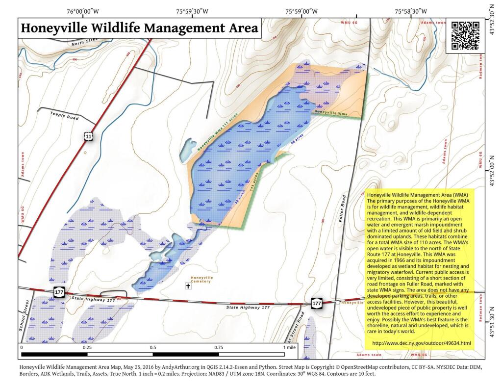
his WMA is primarily an open water and emergent marsh impoundment with a limited amount of old field and shrub dominated uplands. These habitats combine for a total WMA size of 110 acres. The WMA's open water is visible to the north of State Route 177 at Honeyville. This WMA was acquired in 1966 and its impoundment developed as wetland habitat for nesting and migratory waterfowl. Current public access is very limited, consisting of a short section of road frontage on Fuller Road, marked with state WMA signs. The area does not have any developed parking areas, trails, or other access facilities. However, this beautiful, undeveloped piece of public property is well worth the access effort to experience and enjoy. Possibly the WMA's best feature is the shoreline, natural and undeveloped, which is rare in today's world.
http://www.dec.ny.gov/outdoor/49634.html
... photos, maps and other content from from Jefferson County.