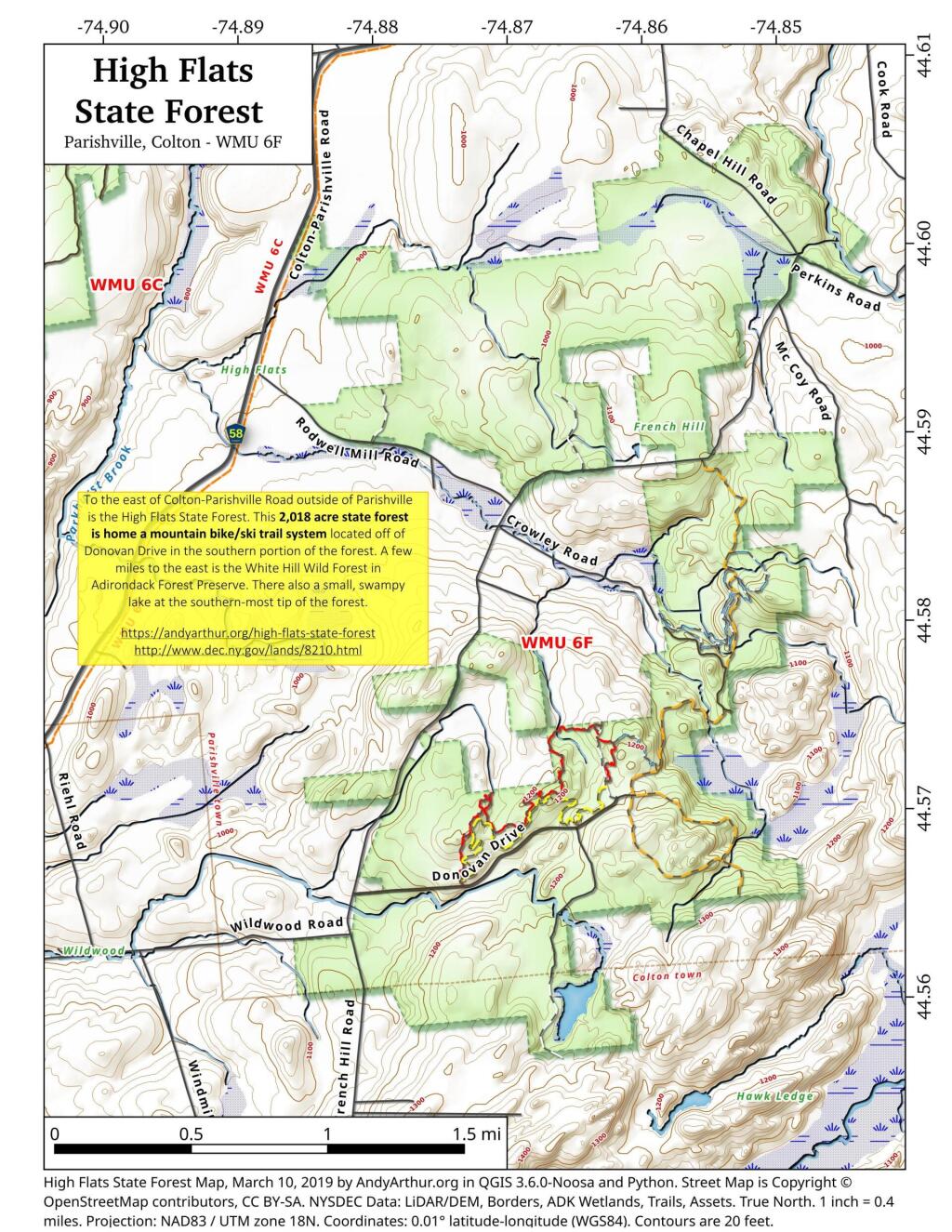
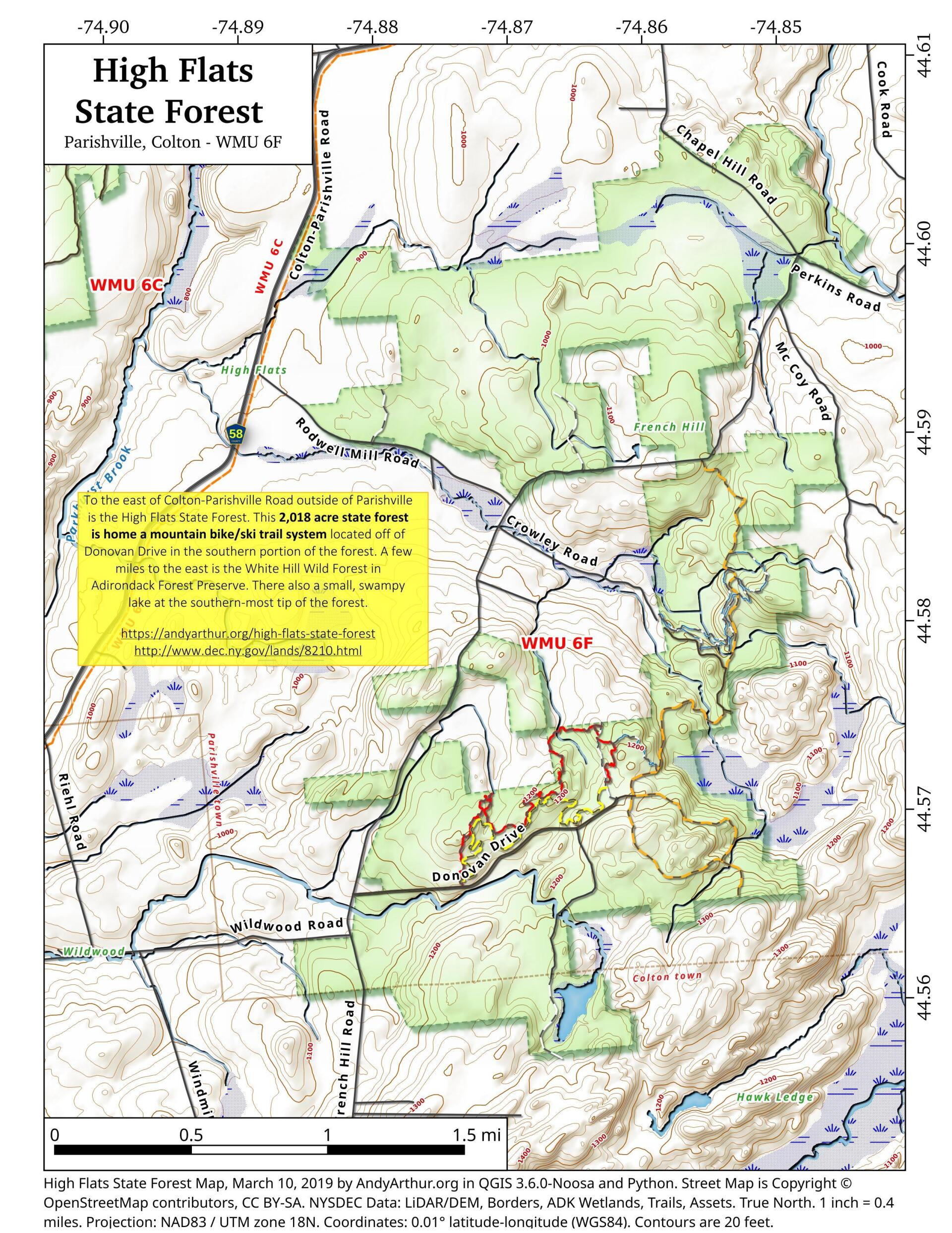
Map: High Flats State Forest
Download a High Resolution JPEG Image of the High Flats State Forest or an Adobe Acrobat Printable PDF of the High Flats State Forest.

Bookmark my free Interactive GPS Map for your phone:
https://andyarthur.org/ny
... shows your location as a blue dot in relationship to campsites, trails, state land. This online map requires cell service, won't work in remote country, so also bring a paper map.
Free Download of New & Historical USGS 1:24k Topograpic Maps
Interactive maps with backcountry and roadside camping: New York, Pennsylvania, West Virginia & Vermont. List of NYS DEC Lean-Tos and Firetowers.
Google Spreadsheet with Roadside, Primitive and Pay Campsites
More about High Flats State Forest...
High Flats State Forest covers 2018 acres. The topography is variable with upland areas supporting a mixture northern hardwood, hemlock, and white pine forests. Pine and spruce plantations were established on what were formerly farm fields and pastures. Flatter ground supports open wetlands and shrub swamps, which gradually transition to spruce-balsam fir and swamp hardwoods stands in poorly drained areas.
http://www.dec.ny.gov/lands/104007.html
... photos, maps and other content from from St. Lawrence County.