Map: Happy Valley Wildlife Mangement Area
Download a High Resolution JPEG Image of the Happy Valley Wildlife Mangement Area or an Adobe Acrobat Printable PDF of the Happy Valley Wildlife Mangement Area.

Bookmark my free Interactive GPS Map for your phone:
https://andyarthur.org/ny
... shows your location as a blue dot in relationship to campsites, trails, state land. This online map requires cell service, won't work in remote country, so also bring a paper map.
Free Download of New & Historical USGS 1:24k Topograpic Maps
Interactive maps with backcountry and roadside camping: New York, Pennsylvania, West Virginia & Vermont. List of NYS DEC Lean-Tos and Firetowers.
Google Spreadsheet with Roadside, Primitive and Pay Campsites
More about Happy Valley WMA...
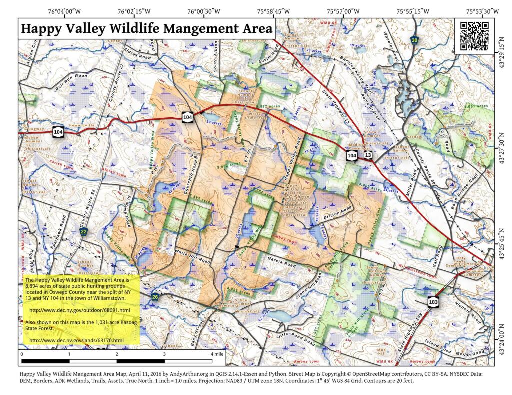
Happy Valley Wildlife Management Area, totaling some 8,898 acres, is located in eastern Oswego County with its northern boundary transected by U.S. Route 104 and its southern boundary by Oswego County Route 26. These Routes are easily accessible off Exit 34 of Interstate 81 and hence east on Route 104 to Happy Valley. The 7½ minute topographic maps covering the area are Dugway and Williamstown.
Happy Valley Wildlife Management Area has generally flat terrain ranging in elevation mostly between 600 to 700 feet above mean sea level. The soils are generally stony fine field loam or sandy knolls. Due to the area's close proximity to Lake Ontario, snow depths average about 125 inches annually.
Reforestation and former farming activity have changed the original forest in much of the area. Fields in all stages of succession exist along with northern hardwoods such as sugar maple, beech, yellow birch and softwoods such as hemlock, white pine and spruce.
Wildlife associated with uplands and water are common and include: deer, hare, squirrel, beaver, muskrat, raccoon, mink, weasel, fisher and porcupine to name only a few of the mammals. A large variety of songbirds as well as grouse, woodcock, turkey and waterfowl are also on the area.
1 Comment
I find this helpful to myself because I don’t know much of the area.