| Albany |
| Albany Pine Bush Preserve |
1,918 |
Pine Bush |
Albany, Schenectady, Voorheesville |
| Black Creek Marsh WMA |
580 |
– |
Voorheesville |
| Catskill Creek Fishing Access |
1 |
– |
Durham |
| Coeymans Creek WMA |
718 |
– |
Delmar, Ravena |
| Cole Hill State Forest |
858 |
Albany |
Westerlo |
| Five Rivers Environmental Education Center |
445 |
Five Rivers Env Ed Center |
Clarksville |
| Louise E. Keir WMA |
188 |
Louise E. Keir HMP |
Clarksville |
| Margaret Burke WMA |
246 |
Margaret Burke HMP |
Altamont |
| Onesquethaw Creek Fishing Access |
0 |
– |
Delmar |
| Partridge Run State Forest |
935 |
Albany |
Rensselaerville |
| Partridge Run WMA |
8,231 |
Partridge Run HMP |
Rensselaerville, Westerlo |
| Rensselaerville State Forest |
5,142 |
Albany |
Durham, Rensselaerville |
| Allegany |
| Allen Lake State Forest |
4,849 |
Allegany |
Angelica, Fillmore |
| Alma Pond |
130 |
– |
Allentown, Wellsville South |
| Bald Mountain State Forest |
763 |
Allegany |
West Almond |
| Bully Hill State Forest |
7,048 |
Allegany |
Alfred, Hornell |
| Cold Creek State Forest |
496 |
Allegany |
Pike |
| Coyle Hill State Forest |
4,691 |
Allegany |
Angelica, Belmont |
| Crab Hollow State Forest |
2,301 |
Allegany |
Black Creek, Rawson |
| English Hill State Forest |
2,789 |
Allegany |
Birdsall, Fillmore |
| Gas Springs State Forest |
4,551 |
Allegany |
Birdsall, Canaseraga |
| Genesee River Wildlife Management Area |
318 |
– |
Wellsville South |
| Genesee Valley WMA |
717 |
– |
Portageville |
| Gillies Hill State Forest |
4,656 |
Allegany |
Birdsall, West Almond |
| Hanging Bog WMA |
9,120 |
Hanging Bog HMP |
Black Creek, Rawson |
| Hanging Bog WMA – Showy Lady Slipper |
2 |
– |
Black Creek |
| Hiltonville State Forest |
3,029 |
Allegany |
Alfred, Canaseraga, West Almond |
| Jersey Hill State Forest |
1,092 |
Allegany |
West Almond |
| Karr Valley Creek State Forest |
3,831 |
Allegany |
Alfred, West Almond |
| Keeney Swamp State Forest |
2,411 |
Allegany |
Birdsall |
| Keeney Swamp WMA |
1,232 |
Keeney Swamp HMP |
Birdsall, Canaseraga |
| Klipnocky State Forest |
5,422 |
Allegany |
Alfred, Canaseraga |
| Lost Nation State Forest |
5,400 |
Allegany |
Bliss, Freedom, Houghton, Pike |
| Palmer’s Pond State Forest |
5,441 |
Allegany |
Alfred, West Almond |
| Phillips Creek State Forest |
10,916 |
Allegany |
Alfred, Andover, Wellsville North, West Almond |
| Plumbottom State Forest |
1,680 |
Allegany |
Wellsville North |
| Rush Creek State Forest |
1,405 |
Allegany |
Black Creek |
| Slader Creek State Forest |
1,225 |
Allegany |
Canaseraga |
| Swift Hill State Forest |
1,571 |
Allegany |
Houghton |
| Turnpike State Forest |
9,522 |
Allegany |
Alfred, West Almond |
| Vandermark State Forest |
4,850 |
Allegany |
Andover, Wellsville North |
| Wag Trail |
148 |
Allegany |
Wellsville South, Whitesville |
| Bronx |
| Bronx River Trail |
1 |
– |
Central Park, Flushing |
| Broome |
| Beaver Flow State Forest |
2,053 |
Chenango Trail |
Belden, Brisben |
| Beaver Pond State Forest |
2,372 |
Broome |
Afton, Gulf Summit, North Sanford |
| Cascade Valley State Forest |
534 |
Broome |
Gulf Summit |
| Cat Hollow State Forest |
760 |
Broome |
Deposit |
| Hawkins Pond State Forest |
538 |
Broome |
Windsor |
| Kirkwood Sub-Office |
10 |
– |
Binghamton East |
| Marsh Pond State Forest |
1,794 |
Broome |
Afton, Gulf Summit |
| Melondy Hill State Forest |
1,983 |
Treaty Line |
North Sanford |
| Nanticoke Creek Fishing Access |
1 |
– |
Maine |
| Nanticoke Lake Multiple Use Area |
339 |
Long Pond |
Lisle |
| Oquaga Creek Fishing Access |
0 |
– |
Deposit |
| Skyline Drive State Forest |
1,066 |
Broome |
Binghamton East, Windsor |
| Susquehanna Waterway Access |
1 |
– |
Windsor |
| Tracy Creek State Forest |
507 |
Broome |
Endicott |
| Triangle State Forest |
1,988 |
Long Pond |
Smithville Flats, Whitney Point, Willet |
| West Branch Delaware River Waterway Access |
3 |
– |
Deposit |
| Whitaker Swamp State Forest |
808 |
Broome |
Deposit |
| Cattaraugus |
| Bear Creek State Forest |
562 |
Cattaraugus |
Franklinville |
| Birch Run Ponds Fwma |
39 |
– |
Knapp Creek |
| Boyce Hill State Forest |
979 |
Cattaraugus |
Ashford |
| Bryant Hill State Forest |
511 |
Cattaraugus |
Ashford |
| Bucktooth State Forest |
2,281 |
Cattaraugus |
Little Valley |
| Bush Hill State Forest |
11,295 |
Cattaraugus |
Delevan, Franklinville, Freedom, Rawson |
| Cattaraugus Creek Waterway Access |
5 |
– |
Collins Center |
| Cattaraugus State Forest |
1,061 |
Cattaraugus |
Cattaraugus |
| Conewango Creek Waterway Access |
267 |
– |
New Albion |
| Conewango Swamp WMA |
1,403 |
– |
Kennedy, Randolph |
| Dobbins Memorial State Forest |
2,206 |
Cattaraugus |
Cattaraugus, Ellicottville |
| East Otto State Forest |
1,382 |
Niagara Frontier |
Collins Center |
| Elkdale State Forest |
432 |
Cattaraugus |
Little Valley |
| Farmersville State Forest |
1,148 |
Cattaraugus |
Freedom |
| Golden Hill State Forest |
5,772 |
Cattaraugus |
Ashford, Franklinville, Humphrey |
| Harwood Lake Mua |
602 |
Harwood Lake HMP |
Delevan, Freedom |
| Ischua Creek Fishing Access |
1 |
– |
Franklinville |
| Lime Lake Outlet Fishing Access |
0 |
– |
Delevan |
| Mansfield Creek Fishing Access |
0 |
– |
Cattaraugus |
| Mccarty Hill State Forest |
6,399 |
Cattaraugus |
Ellicottville, Salamanca |
| Nine Mile Creek State Forest |
6,681 |
Cattaraugus |
Humphrey, Knapp Creek |
| Pine Hill State Forest |
1,142 |
Cattaraugus |
Steamburg |
| Poverty Hill WMA |
1,106 |
– |
Ellicottville |
| Raecher Hill State Forest |
842 |
Cattaraugus |
Humphrey |
| Randolph Fish Hatchery |
62 |
– |
Randolph |
| Rock City State Forest |
2,918 |
Cattaraugus |
Salamanca |
| South Valley State Forest |
8,728 |
Cattaraugus |
Ivory, Steamburg |
| Windfall Creek State Forest |
2,930 |
Cattaraugus |
Humphrey, Limestone, Salamanca |
| Zoar Valley Multiple Use Area |
2,524 |
Zoar Valley Mua |
Collins Center, Gowanda |
| Zoar Valley Unique Area |
2,992 |
Zoar Valley Mua |
Collins Center, Gowanda |
| Cayuga |
| Bear Swamp State Forest |
5,642 |
Hewitt-Cayuga Highlands |
Sempronius, Spafford |
| Carpenter Falls Unique Area |
37 |
Hewitt-Cayuga Highlands |
Spafford |
| Cross Lake Islands WMA |
0 |
– |
Jordan |
| Dutch Hollow Brook Parking Area |
0 |
– |
Owasco |
| Frozen Ocean State Forest |
753 |
Hewitt-Cayuga Highlands |
Owasco |
| Northern Montezuma WMA |
5,348 |
– |
Montezuma, Victory |
| Owasco Flats WMA |
52 |
– |
Moravia |
| Owasco Lake Inlet Fishing Access |
7 |
– |
Moravia |
| Owasco Lake Water Access |
9 |
– |
Owasco |
| Seneca River Boat Launch |
3 |
– |
Weedsport |
| Summer Hill State Forest |
8,842 |
Hewitt-Cayuga Highlands |
Moravia, Sempronius |
| Chautauqua |
| Alder Bottom WMA |
820 |
– |
North Clymer |
| Bear Lake Boat Launch |
4 |
– |
Hartfield |
| Boutwell Hill State Forest |
2,965 |
Chautauqua County |
Hamlet |
| Brokenstraw State Forest |
1,900 |
Chautauqua County |
North Clymer, Panama |
| Canadaway Creek Nature Sanctuary |
33 |
– |
Dunkirk |
| Canadaway Creek WMA |
8,759 |
Canadaway Creek HMP |
Cassadaga, Dunkirk, Forestville, Hamlet |
| Chatauqua Creek Fishing Access |
6 |
– |
Westfield |
| Chautauqua Fish Hatchery |
69 |
– |
Chautauqua |
| Chautauqua Gorge State Forest |
547 |
Chautauqua County |
Sherman |
| Chautauqua Lake Fish And Wildlife Management Area |
134 |
– |
Chautauqua, Ellery Center |
| Clay Pond WMA |
215 |
– |
Jamestown |
| Clear Creek Fishing Access |
2 |
– |
Hamlet |
| Dunkirk Office |
6 |
– |
Dunkirk |
| Findley Lake Waterway Access |
0 |
– |
Clymer |
| Harris Hill State Forest |
3,504 |
Chautauqua County |
Gerry, Hamlet, Kennedy |
| Hartson Swamp WMA |
199 |
– |
Gerry, Jamestown |
| Hatch Creek State Forest |
2,567 |
Chautauqua County |
Gerry, Hamlet |
| Hill Higher State Forest |
1,160 |
Chautauqua County |
Panama |
| Jacquins Pond WMA |
31 |
– |
North Clymer |
| Kabob WMA |
37 |
Kabob HMP |
Cassadaga |
| Mount Pleasant State Forest |
1,539 |
Chautauqua County |
Sherman |
| North Harmony State Forest |
5,150 |
Chautauqua County |
North Clymer, Panama |
| Panama State Forest |
2,449 |
Chautauqua County |
North Clymer, Panama |
| Stockton State Forest |
1,968 |
Chautauqua County |
Cassadaga, Hartfield |
| Watts WMA |
1,395 |
– |
Panama |
| Wellman Multiple Use Area |
447 |
Chautauqua County |
Lakewood |
| Whalen Memorial State Forest |
5,387 |
Chautauqua County |
Chautauqua, North Clymer, Panama, Sherman |
| Chemung |
| Big Flats WMA |
241 |
Great Divide |
Seeley Creek |
| Catharine Creek Fishing Access |
3 |
– |
Montour Falls |
| Catlin State Forest |
607 |
Great Divide |
Big Flats |
| Maple Hill State Forest |
1,191 |
Great Divide |
Waverly, Wellsburg |
| Chenango |
| Ambler State Forest |
642 |
Between Rivers |
Holmesville |
| Balsam Swamp State Forest |
5,359 |
Five Streams |
East Pharsalia, Pitcher |
| Basswood State Forest |
935 |
Between Rivers |
Oxford |
| Beaver Meadow State Forest |
5,816 |
Northern Chenango Highlands |
Otselic |
| Berry Hill Radio Facility |
1 |
– |
East Pharsalia |
| Bobell State Forest |
2,159 |
Chenango Trail |
Brisben |
| Bucks Brook State Forest |
2,178 |
Northern Chenango Highlands |
South Otselic |
| Bumps Creek State Forest |
527 |
Chenango Trail |
West Bainbridge |
| Coventry State Forest |
2,337 |
Chenango Trail |
Brisben, West Bainbridge |
| Five Streams State Forest |
9,946 |
Five Streams |
Pitcher, Smithville Flats |
| Genegantslet Creek Fishing Access |
0 |
– |
Smithville Flats |
| Genegantslet State Forest |
6,405 |
Mcdonough |
Smithville Flats, Tyner |
| Hunts Pond State Forest |
2,748 |
Between Rivers |
Holmesville, New Berlin South |
| Lincklaen State Forest |
5,903 |
Northern Chenango Highlands |
Pitcher, South Otselic |
| Long Pond State Forest |
3,185 |
Long Pond |
Smithville Flats |
| Ludlow Creek State Forest |
3,197 |
Mcdonough |
Tyner |
| Lyon Brook State Forest |
527 |
Between Rivers |
Oxford |
| Mcdonough State Forest |
12,700 |
Mcdonough |
East Pharsalia, Tyner |
| Melondy Hill State Forest |
6,052 |
Treaty Line |
Afton, North Sanford |
| Oak Ridge State Forest |
1,130 |
Chenango Trail |
Sidney, West Bainbridge |
| Otselic State Forest |
2,082 |
Northern Chenango Highlands |
Otselic, South Otselic |
| Perkins Pond State Forest |
7,812 |
Pharsalia Woods |
East Pharsalia, Otselic, Pitcher, South Otselic |
| Pharsalia WMA |
9,352 |
Pharsalia HMP |
East Pharsalia, Otselic |
| Pharsalia Woods State Forest |
17,846 |
Pharsalia Woods |
East Pharsalia, Norwich, Pitcher |
| Pigeon Hill State Forest |
2,209 |
Pharsalia Woods |
Earlville, East Pharsalia, Otselic |
| Pine Ridge State Forest |
275 |
Between Rivers |
Sherburne |
| Pitcher Springs State Forest |
1,836 |
Pharsalia Woods |
Pitcher |
| Red Brook State Forest |
602 |
Five Streams |
Smithville Flats |
| Rogers Environmental Education Center |
575 |
– |
Earlville |
| Sherburne Sub-Office |
12 |
– |
Earlville |
| Skinner Hill State Forest |
3,335 |
Between Rivers |
Holmesville, Sherburne |
| South Hill State Forest |
2,647 |
Between Rivers |
Guilford, Sidney |
| South Otselic Fish Hatchery |
142 |
– |
South Otselic |
| Susquehanna River Boat Launch |
6 |
– |
Afton |
| Unadilla River Fishing Access |
1 |
– |
Holmesville |
| Whaupaunaucau State Forest |
1,187 |
Between Rivers |
Holmesville |
| Wiley Brook State Forest |
2,481 |
Between Rivers |
Oxford, West Bainbridge |
| Clinton |
| Ausable Marsh WMA |
730 |
– |
Keeseville |
| Ausable Point Campground |
111 |
Ausable Point Camp |
Keeseville |
| Burnt Hill State Forest |
3,157 |
Taylor Pond |
Dannemora, Peasleeville |
| Cadyville State Forest |
371 |
Northern Clinton |
Dannemora |
| Chazy Highlands State Forest |
11,081 |
Chazy Highlands |
Dannemora, Ellenburg Center, Ellenburg Mountain, Moffitsville |
| Chazy Highlands Wild Forest |
51,403 |
Chazy Highlands |
Alder Brook, Brainardsville, Ellenburg Center, Ellenburg Mountain, Lyon Mountain, Moffitsville, Redford |
| Chazy Highlands WMA |
1,005 |
– |
Lyon Mountain |
| Clinton FP Detached Parcel |
679 |
– |
Churubusco, Ellenburg Depot, Mooers |
| Clinton Mooers FP Detached Parcel |
664 |
– |
Altona, Ellenburg Depot |
| Dunkin’s Reserve State Forest |
4,573 |
Chazy Highlands |
Dannemora, Jericho, West Chazy |
| Flat Rock State Forest |
3,669 |
Northern Clinton |
Altona, Jericho, Mooers, West Chazy |
| Garden Island |
1 |
Lake Champlain Islands |
Keeseville |
| Great Chazy River Fishing Access |
60 |
– |
Altona |
| Great Chazy River Special Use |
0 |
– |
Champlain |
| Imperial Mills Dam |
7 |
– |
Plattsburgh |
| Kings Bay WMA |
671 |
– |
Champlain, Rouses Point |
| Lake Alice WMA |
5,924 |
– |
Beekmantown, Champlain, Mooers, West Chazy |
| Lewis Preserve WMA |
1,325 |
– |
Jericho |
| Macomb State Forest |
2,800 |
Northern Clinton |
Dannemora, Morrisonville, Peasleeville, Peru |
| Montys Bay WMA |
318 |
– |
Beekmantown |
| Moon Pond State Forest |
787 |
Chazy Highlands |
Ellenburg Mountain |
| Peru Dock Boat Launch |
10 |
Lake Champlain Islands |
Keeseville |
| Plattsburg Boat Launch |
0 |
– |
Plattsburgh |
| Rouses Point |
50 |
– |
Rouses Point |
| Saranac River Access |
0 |
– |
Morrisonville |
| Spoon Island Primitive Area |
2 |
Lake Champlain Islands |
Plattsburgh |
| Spring Brook State Forest |
2,045 |
Chazy Highlands |
Altona, Ellenburg Depot, Ellenburg Mountain, Jericho |
| Taylor Pond Campground |
147 |
Taylor Pond Camp |
Wilmington |
| Taylor Pond Wild Forest |
5,640 |
Taylor Pond |
Keeseville, Peasleeville, Redford |
| Terry Mountain State Forest |
4,814 |
Taylor Pond |
Peasleeville |
| The Gulf Unique Area |
606 |
Northern Clinton |
Ellenburg Depot |
| Unclassified |
3 |
– |
Redford |
| Upper Chateaugay Lake Boat Launch |
2 |
Chazy Highlands |
Ellenburg Center |
| Valcour Island Primitive Area |
1,891 |
Lake Champlain Islands |
Keeseville, Plattsburgh |
| Wilmington Wild Forest |
2,113 |
Wilmington |
Au Sable Forks, Wilmington |
| Columbia |
| Beebe Hill Multiple Use Area |
2,913 |
Taconic Highlands |
Chatham, State Line |
| Beebe Hill State Forest |
548 |
Taconic Highlands |
State Line |
| Charles Flood WMA At The Empire Brickyard |
590 |
– |
Hudson North |
| Doodletown Wildlife Management Area |
2,155 |
– |
Ancram, Copake |
| Hand Hollow State Forest |
1,139 |
Taconic Highlands |
Canaan |
| Harvey Mountain State Forest |
2,008 |
Taconic Highlands |
State Line |
| Livingston State Forest |
319 |
Taconic Highlands |
Hudson South |
| New Forge State Forest |
677 |
Taconic Highlands |
Ancram |
| Nutten Hook State Tidal Wetland |
1,174 |
– |
Hudson North, Ravena |
| Rogers Island WMA |
322 |
Hudson Valley |
Hudson South |
| Stockport Flats Estuarine Sanctuary |
478 |
– |
Hudson North |
| Stockport WMA |
354 |
Stockport HMP |
Hudson North |
| Cortland |
| Baker School House State Forest |
2,527 |
Taylor Valley |
Cincinnatus, Mcgraw |
| Casterline Pond Waterway Access |
15 |
– |
Homer |
| Cortland Sub-Office |
25 |
– |
Cortland |
| Cuyler Hill State Forest |
5,635 |
Cuyler Hill |
Cuyler |
| Dog Hollow State Forest |
729 |
Cuyler Hill |
Cuyler |
| Donahue Woods State Forest |
1,158 |
Taylor Valley |
Truxton |
| East Branch Tioughnioga River Fishing Access |
1 |
– |
Cuyler |
| Gee Brook State Forest |
865 |
Taylor Valley |
Cincinnatus |
| Griggs Gulf State Forest |
2,346 |
Rockefeller |
Harford |
| Grout Brook Fishing Access |
20 |
– |
Sempronius, Spafford |
| Hewitt State Forest |
1,875 |
Hewitt-Cayuga Highlands |
Homer, Otisco Valley |
| Hoxie Gorge State Forest |
3,067 |
Taylor Valley |
Marathon, Mcgraw |
| James Kennedy State Forest |
11,071 |
Virgil Mountain |
Cortland, Harford, Marathon |
| Kettlebail State Forest |
579 |
Hill And Hollow |
Tully |
| Maxon Creek State Forest |
905 |
Cuyler Hill |
Cuyler |
| Morgan Hill State Forest |
12,510 |
Hill And Hollow |
Cuyler, Deruyter, Truxton, Tully |
| Owasco Flats WMA |
15 |
– |
Moravia |
| Papish Pond Multiple Use Area |
383 |
Taylor Valley |
Cincinnatus, Willet |
| Taylor Valley State Forest |
18,523 |
Taylor Valley |
Cincinnatus, Cuyler, Mcgraw, Truxton |
| Tuller Hill State Forest |
3,983 |
Virgil Mountain |
Cortland, Mcgraw |
| Tully Lake Fishing Access |
1 |
– |
Otisco Valley |
| Delaware |
| Andes FP Detached Parcel |
98 |
– |
Lewbeach |
| Arctic China State Forest |
4,142 |
Treaty Line |
North Sanford, Trout Creek |
| Barbour Brook State Forest |
759 |
Treaty Line |
Trout Creek |
| Beals Pond State Forest |
1,113 |
Treaty Line |
North Sanford |
| Bear Spring Mountain Campground |
12 |
Bear Spring Mountain Camp |
Corbett |
| Bear Spring Mountain WMA |
14,280 |
– |
Corbett, Walton East |
| Beaverkill Fishing Access |
2 |
– |
Roscoe |
| Colchester FP Detached Parcel |
779 |
– |
Corbett, Roscoe |
| Columbia Lake State Forest |
701 |
Treaty Line |
Deposit |
| Davenport FP Detached Parcel |
195 |
– |
West Davenport |
| Delaware County Scenic Resource |
218 |
East Branch |
Roscoe |
| Delaware FP Detached Parcel |
67 |
– |
Roscoe |
| Delaware Wild Forest |
112,455 |
Delaware |
Arena, Corbett, Downsville, Lewbeach, Livingston Manor, Roscoe |
| Dry Brook Ridge Wild Forest |
30,837 |
Dry Brook Ridge |
Arena, Fleischmanns, Lewbeach, Margaretville, Seager |
| East Branch Delaware River Waterway Access |
12 |
– |
Fishs Eddy |
| Hancock FP Detached Parcel |
1,936 |
– |
Fishs Eddy, Horton, Long Eddy |
| John Lennox State Demonstration Forest |
175 |
– |
Davenport |
| Kerryville State Forest |
703 |
Treaty Line |
Cannonsville Reservoir |
| Little Pond Campground |
874 |
Little Pond Camp |
Arena, Lewbeach |
| Lower West Branch Delaware River Fishing Access |
4 |
– |
Deposit |
| Michigan Hill State Forest |
2,376 |
Treaty Line |
Cannonsville Reservoir, Deposit, North Sanford, Trout Creek |
| Middletown FP Detached Parcel |
62 |
– |
Margaretville |
| Murphy Hill State Forest |
2,530 |
East Branch |
Andes, Downsville, Hamden, Lewbeach |
| Pine Hill State Forest |
2,182 |
Treaty Line |
Sidney, Unadilla |
| Plattekill State Forest |
1,788 |
East Branch |
Hobart |
| Relay State Forest |
2,554 |
East Branch |
Hobart, Roxbury |
| South Hill State Forest |
1,044 |
Cherry Valley |
Davenport, Schenevus |
| Stamford FP Detached Parcel |
79 |
– |
Stamford |
| Stamford Regional Sub-Office |
12 |
– |
Stamford |
| Steam Mill State Forest |
11,176 |
Treaty Line |
North Sanford, Trout Creek |
| Tomannex State Forest |
2,028 |
East Branch |
Corbett, Readburn |
| Tompkins FP Detached Parcel |
719 |
– |
Cannonsville Reservoir, Trout Creek |
| Town Brook Fishing Access |
0 |
– |
Roxbury |
| Walton FP Detached Parcel |
110 |
– |
Walton East |
| West Branch Delaware River |
11 |
– |
Deposit |
| Wolf Hollow WMA |
52 |
East Branch |
Andes |
| Dutchess |
| Baxtertown Woods WMA |
248 |
– |
Wappingers Falls |
| Crum Elbow Creek Fishing Access |
1 |
– |
Hyde Park |
| Crum Elbow Creek Waterway Access |
13 |
– |
Hyde Park |
| Depot Hill Multiple Use Area |
256 |
East Of Hudson |
Poughquag |
| Lafayetteville Multiple Use Area |
718 |
East Of Hudson |
Pine Plains |
| Roeliff Jansenkill Multiple Use Area |
119 |
East Of Hudson |
Ancram |
| Shekomeko Creek Parking Fishing Access |
0 |
– |
Pine Plains |
| Stissing Mountain Multiple Use Area |
590 |
East Of Hudson |
Pine Plains |
| Stonykill Environmental Education Center |
786 |
– |
Wappingers Falls |
| Swamp River Fishing Access |
0 |
– |
Dover Plains |
| Swamp River Waterway Access |
58 |
– |
Dover Plains |
| Sylvan Lake Waterway Access |
0 |
– |
Poughquag |
| Taconic Hereford Multiple Use Area |
2,751 |
East Of Hudson |
Pleasant Valley, Salt Point, Verbank |
| Tivoli Bays WMA |
1,679 |
– |
Saugerties |
| Wappinger Creek Fishing Access |
2 |
– |
Millbrook |
| Wassaic Creek Fishing Access |
9 |
– |
Amenia |
| Wassaic Multiple Use Area |
513 |
East Of Hudson |
Amenia |
| West Mountain State Forest |
3,299 |
East Of Hudson |
Dover Plains, Pawling, Poughquag, Verbank |
| Erie |
| Cattaraugus Creek Fishing Access Parking |
0 |
– |
Sardinia |
| Cazenovia Creek Fwma |
127 |
– |
Orchard Park |
| Clear Lake WMA |
527 |
– |
Langford |
| Eighteen Mile Creek Access |
34 |
– |
Eden |
| Great Baehre Swamp WMA |
271 |
– |
Clarence Center |
| Hampton Brook Woods WMA |
78 |
Hanging Bog HMP |
Hamburg |
| Motor Island WMA |
19 |
– |
Buffalo NW |
| Onondaga Escarpment Unique Area |
49 |
Niagara Frontier |
Akron |
| Reinstein Woods Nature Preserve And Environmental Education Center |
292 |
Reinstein Woods Nature Preserve |
Lancaster |
| Spicer Creek WMA |
34 |
– |
Tonawanda West |
| Tillman Road WMA |
237 |
– |
Clarence |
| Essex |
| Bald Ledge Primitive Area |
511 |
Pharaoh Lake |
Graphite |
| Bartlett Primitive Area |
7 |
Sentinel Range |
Keene |
| Blue Mountain Wild Forest |
19,826 |
Blue Mountain |
Bad Luck Mountain, Dun Brook Mountain, Newcomb |
| Boquet River Fishing Access |
1 |
Taylor Pond |
Willsboro |
| Boquet River Primtive Area |
86 |
Giant Mountain |
Underwood |
| Boreas Ponds Primitive Area |
11 |
High Peaks |
Mount Marcy |
| Camp Santanoni Historic Area |
74 |
Camp Santanoni Historic Area |
Newcomb, Santanoni Peak |
| Cole Island |
1 |
Lake Champlain Islands |
Westport |
| Crown Point Campground |
70 |
Crown Point Camp |
Port Henry |
| Crown Point Historic Area |
364 |
Crown Point Camp |
Port Henry |
| Essex Chain Lakes Primitive Area |
27,837 |
Essex Chain Lakes |
Bad Luck Mountain, Dun Brook Mountain, Newcomb, Rock Lake |
| Giant Mountain Wilderness |
94,671 |
Giant Mountain |
Elizabethtown, Keene Valley, Rocky Peak Ridge, Underwood |
| Gooseneck Pond Primitive Area |
1 |
Pharaoh Lake |
Graphite |
| Hammond Pond Wild Forest |
159,303 |
Hammond Pond |
Blue Ridge, Crown Point, Eagle Lake, Elizabethtown, Graphite, Keene Valley, Keene, Paradox Lake, Pharaoh Mountain, Rocky Peak Ridge, Schroon Lake, Underwood, Westport, Witherbee |
| High Peaks Wilderness |
6,318,923 |
Boreas Ponds Tract |
Ampersand Lake, Blue Ridge, Cheney Pond, Deerland, Dix Mountain, Dun Brook Mountain, Grampus Lake, Keene Valley, Keene, Kempshall Mountain, Mckenzie Mountain, Mount Adams, Mount Marcy, Newcomb, North Elba, Paradox Lake, Rocky Peak Ridge, Santanoni Peak, Saranac Lake, Stony Creek Mountain, Street Mountain, Underwood, Vanderwhacker Mountain |
| Hoffman Notch Primitive Area |
4 |
Hoffman Notch |
Blue Ridge |
| Hoffman Notch Wilderness |
192,627 |
Hoffman Notch |
Blue Ridge, Cheney Pond, Minerva, Paradox Lake, Schroon Lake |
| Hudson Gorge Wilderness |
73,527 |
Hudson Gorge |
Bad Luck Mountain, Dutton Mountain, Newcomb |
| Hurricane Mountain Fire Tower Historic Area |
0 |
Hurricane Mountain Ftha |
Rocky Peak Ridge |
| Hurricane Mountain Primitive Area |
34 |
Hurricane Mountain |
Jay Mountain, Keene, Rocky Peak Ridge |
| Hurricane Mountain Wilderness |
42,601 |
Hurricane Mountain |
Jay Mountain, Keene, Rocky Peak Ridge |
| Jay Mountain Wilderness |
15,728 |
Jay Mountain |
Jay Mountain, Lewis |
| John Browns Farm Historic Site |
114 |
Saranac Lakes |
Lake Placid |
| Johns Brook Primitive Area |
147 |
High Peaks |
Keene Valley |
| Lake George Wild Forest |
51 |
Lake George |
Schroon Lake, Ticonderoga |
| Lake Harris Campground |
467 |
Lake Harris Camp |
Newcomb, Vanderwhacker Mountain |
| Lincoln Pond Campground |
134 |
Lincoln Pond Camp |
Elizabethtown |
| Macintyre Primitive Area |
11 |
High Peaks |
Mount Adams |
| Mckenzie Mountain Wilderness |
187,079 |
Mckenzie Mountain |
Bloomingdale, Franklin Falls, Keene, Lake Placid, Mckenzie Mountain |
| Meadowbrook Campground |
128 |
Meadowbrook Camp |
Mckenzie Mountain |
| Mirror Lake Boat Launch |
2 |
Saranac Lakes |
Lake Placid |
| Mossy Point State Boat Launch |
17 |
Lake George |
Ticonderoga |
| Mount Van Hoevenberg Winter Recreation Area |
1,186 |
Mount Van Hoevenberg Olympic Sports Complex |
North Elba |
| Paradox Lake Campground |
283 |
Paradox Lake Camp |
Paradox Lake |
| Pauline Murdock WMA |
73 |
Taylor Pond |
Elizabethtown |
| Pharaoh Lake Wilderness |
369,686 |
Pharaoh Lake |
Brant Lake, Eagle Lake, Graphite, Paradox Lake, Pharaoh Mountain, Schroon Lake, Silver Bay, Ticonderoga |
| Pine Lake Primitive Area |
5,578 |
Essex Chain Lakes |
Bad Luck Mountain, Rock Lake |
| Poke-O-Moonshine Day Use Area |
274 |
Taylor Pond |
Clintonville |
| Port Douglass Boat Launch |
2 |
Taylor Pond |
Port Douglass |
| Port Henry Boat Launch |
5 |
Wilmington |
Port Henry |
| Putnam Creek Access |
0 |
Wilmington |
Crown Point |
| Putnam Creek Fishing Access |
0 |
Wilmington |
Crown Point |
| Putnam Pond Campground |
851 |
Putnam Pond Camp |
Graphite |
| Putts Creek WMA |
112 |
– |
Crown Point |
| Saranac Lakes Wild Forest |
69,082 |
Saranac Lakes |
Ampersand Lake, Bloomingdale, Gabriels, Lake Placid, Mckenzie Mountain, North Elba, Saranac Lake, Street Mountain |
| Schuyler Island Primitive Area |
669 |
Lake Champlain Islands |
Colchester Point, Juniper Island, Keeseville, Port Douglass |
| Sentinel Range Wilderness |
92,185 |
Sentinel Range |
Keene Valley, Keene, Lake Placid, North Elba |
| Sharp Bridge Campground |
193 |
Sharp Bridge Camp |
Underwood |
| Sheepshead Island |
0 |
Lake Champlain Islands |
Crown Point |
| Signal Buoy Island |
0 |
Lake Champlain Islands |
Crown Point |
| Split Rock Wild Forest |
14,167 |
Split Rock |
Charlotte, Vergennes West, Westport, Willsboro |
| Tahawas Primitive Area |
2 |
High Peaks |
Mount Adams |
| Taylor Pond Wild Forest |
13,859 |
Taylor Pond |
Au Sable Forks, Bloomingdale, Clintonville, Elizabethtown, Franklin Falls, Jay Mountain, Keeseville, Lewis, Port Douglass, Willsboro |
| Unclassified |
1,621 |
– |
Bad Luck Mountain, Keeseville, Mckenzie Mountain, Port Douglass, Rock Lake |
| Vanderwhacker Mountain Wild Forest |
777,644 |
Boreas Ponds Tract |
Bad Luck Mountain, Blue Ridge, Cheney Pond, Dutton Mountain, Gore Mountain, Minerva, Mount Adams, Mount Marcy, Newcomb, North Creek, Paradox Lake, Santanoni Peak, Schroon Lake, Vanderwhacker Mountain |
| Westport Boat Launch |
3 |
Taylor Pond |
Westport |
| Whiteface Mountain Ski Center |
12,089 |
Whiteface Mtn. Ski Center |
Franklin Falls, Keene, Lake Placid, Wilmington |
| Wickham Marsh WMA |
716 |
– |
Keeseville |
| Willsboro Bay Boat Launch |
6 |
Taylor Pond |
Port Douglass |
| Wilmington Notch Campground |
120 |
Wilmington Notch Camp |
Keene |
| Wilmington Wild Forest |
57,527 |
Wilmington |
Au Sable Forks, Franklin Falls, Jay Mountain, Keene, Lake Placid, Wilmington |
| Wilsboro Dam Fish Dam |
1 |
Taylor Pond |
Willsboro |
| Franklin |
| Ampersand Primitive Area |
430 |
High Peaks |
Stony Creek Mountain |
| Bombay State Forest |
8,719 |
St. Lawrence Flatlands |
Bombay, Brushton, Hogansburg, North Lawrence |
| Buck Pond Campground |
596 |
Buck Pond Camp |
Bloomingdale, Loon Lake |
| Chateaugay Fish Hatchery |
14 |
– |
Chateaugay |
| Chazy Highlands Wild Forest |
52,198 |
Chazy Highlands |
Alder Brook, Brainardsville, Chasm Falls, Debar Mountain, Lake Titus, Loon Lake, Lyon Mountain, Owls Head, Ragged Lake |
| Debar Mountain Wild Forest |
427,454 |
Debar Mountain |
Bay Pond, Bloomingdale, Debar Mountain, Gabriels, Lake Ozonia, Lake Titus, Loon Lake, Meacham Lake, Meno, Owls Head, Saint Regis Falls, Saint Regis Mountain, Santa Clara |
| Deer River Primitive Area |
3,742 |
Debar Mountain |
Lake Titus, Santa Clara |
| Deer River State Forest |
45,392 |
Northern Franklin |
Bangor, Brushton, Lake Titus, Malone, Saint Regis Falls, Santa Clara |
| Fish Creek Pond Campground |
1,687 |
Fish Creek Pond Camp |
Derrick, Upper Saranac Lake |
| Franklin FP Detached Parcel |
138 |
– |
Lake Titus |
| High Peaks Wilderness |
4 |
Boreas Ponds Tract |
Stony Creek Mountain |
| Horseshoe Lake Wild Forest |
3,627 |
Bog River Complex |
Piercefield, Tupper Lake |
| Lake Flower Boat Launch |
1 |
Saranac Lakes |
Saranac Lake |
| Lake Titus Boat Launch |
2 |
– |
Lake Titus |
| Little Salmon River Access |
4 |
– |
Bangor |
| Lower Saranac Lake Boat Launch |
12 |
Saranac Lakes |
Saranac Lake |
| Madawaska Flow – Quebec Brook Primitive Area |
17,990 |
Debar Mountain |
Bay Pond, Meacham Lake, Meno, Saint Regis Mountain |
| Meacham Lake Campground |
358 |
Meacham Lake Camp |
Meacham Lake |
| Middle Saranac Lake Boat Launch |
6 |
High Peaks |
Stony Creek Mountain |
| Raquette River Boat Launch |
6 |
Saranac Lakes |
Tupper Lake |
| Rollins Pond Campground |
519 |
Rollins Pond Camp |
Derrick |
| Saint Regis Canoe Area |
75,859 |
Saint Regis Canoe Area |
Bay Pond, Derrick, Saint Regis Mountain, Upper Saranac Lake |
| Saint Regis Mountain Fire Tower Historic Area |
0 |
Saint Regis Canoe Area |
Saint Regis Mountain |
| Salmon River Waterway Access |
0 |
– |
Constable |
| Saranac Lake Boat Launch |
4 |
Saranac Lakes |
Upper Saranac Lake |
| Saranac Lake Islands Campground |
9 |
Second Pond Bl |
Saranac Lake |
| Saranac Lakes Wild Forest |
226,054 |
Saranac Lakes |
Ampersand Lake, Derrick, Gabriels, Saint Regis Mountain, Saranac Lake, Stony Creek Mountain, Tupper Lake, Upper Saranac Lake |
| St. Regis River State Forest |
929 |
Northern Franklin |
Saint Regis Falls |
| Taylor Pond Wild Forest |
153,800 |
Taylor Pond |
Alder Brook, Bloomingdale, Franklin Falls, Loon Lake, Redford, Wilmington |
| Titusville Mountain State Forest |
14,337 |
Northern Franklin |
Lake Titus, Owls Head |
| Trout River State Forest |
643 |
Northern Franklin |
Constable |
| Tupper Lake Boat Launch |
2 |
Bog River Complex |
Tupper Lake |
| Unclassified |
7 |
– |
Santa Clara |
| Valley View State Forest |
75 |
Northern Franklin |
Chateaugay |
| Fulton |
| Broadalbin Boat Launch |
16 |
Wilcox Lake |
Broadalbin |
| Caroga Lake Campground |
99 |
Caroga Lake Camp |
Caroga Lake, Peck Lake |
| Ferris Lake Wild Forest |
629 |
Ferris Lake |
Canada Lake, Oppenheim, Stratford |
| Fulton FP Detached Parcel |
207 |
Sacandaga |
Lassellsville, Oppenheim |
| Johnstown FP Detached Parcel |
135 |
Sacandaga |
Gloversville |
| Lassellsville State Forest |
4,433 |
Sacandaga |
Lassellsville, Oppenheim |
| North Creek Fishing Access |
1 |
Ferris Lake |
Stratford |
| Northampton Beach Campground |
219 |
Northampton Beach Camp |
Northville |
| Peck Hill State Forest |
2,744 |
Sacandaga |
Peck Lake |
| Rockwood State Forest |
1,728 |
Sacandaga |
Lassellsville, Peck Lake |
| Sacandaga River State Boat Launch |
20 |
Shaker Mountain |
Northville |
| Shaker Mountain Wild Forest |
75,526 |
Shaker Mountain |
Canada Lake, Caroga Lake, Jackson Summit, Lassellsville, Northville, Peck Lake |
| Unclassified |
19 |
– |
Canada Lake |
| Wilcox Lake Wild Forest |
483 |
Wilcox Lake |
Broadalbin, Edinburg, Galway, Northville |
| Zimmerman Creek Fishing Access |
54 |
– |
Lassellsville |
| Genesee |
| Groveland Secondary Trailway |
1,267 |
– |
Batavia South, Le Roy, Leicester, Stafford |
| John White WMA |
329 |
– |
Akron |
| Oak Orchard WMA |
5,090 |
– |
Knowlesville, Oakfield |
| Tonawanda WMA |
11,496 |
– |
Akron, Medina, Wolcottsville |
| Greene |
| Ashland Pinnacle State Forest |
955 |
Mt. Pisgah |
Ashland |
| Athens FP Detached Parcel |
81 |
– |
Leeds |
| Athens State Boat Launch |
2 |
– |
Hudson North |
| Bearpen Mountain State Forest |
5,680 |
Mt. Pisgah |
Prattsville, Roxbury, West Kill |
| Brandow Point Unique Area |
126 |
Hudson Valley |
Hudson North, Hudson South |
| Bronck Island |
57 |
– |
Ravena |
| Cairo Lockwood State Forest |
49 |
Mt. Pisgah |
Freehold |
| Catskill FP Detatched Parcel |
23 |
– |
Cementon |
| Colgate Lake Wild Forest |
5,623 |
Colgate Lake |
Freehold, Hensonville, Hunter, Kaaterskill Clove |
| Coxsackie FP Detached Parcel |
33 |
– |
Alcove |
| Devil’s Tombstone Campground |
193 |
Devil’s Tombstone Camp |
Hunter |
| Diamond Notch Primitive Bicycle Corridor |
31 |
Hunter-West Kill |
Lexington |
| Dutcher Notch Primitive Bicycle Corridor |
38 |
Windham-Blackhead Range |
Kaaterskill Clove |
| Elm Ridge Wild Forest |
2,380 |
Elm Ridge |
Hensonville |
| Great Vly WMA |
202 |
Hudson Valley |
Cementon |
| Greene County FP Detached Parcel |
901 |
– |
Fleischmanns, West Kill |
| Greenville FP Detached Parcel |
102 |
– |
Alcove |
| Halcott Mountain Wild Forest |
4,934 |
Halcott Mountain |
West Kill |
| Hannacroix Unique Area |
25 |
Hudson Valley |
Ravena |
| Hunter-West Kill Wilderness |
67,007 |
Hunter-West Kill |
Hunter, Lexington, Phoenicia, West Kill |
| Huntersfield State Forest |
2,653 |
Mt. Pisgah |
Ashland, Prattsville |
| Indian Head Wilderness |
64,044 |
Indian Head |
Bearsville, Hunter, Kaaterskill Clove, Woodstock |
| Kaaterskill Wild Forest |
16,042 |
Kaaterskill |
Hunter, Kaaterskill Clove, Woodstock |
| Middle Ground Flats Unique Area |
323 |
Hudson Valley |
Hudson North |
| Mink Hollow Primitive Bicycle Corridor |
65 |
Indian Head |
Bearsville, Hunter |
| Mount Hayden State Forest |
881 |
Mt. Pisgah |
Durham, Hensonville |
| Mount Pisgah State Forest |
2,606 |
Mt. Pisgah |
Ashland, Durham, Hensonville, Livingstonville |
| New Baltimore FP Detached Parcel |
78 |
– |
Ravena |
| North/South Lake Campground |
1,107 |
North/South Lake Camp |
Kaaterskill Clove |
| Overlook Turnpike Primitive Bicycle Corridor |
106 |
Indian Head |
Kaaterskill Clove, Woodstock |
| Rusk Mountain Wild Forest |
11,720 |
Rusk Mountain |
Hunter, Lexington, West Kill |
| Seward’s Island |
72 |
– |
Cementon |
| Shandaken Wild Forest |
10,244 |
Shandaken |
Lexington, Phoenicia, Shandaken, West Kill |
| Van Schaak Unique Area |
25 |
– |
Ravena |
| Vinegar Hill WMA |
407 |
Vinegar Hill HMP |
West Kill |
| Vosburgh Swamp WMA |
311 |
Vosburgh Swamp HMP |
Hudson North |
| Windham-Blackhead Range Wilderness |
68,135 |
Windham-Blackhead Range |
Freehold, Hensonville, Hunter, Kaaterskill Clove |
| Hamilton |
| Blue Mountain Wild Forest |
140,648 |
Blue Mountain |
Bad Luck Mountain, Blue Mountain Lake, Deerland, Dun Brook Mountain, Newcomb, Rock Lake |
| Blue Ridge Wilderness |
289,578 |
Blue Ridge |
Blue Mountain Lake, Raquette Lake, Rock Lake, Sargent Ponds, Snowy Mountain, Wakely Mountain |
| Brown Tract Pond Campground |
273 |
Brown Tract Pond Camp |
Raquette Lake |
| Cathead Mountain Primitive Area |
173 |
Silver Lake |
Cathead Mountain |
| Dug Mountain Primitive Area |
50 |
Siamese Ponds |
Kunjamuk River |
| Eastern Five Ponds Access Primitive Area |
9 |
Five Ponds |
Wolf Mountain |
| Eighth Lake Campground |
242 |
Eighth Lake Camp |
Raquette Lake |
| Ferris Lake Wild Forest |
2,029,916 |
Ferris Lake |
Black Creek Lake, Canada Lake, Caroga Lake, Hoffmeister, Jerseyfield Lake, Lassellsville, Middleville, Morehouse Lake, Morehouseville, Ohio, Piseco Lake, Salisbury, Stratford, Tomany Mountain |
| Forked Lake Campground |
354 |
Forked Lake Camp |
Forked Lake |
| Forks Mountain Primitive Area |
29 |
Siamese Ponds |
Griffin, Wells |
| Fourth Lake Boat Launch |
1 |
Fulton Chain |
Eagle Bay |
| Fulton Chain Boat Launch |
9 |
Moose River Plains |
Mount Tom |
| Golden Beach Campground |
99 |
Golden Beach Camp |
Sargent Ponds |
| High Peaks Wilderness |
4 |
Boreas Ponds Tract |
Kempshall Mountain |
| Hudson Gorge Primitive Area |
6 |
Hudson Gorge |
Dutton Mountain |
| Indian Lake Islands Campground |
15 |
Indian Lake Camp |
Snowy Mountain |
| Jessup River Wild Forest |
176,062 |
Jessup River |
Bad Luck Mountain, Blue Mountain Lake, Bullhead Mountain, Cathead Mountain, Griffin, Indian Lake, Kunjamuk River, Lake Pleasant, Page Mountain, Piseco Lake, Rock Lake, Snowy Mountain, Spruce Lake, Wells |
| Lake Durant Campground |
276 |
Lake Durant Camp |
Blue Mountain Lake |
| Lake Eaton Campground |
152 |
Lake Eaton Camp |
Deerland |
| Lewey Lake Campground |
141 |
Lewey Lake Camp |
Snowy Mountain |
| Little Moose Wilderness |
24,566 |
Moose River Plains Complex |
Mount Tom, Wakely Mountain |
| Little Sand Point Campground |
67 |
Little Sand Point Camp |
Piseco Lake |
| Long Lake State Boat Launch |
20 |
Blue Mountain |
Deerland |
| Moffitt Beach Campground |
396 |
Moffitt Beach Camp |
Lake Pleasant |
| Moose River Plains Camping Area |
11,633 |
Moose River Plains |
Limekiln Lake, Mount Tom, Snowy Mountain, Wakely Mountain |
| Moose River Plains Wild Forest |
602,967 |
Moose River Plains |
Eagle Bay, Honnedaga Lake, Limekiln Lake, Mount Tom, Raquette Lake, Sargent Ponds, Snowy Mountain, Spruce Lake Mountain, Wakely Mountain |
| Nehasane Primitive Area |
263 |
William C. Whitney |
Nehasane Lake, Sabattis, Wolf Mountain |
| Ok Slip Pond Primitive Area |
19 |
Hudson Gorge |
Dutton Mountain |
| Partlow Lake Primitive Area |
78 |
Five Ponds |
Nehasane Lake, Wolf Mountain |
| Pigeon Lake Wilderness |
305,007 |
Pigeon Lake |
Beaver River, Big Moose, Brandreth Lake, Eagle Bay, Nehasane Lake, Raquette Lake |
| Point Comfort Campground |
83 |
Point Comfort Camp |
Piseco Lake |
| Poplar Point Day Use Area |
35 |
Poplar Point Camp |
Piseco Lake |
| Round Lake Wilderness |
34,218 |
Bog River Complex |
Little Tupper Lake, Long Tom Mountain, Sabattis |
| Sacandaga Campground |
160 |
Sacandaga Camp |
Cathead Mountain |
| Sacandaga Primitive Area |
15 |
Silver Lake |
Cathead Mountain, Whitehouse |
| Sargent Ponds Wild Forest |
273,893 |
Sargent Ponds |
Blue Mountain Lake, Brandreth Lake, Deerland, Forked Lake, Grampus Lake, Kempshall Mountain, Little Tupper Lake, Raquette Lake, Sargent Ponds |
| Shaker Mountain Wild Forest |
96,382 |
Shaker Mountain |
Cathead Mountain, Gloversville, Hope Falls, Jackson Summit, Northville |
| Silver Lake Wilderness |
1,095,495 |
Silver Lake |
Canada Lake, Caroga Lake, Cathead Mountain, Hope Falls, Jackson Summit, Lake Pleasant, Piseco Lake, Tomany Mountain, Wells, Whitehouse |
| Tioga Point Campground |
36 |
Tioga Point Camp |
Raquette Lake |
| Twitchell Lake Primitive Area |
1 |
Pigeon Lake |
Big Moose |
| Vanderwhacker Mountain Wild Forest |
192 |
Vanderwhacker Mtn |
Dutton Mountain |
| Wakely Mountain Primitive Area |
224 |
Blue Ridge |
Wakely Mountain |
| West Canada Lake Wilderness |
2,441,375 |
West Canada Lake |
Bisby Lakes, Blue Mountain Lake, Hoffmeister, Honnedaga Lake, Indian Lake, Limekiln Lake, Morehouseville, Mount Tom, Page Mountain, Piseco Lake, Snowy Mountain, Spruce Lake Mountain, Spruce Lake, Wakely Mountain |
| West Canada Mountain Primitive Area |
12,555 |
West Canada Lake |
Hoffmeister, Honnedaga Lake, Morehouseville, Spruce Lake Mountain |
| Wilcox Lake Wild Forest |
40 |
Wilcox Lake |
Wells |
| William C. Whitney Wilderness |
117,753 |
William C. Whitney |
Brandreth Lake, Forked Lake, Little Tupper Lake, Nehasane Lake, Sabattis, Wolf Mountain |
| Wilmurt Club Road Primitive Area |
3 |
West Canada Lake |
Hoffmeister |
| Winding Falls Primitive Area |
26 |
Bog River Complex |
Little Tupper Lake |
| Herkimer |
| Alder Creek Primitive Area |
46 |
Five Ponds |
Soft Maple Reservoir, Stillwater |
| Alger Island Campground |
75 |
Alger Island Camp |
Limekiln Lake, Old Forge |
| Bear Pond Primitive Area |
17 |
Five Ponds |
Stillwater |
| Black Creek State Forest |
2,021 |
Adirondack Foothills |
Middleville, Ohio |
| Black River Wild Forest |
1,348,000 |
Black River |
Bisby Lakes, Black Creek Lake, Hinckley, Honnedaga Lake, Mckeever, Morehouseville, North Wilmurt, Ohio, Old Forge, Thendara, Woodgate |
| Ferris Lake Wild Forest |
1,768 |
Ferris Lake |
Black Creek Lake, Hinckley, Ohio, Salisbury |
| Five Ponds Wilderness |
1,548,894 |
Five Ponds |
Beaver River, Cranberry Lake, Five Ponds, Long Tom Mountain, Nehasane Lake, Newton Falls, Oswegatchie SE, Oswegatchie SW, Oswegatchie, Sabattis, Stillwater, Wolf Mountain |
| Former Dairy Hill Firetower Site |
0 |
Adirondack Foothills |
Middleville |
| Fourth Lake Day Use Area |
12 |
Alger Island Camp |
Old Forge |
| Fulton Chain Wild Forest |
38,105 |
Fulton Chain |
Big Moose, Eagle Bay, Limekiln Lake, Old Forge |
| Ha-De-Ron-Dah Wilderness |
128,161 |
Ha-De-Ron-Dah |
Big Moose, Copper Lake, Old Forge, Stillwater Mountain, Thendara |
| Herkimer FP Detached Parcel |
1,107 |
– |
Jordanville, Millers Mills, Salisbury, Stratford, Utica East |
| Hinckley Day Use Area |
573 |
Ferris Lake |
Hinckley |
| Hinckley State Forest |
1,594 |
Adirondack Foothills |
Hinckley |
| Independence River Wild Forest |
1,095 |
Independence River |
Copper Lake, Stillwater, Thendara |
| Limekiln Lake Campground |
312 |
Limekiln Lake Camp |
Limekiln Lake |
| Maumee Swamp |
38 |
– |
Richfield Springs |
| Moose River Plains Wild Forest |
0 |
Moose River Plains |
Limekiln Lake |
| Nicks Lake Campground |
687 |
Nicks Lake Camp |
Old Forge |
| Ohisa State Forest |
681 |
Mohawk Vista |
Van Hornesville |
| Otsquago State Forest |
411 |
Mohawk Vista |
Van Hornesville |
| Pepperbox Wilderness |
97,268 |
Pepperbox |
Number Four, Oswegatchie SE, Soft Maple Reservoir, Stillwater |
| Plantation Island WMA |
268 |
Plantation Island HMP |
Herkimer |
| Raven Lake Road Primitive Area |
29 |
Pepperbox |
Stillwater |
| Steuben Hill State Forest |
1,009 |
Mohawk Vista |
Ilion |
| Stillwater Boat Launch |
4 |
Independence River |
Stillwater |
| Tied Lake Primitive Area |
9 |
Pepperbox |
Stillwater |
| Van Hornesville Fish Hatchery |
8 |
– |
Van Hornesville |
| Wanakena Primitive Area |
15 |
Five Ponds |
Five Ponds, Newton Falls |
| Watson’s East Triangle Wild Forest |
47,230 |
Watson East Triangle |
Oswegatchie SE, Oswegatchie SW, Soft Maple Reservoir, Stillwater |
| West Canada Creek Fishing Access |
29 |
– |
Herkimer, Newport |
| Jefferson |
| Ashland Flats WMA |
3,855 |
Ashland Flats HMP |
Chaumont, Saint Lawrence |
| Black Pond WMA |
551 |
– |
Henderson |
| Black River At Huntingtonville Waterway Access |
34 |
– |
Rutland Center |
| Brownville WMA |
237 |
– |
Dexter |
| Butterfield Lake Waterway Access |
9 |
– |
Redwood |
| Collins Landing WMA |
52 |
– |
Alexandria Bay |
| Coyote Flats State Forest |
1,120 |
Ontario Plains |
La Fargeville, Theresa |
| Cranberry Creek WMA |
13 |
Cranberry Creek HMP |
Alexandria Bay |
| Crystal Lake Waterway Access |
1 |
– |
Henderson |
| Dexter Marsh WMA |
2,480 |
– |
Dexter, Sackets Harbor |
| Eastern Ontario Waterway Access |
18 |
– |
Cape Vincent South |
| French Creek WMA |
4,536 |
– |
Clayton, Saint Lawrence |
| Gould’s Corners State Forest |
2,065 |
Tug Hill North |
Rodman |
| Henderson Shores Unique Area |
891 |
Ontario Plains |
Stony Point |
| Honeyville WMA |
111 |
Honeyville HMP |
Rodman |
| Hyde Lake Fishing Access |
12 |
– |
Redwood, Theresa |
| Indian River Fishing Access |
0 |
– |
Theresa |
| Indian River WMA |
1,278 |
Indian River HMP |
Muskellunge Lake, Redwood |
| Lake Of The Woods Waterway Access |
2 |
– |
Muskellunge Lake |
| Lake Ontario Waterway Access |
1 |
– |
Chaumont |
| Lake Ontario Islands WMA |
75 |
– |
Galloo Island, Henderson Bay |
| Lake Ontario Waterway Access |
12 |
– |
Cape Vincent South |
| Lakeview WMA |
6,888 |
Lakeview HMP |
Ellisburg, Henderson |
| Lindsey Creek Fishing Access |
0 |
– |
Sandy Creek |
| Millsite Lake Fishing Access |
3 |
– |
Redwood |
| Moon Lake Fishing Access |
2 |
– |
Muskellunge Lake |
| Ontario Lake Boat Launch |
18 |
– |
Henderson |
| Oswegatchie River At Oxbow Fishing Access |
4 |
– |
Natural Dam |
| Perch River WMA |
16,100 |
– |
Brownville, Dexter, La Fargeville |
| Point Peninsula WMA |
4,020 |
– |
Cape Vincent South, Chaumont, Henderson Bay, Point Peninsula |
| Pulpit Rock State Forest |
1,602 |
Ontario Plains |
Muskellunge Lake |
| Sixberry Lake Fishing Access |
1 |
– |
Redwood |
| South Sandy Creek Fishing Access |
0 |
– |
Rodman |
| Stony Creek Fishing Access |
1 |
– |
Henderson |
| Tug Hill State Forest |
24,593 |
Tug Hill North |
Barnes Corners, Rodman, Worth Center |
| Lewis |
| Aldrich Pond Wild Forest |
449 |
Aldrich Pond |
Remington Corners |
| Balsam Creek State Forest |
561 |
Westward Waters |
Belfort |
| Beartown State Forest |
20,176 |
Westward Waters |
Carthage, Croghan, Natural Bridge |
| Black River At Glenfield Fishing Access |
4 |
Westward Waters |
Glenfield |
| Black River At Beeches Bridge Fishing Access |
19 |
– |
Lowville |
| Black River At Lowville Fishing Access |
2 |
– |
Lowville |
| Black River Fishing Access |
6 |
– |
Carthage, Glenfield |
| Black River Waterway Access |
2 |
– |
Carthage |
| Black River Wild Forest |
219 |
Black River |
Port Leyden, Woodgate |
| Bonaparte’s Cave State Forest |
2,875 |
Westward Waters |
Harrisville, Lake Bonaparte |
| Burdicks Crossing Fishing Access |
9 |
– |
Brantingham |
| Cobb Creek State Forest |
2,203 |
Tug Hill North |
New Boston |
| Cottrell State Forest |
482 |
Tug Hill East |
Point Rock |
| Crystal Creek Fishing Access |
7 |
– |
Crystal Dale |
| Diana FP Detached Parcel |
461 |
Westward Waters |
Harrisville |
| East Br Fish/Big Alder Creek Fishing Access |
0 |
– |
High Market |
| East Branch Fish Creek Fishing Access |
1 |
– |
High Market, Point Rock |
| East Branch Fish Creek State Forest |
2,728 |
East Branch Of Fish Creek Rec |
High Market, Page, Point Rock |
| East Osceola State Forest |
3,010 |
East Branch Of Fish Creek Rec |
Florence, North Osceola |
| Fish Creek Fishing Access |
2 |
– |
Point Rock |
| Frank E. Jadwin Memorial State Forest |
36,949 |
Westward Waters |
Belfort, Harrisville, Natural Bridge, Remington Corners |
| Gomer Hill Radio Facility |
2 |
– |
Glenfield |
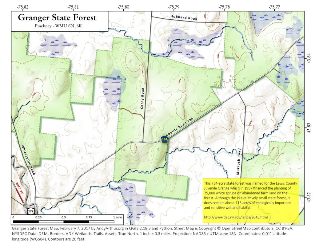
| Granger State Forest |
737 |
Tug Hill North |
Barnes Corners |
| Grant Powell State Forest |
17,195 |
Tug Hill North |
New Boston, Page, Sears Pond, West Lowville |
| Greig FP Detached Parcel |
245 |
– |
Brantingham |
| High Towers State Forest |
730 |
Westward Waters |
Brantingham |
| Hogsback State Forest |
629 |
Westward Waters |
Natural Bridge |
| Independence River State Forest |
1,387 |
Westward Waters |
Brantingham, Crystal Dale |
| Independence River Wild Forest |
844,450 |
Independence River |
Beaver River, Big Moose, Brantingham, Copper Lake, Crystal Dale, Nehasane Lake, Number Four, Port Leyden, Soft Maple Reservoir, Stillwater Mountain, Stillwater, Thendara |
| Indian Pipe State Forest |
1,185 |
Westward Waters |
Crystal Dale, Lowville |
| Kotary Road Fishing Access |
7 |
– |
Point Rock |
| Lesser Wilderness State Forest |
34,335 |
Tug Hill East |
Constableville, Glenfield, High Market, Page |
| Lewis FP Detached Parcel |
1,701 |
East Branch Of Fish Creek Rec |
Florence, High Market, North Osceola, Point Rock |
| Line Brook State Forest |
2,135 |
Tug Hill East |
North Osceola, Redfield |
| Lookout State Forest |
7,966 |
Tug Hill North |
Barnes Corners, New Boston |
| Lot 127 FP Detached Parcel |
272 |
East Branch Of Fish Creek Rec |
Florence |
| Lot 134 FP Detached Parcel |
74 |
East Branch Of Fish Creek Rec |
Florence |
| Lot 38 FP Detached Parcel |
61 |
– |
North Osceola |
| Lot 50 FP Detached Parcel |
124 |
– |
North Osceola |
| Lot 69 FP Detached Parcel |
24 |
East Branch Of Fish Creek Rec |
North Osceola |
| Lot 74 FP Detached Parcel |
239 |
East Branch Of Fish Creek Rec |
North Osceola |
| Lot 98 FP Detached Parcel |
188 |
East Branch Of Fish Creek Rec |
North Osceola |
| Lowville Demonstration Area |
80 |
Westward Waters |
Lowville |
| Lowville Office |
10 |
– |
Lowville |
| Lyonsdale FP Detached Parcel |
29 |
– |
Brantingham, Port Leyden |
| Mill Stream Fishing Access |
1 |
– |
Redfield |
| Mohawk Springs State Forest |
1,840 |
Tug Hill East |
Constableville, West Leyden |
| Onjebonge State Forest |
3,660 |
Westward Waters |
Natural Bridge, North Wilna |
| Otter Creek State Forest |
1,411 |
Westward Waters |
Brantingham |
| Pinckney State Forest |
8,263 |
Tug Hill North |
Barnes Corners, Copenhagen, New Boston, Rutland Center |
| Raywood Unique Area |
317 |
Tug Hill East |
Point Rock |
| Salmon River East Branch Fishing Access |
0 |
– |
Florence |
| Salmon River Fishing Access |
0 |
– |
Florence |
| Sand Bay State Forest |
325 |
Westward Waters |
Lake Bonaparte |
| Sand Flats State Forest |
5,060 |
Westward Waters |
Port Leyden, Woodgate |
| Sears Pond State Forest |
16,497 |
Tug Hill North |
Barnes Corners, New Boston, Sears Pond, Worth Center |
| Swancott Mill State Forest |
1,482 |
Tug Hill East |
Florence, Point Rock |
| Tug Hill WMA |
5,081 |
Tug Hill HMP |
Sears Pond |
| Turin FP Detached Parcel |
13 |
– |
Glenfield |
| Watson’s East Triangle Wild Forest |
3,300 |
Watson East Triangle |
Oswegatchie SW, Soft Maple Reservoir |
| West Martinsburg Radio Facility |
5 |
– |
Page |
| Livingston |
| Avon Regional Office |
20 |
Northern Finger Lakes |
Rush |
| Caledonia Fish Hatchery |
38 |
– |
Caledonia |
| Canaseraga State Forest |
2,571 |
Livingston |
Canaseraga, Ossian |
| Conesus Inlet WMA |
1,142 |
Livingston |
Conesus |
| Conesus Lake Waterway Access |
5 |
– |
Livonia |
| Genesee River Waterway Access |
8 |
– |
Rush |
| Hemlock-Canadice State Forest |
28,241 |
Hemlock Canadice |
Conesus, Honeoye, Livonia, Springwater |
| Ossian State Forest |
2,583 |
Livingston |
Canaseraga, Ossian |
| Rattlesnake Hill WMA |
20,554 |
Livingston |
Birdsall, Canaseraga, Nunda, Ossian |
| Sonyea State Forest |
926 |
Livingston |
Sonyea |
| Twin Cedars Environmental Area |
62 |
– |
Rush |
| Madison |
| Beaver Creek State Forest |
6,420 |
Brookfield |
Brookfield, Cassville |
| Brookfield Railroad State Forest |
847 |
Brookfield |
Brookfield |
| Charles E. Baker State Forest |
33,930 |
Brookfield |
Brookfield, Hubbardsville, New Berlin North, Sherburne |
| Chenango River Fishing Access |
0 |
– |
Hamilton, Munnsville |
| Chittenango Creek Fishing Access |
2 |
– |
Cazenovia, Oran |
| Deruyter State Forest |
1,944 |
Tioughnioga |
Deruyter, Erieville |
| Earlville State Forest |
1,270 |
Northern Chenango Highlands |
Earlville, Hamilton |
| Eaton Reservoir Boat Launch |
1 |
– |
West Eaton |
| Gorton Lake State Forest |
1,521 |
Brookfield |
Brookfield, Cassville, Hubbardsville |
| Lebanon Reservoir Fishing Access |
1 |
– |
Hamilton |
| Lebanon State Forest |
2,337 |
Northern Chenango Highlands |
Earlville, Otselic, West Eaton |
| Leland Pond Fishing Access |
2 |
– |
Munnsville |
| Madison Reservoir Fishing Access |
2 |
– |
Hamilton |
| Mariposa State Forest |
5,110 |
Muller Hill |
Cuyler, South Otselic |
| Morrow Mountain State Forest |
2,580 |
Tioughnioga |
Erieville, West Eaton |
| Muller Hill State Forest |
9,140 |
Muller Hill |
Erieville, Otselic, South Otselic |
| Nelson Swamp Unique Area |
972 |
Nelson Swamp |
Cazenovia |
| Oneida Lake Boat Launch |
7 |
– |
Cleveland |
| Stoney Pond State Forest |
2,938 |
Tioughnioga |
Cazenovia, Morrisville |
| Texas Hill State Forest |
1,409 |
Northern Chenango Highlands |
Otselic, West Eaton |
| Three Springs State Forest |
797 |
Muller Hill |
Erieville |
| Tioughnioga WMA |
3,903 |
Tioughnioga HMP |
Erieville |
| Monroe |
| Black Creek Waterway Access |
58 |
– |
West Henrietta |
| Braddock Bay WMA |
2,865 |
– |
Braddock Heights, Hilton |
| Cedar Springs Fish Hatchery |
46 |
– |
Clifton |
| Rush Oak Openings Unique Area |
240 |
Northern Finger Lakes |
Rush |
| Sandy Creek Fishing Access Parking |
0 |
– |
Hamlin |
| Sandy Creek Wetlands |
9 |
– |
Hamlin |
| Slater Creek Waterway Access |
7 |
– |
Braddock Heights |
| Montgomery |
| Charleston State Forest |
4,032 |
Charleston |
Esperance |
| Lost Valley State Forest |
748 |
Charleston |
Esperance |
| Rural Grove State Forest |
1,287 |
Charleston |
Carlisle |
| Yatesville Falls State Forest |
1,425 |
Charleston |
Carlisle, Randall |
| Nassau |
| Inwood Bay State Tidal Wetland |
11 |
North Atlantic |
Lynbrook |
| Lido Beach State Tidal Wetland |
99 |
– |
Jones Inlet |
| Oceanside Landing Waterway Access Site |
1 |
– |
Lynbrook |
| Old Westbury Unique Area |
32 |
North Atlantic |
Hicksville |
| Oyster Bay Western Waterfront Waterway |
4 |
– |
Bayville |
| Udall’s Cove And Ravine Natural Resource Area |
0 |
– |
Sea Cliff |
| Underhill Unique Area |
25 |
North Atlantic |
Hicksville |
| Niagara |
| Hartland Swamp WMA |
402 |
– |
Barker |
| Tonawanda Creek Fishing Access |
1 |
– |
Wolcottsville |
| Oneida |
| Albert J. Woodford Memorial State Forest |
2,649 |
Mohawk Vista |
Cassville |
| Big Brook State Forest |
3,866 |
Forty-Six Corners |
Florence |
| Black River Fishing Access |
13 |
– |
Boonville, Forestport, North Wilmurt, Port Leyden |
| Black River Wild Forest |
9,515 |
Black River |
Mckeever, Woodgate |
| Boonville FP Detached Parcel |
647 |
Adirondack Foothills |
Port Leyden, Woodgate |
| Buck Hill State Forest |
6,794 |
Oneida Hills |
Boonville, North Western, West Leyden, Westernville |
| Canada Creek State Forest |
627 |
Oneida Hills |
Lee Center |
| Cincinnati Creek Waterway Access |
5 |
– |
Remsen |
| Clark Hill State Forest |
6,557 |
Oneida Hills |
Boonville, North Western |
| Cobb Brook State Forest |
689 |
Forty-Six Corners |
Camden East |
| Fall Brook State Forest |
8,963 |
Forty-Six Corners |
Florence, Point Rock |
| Fish Creek State Forest |
679 |
Vienna Woods |
Camden East |
| Florence Hill State Forest |
1,361 |
Forty-Six Corners |
Westdale |
| Forestport FP Detached Parcel |
811 |
Adirondack Foothills |
Forestport, North Wilmurt |
| Furnace Creek State Forest |
2,788 |
Forty-Six Corners |
Camden East, Florence |
| Hogsback State Forest |
3,347 |
Adirondack Foothills |
Boonville, Forestport, Woodgate |
| Jackson Hill State Forest |
2,799 |
Oneida Hills |
Boonville, West Leyden |
| Mad River State Forest |
5,600 |
Forty-Six Corners |
Florence, Westdale |
| Mohawk River Fishing Access |
1 |
– |
Oriskany |
| Mount Hunger State Forest |
1,200 |
Mohawk Vista |
Brookfield, Cassville |
| Oneida FP Detached Parcel |
852 |
Vienna Woods |
Camden East, Camden West |
| Oneida Lake At Jewell Fishing Access |
1 |
– |
Jewell |
| Oriskany Flats WMA |
784 |
Oriskany Flats HMP |
Oriskany |
| Penn Mountain State Forest |
14,921 |
Oneida Hills |
Boonville, Forestport, North Western, Remsen |
| Point Rock State Forest |
3,617 |
Oneida Hills |
Lee Center, Point Rock, West Leyden |
| Popple Pond State Forest |
4,910 |
Adirondack Foothills |
Port Leyden, Woodgate |
| Punkeyville State Forest |
535 |
Adirondack Foothills |
Forestport |
| Rome Fish Hatchery |
84 |
– |
Westernville |
| Rome Sand Plains Unique Area |
4,721 |
Rome Sand Plains |
Lee Center, Verona |
| Rome WMA |
2,426 |
Romw HMP |
Rome, Verona |
| Sauquoit Creek Fishing Access |
1 |
– |
Cassville |
| South Hill State Forest |
528 |
Oneida Hills |
North Western |
| Stone Barn State Forest |
1,241 |
Vienna Woods |
Camden West, Jewell |
| Swancott Hill State Forest |
2,025 |
Forty-Six Corners |
Florence |
| Tri-County State Forest |
2,567 |
Forty-Six Corners |
Florence, Westdale |
| Utica Marsh WMA |
194 |
Utica Marsh HMP |
Utica East |
| Webster Hill State Forest |
1,064 |
Oneida Hills |
West Leyden |
| West Branch Fish Creek Fishing Access |
9 |
– |
Camden East, Westdale |
| West Branch State Forest |
527 |
Oneida Hills |
Lee Center |
| West Canada Creek Fishing Access |
0 |
– |
Newport |
| Woodhull Creek Fishing Access |
0 |
– |
Forestport |
| Woodhull Detached Parcel |
301 |
Adirondack Foothills |
North Wilmurt |
| Woodhull State Forest |
568 |
Adirondack Foothills |
Forestport |
| Onondaga |
| Butternut Creek Fishing Access |
0 |
– |
Jamesville |
| Camillus Forest Unique Area |
340 |
Onondaga |
Camillus |
| Carpenter’s Creek Fishing Access |
0 |
– |
Jordan |
| Cicero Swamp WMA |
15,034 |
Cicero Swamp HMP |
Cicero, Cleveland, Manlius |
| Cold Brook Parking Area |
0 |
– |
Jordan |
| Cross Lake Islands WMA |
26 |
– |
Jordan |
| Cross Lake Waterway Access |
16 |
– |
Jordan |
| Fabius Brook Fishing Access |
0 |
– |
Deruyter |
| Hamlin Marsh WMA |
1,668 |
– |
Brewerton |
| Labrador Hollow Unique Area |
1,491 |
Hill And Hollow |
Tully |
| Limestone Creek Fishing Access |
1 |
– |
Manlius, Oran |
| Limestone Creek Fishing Access Parking |
0 |
– |
Oran |
| Morgan Hill State Forest |
4,330 |
Hill And Hollow |
Deruyter, Tully |
| Nine Mile Creek Fishing Access |
30 |
– |
Camillus |
| Onondaga Lake Access |
9 |
– |
Syracuse West |
| Otisco Lake Waterway Access |
4 |
– |
Marcellus |
| Otisco Lake Waterway Access Site |
17 |
– |
Spafford |
| Seneca River Boat Launch |
2 |
– |
Baldwinsville |
| Seneca River Waterway Access |
19 |
– |
Brewerton |
| Skaneateles Lake Boat Launch |
6 |
– |
Skaneateles |
| Split Rock Unique Area |
68 |
Onondaga |
Camillus, Syracuse West |
| Three Rivers WMA |
4,282 |
Three Rivers HMP |
Baldwinsville, Lysander |
| Ontario |
| Bare Hill Unique Area |
95 |
Northern Finger Lakes |
Canandaigua Lake |
| Canandaigua Lake Access |
7 |
– |
Canandaigua Lake |
| Canandaigua Outlet Boat Launch |
12 |
– |
Clifton Springs |
| Honeoye Creek WMA |
749 |
Northern Finger Lakes |
Honeoye |
| Honeoye Inlet WMA |
5,251 |
Northern Finger Lakes |
Bristol Springs, Springwater |
| Skenoh Island WMA |
0 |
Northern Finger Lakes |
Canandaigua Lake |
| Stid Hill Mua |
1,035 |
Northern Finger Lakes |
Bristol Center, Bristol Springs |
| Orange |
| Cherry Island WMA |
14 |
– |
Port Jervis North |
| Gobbler’s Knob State Forest |
304 |
Shawangunk Ridge |
Otisville |
| Graham Mountain State Forest |
163 |
Shawangunk Ridge |
Otisville |
| Huckleberry Ridge State Forest |
3,185 |
Shawangunk Ridge |
Otisville, Port Jervis North, Port Jervis South, Unionville |
| Kowawese Unique Area |
165 |
West Of Hudson |
Cornwall-on-Hudson |
| Moodna Creek Waterway Access |
3 |
– |
Cornwall-on-Hudson |
| Mount Peter Hawk Watch Trailway |
5 |
West Of Hudson |
Greenwood Lake |
| Pochuck Mountain State Forest |
1,010 |
West Of Hudson |
Pine Island, Unionville |
| Stewart State Forest |
13,305 |
West Of Hudson |
Cornwall-on-Hudson, Maybrook, Walden |
| Oswego |
| Altmar State Forest |
926 |
Eastern Lake Ontario |
Richland |
| Battle Hill State Forest |
1,730 |
Upper Salmon River |
Redfield |
| Chateaugay State Forest |
4,047 |
Eastern Lake Ontario |
Orwell |
| Curtiss Gale WMA |
46 |
– |
Fulton |
| Deer Creek Marsh WMA |
1,771 |
– |
Pulaski |
| Fish Creek Fishing Access |
8 |
– |
Williamstown |
| Grindstone Creek Fishing Access |
2 |
– |
Mexico, Pulaski |
| Hall Island State Forest |
4,241 |
Upper Salmon River |
Orwell, Redfield |
| Happy Valley WMA |
17,795 |
Happy Valley HMP |
Dugway, Williamstown |
| Kasoag State Forest |
1,052 |
Fish Creek |
Williamstown |
| Klondike State Forest |
868 |
Fish Creek |
Panther Lake |
| Little Sandy Creek Fishing Access |
2 |
– |
Ellisburg, Sandy Creek |
| Littlejohn WMA |
15,395 |
– |
Boylston Center, Worth Center |
| Lower Salmon River State Forest |
2,666 |
– |
Orwell, Richland |
| Mill Stream Fishing Access |
2 |
– |
Redfield |
| North Pond Sandy Creek Waterway Access |
6 |
– |
Ellisburg |
| O’hara State Forest |
2,794 |
Upper Salmon River |
Redfield, Westdale |
| Oneida Fish Hatchery |
37 |
– |
Cleveland, Mallory, Panther Lake |
| Oneida Lake Boat Launch |
4 |
– |
Cleveland |
| Orton Hollow State Forest |
886 |
Fish Creek |
Westdale, Williamstown |
| Peter Scott Swamp Freshwater Wetlands |
779 |
– |
Baldwinsville, Pennellville |
| Salmon River Falls Unique Area |
121 |
Salmon River Falls Ua |
Orwell |
| Salmon River Fish Hatchery |
1,009 |
Lower Salmon River |
Orwell, Williamstown |
| Salmon River Fishing Access |
49 |
– |
Orwell, Pulaski, Redfield, Richland |
| Salmon River North Branch Fishing Access |
1 |
– |
Orwell, Redfield |
| Salmon River Reservoir Boat Launch |
36 |
– |
Orwell |
| Salmon River State Forest |
5,161 |
Upper Salmon River |
Orwell, Redfield |
| Sandy Creek State Forest |
538 |
Eastern Lake Ontario |
Richland |
| Stave Mill State Forest |
6,257 |
Upper Salmon River |
Orwell, Redfield |
| Stone Hill State Forest |
1,031 |
Fish Creek |
Williamstown |
| Three Mile Bay WMA |
8,474 |
The Cuse |
Central Square, Cicero, Mallory |
| Training Academy |
14 |
– |
Cleveland |
| Trout Brook Parking Area |
0 |
– |
Richland |
| Trout Brook State Forest |
1,252 |
Eastern Lake Ontario |
Orwell, Richland |
| Unclassifed |
2 |
– |
Cicero, Cleveland |
| West Branch Fish Creek Fishing Access |
0 |
– |
Williamstown |
| West Osceola State Forest |
5,803 |
Upper Salmon River |
Florence, North Osceola, Redfield, Westdale |
| Winona State Forest |
27,704 |
Winona |
Boylston Center, Rodman, Sandy Creek |
| Otsego |
| Arnold Lake State Forest |
2,506 |
Leatherstocking |
Milford, Mount Vision |
| Basswood Pond State Forest |
2,864 |
Leatherstocking |
Edmeston, Hartwick, Schuyler Lake, Unadilla Forks |
| Bear Swamp State Forest |
1,748 |
Cherry Valley |
South Valley |
| Butternut Creek Fishing Access |
3 |
– |
Edmeston |
| Calhoun Creek State Forest |
723 |
Leatherstocking |
New Berlin South |
| Charlotte River Fishing Access |
1 |
– |
Oneonta |
| Cherry Valley State Forest |
3,022 |
Cherry Valley |
South Valley, Sprout Brook |
| Crumhorn Mountain WMA |
60 |
Leatherstocking |
Milford |
| Decatur State Forest |
595 |
Cherry Valley |
South Valley |
| Exeter State Forest |
1,966 |
Leatherstocking |
Schuyler Lake |
| General Jacob Morris State Forest |
1,191 |
Leatherstocking |
New Berlin South |
| Goodyear Lake Waterway Access |
29 |
Leatherstocking |
Milford |
| Hartwick State Forest |
1,241 |
Leatherstocking |
Hartwick |
| Honey Hill State Forest |
2,029 |
Cherry Valley |
South Valley, Sprout Brook |
| Hooker Mountain State Forest |
1,607 |
Cherry Valley |
Milford, Schenevus |
| Hooker Mountain WMA |
83 |
Cherry Valley |
Schenevus |
| Maple Valley State Forest |
1,612 |
Cherry Valley |
South Valley, Westford |
| Milford State Forest |
512 |
Leatherstocking |
Mount Vision |
| Morris Reservoir Waterway Access |
13 |
– |
New Berlin South |
| Plainfield State Forest |
1,862 |
Leatherstocking |
Unadilla Forks |
| R. Milton Hick Memorial State Forest |
2,792 |
Cherry Valley |
South Valley, Westford |
| Roseboom State Forest |
632 |
Cherry Valley |
Westford |
| Schenevus Creek Fishing Access |
1 |
– |
Charlotteville, Schenevus |
| Susquehanna River Fishing Access |
0 |
– |
West Davenport |
| Susquehanna State Forest |
425 |
Leatherstocking |
Milford |
| Texas School House State Forest |
2,503 |
Leatherstocking |
Edmeston, Hartwick |
| Wagner Farm State Forest |
458 |
Leatherstocking |
New Berlin South |
| Putnam |
| Big Buck Mountain Multiple Use Area |
361 |
East Of Hudson |
Lake Carmel, Poughquag |
| Bog Brook Unique Area |
132 |
East Of Hudson |
Brewster |
| California Hill State Forest |
983 |
East Of Hudson |
Oscawana Lake |
| Cranberry Mountain WMA |
1,829 |
Cranberry Mountain HMP |
Brewster, Pawling |
| Great Swamp WMA |
972 |
– |
Brewster, Pawling |
| Nimham Mountain Multiple Use Area |
1,021 |
East Of Hudson |
Lake Carmel |
| White Pond Multiple Use Area |
512 |
East Of Hudson |
Lake Carmel, Poughquag |
| Queens |
| Norton Basin Natural Resource Area |
10 |
Gateway |
Far Rockaway |
| Udall’s Cove And Ravine Natural Resource Area |
42 |
Gateway |
Sea Cliff |
| Rensselaer |
| Berlin State Forest |
1,949 |
Taconic Highlands |
Berlin |
| Capital District WMA |
12,851 |
Capital District HMP |
Stephentown Center, Taborton |
| Cowee State Forest |
320 |
– |
Taborton |
| Hoosick River Waterway Access |
1 |
– |
Eagle Bridge |
| Kinderhook Creek Fishing Access |
2 |
– |
Nassau |
| Pittstown State Forest |
4,685 |
Taconic Highlands |
Grafton, Tomhannock |
| Poesten Kill Fishing Access |
0 |
– |
Averill Park |
| Taconic Ridge State Forest |
17,246 |
Taconic Highlands |
Berlin, Hancock MA-NY, North Pownal |
| Tibbitts State Forest |
846 |
Taconic Highlands |
North Pownal |
| Richmond |
| Arden Heights Woods |
8 |
Southern Staten Island |
Arthur Kill |
| Bloesser’s Pond State Tidal Wetland |
4 |
Southern Staten Island |
Arthur Kill |
| Butler Manor Woods |
19 |
Southern Staten Island |
Arthur Kill |
| Goethals Pond Complex State Tidal Wetland |
62 |
– |
Elizabeth |
| Lemon Creek State Tidal Wetland |
42 |
Southern Staten Island |
Arthur Kill |
| Mount Loretto Unique Area |
193 |
Southern Staten Island |
Arthur Kill |
| North Mount Loretto |
75 |
Southern Staten Island |
Arthur Kill |
| Oakwood Beach State Tidal Wetland |
1 |
– |
The Narrows |
| Old Place Creek State Tidal Wetland |
90 |
– |
Arthur Kill, Elizabeth |
| Sawmill Creek State Tidal Wetland |
5 |
– |
Arthur Kill |
| Sharrotts Shoreline |
25 |
Gateway |
Arthur Kill |
| St. Francis Woodlands |
25 |
Gateway |
The Narrows |
| Todt Hill Woods |
56 |
Gateway |
The Narrows |
| Zuckermann Natural Resource Area |
3 |
– |
Arthur Kill |
| Rockland |
| Minisceongo Creek Err |
20 |
– |
Haverstraw |
| Piermont Marsh State Tidal Wetland |
70 |
– |
Nyack |
| Saratoga |
| Daketown State Forest |
506 |
Saratoga Warren |
Middle Grove |
| Daniels Road State Forest |
1,048 |
– |
Corinth, Saratoga Springs |
| Great Sacandaga Lake Boat Launch |
3 |
Wilcox Lake |
Ohmer Mountain |
| Hudson River Boat Launch |
6 |
– |
Hudson Falls |
| Hudson River Special Management Area |
193 |
Lake George |
Lake Luzerne |
| Kayaderosseras Creek Fishing Access |
1 |
– |
Middle Grove, Saratoga Springs |
| Lake Desolation State Forest |
610 |
Saratoga Warren |
Porter Corners |
| Lincoln Mountain State Forest |
1,219 |
Saratoga Warren |
Corinth |
| Middle Grove State Forest |
792 |
Saratoga Warren |
Middle Grove |
| Parcel 48 WMA |
0 |
– |
Quaker Springs |
| Saratoga FP Detached Parcel |
142 |
– |
Burnt Hills, Corinth, Galway, Porter Corners |
| Saratoga Nursery |
268 |
– |
Saratoga Springs |
| Saratoga Sand Plains Archery Range |
51 |
– |
Quaker Springs |
| Saratoga Sand Plains State Forest |
352 |
– |
Gansevoort |
| Saratoga Sand Plains WMA |
1,153 |
– |
Gansevoort, Quaker Springs |
| Stewarts Bridge Reservoir Fishing Access |
0 |
Wilcox Lake |
Conklingville |
| Ushers Road State Forest |
121 |
Saratoga Warren |
Round Lake |
| Victory Mills |
47 |
– |
Schuylerville |
| Wilcox Lake Wild Forest |
13,373 |
Wilcox Lake |
Conklingville, Edinburg, Lake Luzerne, Ohmer Mountain, Porter Corners |
| Schenectady |
| Featherstonhaugh State Forest |
1,381 |
Charleston |
Duanesburg, Rotterdam Junction |
| Schoharie |
| Armlin Hill State Forest |
511 |
Catskill Creek |
Middleburgh |
| Bates State Forest |
1,137 |
Catskill Creek |
Livingstonville |
| Blenheim Hill State Forest |
1,559 |
Eminence |
Gilboa, Stamford |
| Burnt-Rossman Hills State Forest |
29,508 |
Eminence |
Breakabeen, Gilboa, Stamford, Summit |
| Clapper Hollow State Forest |
818 |
Cherry Valley |
Charlotteville |
| Cotton Hill State Forest |
995 |
Albany |
Middleburgh, Schoharie |
| Dutch Settlement State Forest |
4,036 |
– |
Gallupville, Middleburgh, Rensselaerville, Schoharie |
| Dutton Ridge State Forest |
2,434 |
Catskill Creek |
Livingstonville, Middleburgh |
| Franklinton Vlaie WMA |
226 |
Catskill Creek |
Middleburgh |
| Gates Hill State Forest |
1,501 |
Catskill Creek |
Breakabeen, Middleburgh |
| High Knob State Forest |
1,345 |
Catskill Creek |
Livingstonville |
| Keyserkill State Forest |
4,680 |
Catskill Creek |
Breakabeen, Gilboa, Livingstonville, Middleburgh |
| Leonard Hill State Forest |
1,636 |
Catskill Creek |
Livingstonville |
| Lutheranville State Forest |
3,537 |
Cherry Valley |
Charlotteville, Summit |
| Mallet Pond State Forest |
5,155 |
Eminence |
Breakabeen, Summit |
| Patria State Forest |
2,181 |
Eminence |
Breakabeen |
| Petersburg State Forest |
2,177 |
Eminence |
Breakabeen, Cobleskill |
| Schoharie Creek Parking Fishing Access |
2 |
– |
Schoharie |
| Scott Patent State Forest |
2,829 |
Catskill Creek |
Durham, Livingstonville |
| South Mountain State Forest |
2,998 |
Mt. Pisgah |
Ashland, Livingstonville |
| Stone Store State Forest |
1,445 |
Catskill Creek |
Livingstonville, Middleburgh |
| Vroman’s Nose Unique Area |
139 |
– |
Middleburgh |
| Schuyler |
| Catharine Creek WMA |
1,321 |
Great Divide |
Burdett, Montour Falls |
| Cayuta Lake Boat Launch |
80 |
– |
Mecklenburg |
| Cliffside State Forest |
963 |
New Field |
Alpine |
| Coon Hollow State Forest |
4,967 |
Six Nations |
Beaver Dams, Bradford |
| Goundry Hill State Forest |
2,107 |
Six Nations |
Bradford |
| Sugar Hill State Forest |
36,851 |
Six Nations |
Beaver Dams, Bradford, Reading Center, Wayne |
| Texas Hollow State Forest |
985 |
Great Divide |
Burdett |
| Waneta Lamoka WMA |
160 |
– |
Wayne |
| Seneca |
| Canoga Marsh WMA |
104 |
– |
Union Springs |
| Junius Pond Unique Area |
201 |
Northern Finger Lakes |
Geneva North |
| Northern Montezuma WMA |
175 |
– |
Cayuga, Seneca Falls |
| Willard WMA |
154 |
– |
Ovid |
| St Lawrence |
| Unclassified |
1,897 |
– |
Brother Ponds, Cranberry Lake |
| St. Lawrence |
| Aldrich Pond Wild Forest |
122,912 |
Aldrich Pond |
Fine, Harrisville, Oswegatchie SE, Oswegatchie SW, Oswegatchie |
| Alice Brook Primitive Area |
25 |
Five Ponds |
Newton Falls, Oswegatchie |
| Beaver Creek State Forest |
6,380 |
St. Lawrence Rock Ridge |
Heuvelton, Pope Mills, Richville |
| Black Lake Waterway Access |
31 |
– |
Hammond |
| Bonner Lake State Forest |
98 |
St. Lawrence Rock Ridge |
South Edwards |
| Brasher State Forest |
48,420 |
St. Lawrence Flatlands |
Brasher Falls, Hogansburg, North Lawrence, Raquette River |
| Buck Pond Primitive Area |
94 |
Five Ponds |
Five Ponds, Oswegatchie SE, Oswegatchie |
| Buckton State Forest |
1,936 |
St. Lawrence Flatlands |
Brasher Falls, Parishville |
| California Road State Forest |
2,828 |
St. Lawrence Rock Ridge |
Harrisville, Lake Bonaparte |
| Catherineville State Forest |
3,246 |
St. Lawrence Foothills |
Nicholville, Sylvan Falls |
| Cold Spring Brook State Forest |
1,882 |
St. Lawrence Rock Ridge |
Fine, Harrisville |
| Cranberry Lake Boat Launch |
5 |
Cranberry Lake Bl |
Cranberry Lake |
| Cranberry Lake Campground |
264 |
Cranberry Lake Camp |
Cranberry Lake |
| Cranberry Lake Wild Forest |
52,691 |
Cranberry Lake Complex |
Brother Ponds, Childwold, Cranberry Lake, Five Ponds, Long Tom Mountain, Newton Falls |
| Crary Mills State Forest |
579 |
St. Lawrence Foothills |
Pierrepont |
| De Peyster FP Detached Parcel |
81 |
St. Lawrence Rock Ridge |
Edwardsville |
| Dead Creek Primitive Area |
2,271 |
Bog River Complex |
Long Tom Mountain, Piercefield |
| Degrasse State Forest |
2,362 |
St. Lawrence Foothills |
Degrasse, West Pierrepont |
| Dekalb FP Detached Parcel |
0 |
St. Lawrence Rock Ridge |
Rensselaer Falls |
| Downerville State Forest |
1,443 |
St. Lawrence Foothills |
West Pierrepont |
| Eastern Five Ponds Access Primitive Area |
3,798 |
Five Ponds |
Long Tom Mountain, Sabattis, Wolf Mountain |
| Fire-Fall State Forest |
3,225 |
St. Lawrence Rock Ridge |
Bigelow, Edwards |
| Fish Creek WMA |
13,667 |
– |
Edwardsville, Heuvelton, Pope Mills |
| Five Ponds Wilderness |
4,285 |
Five Ponds |
Long Tom Mountain, Oswegatchie SE, Oswegatchie, Sabattis |
| Fort Jackson State Forest |
1,829 |
St. Lawrence Flatlands |
Nicholville, Parishville |
| Glenmeal State Forest |
1,653 |
St. Lawrence Foothills |
Pierrepont, West Pierrepont |
| Gouverneur FP Detached Parcel |
17 |
St. Lawrence Rock Ridge |
Gouverneur |
| Grantville State Forest |
1,550 |
St. Lawrence Flatlands |
Massena, Norfolk |
| Grass Lake Fishing Access |
7 |
– |
Muskellunge Lake |
| Grass River Wild Forest |
26,908 |
Grass River Complex |
Albert Marsh, Brother Ponds, Childwold, Cranberry Lake, Degrasse, Fine, Stark, Tooley Pond, West Pierrepont |
| Greenwood Creek State Forest |
1,022 |
St. Lawrence Rock Ridge |
Fine |
| Hickory Lake State Forest |
581 |
St. Lawrence Rock Ridge |
Pope Mills |
| High Flats State Forest |
3,942 |
St. Lawrence Foothills |
Colton, Rainbow Falls |
| Horseshoe Lake Wild Forest |
60,075 |
Bog River Complex |
Little Tupper Lake, Long Tom Mountain, Piercefield, Sabattis |
| Indian Meadows FP Detached Parcel |
45 |
– |
Raquette River |
| Knapp Station State Forest |
1,803 |
St. Lawrence Flatlands |
Brasher Falls, Norfolk |
| Lake Ozonia Fishing Access Site |
3 |
Raquette Boreal Complex |
Lake Ozonia, Sylvan Falls |
| Lisbon FP Detached Parcel |
34 |
– |
Lisbon, Morley |
| Lonesome Bay State Forest |
1,122 |
St. Lawrence Rock Ridge |
Hammond |
| Lost Nation State Forest |
3,836 |
St. Lawrence Flatlands |
Brasher Falls, Norfolk |
| Louisville FP Detached Parcel |
664 |
– |
Massena, Norfolk |
| Orebed Creek State Forest |
791 |
St. Lawrence Foothills |
Degrasse |
| Pitcairn FP Detached Parcel |
174 |
St. Lawrence Rock Ridge |
Harrisville |
| Pleasant Lake State Forest |
1,926 |
St. Lawrence Rock Ridge |
Natural Dam, Pope Mills |
| Raquette River Wild Forest |
5,216 |
Raquette Boreal Complex |
Carry Falls Reservoir, Childwold, Stark |
| Raquette-Jordan Boreal Primitive Area |
44,297 |
Raquette Boreal Complex |
Augerhole Falls, Carry Falls Reservoir, Childwold, Mount Matumbla, Piercefield |
| Raymondville State Forest |
644 |
St. Lawrence Flatlands |
Norfolk |
| Silver Hill State Forest |
1,566 |
St. Lawrence Foothills |
Degrasse, South Edwards |
| Snow Bowl State Forest |
797 |
St. Lawrence Foothills |
Stark |
| Sodom State Forest |
1,424 |
St. Lawrence Flatlands |
Chase Mills |
| South Hammond State Forest |
3,866 |
St. Lawrence Rock Ridge |
Hammond, Muskellunge Lake |
| Southville State Forest |
1,103 |
St. Lawrence Flatlands |
Parishville, Potsdam |
| St. Lawrence FP Detached Parcel |
289 |
St. Lawrence Rock Ridge |
Harrisville, Lake Bonaparte |
| Stammer Creek State Forest |
460 |
St. Lawrence Rock Ridge |
South Edwards |
| Sucker Lake Water Access |
187 |
Aldrich Pond |
Fine, Oswegatchie |
| Swallow Bluffs WMA |
55 |
– |
Sparrowhawk Point |
| Tamarack Creek Primitive Area |
48 |
Aldrich Pond |
Oswegatchie |
| Taylor Creek State Forest |
3,686 |
St. Lawrence Foothills |
Albert Marsh, West Pierrepont |
| Toothaker Creek State Forest |
709 |
St. Lawrence Rock Ridge |
Harrisville |
| Trout Lake State Forest |
2,173 |
St. Lawrence Rock Ridge |
Edwards, South Edwards |
| Upper And Lower Lakes WMA |
35,212 |
Upper And Lower Lakes HMP |
Canton, Lisbon, Morley, Rensselaer Falls |
| Waddington FP Detached Parcel |
10 |
– |
Waddington |
| West Parishville State Forest |
793 |
St. Lawrence Foothills |
Colton |
| Whippoorwill Corners State Forest |
2,562 |
St. Lawrence Foothills |
Hermon, West Pierrepont |
| Whiskey Flats State Forest |
4,231 |
St. Lawrence Foothills |
Nicholville, Parishville, Rainbow Falls |
| White Hill Wild Forest |
19,132 |
Raquette Boreal Complex |
Carry Falls Reservoir, Rainbow Falls, Stark, Sylvan Falls |
| Wilson Hill WMA |
4,036 |
Wilson Hill HMP |
Louisville |
| Wolf Lake State Forest |
8,724 |
St. Lawrence Rock Ridge |
Bigelow, Edwards |
| Yellow Lake State Forest |
760 |
St. Lawrence Rock Ridge |
Natural Dam |
| Yellow Lake Waterway Access |
5 |
– |
Natural Dam |
| Steuben |
| Bath Fish Hatchery |
23 |
– |
Bath, Rheims |
| Beaver Dams State Forest |
1,065 |
Six Nations |
Beaver Dams, Bradford |
| Birdseye Hollow State Forest |
10,487 |
Keuka Lowlands |
Bradford, Hammondsport, Savona |
| Burt Hill Multiple Use Area |
398 |
Canisteo River Basin |
Canisteo |
| Cameron Mills State Forest |
1,089 |
Canisteo River Basin |
Cameron, Rathbone |
| Cameron State Forest |
3,933 |
Canisteo River Basin |
Cameron, Towlesville |
| Canacadea State Forest |
1,632 |
Canisteo River Basin |
Hornell |
| Cinnamon Lake State Forest |
1,772 |
Six Nations |
Bradford |
| Cohocton River Fishing Access |
0 |
– |
Avoca |
| Cold Brook WMA |
143 |
– |
Hammondsport |
| Dry Run State Forest |
2,662 |
Six Nations |
Bradford, Corning |
| Erwin Hollow State Forest |
529 |
Great Divide |
Corning |
| Erwin Mountain State Forest |
1,005 |
Great Divide |
Addison, Campbell |
| Erwin WMA |
2,507 |
Great Divide |
Campbell |
| Greenwood State Forest |
911 |
Canisteo River Basin |
Greenwood |
| Helmer Creek WMA |
126 |
Canisteo River Basin |
Rathbone |
| Keuka Lake Inlet Parking Area |
0 |
– |
Rheims |
| Mccarthy Hill State Forest |
792 |
Great Divide |
Addison |
| Meads Creek State Forest |
5,671 |
Six Nations |
Bradford, Campbell, Corning, Savona |
| Mill Creek Fishing Access |
0 |
– |
Wayland |
| Moss Hill State Forest |
2,727 |
Keuka Lowlands |
Bath, Savona |
| Mount Washington Multiple Use Area |
1,325 |
Keuka Lowlands |
Bath, Hammondsport, Savona |
| Pigtail Hollow State Forest |
995 |
Keuka Highlands |
Rheims |
| Rock Creek State Forest |
704 |
Canisteo River Basin |
Greenwood |
| South Bradford State Forest |
3,635 |
Six Nations |
Bradford, Savona |
| Tracy Creek State Forest |
568 |
Canisteo River Basin |
Rathbone |
| Turkey Ridge State Forest |
683 |
Canisteo River Basin |
South Canisteo |
| Urbana State Forest |
5,412 |
Keuka Highlands |
Hammondsport, Rheims |
| West Cameron WMA |
165 |
Canisteo River Basin |
Cameron |
| West Hill State Forest |
895 |
Six Nations |
Corning |
| NA |
20 |
– |
Campbell, Corning |
| Suffolk |
| Accabonac Marsh State Tidal Wetland |
6 |
– |
Gardiners Island West |
| Babylon Marsh-Elder And Petteanger Isl Stw |
136 |
– |
Amityville, West Gilgo Beach |
| Baiting Hollow State Tidal Wetland |
77 |
– |
Wading River |
| Bellport Bay State Tidal Wetland |
55 |
– |
Bellport |
| Brookhaven Pine Barrens State Forest |
35 |
North Atlantic |
Middle Island |
| Browns River State Tidal Wetland |
9 |
– |
Sayville |
| Calverton Pine Barrens State Forest |
191 |
Peconic Headwaters |
Wading River |
| Carmans River Pine Barrens State Forest |
25 |
North Atlantic |
Bellport |
| David A. Sarnoff Pine Barrens State Forest |
5,634 |
North Atlantic |
Eastport, Mattituck, Quogue, Riverhead |
| East Bartlett Pine Barrens State Forest |
210 |
North Atlantic |
Bellport, Middle Island |
| Eastport Pine Barrens State Forest |
880 |
Peconic Headwaters |
Eastport, Moriches |
| Edgewood Oak Brush Plains State Forest |
806 |
North Atlantic |
Greenlawn |
| Fireplace Neck State Tidal Wetland |
182 |
– |
Bellport |
| Flax Pond State Tidal Wetland |
149 |
– |
Saint James |
| Hashamomuck Pond Waterway Access |
4 |
– |
Southold |
| Havens Point State Tidal Wetland |
72 |
– |
Eastport |
| Henry’s Hollow Pine Barrens State Forest |
545 |
North Atlantic |
Mattituck, Quogue |
| Isbrandtsen Marsh State Tidal Wetland |
71 |
– |
Bay Shore West |
| Johns Neck State Tidal Wetland |
180 |
– |
Moriches, Pattersquash Island |
| Kings Park |
208 |
North Atlantic |
Central Islip, Northport, Saint James |
| Lake Ronkonkoma Boat Launch |
2 |
– |
Central Islip |
| Laurel Lake Waterway Access |
14 |
– |
Mattituck |
| Linda A. Gronlund Memorial Nature State Forest At Barcelona Neck |
565 |
North Atlantic |
Greenport, Sag Harbor |
| Little Bay State Tidal Wetland |
62 |
– |
Port Jefferson |
| Little Northwest Creek State Tidal Wetland |
376 |
– |
Greenport, Sag Harbor |
| Long Beach Bay State Tidal Wetland |
457 |
– |
Orient, Plum Island |
| Longwood Pine Barrens State Forest |
330 |
North Atlantic |
Bellport, Middle Island |
| Ludlow Creek State Tidal Wetland |
267 |
– |
Bay Shore East, Sayville |
| Lymans Marsh State Tidal Wetland |
36 |
– |
Howells Point |
| Mastic-Shirley Conservation Area |
0 |
– |
Moriches |
| Mattituck Creek Waterway Access Site |
17 |
– |
Mattituck Hills |
| Moneyboque Bay State Tidal Wetland |
57 |
– |
Eastport |
| Moriches Bay Marine Waterway Access |
16 |
– |
Eastport |
| Mount Sinai State Tidal Wetland |
6 |
– |
Port Jefferson |
| Namkee Creek State Tidal Wetland |
21 |
– |
Sayville |
| Napeague Harbor State Tidal Wetland |
78 |
– |
Gardiners Island East, Napeague Beach |
| North Haven State Tidal Wetland |
7 |
– |
Greenport |
| Northwest Harbor State Tidal Wetland |
48 |
– |
Gardiners Island West |
| Oregon Marsh State Tidal Wetland |
31 |
– |
Mattituck Hills |
| Otis Pike Pine Barrens State Forest – Canoe Lake |
75 |
Peconic Headwaters |
Riverhead, Wading River |
| Otis Pike Pine Barrens State Forest – East |
1,283 |
Peconic Headwaters |
Riverhead, Wading River |
| Otis Pike Pine Barrens State Forest – Fresh Pond |
492 |
Peconic Headwaters |
Wading River |
| Otis Pike Pine Barrens State Forest – Nugent Drive |
267 |
Peconic Headwaters |
Riverhead |
| Otis Pike Pine Barrens State Forest – South River Road |
155 |
Peconic Headwaters |
Riverhead |
| Otis Pike Pine Barrens State Forest – Toppings Path |
3,648 |
Peconic Headwaters |
Eastport, Riverhead, Wading River |
| Otis Pike Pine Barrens State Forest – West |
893 |
Peconic Headwaters |
Moriches, Wading River |
| Oyster Ponds Waterway Access Site |
2 |
– |
Orient |
| Panamoka Pine Barrens State Forest |
100 |
Peconic Headwaters |
Wading River |
| Patriots Hollow State Forest |
42 |
North Atlantic |
Port Jefferson |
| Pepperidge Hall Marsh State Tidal Wetland |
156 |
– |
Bay Shore East, Sayville |
| Pickman-Rimmer State Tidal Wetland |
132 |
– |
Bay Shore East |
| Ridge Pine Barrens State Forest And Maintenance Center |
190 |
North Atlantic |
Middle Island |
| Rocky Point Pine Barrens State Forest |
5,795 |
North Atlantic |
Middle Island |
| Sag Harbor State Tidal Wetland |
1 |
– |
Sag Harbor |
| Shelter Island State Tidal Wetland |
39 |
– |
Greenport |
| Shinnecock Bay State Tidal Wetland |
17 |
– |
Shinnecock Inlet |
| Stillman Creek State Tidal Wetland |
32 |
– |
Sayville |
| Stony Brook Harbor State Tidal Wetland |
11 |
– |
Saint James |
| Timber Point State Tidal Wetland |
186 |
– |
Bay Shore East |
| Tuthill Cove State Tidal Wetland |
7 |
– |
Moriches |
| Westhampton Dwarf Pine Plains Pine Barrens State Forest |
1,323 |
North Atlantic |
Eastport, Quogue |
| Wildwood Lake Waterway Access |
2 |
– |
Riverhead |
| Youngs Island State Tidal Wetland |
21 |
– |
Saint James |
| Sullivan |
| Bashakill WMA |
8,110 |
– |
Otisville, Wurtsboro, Yankee Lake |
| Beaverkill Campground |
267 |
Beaverkill Camp |
Livingston Manor |
| Beaverkill Fishing Access |
0 |
– |
Roscoe |
| Callicoon Creek North Branch Fishing Access |
1 |
– |
Callicoon, Jeffersonville |
| Crystal Lake Wild Forest |
1,003 |
Crystal Lake |
Callicoon, Horton |
| Delaware River Access |
1 |
– |
Long Eddy |
| Delaware River Waterway Access |
1 |
– |
Callicoon |
| Hickok Brook Multiple Use Area |
4,145 |
– |
Eldred, Highland Lake, Pond Eddy, Shohola |
| Lake Huntington Waterway Access |
1 |
– |
Lake Huntington |
| Little Beaverkill Fishing Access |
1 |
– |
Liberty West, Livingston Manor |
| Mongaup Pond Campground |
682 |
Mongaup Pond Camp |
Willowemoc |
| Mongaup Valley WMA |
19,247 |
– |
Highland Lake, Pond Eddy, Port Jervis North |
| Neversink River Fishing Access |
1 |
– |
Grahamsville, Woodridge |
| Neversink River Unique Area |
13,165 |
Neversink River |
Hartwood, Yankee Lake |
| Painter Hill Multiple Use Area |
104 |
– |
Ellenville |
| Roosa Gap State Forest |
2,184 |
Shawangunk Ridge |
Ellenville, Wurtsboro |
| Sandburg Creek Fishing Access |
0 |
– |
Ellenville |
| Sullivan FP Detached Parcel |
361 |
– |
Eldred, Grahamsville, Highland Lake, Yankee Lake |
| Sundown Wild Forest |
232 |
Sundown |
Claryville |
| Willowemoc Creek Fishing Access |
2 |
– |
Livingston Manor, Roscoe |
| Willowemoc Creek Waterway Access |
10 |
– |
Livingston Manor |
| Willowemoc Wild Forest |
48,699 |
Willowemoc |
Arena, Claryville, Livingston Manor, Roscoe, Willowemoc |
| Wolf Brook Multiple Use Area |
559 |
Neversink River |
Yankee Lake |
| Wurtsboro Ridge State Forest |
1,137 |
Shawangunk Ridge |
Wurtsboro |
| Tioga |
| Andersen Hill State Forest |
550 |
Tri-County |
Richford |
| Beaver Dam State Forest |
3,453 |
Rockefeller |
Harford, Marathon, Richford |
| East Branch Owego Creek Parking |
0 |
– |
Richford |
| Fairfield State Forest |
810 |
Tioga |
Speedsville |
| Jenksville State Forest |
1,345 |
Tioga |
Richford |
| Ketchumville State Forest |
1,983 |
Tioga |
Lisle, Maine, Newark Valley, Richford |
| Michigan Hill State Forest |
1,198 |
Rockefeller |
Harford |
| Oakley Corners State Forest |
1,154 |
Tioga |
Newark Valley |
| Robinson Hollow State Forest |
3,942 |
Tri-County |
Dryden, Harford |
| Shindagin Hollow State Forest |
71 |
Rapid Waters |
Speedsville |
| Susquehanna River Waterway Access |
1 |
– |
Barton |
| Turkey Hill State Forest |
2,268 |
Rockefeller |
Harford, Richford |
| Tompkins |
| Connecticut Hill WMA |
22,361 |
Connecticut Hill HMP |
Alpine, Mecklenburg |
| Danby State Forest |
14,947 |
Rapid Waters |
West Danby, Willseyville |
| Dryden Lake Multiple Use Area |
198 |
– |
Dryden |
| Hammond Hill State Forest |
3,702 |
Twin Sheds |
Dryden |
| Myers Point Boat Launch |
38 |
– |
Ludlowville |
| Newfield State Forest |
1,561 |
New Field |
Alpine |
| Potato Hill State Forest |
1,716 |
Tri-County |
Richford, Speedsville |
| Reynolds Game Farm |
166 |
– |
Ithaca East |
| Shindagin Hollow State Forest |
5,246 |
Rapid Waters |
Speedsville |
| West Branch Owego Creek |
12 |
– |
Dryden |
| Yellow Barn State Forest |
1,386 |
Twin Sheds |
Dryden |
| Ulster |
| Balsam Lake Mountain Wild Forest |
27,218 |
Balsam Lake Mountain |
Arena, Seager |
| Belleayre Mountain Day Use Area |
105 |
Belleayre Mountain Dua |
Shandaken, West Kill |
| Belleayre Mountain Ski Center |
9,039 |
Belleayre Mountain Ski Center |
Fleischmanns, Seager, Shandaken, West Kill |
| Big Indian Wilderness |
237,019 |
Big Indian |
Arena, Claryville, Fleischmanns, Peekamoose Mountain, Seager, Shandaken, Willowemoc |
| Black Creek State Forest |
1,156 |
West Of Hudson |
Hyde Park, Rosendale |
| Black Creek Waterway Access |
1 |
– |
Hyde Park |
| Bluestone Wild Forest |
5,359 |
Bluestone |
Ashokan, Kingston West, Woodstock |
| Chodikee Lake Wetlands |
124 |
– |
Hyde Park |
| Esopus Creek Fishing Access |
16 |
Phoenicia – Mt. Tobias |
Phoenicia |
| Esopus Creek Waterway Access |
2 |
– |
Kingston West |
| Hemlock Ridge Multiple Use Area |
83 |
West Of Hudson |
Clintondale |
| High Woods Multiple Use Area |
43 |
West Of Hudson |
Woodstock |
| Kenneth L. Wilson Campground |
594 |
Kenneth L. Wilson Camp |
Bearsville |
| New Paltz Office |
11 |
– |
Clintondale |
| Oak Ridge Multiple Use Area |
96 |
– |
Ellenville |
| Overlook Mountain Wild Forest |
2,261 |
Overlook Mountain |
Bearsville, Woodstock |
| Phoenicia – Mt. Tobias Wild Forest |
25,701 |
Phoenicia – Mt. Tobias |
Ashokan, Bearsville, Hunter, Lexington, Phoenicia, West Shokan |
| Rondout Creek Waterway Access |
1 |
– |
Kingston West |
| Sams Point Ellensville Radio Facility |
1 |
Shawangunk Ridge |
Napanoch |
| Shandaken Wild Forest |
5,881 |
Shandaken |
Phoenicia, Shandaken, West Kill |
| Shawangunk Ridge State Forest |
1,452 |
Shawangunk Ridge |
Ellenville |
| Simpson Ski Slope |
7 |
Phoenicia – Mt. Tobias |
Phoenicia |
| Slide Mountain Wilderness |
253,529 |
Slide Mountain |
Claryville, Peekamoose Mountain, Phoenicia, Shandaken, West Shokan |
| Sundown Wild Forest |
148,098 |
Sundown |
Claryville, Grahamsville, Kerhonkson, Peekamoose Mountain, Rondout Reservoir, West Shokan |
| Turkey Point State Forest |
141 |
West Of Hudson |
Saugerties |
| Ulster FP Detached Parcel |
471 |
– |
Ashokan, Clintondale, Ellenville, Kerhonkson, Napanoch, Newburgh, Rosendale |
| Unclassified |
961 |
– |
Phoenicia, Shandaken |
| Vernooy Kill State Forest |
7,441 |
Sundown |
Kerhonkson, Rondout Reservoir |
| West Branch Beerkill Fishing Access |
0 |
– |
Ellenville |
| Whiteport WMA |
11 |
– |
Kingston West |
| Willowemoc Wild Forest |
1,287 |
Willowemoc |
Claryville |
| Witch’s Hole State Forest |
592 |
Shawangunk Ridge |
Napanoch |
| Woodland Valley Campground |
109 |
Woodland Valley Camp |
Phoenicia |
| Woodland Valley Stream Parking |
0 |
– |
Phoenicia |
| Warren |
| Chatiemac Lake Primitive Area |
2 |
Siamese Ponds |
Gore Mountain |
| Eagle Point Campground |
42 |
Eagle Point Camp |
Chestertown, Schroon Lake |
| First Brother Primitive Area |
91 |
Pharaoh Lake |
Brant Lake |
| Gore Mountain Ski Center |
7,522 |
Gore Mountain Ski Center |
Gore Mountain, North Creek |
| Hearthstone Point Campground |
97 |
Hearthstone Point Camp |
Lake George |
| Horicon Boat Launch |
19 |
Horicon Boat Launch |
Chestertown |
| Hudson River Special Management Area |
10,580 |
Lake George |
Lake Luzerne, Stony Creek, Warrensburg |
| Hudson River Waterway Access |
1 |
– |
Corinth |
| Lake George Battlefield Campground |
34 |
Lake George Battlefield Camp |
Lake George |
| Lake George Battlefield Day Use Area |
23 |
Lake George Battlefield Dua |
Lake George |
| Lake George Beach Day Use Area |
55 |
Lake George Beach Dua |
Lake George |
| Lake George Islands Campground |
610 |
Lake George Islands Camp |
Bolton Landing, Lake George, Putnam, Shelving Rock, Silver Bay, Ticonderoga |
| Lake George Wild Forest |
166,239 |
Lake George |
Bolton Landing, Brant Lake, Chestertown, Graphite, Johnsburg, Lake George, Lake Luzerne, North Creek, Pharaoh Mountain, Putnam Mountain, Shelving Rock, Silver Bay, Stony Creek, The Glen, Ticonderoga, Warrensburg |
| Luzerne Campground |
854 |
Luzerne Camp |
Lake Luzerne |
| Mill Creek Fishing Access |
0 |
Wilcox Lake |
North Creek |
| Mill Creek Parking Area |
0 |
Wilcox Lake |
Johnsburg |
| North Creek Parking Fishing Access |
0 |
Vanderwhacker Mtn. |
Gore Mountain, North Creek |
| Prospect Mountain Parkway |
2,004 |
Prospect Mountain Dua |
Lake George, Warrensburg |
| Ralph Road State Forest |
544 |
Saratoga Warren |
Lake Luzerne |
| Rogers Rock Campground |
308 |
Rogers Rock Camp |
Ticonderoga |
| Scaroon Manor Campground |
241 |
Scaroon Manor Camp |
Schroon Lake |
| Siamese Ponds Wilderness |
1,256,668 |
Siamese Ponds |
Bad Luck Mountain, Bakers Mills, Bullhead Mountain, Dutton Mountain, Gore Mountain, Griffin, Indian Lake, Kunjamuk River, Page Mountain, South Pond Mountain, Wells |
| Unclassified |
2,106 |
– |
Johnsburg, Warrensburg |
| Upper Hudson River Boat Launch |
24 |
– |
Lake Luzerne |
| Vanderwhacker Mountain Wild Forest |
5,479 |
Vanderwhacker Mtn |
Chestertown, Gore Mountain, North Creek, Schroon Lake |
| Warren FP Detached Parcel |
48 |
– |
Corinth |
| Wilcox Lake Wild Forest |
1,245,190 |
Wilcox Lake |
Bakers Mills, Cathead Mountain, Conklingville, Griffin, Harrisburg, Hope Falls, Johnsburg, North Creek, Ohmer Mountain, South Pond Mountain, Stony Creek, The Glen, Warrensburg, Wells |
| Washington |
| Batten Kill State Forest |
535 |
Northern Piedmont |
Shushan |
| Battenkill River Fishing Access |
5 |
– |
Salem, Shushan |
| Carters Pond WMA |
446 |
Northern Piedmont |
Cossayuna |
| Chestnut Woods State Forest |
1,602 |
Northern Piedmont |
Hoosick Falls, Shushan |
| Cossayuna Lake Waterway Access |
3 |
– |
Cossayuna |
| Dolph Pond State Forest |
1,454 |
Northern Piedmont |
Fort Ann, Whitehall |
| East Bay WMA |
78 |
– |
Thorn Hill, Whitehall |
| Eldridge Swamp State Forest |
533 |
Northern Piedmont |
Shushan |
| Goose Egg State Forest |
925 |
Northern Piedmont |
Shushan |
| Lake George Wild Forest |
126,791 |
Lake George |
Bolton Landing, Lake George, Putnam Mountain, Putnam, Shelving Rock, Silver Bay, Ticonderoga, Whitehall |
| Maple Bend Island WMA |
451 |
Lake George |
Putnam |
| Mettawee River Fishing Access |
2 |
– |
Granville |
| Mount Tom State Forest |
3,449 |
Northern Piedmont |
Hoosick Falls, Shushan |
| South Bay State Boat Launch |
8 |
Lake George |
Whitehall |
| The Saddles State Forest |
2,472 |
Northern Piedmont |
Whitehall |
| Washington County Grasslands |
646 |
– |
Fort Miller, Hudson Falls |
| Washington FP Detached Parcel |
37 |
– |
Cambridge, Salem |
| Wayne |
| Galen WMA |
763 |
– |
Lyons |
| Lake Shore Marshes WMA |
9,408 |
Lake Shore Marshes HMP |
Fair Haven, North Wolcott, Rose, Sodus Point, Wolcott |
| Northern Montezuma WMA |
2,330 |
– |
Montezuma, Savannah, Wolcott |
| Westchester |
| Croton Gorge Unique Area |
19 |
East Of Hudson |
Ossining |
| Montrose Point State Forest |
51 |
East Of Hudson |
Haverstraw |
| Salt Hill State Forest |
538 |
East Of Hudson |
Mohegan Lake, Ossining |
| Titus Mill Pond State Tidal Wetland |
7 |
– |
Mount Vernon |
| Wyoming |
| Carlton Hill Mua |
2,501 |
– |
Dale |
| East Koy Creek Fishing Access |
26 |
– |
Portageville |
| Silver Lake Outlet WMA |
10 |
– |
Castile |
| Tonawanda Creek Fishing Access Parking |
1 |
– |
Johnsonburg |
| Wiscoy Creek Fishing Access |
0 |
– |
Pike, Portageville |
| Yates |
| Bare Hill Unique Area |
359 |
Northern Finger Lakes |
Middlesex |
| High Tor WMA |
22,307 |
Canandaiqua Highlands |
Bristol Springs, Middlesex, Naples, Prattsburg |
| High Tor WMA – Clark Gully |
158 |
Canandaiqua Highlands |
Middlesex |
| High Tor WMA – Parrish Gully |
560 |
Canandaiqua Highlands |
Middlesex, Prattsburg |
| Italy Hill State Forest |
7,622 |
Canandaiqua Highlands |
Middlesex, Potter, Prattsburg, Pulteney |
| Seneca Lake Boat Launch |
13 |
– |
Dundee |
| Woodville Boat Launch |
18 |
Canandaiqua Highlands |
Middlesex |