The USDA Plant Hardiness Zone Map (PHZM) is the standard by which gardeners and growers can determine which plants are most likely to thrive at a location. The most recent revision was prepared by the PRISM Climate Group at Oregon State University, and was released by USDA in 2012. Based on the average annual minimum winter temperature over a 30-year period, the map divides the country into zones representing a spread of 10°F (zones 1-13), each subdivided into two half-zones with 5°F spreads (e.g., zone 1a and 1b).
Data Source: PRISM Climate Group. USDA Plant Hardiness Zone, New York State.
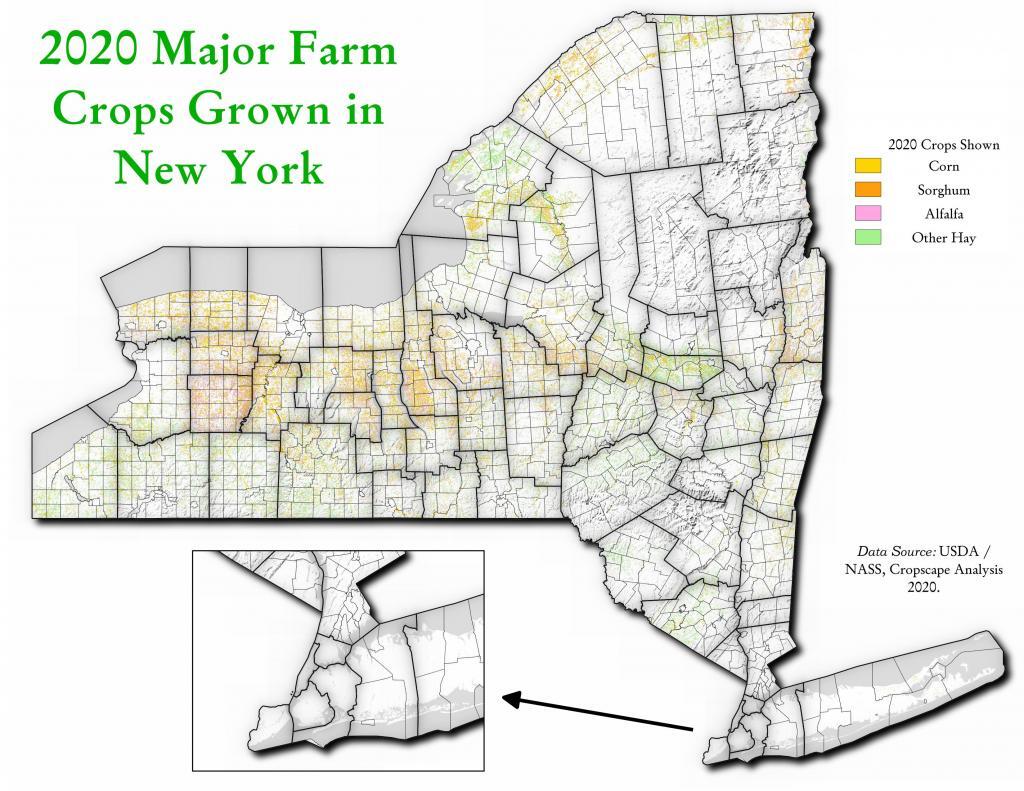
Been playing a lot lately with the Cropscape data lately, looking and comparing maps of crops grown in New York State. I wanted to create an interactive map here, but it's not projected in Web Meractor so it won't play nicely with my software. But you can explore the data here: https://nassgeodata.gmu.edu/CropScape/index.jsp?state=NY
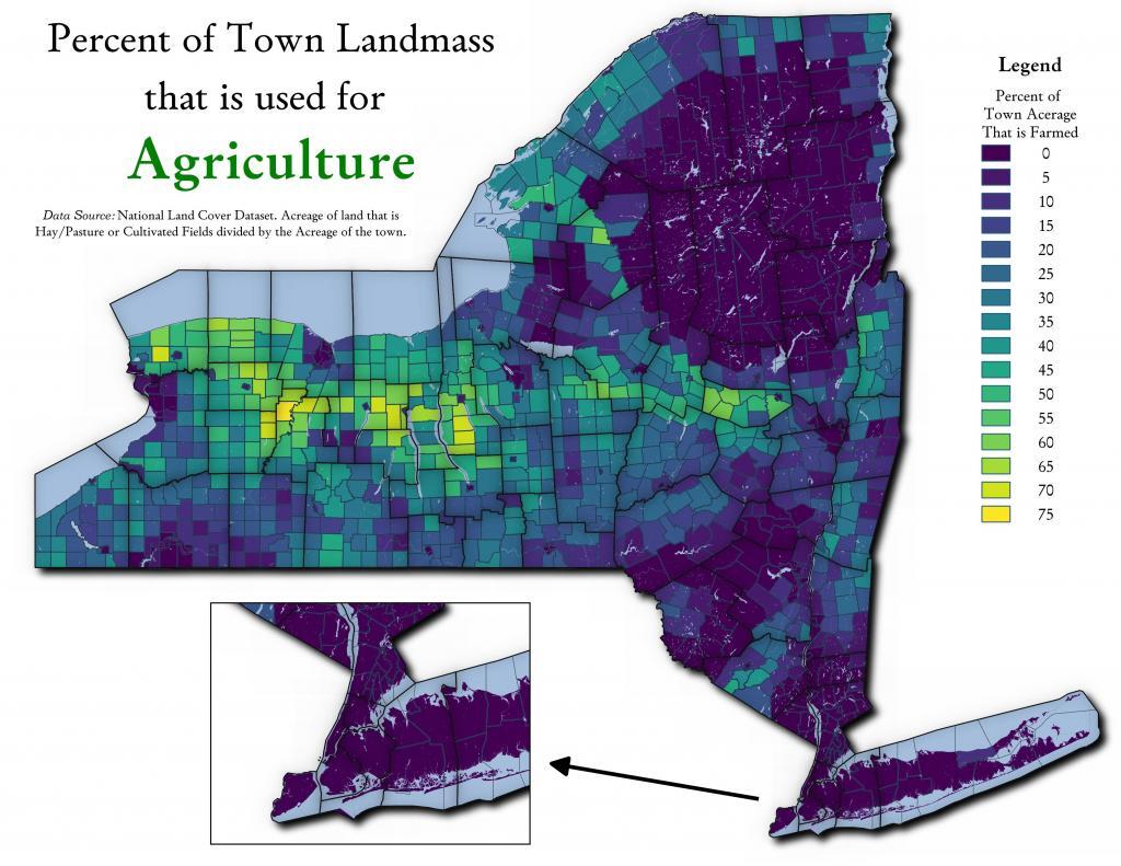
One thing that is misleading with the table I just shared is some towns are larger then others. Some towns have a lot of farm acerage, because they are big towns in area. This map shows the percentage of town landmass used for agriculture - including field crops and forage production.
It really is a miracle that he was able to save the calf.