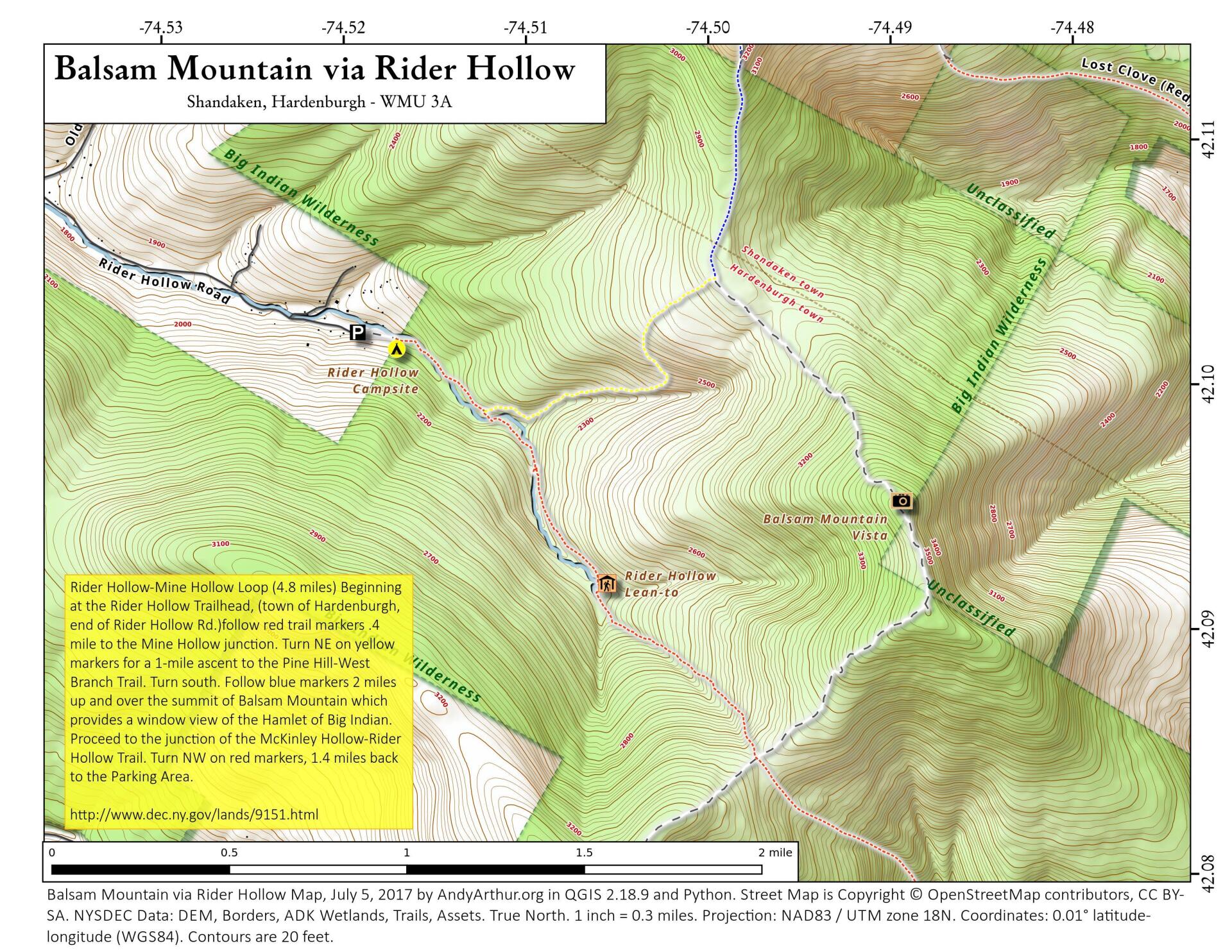
Map: Balsam Mountain Via Rider Hollow

Download a High Resolution JPEG Image of the Balsam Mountain Via Rider Hollow or an Adobe Acrobat Printable PDF of the Balsam Mountain Via Rider Hollow.

Bookmark my free Interactive GPS Map for your phone:
https://andyarthur.org/ny
... shows your location as a blue dot in relationship to campsites, trails, state land. This online map requires cell service, won't work in remote country, so also bring a paper map.
Free Download of New & Historical USGS 1:24k Topograpic Maps
Interactive maps with backcountry and roadside camping: New York, Pennsylvania, West Virginia & Vermont. List of NYS DEC Lean-Tos and Firetowers.
Google Spreadsheet with Roadside, Primitive and Pay Campsites
More about Big Indian Wilderness...
The Big Indian Wilderness Area encompasses over 33,500 acres of "Forever Wild" Forest Preserve lands in the heart of the Catskill Park. Wilderness, in contrast to areas where man and his works dominate the landscape, is where the earth and its community of life are untrammeled by man, where man himself is a visitor who does not remain.
In fact, the Big Indian Wilderness Area provides the user with the longest stretch of trail through uninterrupted virgin forest in the Catskills, offering numerous opportunities for solitude in a remote and rugged environment.
http://www.dec.ny.gov/lands/9151.html
... photos, maps and other content from from Ulster County.