Map: Ketchumville State Forest

Download a High Resolution JPEG Image of the Ketchumville State Forest or an Adobe Acrobat Printable PDF of the Ketchumville State Forest.

Bookmark my free Interactive GPS Map for your phone:
https://andyarthur.org/ny
... shows your location as a blue dot in relationship to campsites, trails, state land. This online map requires cell service, won't work in remote country, so also bring a paper map.
Free Download of New & Historical USGS 1:24k Topograpic Maps
Interactive maps with backcountry and roadside camping: New York, Pennsylvania, West Virginia & Vermont. List of NYS DEC Lean-Tos and Firetowers.
Google Spreadsheet with Roadside, Primitive and Pay Campsites
More about Ketchumville State Forest...
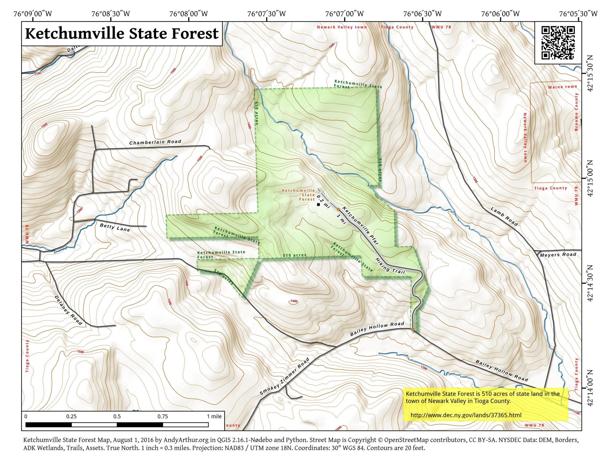
Ketchumville State Forest encompasses 500 acres. Its rustic and primitive feel makes it ideal for recreational activities such as hunting, snowshoeing, bird watching, and nature viewing. Ketchumville State Forest is undeveloped and has no formally marked trails. Former logging trails, the public forest access road, and old town roads provide informal hiking opportunities. As such, this forest offers unique opportunities to those who wish to explore on their own. No target shooting is allowed on this state forest.
http://www.dec.ny.gov/lands/37365.html
... photos, maps and other content from from Tioga County, NY.
1 Comment
There are old horse trail markers from years ago
Budget cuts have effects
This state land needs some TLC from a horse riding club