Map: Wurstboro Ridge State Forest
Download a High Resolution JPEG Image of the Wurstboro Ridge State Forest or an Adobe Acrobat Printable PDF of the Wurstboro Ridge State Forest.
About Map: Wurstboro Ridge State Forest ....
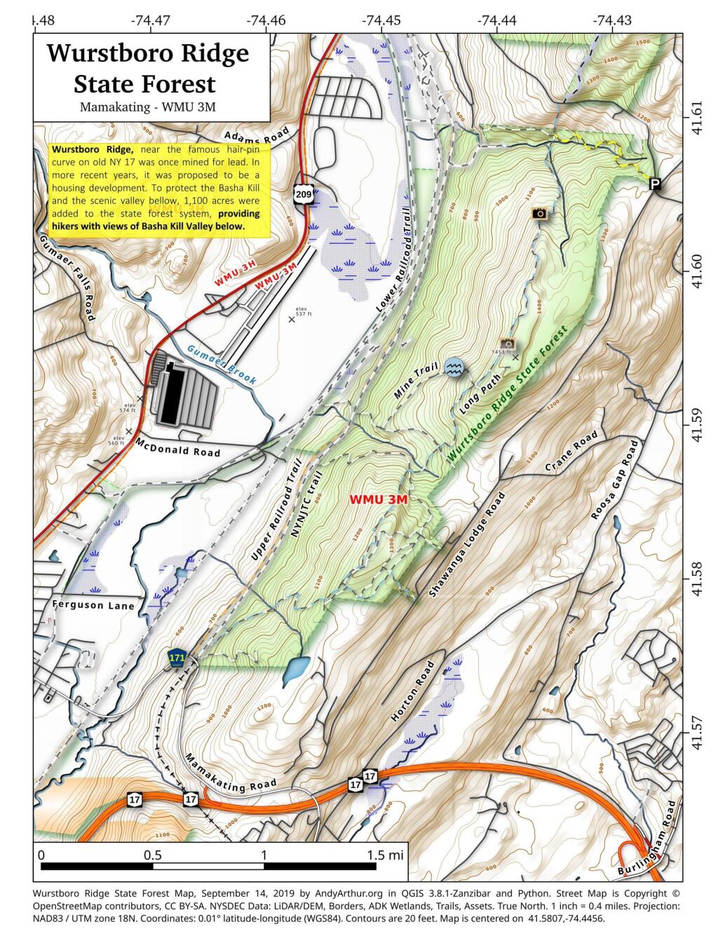
Wurstboro Ridge, near the famous hair-pin curve on old NY 17 was once mined for lead. In more recent years, it was proposed to be a housing development. To protect the Basha Kill and the scenic valley bellow, 1,100 acres were added to the state forest system, providing hikers with views of Basha Kill Valley below.

Bookmark my free Interactive GPS Map for your phone:
https://andyarthur.org/ny
... shows your location as a blue dot in relationship to campsites, trails, state land. This online map requires cell service, won't work in remote country, so also bring a paper map.
Free Download of New & Historical USGS 1:24k Topograpic Maps
Interactive maps with backcountry and roadside camping: New York, Pennsylvania, West Virginia & Vermont. List of NYS DEC Lean-Tos and Firetowers.
Google Spreadsheet with Roadside, Primitive and Pay Campsites
More about Wurstboro Ridge Open Space...
Approximately 1,100 acres of state land that were acquired to protect the Wurstboro Ridge from development.
http://bashakillbirder.wordpress.com/2012/06/22/wurtsboro-ridge-open-space-62112/
... photos, maps and other content from from .