Map: Tracy Creek State Forest (Steuben 16)
Download a High Resolution JPEG Image of the Tracy Creek State Forest (Steuben 16) or an Adobe Acrobat Printable PDF of the Tracy Creek State Forest (Steuben 16).

Bookmark my free Interactive GPS Map for your phone:
https://andyarthur.org/ny
... shows your location as a blue dot in relationship to campsites, trails, state land. This online map requires cell service, won't work in remote country, so also bring a paper map.
Free Download of New & Historical USGS 1:24k Topograpic Maps
Interactive maps with backcountry and roadside camping: New York, Pennsylvania, West Virginia & Vermont. List of NYS DEC Lean-Tos and Firetowers.
Google Spreadsheet with Roadside, Primitive and Pay Campsites
More about Tracy Creek State Forest (Steuben 16)...
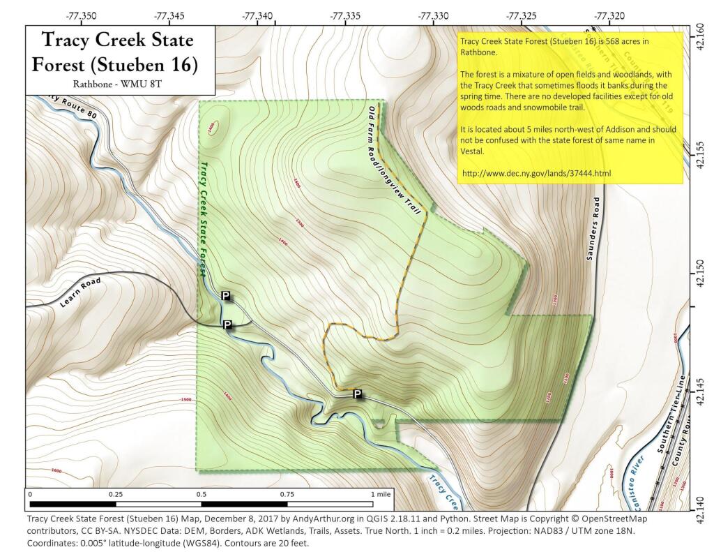
The 569-acre Tracy Creek State Forest has a limited amount of development. There are no designated recreation trails, but the gated Department road (a.k.a. "Long View Trail"), old skid roads, deer paths, and old farm lanes are available for exploring. This forest also has a fair sized component of open fields which are somewhat unique on state forest properties. Tracy Creek, which flows through the center of the forest, is a major water course and has, in the past, had significant incidents of flash flooding.
http://www.dec.ny.gov/lands/37444.html
... photos, maps and other content from from Steuben County.