Map: Fish Creek Wildlife Management Area

Download a High Resolution JPEG Image of the Fish Creek Wildlife Management Area or an Adobe Acrobat Printable PDF of the Fish Creek Wildlife Management Area.

Bookmark my free Interactive GPS Map for your phone:
https://andyarthur.org/ny
... shows your location as a blue dot in relationship to campsites, trails, state land. This online map requires cell service, won't work in remote country, so also bring a paper map.
Free Download of New & Historical USGS 1:24k Topograpic Maps
Interactive maps with backcountry and roadside camping: New York, Pennsylvania, West Virginia & Vermont. List of NYS DEC Lean-Tos and Firetowers.
Google Spreadsheet with Roadside, Primitive and Pay Campsites
More about Fish Creek WMA...
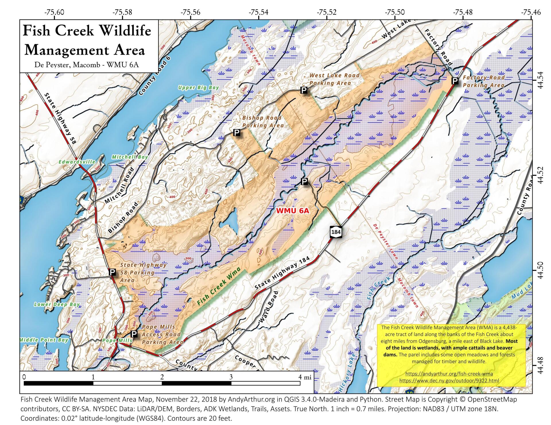
The Fish Creek Wildlife Management Area (WMA) is a 4,438-acre tract of land located in southwestern St. Lawrence County, eight miles west of the city of Ogdensburg and one mile south of Black Lake. There are 2,046 acre natural wetland which is primarily an emergent marsh whose water level is dependent on the many beaver dams on the Fish Creek drainage and 2,392 acres of upland most of which is forested. The emergent marsh is mainly cattail with flooded shrubs interspersed throughout the area. There is a hardwood swamp along the fringe of the emergent marsh. The upland portion contains approximately 1000 acres of softwood scattered throughout the area which deer use as wintering areas and 861 acres of young northern hardwoods that are being managed using commercial forest sales. There are 93 acres of open grassland maintained for ground nesting birds.
http://www.dec.ny.gov/outdoor/9322.html
... photos, maps and other content from from St. Lawrence County.