Map: Buckton State Forest

Download a High Resolution JPEG Image of the Buckton State Forest or an Adobe Acrobat Printable PDF of the Buckton State Forest.
About Map: Buckton State Forest ....
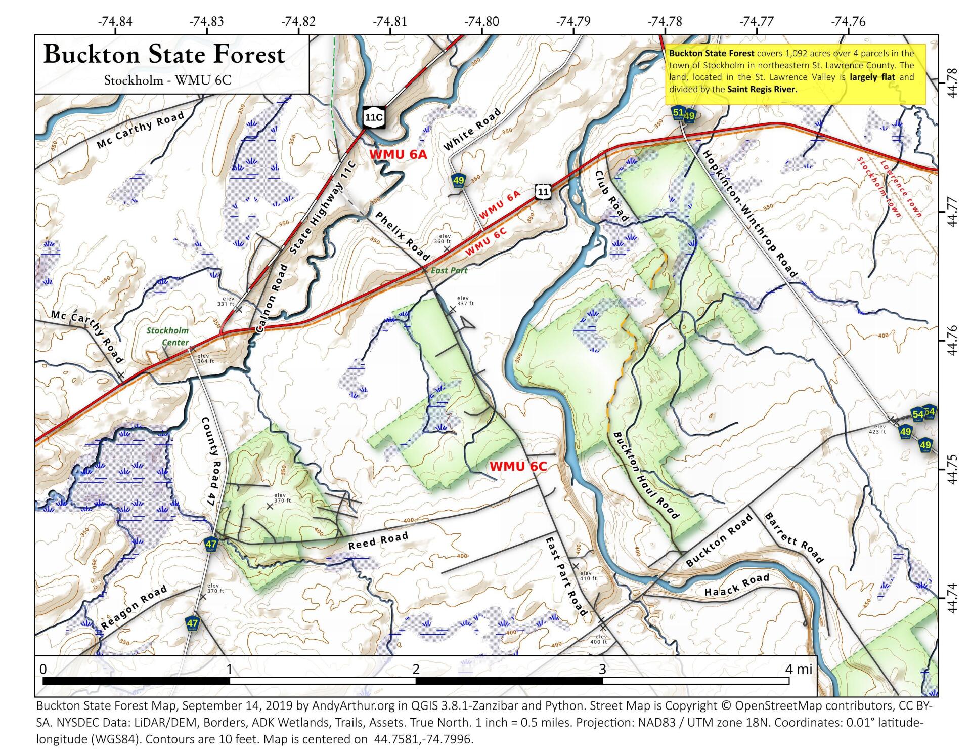
Buckton State Forest covers 1,092 acres over 4 parcels in the town of Stockholm in northeastern St. Lawrence County. The land, located in the St. Lawrence Valley is largely flat and divided by the Saint Regis River.

Bookmark my free Interactive GPS Map for your phone:
https://andyarthur.org/ny
... shows your location as a blue dot in relationship to campsites, trails, state land. This online map requires cell service, won't work in remote country, so also bring a paper map.
Free Download of New & Historical USGS 1:24k Topograpic Maps
Interactive maps with backcountry and roadside camping: New York, Pennsylvania, West Virginia & Vermont. List of NYS DEC Lean-Tos and Firetowers.
Google Spreadsheet with Roadside, Primitive and Pay Campsites
More about Buckton State Forest...
Buckton State Forest covers 1,092 acres located in the town of Stockholm in northeastern St. Lawrence County.
Recreation
There is a section of the New York State Snowmobile Trail System that crosses this state forest. The trail is classified as a corridor trail 7E. This trail also crosses various parcels of private land so please be respectful of private landowners and stay on the trail. This property also provides large undeveloped areas well suited for hunting, hiking, and nature viewing.
Camping - There are no designated campsites on this property. Back country camping is allowed. Camping for more than three nights or in a group of ten or more requires a permit from a Forest Ranger. Camping is prohibited within 150 feet of water, roads or trail.
Hunting and Trapping are permitted on the property in accordance with all game regulations, unless otherwise posted. Fishing is permitted in the nearby St. Regis River in accordance with all fishing regulations.
Geo-caching is allowed although caches must be marked with the owner's contact information and may not be placed in dangerous or ecologically sensitive locations. See the February 2005 article in Conservationist Magazine for more information on geo-caching.
http://www.dec.ny.gov/lands/80851.html
... photos, maps and other content from from St. Lawrence County.