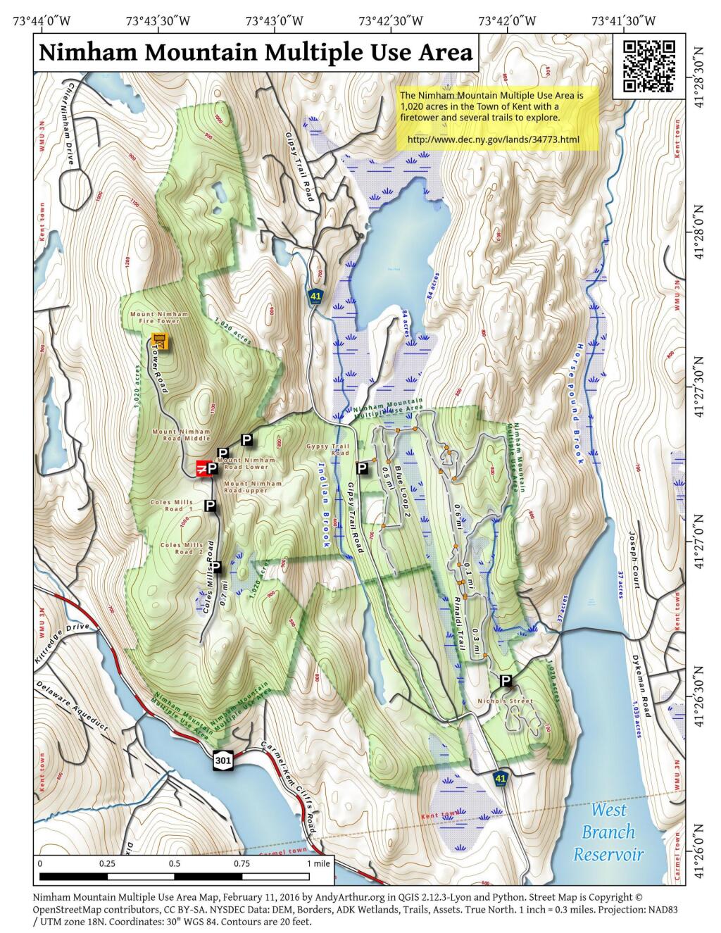
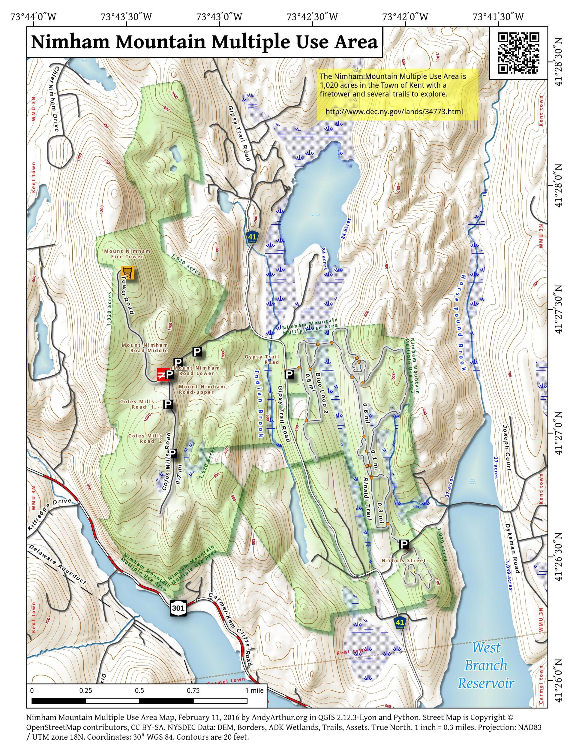
Map: Nimham Mountain Multiple Use Area
Download a High Resolution JPEG Image of the Nimham Mountain Multiple Use Area or an Adobe Acrobat Printable PDF of the Nimham Mountain Multiple Use Area.

Bookmark my free Interactive GPS Map for your phone:
https://andyarthur.org/ny
... shows your location as a blue dot in relationship to campsites, trails, state land. This online map requires cell service, won't work in remote country, so also bring a paper map.
Free Download of New & Historical USGS 1:24k Topograpic Maps
Interactive maps with backcountry and roadside camping: New York, Pennsylvania, West Virginia & Vermont. List of NYS DEC Lean-Tos and Firetowers.
Google Spreadsheet with Roadside, Primitive and Pay Campsites
More about Nimham Mountain Multiple Use Area...
Nimham Mountain, named after Chief Daniel Nimham of the Wappingers tribe, contains 1,023 acres in the town of Kent, Putnam County. This property is very popular with bikers, hikers and horseback riders and has an extensive network of trails and old roads. Forest cover is mainly mixed hardwoods with some conifer plantations. Parking lots are on Nichols Street, Gipsy Trail Road, and Mt. Nimham Road.
http://www.dec.ny.gov/lands/34773.html
... photos, maps and other content from from .