Map: Sears Pond State Forest
Download a High Resolution JPEG Image of the Sears Pond State Forest or an Adobe Acrobat Printable PDF of the Sears Pond State Forest.

Bookmark my free Interactive GPS Map for your phone:
https://andyarthur.org/ny
... shows your location as a blue dot in relationship to campsites, trails, state land. This online map requires cell service, won't work in remote country, so also bring a paper map.
Free Download of New & Historical USGS 1:24k Topograpic Maps
Interactive maps with backcountry and roadside camping: New York, Pennsylvania, West Virginia & Vermont. List of NYS DEC Lean-Tos and Firetowers.
Google Spreadsheet with Roadside, Primitive and Pay Campsites
More about Sears Pond State Forest...
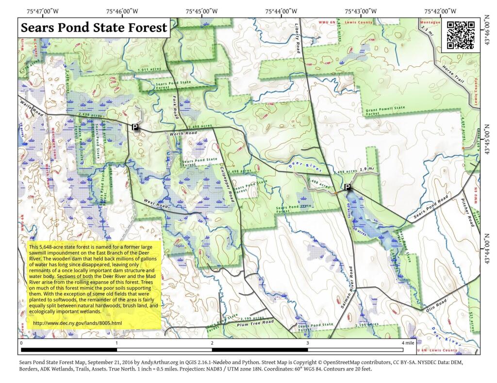
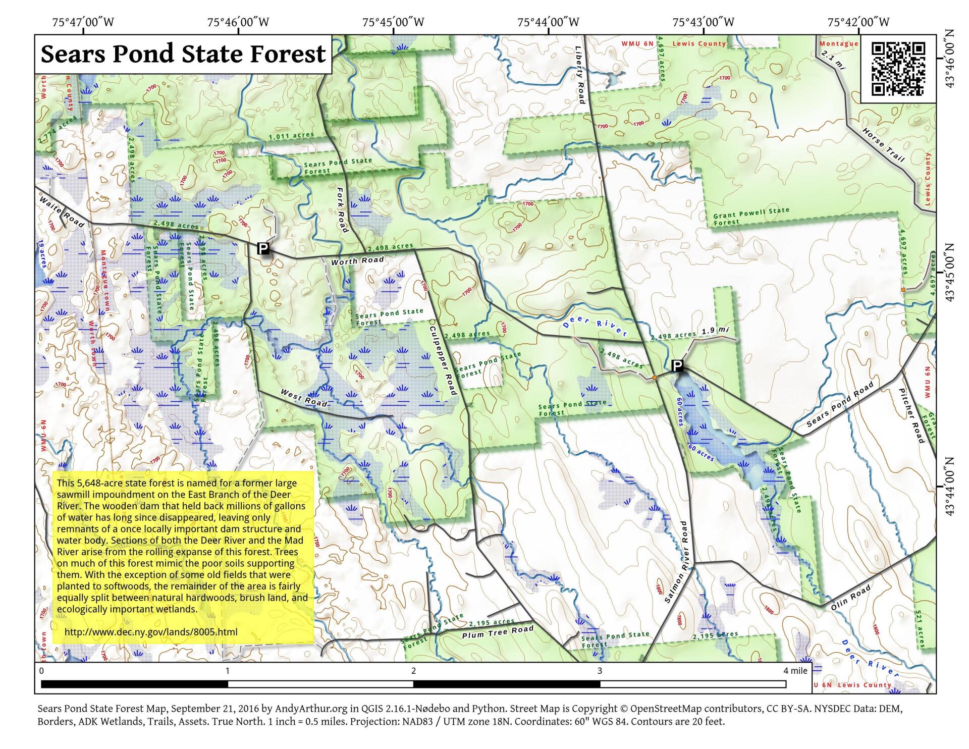
This 5,648-acre state forest is named for a former large sawmill impoundment on the East Branch of the Deer River. The wooden dam that held back millions of gallons of water has long since disappeared, leaving only remnants of a once locally important dam structure and water body. Sections of both the Deer River and the Mad River arise from the rolling expanse of this forest. Trees on much of this forest mimic the poor soils supporting them. With the exception of some old fields that were planted to softwoods, the remainder of the area is fairly equally split between natural hardwoods, brush land, and ecologically important wetlands.
... photos, maps and other content from from .