Map: High Towers State Forest

Download a High Resolution JPEG Image of the High Towers State Forest or an Adobe Acrobat Printable PDF of the High Towers State Forest.

Bookmark my free Interactive GPS Map for your phone:
https://andyarthur.org/ny
... shows your location as a blue dot in relationship to campsites, trails, state land. This online map requires cell service, won't work in remote country, so also bring a paper map.
Free Download of New & Historical USGS 1:24k Topograpic Maps
Interactive maps with backcountry and roadside camping: New York, Pennsylvania, West Virginia & Vermont. List of NYS DEC Lean-Tos and Firetowers.
Google Spreadsheet with Roadside, Primitive and Pay Campsites
More about High Towers State Forest...
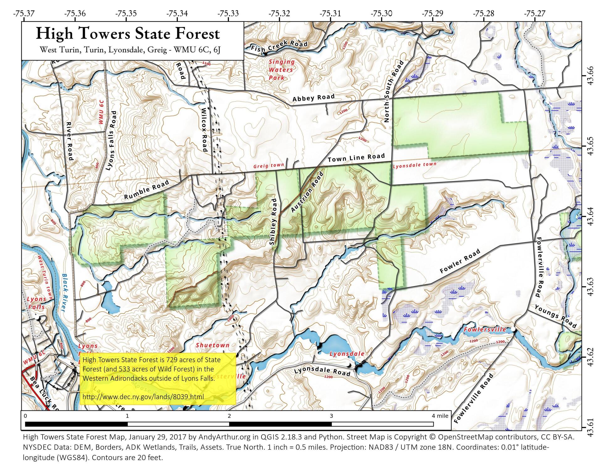
This 729-acre state forest is named for the tall electric towers that were constructed on the area many years ago. Since that time, newer and higher towers have been constructed adjacent to the originals, but the name has persisted. The diverse landscape provides a range of recreational experiences. Minimal developed facilities besides town roads exist on this state forest.
http://www.dec.ny.gov/lands/8039.html
... photos, maps and other content from from Lewis County.