Map: Grant Powell State Forest
Download a High Resolution JPEG Image of the Grant Powell State Forest or an Adobe Acrobat Printable PDF of the Grant Powell State Forest.

Bookmark my free Interactive GPS Map for your phone:
https://andyarthur.org/ny
... shows your location as a blue dot in relationship to campsites, trails, state land. This online map requires cell service, won't work in remote country, so also bring a paper map.
Free Download of New & Historical USGS 1:24k Topograpic Maps
Interactive maps with backcountry and roadside camping: New York, Pennsylvania, West Virginia & Vermont. List of NYS DEC Lean-Tos and Firetowers.
Google Spreadsheet with Roadside, Primitive and Pay Campsites
More about Grant Powell State Forest...
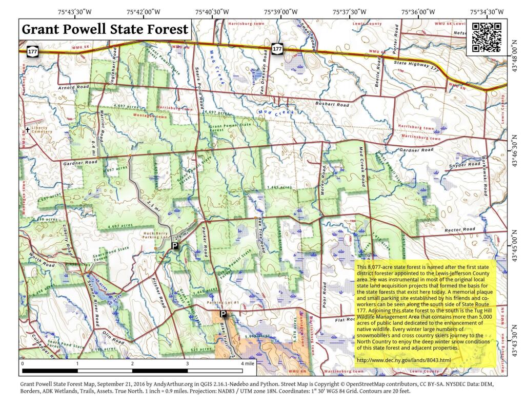
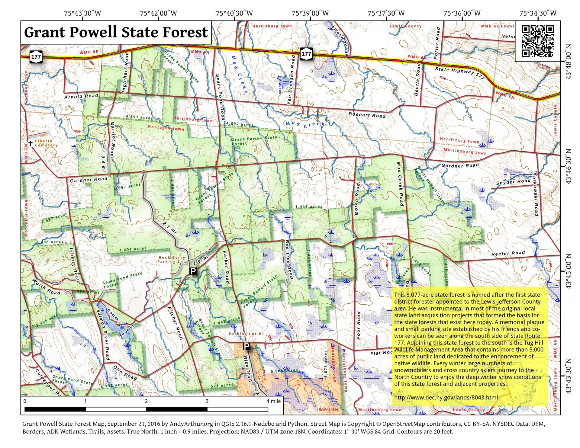
This 8,077-acre state forest is named after the first state district forester appointed to the Lewis-Jefferson County area. He was instrumental in most of the original local state land acquisition projects that formed the basis for the state forests that exist here today. A memorial plaque and small parking site established by his friends and co-workers can be seen along the south side of State Route 177. Adjoining this state forest to the south is the Tug Hill Wildlife Management Area that contains more than 5,000 acres of public land dedicated to the enhancement of native wildlife. Every winter large numbers of snowmobilers and cross country skiers journey to the North Country to enjoy the deep winter snow conditions of this state forest and adjacent properties.
http://www.dec.ny.gov/lands/8043.html
... photos, maps and other content from from Lewis County.