Map: Plantation Island Wildlife Management Area

Download a High Resolution JPEG Image of the Plantation Island Wildlife Management Area or an Adobe Acrobat Printable PDF of the Plantation Island Wildlife Management Area.

Bookmark my free Interactive GPS Map for your phone:
https://andyarthur.org/ny
... shows your location as a blue dot in relationship to campsites, trails, state land. This online map requires cell service, won't work in remote country, so also bring a paper map.
Free Download of New & Historical USGS 1:24k Topograpic Maps
Interactive maps with backcountry and roadside camping: New York, Pennsylvania, West Virginia & Vermont. List of NYS DEC Lean-Tos and Firetowers.
Google Spreadsheet with Roadside, Primitive and Pay Campsites
More about Plantation Island Wildlife Management Area...
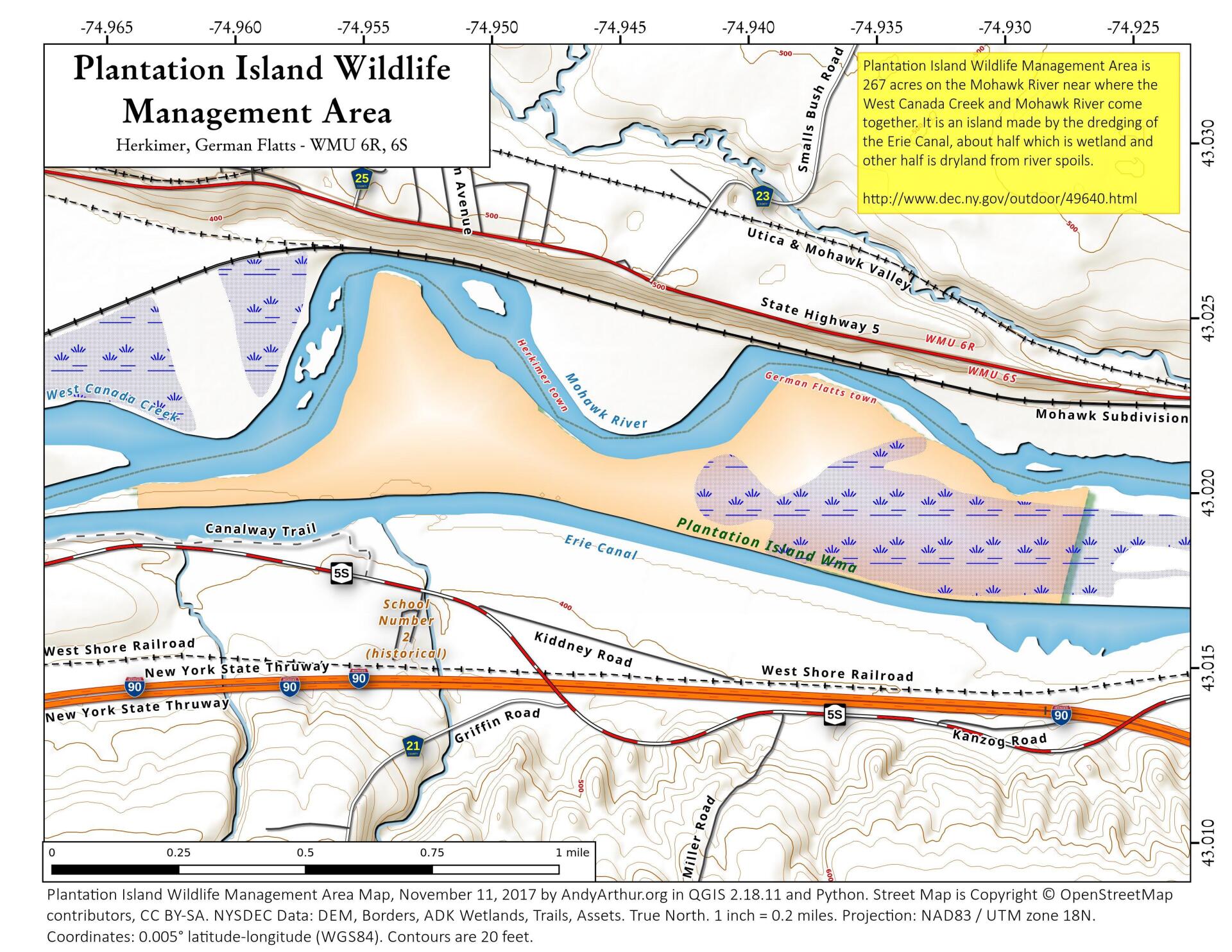
The primary purposes of Plantation Island Wildlife Management Area (WMA) are for wildlife management, wildlife habitat management, and wildlife-dependent recreation. This WMA is approximately 200 acres of Mohawk River floodplain in the Town of German Flats, Herkimer County. The Mohawk River is the north perimeter of the island, with the NYS Barge Canal defining the south border. Historically, Plantation Island was used for agriculture and canal maintenance. Agricultural activity has long ceased, but portions of the island are still managed by the NYS Thruway Authority for Barge Canal management and upkeep. The island is a mixture of wetlands (open marsh, wet meadow, and small, shallow wetland pools), old pasture and meadow, and floodplain forest. Due to previous significant disturbance, the island has large stands of invasive plant species such as honeysuckle, buckthorn, purple loosestrife, and Phragmites. Since access is limited, the island has little infrastructure.
http://www.dec.ny.gov/outdoor/49640.html
... photos, maps and other content from from Herkimer County.
1 Trackback or Pingback