Map: Mount Hayden State Forest

Download a High Resolution JPEG Image of the Mount Hayden State Forest or an Adobe Acrobat Printable PDF of the Mount Hayden State Forest.

Bookmark my free Interactive GPS Map for your phone:
https://andyarthur.org/ny
... shows your location as a blue dot in relationship to campsites, trails, state land. This online map requires cell service, won't work in remote country, so also bring a paper map.
Free Download of New & Historical USGS 1:24k Topograpic Maps
Interactive maps with backcountry and roadside camping: New York, Pennsylvania, West Virginia & Vermont. List of NYS DEC Lean-Tos and Firetowers.
Google Spreadsheet with Roadside, Primitive and Pay Campsites
More about Mount Hayden State Forest...
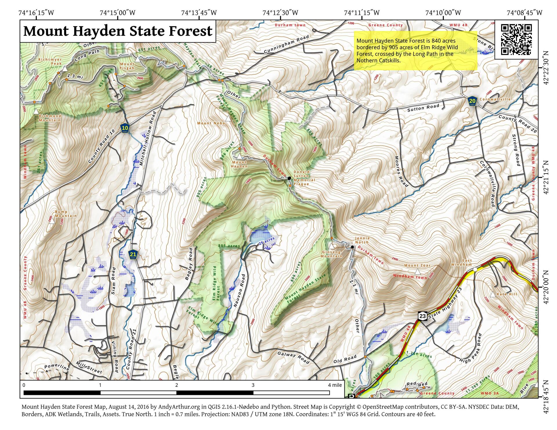
The 844-acre Mount Hayden State Forest is located on the northeast boundary of the Catskill Forest Preserve. The Long Path traverses Mount Hayden State Forest.
The Long Path is a long distance trail that extends from the George Washington Bridge to Altamont, NY. Approximately 4.5 miles of the Long Path pass through Mount Hayden State Forest, extending from private land in the southeast to Mount Pisgah State Forest in the northwest.
General information on backcountry camping includes how-to and safety tips and links to rules & regulations
There are no designated campsites in Mount Hayden, but at-large backcountry camping is allowed.
http://www.dec.ny.gov/lands/102510.html
... photos, maps and other content from from Greene County.