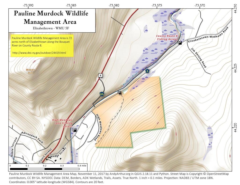
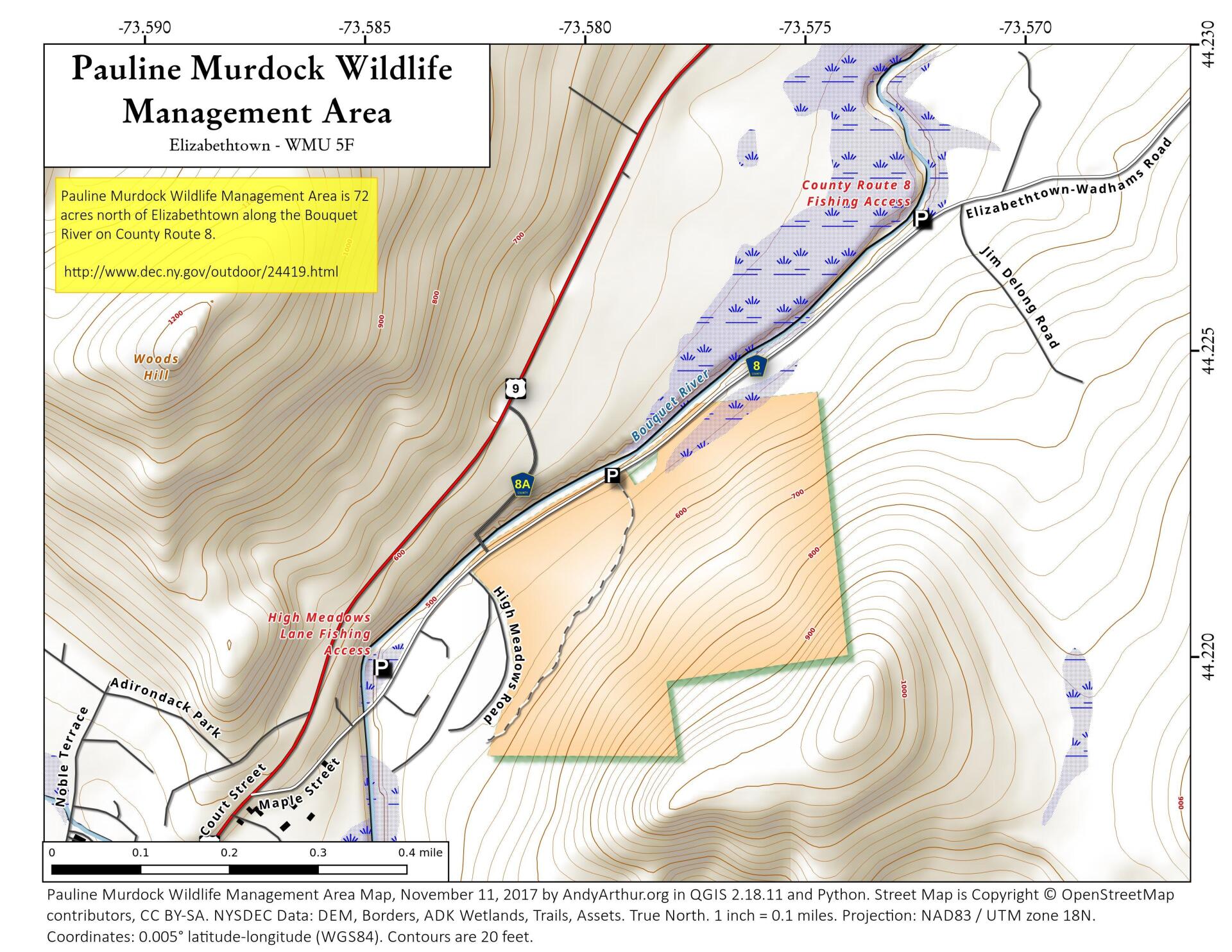
Map: Pauline Murdock Wildlife Management Area
Download a High Resolution JPEG Image of the Pauline Murdock Wildlife Management Area or an Adobe Acrobat Printable PDF of the Pauline Murdock Wildlife Management Area.

Bookmark my free Interactive GPS Map for your phone:
https://andyarthur.org/ny
... shows your location as a blue dot in relationship to campsites, trails, state land. This online map requires cell service, won't work in remote country, so also bring a paper map.
Free Download of New & Historical USGS 1:24k Topograpic Maps
Interactive maps with backcountry and roadside camping: New York, Pennsylvania, West Virginia & Vermont. List of NYS DEC Lean-Tos and Firetowers.
Google Spreadsheet with Roadside, Primitive and Pay Campsites
More about Pauline Murdock Wildlife Management Area...
The primary purposes of Pauline Murdock Wildlife Management Area (WMA) are for wildlife management, wildlife habitat management, and wildlife-dependent recreation. This WMA is a 68.5 acre parcel. In 1974, the property was received as a gift from Mr. Robert B. Murdock, in memory of his wife Pauline. It was accepted as a state refuge to enhance and perpetuate local wildlife.
About 5 acres of the parcel is flood plain and the rest is a moderately steep mountain slope. A manmade canal clearly accentuates the terminus of the flood plain and the base of the mountain. This canal now directs snow melt and rainfall to a very small man made pond to a log crib dam and continues to the Boquet River.
The flood plain is currently in a pioneer old field successional stage. A variety of grasses and wildflowers compliment the area and provide seasonal color change. Wild grape vines cling to the remaining fence post and wire. Raspberry, lilac, and red barberry bushes denote buried building foundation sites. White pine, quaking aspen, speckled alder, and fire cherry are the primary woody plants. The mountain slope is a mature white pine-northern hardwood forest. The primary forest species include white pine, eastern hemlock, sugar maple, beech, red pine, and red oak.
http://www.dec.ny.gov/outdoor/24419.html
... photos, maps and other content from from Essex County.