Map: Pharsalia Wildlife Management Area
Download a High Resolution JPEG Image of the Pharsalia Wildlife Management Area or an Adobe Acrobat Printable PDF of the Pharsalia Wildlife Management Area.

Bookmark my free Interactive GPS Map for your phone:
https://andyarthur.org/ny
... shows your location as a blue dot in relationship to campsites, trails, state land. This online map requires cell service, won't work in remote country, so also bring a paper map.
Free Download of New & Historical USGS 1:24k Topograpic Maps
Interactive maps with backcountry and roadside camping: New York, Pennsylvania, West Virginia & Vermont. List of NYS DEC Lean-Tos and Firetowers.
Google Spreadsheet with Roadside, Primitive and Pay Campsites
More about Pharsalia Wildlife Management Area...
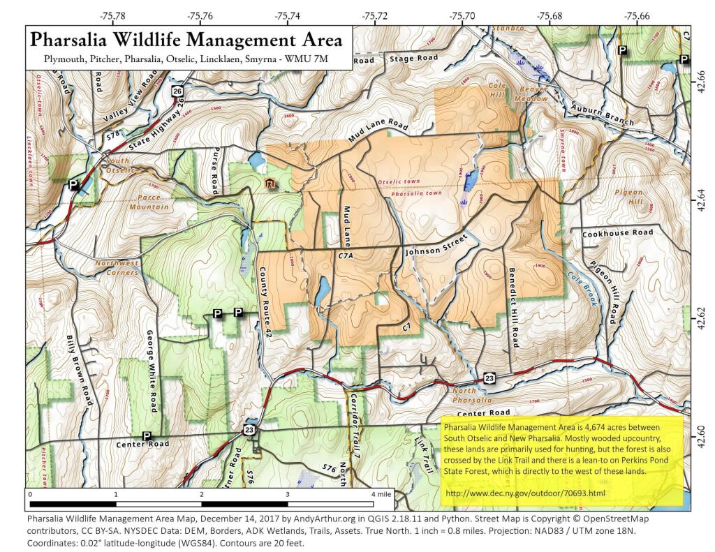
e primary purposes of Pharsalia Wildlife Management Area (WMA) are for wildlife management, wildlife habitat management, and wildlife-dependent recreation. This WMA is 4,689 acres in size and is located in the northwest portion of Chenango County, approximately 10 miles southwest of Sherburne. Pharsalia generally has flat or gently sloping terrain.
In 1926 Pharsalia became the first State Game Refuge purchased with Conservation Fund monies. Thousands of trees and shrubs were planted for reforestation and wildlife purposes. A 200-man Civilian Conservation Corp camp accomplished much of the work and also constructed several small ponds for waterfowl use.
http://www.dec.ny.gov/outdoor/70693.html
... photos, maps and other content from from Chenango County.