Map: Hewitt State Forest
Download a High Resolution JPEG Image of the Hewitt State Forest or an Adobe Acrobat Printable PDF of the Hewitt State Forest.

Bookmark my free Interactive GPS Map for your phone:
https://andyarthur.org/ny
... shows your location as a blue dot in relationship to campsites, trails, state land. This online map requires cell service, won't work in remote country, so also bring a paper map.
Free Download of New & Historical USGS 1:24k Topograpic Maps
Interactive maps with backcountry and roadside camping: New York, Pennsylvania, West Virginia & Vermont. List of NYS DEC Lean-Tos and Firetowers.
Google Spreadsheet with Roadside, Primitive and Pay Campsites
More about Hewitt State Forest...
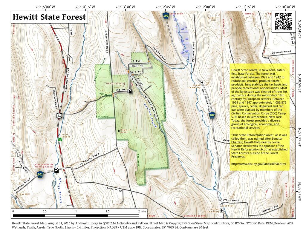
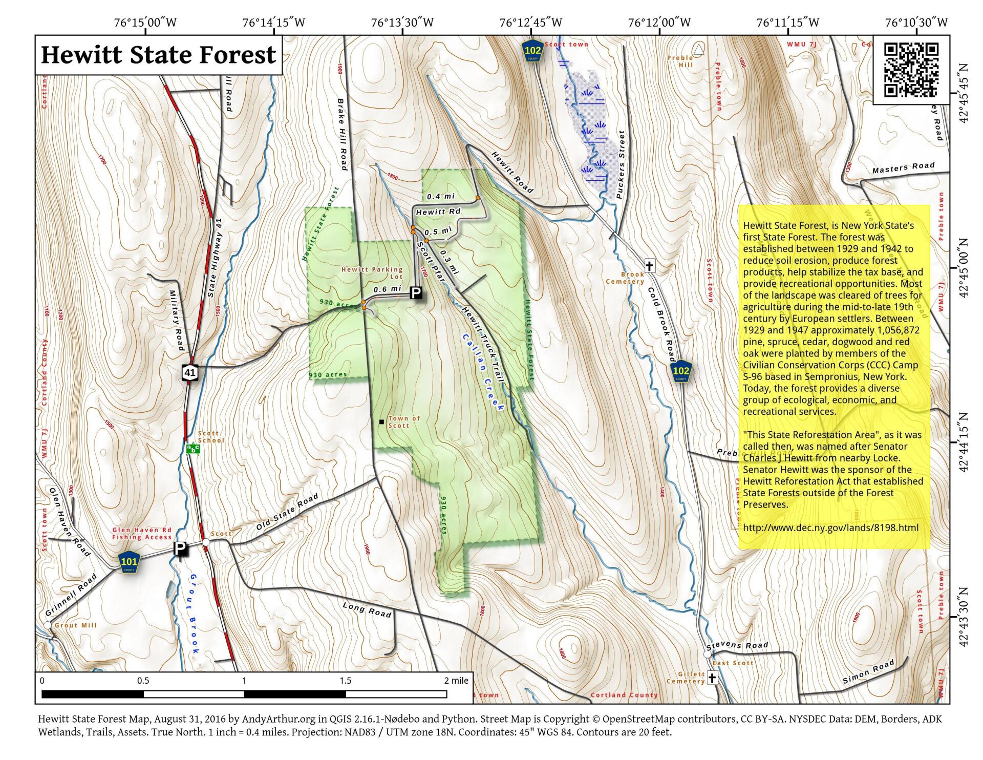
The forest was established between 1929 and 1942 to reduce soil erosion, produce forest products, help stabilize the tax base, and provide recreational opportunities. Most of the landscape was cleared of trees for agriculture during the mid-to-late 19th century by European settlers. Between 1929 and 1947 approximately 1,056,872 pine, spruce, cedar, dogwood and red oak were planted by members of the Civilian Conservation Corps (CCC) Camp S-96 based in Sempronius, New York. Today, the forest provides a diverse group of ecological, economic, and recreational services
http://www.dec.ny.gov/lands/8198.html
... photos, maps and other content from from Cayuga County.