Map: Cat Hollow State Forest

Download a High Resolution JPEG Image of the Cat Hollow State Forest or an Adobe Acrobat Printable PDF of the Cat Hollow State Forest.

Bookmark my free Interactive GPS Map for your phone:
https://andyarthur.org/ny
... shows your location as a blue dot in relationship to campsites, trails, state land. This online map requires cell service, won't work in remote country, so also bring a paper map.
Free Download of New & Historical USGS 1:24k Topograpic Maps
Interactive maps with backcountry and roadside camping: New York, Pennsylvania, West Virginia & Vermont. List of NYS DEC Lean-Tos and Firetowers.
Google Spreadsheet with Roadside, Primitive and Pay Campsites
More about Cat Hollow State Forest...
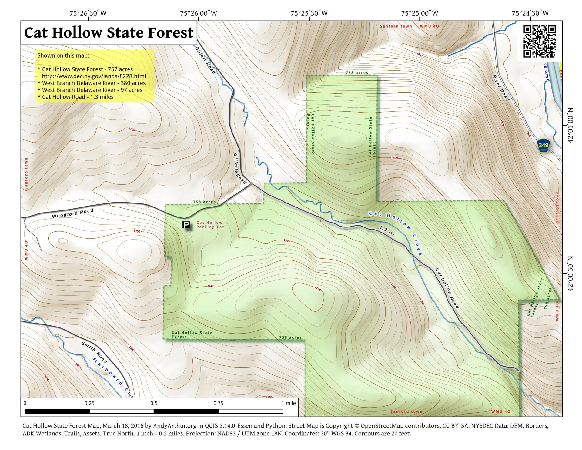
Cat Hollow State Forest covers 759 acres and is located in the town of Sanford in Broome County. The forest was acquired in 1964 using Bond Act funds and is named after the cougars that roamed the area prior to 1900.
The area is ideal for passive recreation, such as hunting, bird watching and hiking. No formal hiking or cross country ski trails exist, although McMurray road, a 1.2 mile road traverses the forest.
The southern boundary of the forest runs for three quarters of a mile along the New York-Pennsylvania Border. A roadside beaver pond can be found along Woodford Road near the west edge of the forest. This area is a good place to see geese, ducks, beaver, herons and other wetland wildlife species. The forest has two streams- Cat Hollow stream and a small tributary of Cat Hollow that is unnamed. In addition, there are two small wetlands on the forest that total 8.8 acres in size, and two interior ponds.
http://www.dec.ny.gov/lands/8228.html
... photos, maps and other content from from Broome County.