Map: Degrasse State Forest
Download a High Resolution JPEG Image of the Degrasse State Forest or an Adobe Acrobat Printable PDF of the Degrasse State Forest.

Bookmark my free Interactive GPS Map for your phone:
https://andyarthur.org/ny
... shows your location as a blue dot in relationship to campsites, trails, state land. This online map requires cell service, won't work in remote country, so also bring a paper map.
Free Download of New & Historical USGS 1:24k Topograpic Maps
Interactive maps with backcountry and roadside camping: New York, Pennsylvania, West Virginia & Vermont. List of NYS DEC Lean-Tos and Firetowers.
Google Spreadsheet with Roadside, Primitive and Pay Campsites
More about Degrasse State Forest...
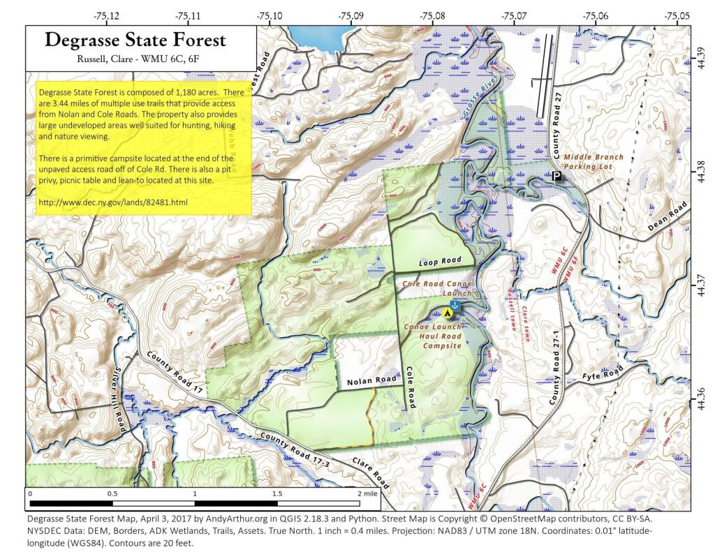
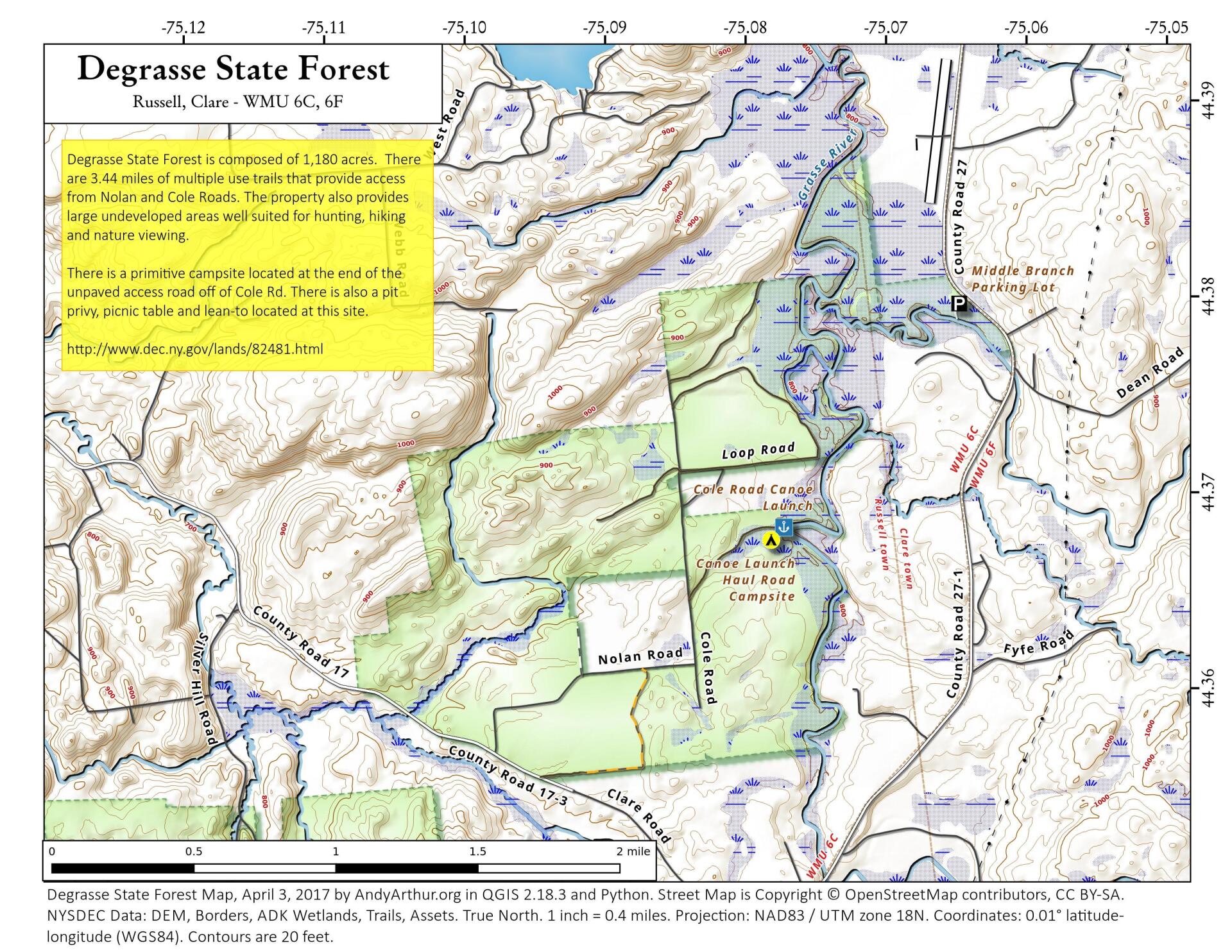
Degrasse State Forest is composed of 1,180 acres located in the town of Russell in southwestern St. Lawrence County. There are 3.44 miles of multiple use trails that provide access from Nolan and Cole Roads. The property also provides large undeveloped areas well suited for hunting, hiking and nature viewing. There is a primitive campsite located at the end of the unpaved access road off of Cole Rd. There is also a pit privy, picnic table and lean-to located at this site.
http://www.dec.ny.gov/lands/82481.html
... photos, maps and other content from from St. Lawrence County.