Map: Cold Creek And Lost Nation State Forest

Download a High Resolution JPEG Image of the Cold Creek And Lost Nation State Forest or an Adobe Acrobat Printable PDF of the Cold Creek And Lost Nation State Forest.

Bookmark my free Interactive GPS Map for your phone:
https://andyarthur.org/ny
... shows your location as a blue dot in relationship to campsites, trails, state land. This online map requires cell service, won't work in remote country, so also bring a paper map.
Free Download of New & Historical USGS 1:24k Topograpic Maps
Interactive maps with backcountry and roadside camping: New York, Pennsylvania, West Virginia & Vermont. List of NYS DEC Lean-Tos and Firetowers.
Google Spreadsheet with Roadside, Primitive and Pay Campsites
More about Cold Creek And Lost Nation State Forest...
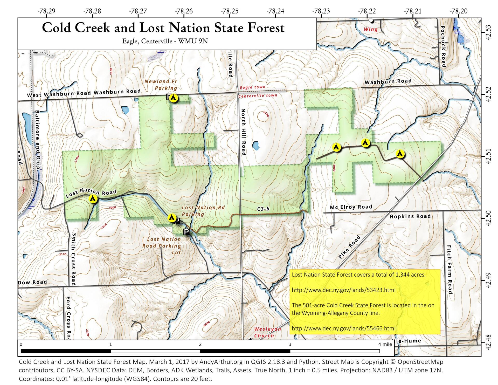
Lost Nation State Forest covers a total of 1,344 acres. The forest is named after the fabled "Lost Nation," a resident tribe of Native Americans who unexpectedly disappeared from the area without a trace. There are no designated trails but hiking is allowed throughout the property.
In the 1930's, the Lost Nation Civilian Conservation Corps (CCC) camp, S-126, was located on this State Forest along Lost Nation Road. Other than a small concrete building foundation, an artesian well and the Norway spruce trees lining the road, little evidence of the camp remains. One of the camp buildings still exists, having been moved to private property on Vosburg Cross Road and known locally as "Sam's Dance Hall."
http://www.dec.ny.gov/lands/53423.html
The 501-acre Cold Creek State Forest is located in the on the Wyoming-Allegany County line. There are no trails on the unit but hiking is allowed on forest roads and throughout the property.
The Centerville area was settled shortly after 1800. Early residents were attracted by the high-quality timber growing there. Ironically, most of this high-quality timberland was eventually cleared for agriculture, but by the early 1900's much of the worn-out farmland was being abandoned and was reverting once again to forest.
http://www.dec.ny.gov/lands/55466.html
... photos, maps and other content from from Allegany County.