Map: Bumps Creek State Forest
Download a High Resolution JPEG Image of the Bumps Creek State Forest or an Adobe Acrobat Printable PDF of the Bumps Creek State Forest.

Bookmark my free Interactive GPS Map for your phone:
https://andyarthur.org/ny
... shows your location as a blue dot in relationship to campsites, trails, state land. This online map requires cell service, won't work in remote country, so also bring a paper map.
Free Download of New & Historical USGS 1:24k Topograpic Maps
Interactive maps with backcountry and roadside camping: New York, Pennsylvania, West Virginia & Vermont. List of NYS DEC Lean-Tos and Firetowers.
Google Spreadsheet with Roadside, Primitive and Pay Campsites
More about Bumps Creek State Forset...
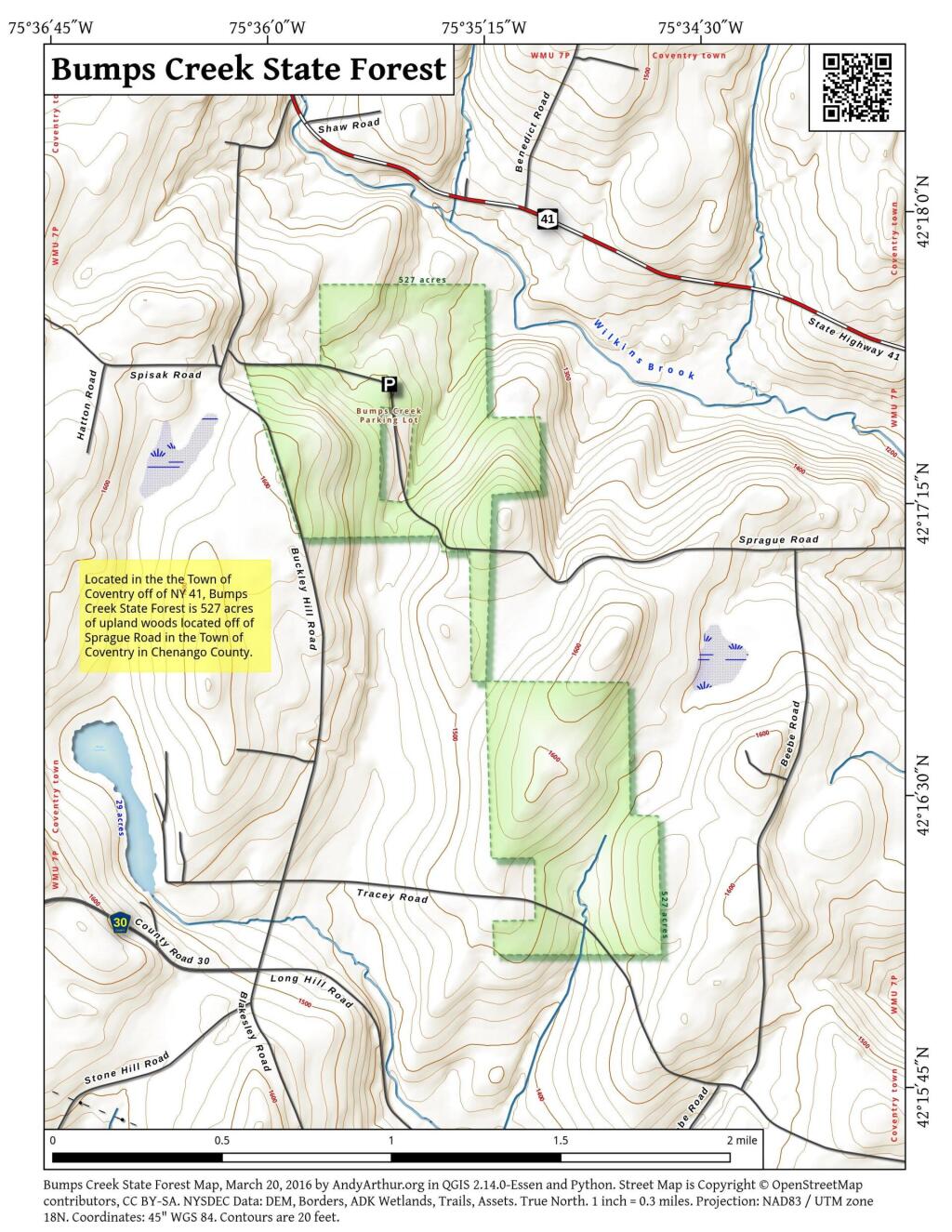
Bumps Creek State Forest, also known as Chenango Reforestation Area #33, is a 528 acre State Forest located in the Town of Coventry, Chenango County. This State Forest is dominated by planted forests of largely Red Pine, but also includes Larch, Jack Pine, White Pine, and Norway Spruce. These forest cover types comprise about seventy percent of the forest area and were largely planted by Civil Conservation Corps in the 1930's. Natural forest stands which consist mainly of Red Maple, Red Oak, American Beech, Black Cherry, White Ash, Sugar Maple, and Eastern Hemlock cover the rest of the area.
http://www.dec.ny.gov/lands/8234.html
... photos, maps and other content from from Chenango County.