Red Falls
Hamlet outside of Prattville in the Northern Catskills. As the tax map overlay shows, these lands are city owned.
Hamlet outside of Prattville in the Northern Catskills. As the tax map overlay shows, these lands are city owned.
A look at changes at the state office campus over the past 25 years.
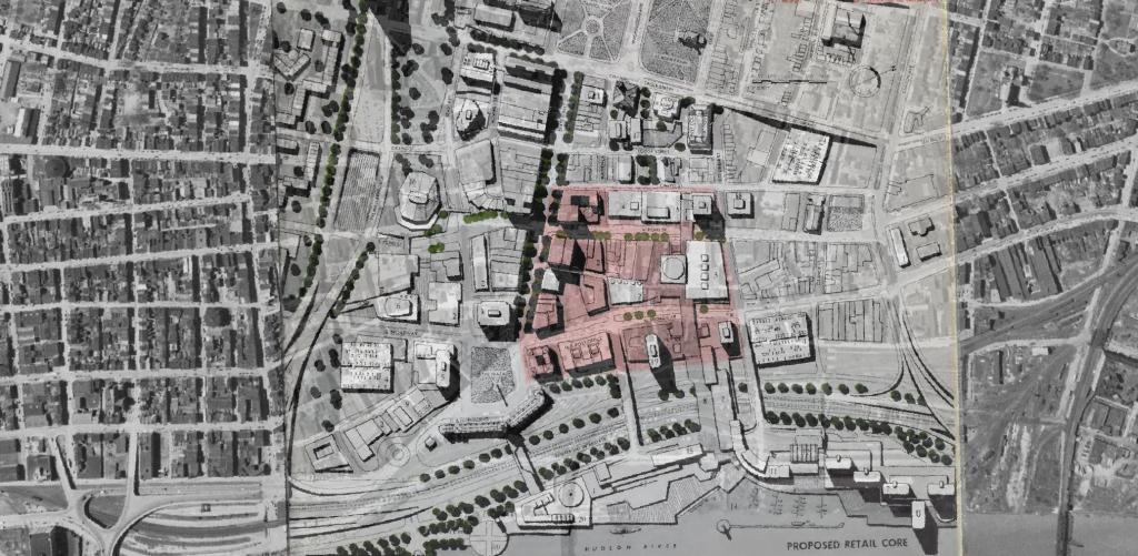
I was experimenting with QGIS and old maps from the 1963 Plan for the Capital City and overlaid the proposed development plan over an aerial photo of the city from 1952. While overall this plan didn't come to fruition, many elements did and can be seen in the contemporary downtown.
This map shows highly detailed contours for the East Barrens of the Albany Pine Bush.
Data Source: NYS GIS Program Office. NYS LIDAR Coverage. http://gis.ny.gov/elevation/lidar-coverage.htm