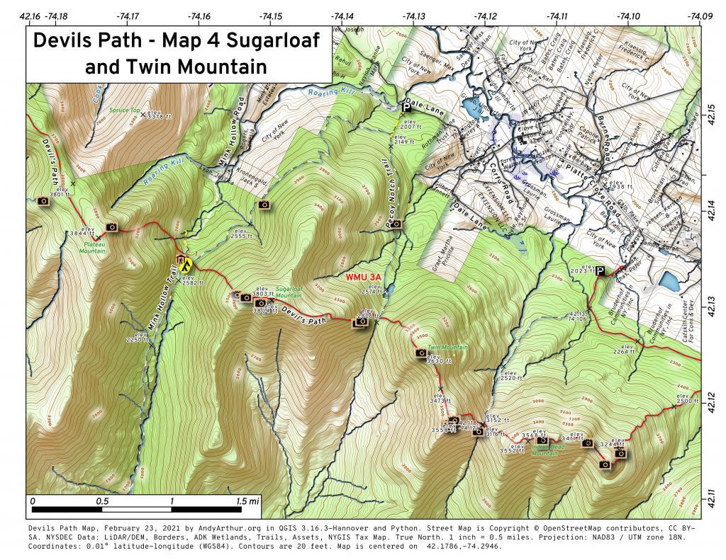
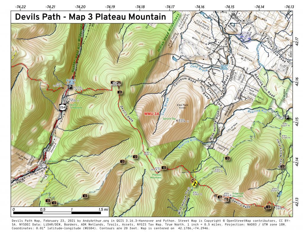
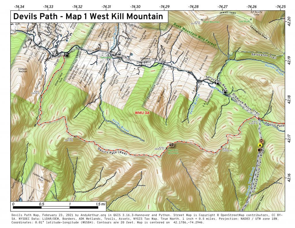
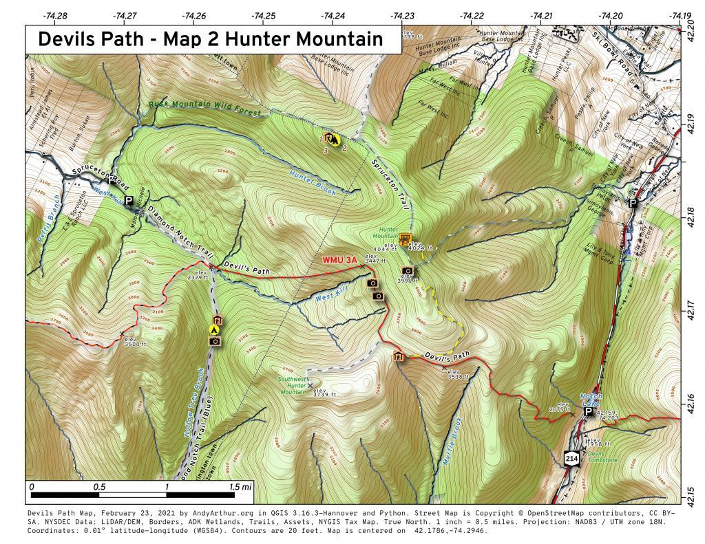
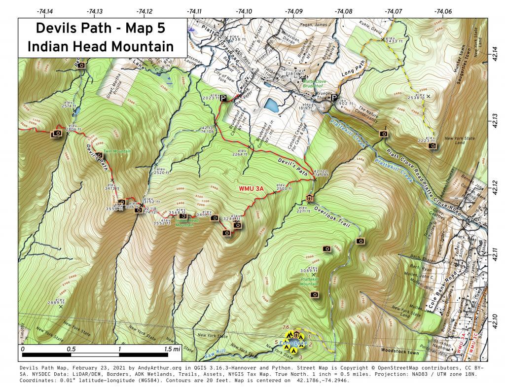
Devil’s Path
The Devil's Path is a challenging hiking trail located in the Catskill Mountains of New York State, renowned for its rugged terrain and demanding ascents and descents. Spanning approximately 25 miles in length, the Devil's Path traverses six major peaks within the Catskills, including Indian Head, Twin, Sugarloaf, Plateau, West Kill, and Hunter Mountains. This trail is notorious among hikers for its steep and rocky sections, as well as its significant elevation gains and losses. The Devil's Path offers stunning panoramic views of the surrounding wilderness.
The trail is divided into two main sections: the eastern and western halves, with each presenting its own set of challenges and scenic vistas. Hiking the entire Devil's Path is considered a formidable accomplishment and is often completed over the course of two or three days by experienced backpackers and outdoor enthusiasts.