Berne Beers Map
An overlay of the Beers Map for Berne over a contemporary aerial photo.

An overlay of the Beers Map for Berne over a contemporary aerial photo.

That tower is kind of a blight next to the ruins of the Catskill Mountain House, but I guess people in the Catskills enjoy getting radio reception.
Taken on Sunday April 5, 2009 at Overlook Mountain.
A very quiet Empire State Plaza during the Coronavirus crisis, heading onto Interstate 787.
While many of grade crossings had been removed at that point, the highway including bridges were only two lanes as the wound through the Tioga State Forest. South of Mansfield, the highway was at grade.
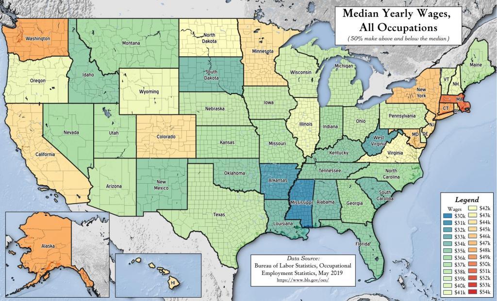
Lately I've been quite interested in difference in cost of living and wages in different places, in part for expanding my knowledge for future possibilities of places to live. This shows the median wage in each state, calculated by the Occupation Employment Survey by state. Certainly not the only way to calculate such things.