It’s kind of interesting how local people I have talked into in Maryland and Virginia – especially women – have Southern accents. In West Virginia, at least in the northern part, don’t have much of an accent or if they do its mostly a rural Midwestern accent as is common in much of Rural Upstate NY, especially the western part of the state.
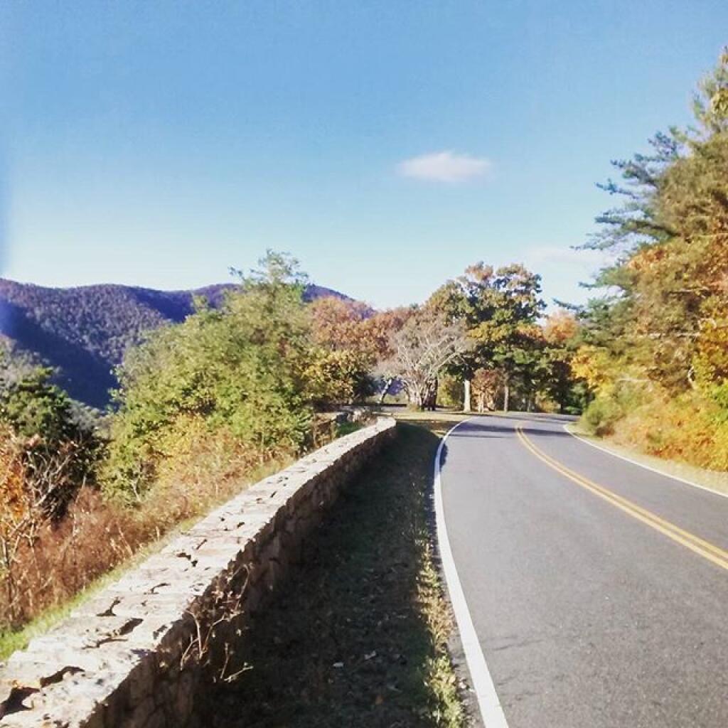
Walking along the drive
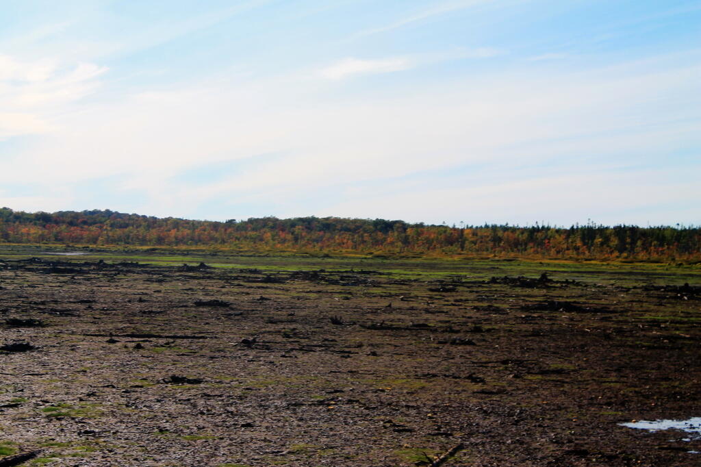
Keyser Ridge Overlook
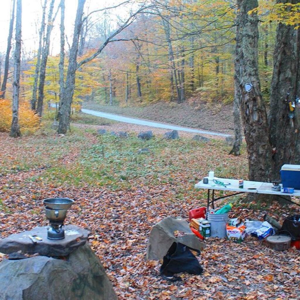
Camping along the Gandy River
October 12, 2015 update
Monday, Columbus Day was my first full day in West Virginia. It was a beautiful day with deep blue skies throughout the day and pretty good colors, at least at the middle elevations. The valleys were still somewhat green and by the time I got up to Dolly Sods, it was well past peak – but still amazingly beautiful. Still no cellphone service, so all of the blog posts from my trip will be posted late. Made a good breakfast of scrambled eggs with Shantung (?) mushrooms that I bought on Saturday afternoon at the farm stand in Coudersport, PA. They were delicious. Sat back and enjoyed the beautiful morning up on the big open campsite at had on Forest Road 13.
I liked the campsite so much, I seriously thought about camping back up there again – although it was a bit far north from my tentatively planned route. I woke up early but didn’t really rush around. I probably should have stayed later in the bed, but I’ve gotten into the habit lately of getting up early. Which is not a good thing because at the same time I’ve been getting up early, I’ve been staying up late. So by evening I’ve been tired. But not having to travel a lot of miles today, I figured to take it easy.
West Virginia Roads are crazy. They are all so narrow, so steep, and so twisty. When people say roads in West Virginia wind and wind, it’s true. But it’s the with of the roads, the lack of guard rails, the speed of other local drivers, that make driving around here kind of hair raising. Most of the secondary roads are little more then a lane wide, and when two vehicles have to pass, they have to virtually come to a stop.
This one road I was on, Virginia Route 32/2 in Lanesville, was a crazy 13-15 feet wide road (about the size of a typical interstate lane), except with two lane traffic sharing that one lane. Virigina 32/4 road was so narrow – that while it had a guard rail – the guard rail was hanging off the edge of the cliff. Lot of traffic too. Both cars had to basically stop to pass each time. I don’t think I have ever driven so many miles with my truck locked into first gear, or smelled my brakes burning a couple of times. After getting down one mountain pass, I felt like a could cook a turkey by placing it next to my wheel well. I tried not to ride the brakes, but I had to control my speed on these steep, twisty, narrow decent. Roads labeled Main_Route/SubRoute are scariest to drive in West Virigina by far. If you want white knuckle driving in West Virginia look for a route labeled like West Virigina 32/4.
Driving up to Dolly Sods is another crazy climb. Again, your 15 feet wide typical West Virginia Road, with no guard rail and steep descent off the side. At least the Dolly Sods road is relatively straight, with some long mile long climbs, where you go up 1,000 feet every mile or so. Dolly Sods is about 3,000 or so feet above the valley, so three miles of craziness. Fortunately, not a lot of people coming in the opposite direction. Still, I was happy enough to drive off the mountain later in the afternoon, again in low gear, then eventually down-shifting into 4×4 low, because I didn’t want to overheat the brakes. Maybe my fear of destroying the brakes on these hills is not rational – the brakes just passed inspection and aren’t making any unusual noises or have any problems that I know of – but brakes are something that scare me a lot on cars.
Brakes are designed to turn forward motion into heat to slow the vehicle. They are designed to have a lot of stopping power in their lifetimes, and modern brakes don’t fade severely until they get very, very hot. I’ve had too many brake problems on old junky cars and trucks, so using the brakes extensively puts a lot of fear in me. And I’ve watched too many Wiley Coyote and Road-Runner shows as a kid, and movies where cars drive off the shoulder, and roll dozens of times, not to be found deep in the hollow for month later. Or as usually happens in movies in California, a big truck rear-ends you, pushing you off the side of the hill, leaving you for death. I think that happened in the movie the China syndrome. Fortunately, I did not any roadrunners along the way, nor any coyotes. I did have a deer run out in front of me on one of those insane decent, but I applied the brakes firmly and aimed the wheels away from the edge of the cliff of death. Plus crazy locals racing past in opposite directions, because the traveled lane in West Virigina primarily exists for one vehicle going in one direction, and the other vehicle takes half of the shoulder where it exists. Even in the valleys, on major arterials, most roads are like 10 feet wide with a gravel shoulder that often ends for narrow culverts or other inconveniences that the DOT couldn’t be bothered to re-engineer for safety. Probably the widest, most modern arterials I’ve been on West Virginia – like parts of US 219 and WV 32 have no more then two 11 feet lanes and a foot shoulder. Certainly not the modern NYSDOT standard of 13-14 foot lanes and 8 foot shoulder.
Freaking insane driving down here.
Despite the awful drive, Dolly Sods is stunningly beautiful. That’s the only way you can describe it. In the autumn the vast, lush fields of blueberries mixed with occasional deciduous trees and surrounding mountains is nothing short of stunning. I hope the pictures I took today came out, because it was a stunning place, from the narrow dirt road to the beauty in all directions.
Looking down off Dolly Sands, you could see the various Blue Ridges, with some color still on them. Their is a campground on top of Dolly Sands and some roadside campsites about a 1 mile below Dolly Sods, but I didn’t want to spend the night up there, with potentially bad weather coming with a front coming through. Those roads are insane enough without them being muddy. Ankle hurt a little bit after stepping funny up there. I have my ankle brace I may put on tomorrow before hiking.
After I made it down from Dolly Sods, the drive on WV 55/4 wasn’t that bad. It was blacktop and had two lanes of at least 10 feet wide. Some crazy curbs and decents, and no place to pull off, but at least I wasn’t sharing a lane. WV 55/4 even had guard rails when it climbed down a mountain. And WV 55 running through the valley actually had nice big lanes and you could go in the straightaways 55 miles per hour. Of course, there was heavy truck traffic on it, and people weren’t happy that I was going cautiously around the curbs and only speeding up to 55 on the straightaways.
Eventually I found a place I could pull off and let traffic go by. Drove down to Seneca Rocks Visitor Center, hoping to find a payphone to call my folks to let them I doing okay, despite the white knuckle driving and no cell service up here, anywheres that I’ve been in West Virigina or Western Maryland. The Seneca Rocks Visitor Center is only open Wednesday through Saturday after September, so it was all closed up. Seneca Rocks was stunning. No payphone to be found here, but then I found a payphone at a general store that looked like a store out of Deliverance or maybe the Easy Rider.
I should have gone in and bought some milk that couldn’t have been that old but I was cheesed off about a call being $1, so I decided to hold off on calling my parents. I would have been fascinated to hear the accents – would they be strong, would they be Mid-western or Southern Applachian sounding? They’ll be startled enough to get a call from me, rather then just seeing a Facebook update. Seneca Rocks is a stunning view, especially right now with color peaking around it. I almost want to hike up Seneca Rocks and look down from it, but I don’t know if I will be back up that way or if my ankle will tolerate it.
I decided in the evening to head over to Gandy River dispersed campsites as shown on the map. I decided to take Forest Route 7 over from WV Route 55. Forest Route 7 was a nice drive, actually fairly wide, following an old creek, until the valley got narrower and the road got steeper and started to drop down to 15 feet or less, with a steep embankment. But I made it up there.
Then to get to Gandy, I had to take WV 33/2, which much like it’s name suggested it was about 13-15 foot wide for both directions with a steep drop off and no guard rail. I think it only dropped 1,500 feet in a mile or so heading into Gandy. I didn’t realize I was in Gandy or the road to the campsites and ended up going north for 5 miles until I found a place to safely pull off of WV 33 and study the map.
When I realized from the map that the road to campsites was relatively flat, I figured I would turn around and drive 5 miles back south and eventually to the campsites. I don’t mind driving in the valleys – the roads tend to be somewhat wider and less scary there, even if they still have crazy curves that you have to watch out. The campsite I got on Gandy River looked pretty nice but once I started to set up the trees didn’t really work for a tarp, so I decided against setting up a tarp.
Rain is expected later tonight, but not until late, so I don’t really need the tarp. I’ll just make sure anything that could be damaged by getting wet is put away. And make sure to retire to bed before it the rain comes. Right now, it’s just starry out so the front must be a ways away. It’s supposed to be a quick clipper with a burst of rain over night with clearing out by afternoon.
Tomorrow morning ain’t supposed to be nice, but a good chance to catch up on sleep. The campsite is not totally out of ear shot of another campsite a ¼ mile down the road, so I’ve had to keep the music down. I like West Virginia just not the driving. The scenery is outstanding. But I’ve had an enough with the white knuckle driving. I need supplies and food, so I need to get to a city with a grocery store, if at all possible.
I’m seriously thinking of heading east tomorrow and if it’s decent getting out on the Blue Ridge Parkway. The Blue Ridge Parkway is no expressway but it’s at least two lanes wide and probably not nearly as steep or narrow as so many of the roads in West Virginia. The state of Virigina is much wealthier then West Virginia, so I suspect their roads are much wider and less scary to drive, even if some of them climb right up mountains. I was planning on spending one more day in West Virigina, but if the weather is decent, I could really get into checking out the Parkway – possibly heading farther south then expected.
Thursday and Friday, heading north to Shenandoah National Park to do Skyline Drive. That said, I’m still kind of disappointed that West Virginia isn’t as wild or backwards as I expected. Honestly, at least the part of West Virginia I’ve been in is no different then most of rural Upstate NY. If anything, the houses are somewhat nicer down here. Probably money goes farther down here, and people can afford nicer cars and yards.
There are some shacks, but nothing like what you see in Western NY and other chronically depressed parts of New York. Maybe I’m just not in the right part of West Virginia, despite this portion of the state not having much in the way of gas stations, stores, or businesses. I think a lot of the houses in this part of West Virginia are second homes, and it’s more tourists from Virginia then real Appalachia.
Maybe I need to go farther south in the National Forest to see real Appalachia. I think I’ve seen far more rural poverty in parts of Pennsylvania then down here.
Columbus Day 2015 morning
Good Morning! As I now have cellphone service, here is a brief update from Sunday. More updates latef.
As soon as I got into Maryland then West Virgina I lost cellphone service. I am surprised, as except for the Adirondacks and a few valleys in Western NY or the Catskills, I usually have good cell service. The same thing is true with the Northern Tier of Pennsylvania, and heck I had good service most of the way down through Pennsylvania on US 219 until I entered Maryland. Then there was no service in Maryland and West Virgina, anywhere I went along US 219 and down through WV Route 32. This is why I haven’t posted a update since yesterday morning.
Saturday night was a pleasant night up on Loleta Grade Road at the Allegheny National Forest. I had previously camped on Loleta Grade Road, but never took the part of Loleta Grade beyond where it leaves the East Branch of the Millstone Creek. Loleta Grade Road (FR 133) gets a lot narrower and somewhat narrower past the Millstone Creek and passes several marshlands and has a handful of campsites on it. It turns out the portion of Loleta Grade Road by East Millstone Creek is closed for reconstruction. They have a done such a nice job at building and improving roadside campsites throughout the Allegheny National Forest, while adding earthen barriers or rock barriers to protect forest resources from people driving past the campsites. Each campsite has a natural stone fire ring and many of them hardened with gravel. Loleta Grade was pretty with the fall colors. I took several pictures and will be uploading them as Internet or cellphone data service becomes available. The sun didn’t rise above the horizon of the forest until well after 8 AM this morning, although first light came a little before 7 AM. The campsite I was at was Forest Road 777, which I knew was a sign of good luck for the day.
Drove Along PA 3002 along the Clarion River to Ridgeway. That’s another part of the Allegheny National Forest I had never explored before. The Clarion River was pretty with the leaves turning, and looks like a lot of fun to paddle at least downstream. It has a good current but is deep and flat enough that it’s not white water by any means. I stopped along one of the State Game Lands where a creek – which I don’t know the name of – cross through a hollow in peak colors. It was beautiful. Eventually I made it to Ridgeway, and much like you would expect from that town, the approach into the city was a steep drive down. Ridgeway stunk of the hydrogen sulfide from paper manufacturing.
Then it was down US 219 all the way down to West Virigina. It’s a beautiful drive, but oh my gosh, does US 219 wind and have some steep descents and climbs. It also hits a lot of hick towns – some quite pretty and others dying coal mining towns – that are mostly sustained these days by government services and healthcare. Some nice farm lands and great sweeping vistas along the way, but not a lot of places to pull over and take pictures. To make matters worst I drank a lot of coffee this morning, and after a piss break at McDonalds bought more coffee and spent have the afternoon looking for places to take piss breaks. US 219 certainly winds a lot. The locals were blowing past me whenever they could pass me or whenever I would pull over. I don’t consider myself to be a slow driver, but with those narrow lanes and windy roads, I certainly had to hold back my speed a bit especially with my big lifted truck.
US 219 becomes an expressway after Clariton and the first ten miles of it is spectacularly beautiful. It reminds me a lot of the Taconic Parkway, only more modern and wider but with many of the same sweeping views of farm country and color packed hills. Some of the steepest hills I’ve ever driven on an expressway. Eventually the terrain becomes more rolling, with some larger farms. I ended up getting off a few different exits looking for a place to piss, and then got back on not finding one. I didn’t stop for a badly needed piss break until I reached a fast-food place just over the line in Maryland, where US 219 joins I-69 for a brief concurrency. The clerk at Burger King in Maryland there had a strong Southern Accent, but strangely enough when I got into West Virgina, the clerk at the gas station sounded modestly Appalachian but without much of a noticeable accent – even less then the Midwestern/Appalachian accent what I heard in Northern Pennsylvania. Being that I was in a hurry to get to West Virgina to figure out where I would camp and realizing that the Flight 92 memorial was 9 miles from US 219, I decided against visiting the memorial. It’s possible it was closed on Sunday. I got off US 219 at this one exit and drove through this large, old coal mining town with narrow roads and houses on the edge of a cliff, facing a mountain whose top had been blown off years ago to produce bituminous coal. At the bottom of the mountain was a vast tank that was being used to collect and treat acid mining discharge. Kind of sad to be driving past a place that time in many ways had left behind with nothing but a toxic legacy. Pennsylvania has a lot of old, small towns that were heavily built up during the industrializing era of America but seem to have little purpose today besides cheap housing and traditional communities.
South of the Pennsylvania Turnpike US 219 suddenly becomes a two lane road. You have to exit the expressway and then drive on another pokey local part of US 219 then you get diverted on a completed section of US 219. It’s obvious from the construction that Pennsylvania plans to continue the US 219 expressway all the way to Maryland border – a project that is requiring the blasting away of whole mountains and building massive bridges through the steep terrain of the Laurel Highlands. After driving a few miles on the congested highway, you get back on the expressway for a few miles before it drops back down two lanes, and your in Maryland.
It’s pretty wild driving I-69 in Maryland with it’s steep hills and the 70 MPH speed limit. At times I was pushing Big Red almost to the floor climbing over the mountains at the speed. I-69 is very twisty and steep. By interstate standards it seems to be sub-prime in design, but that may have to do more with the steep Appalachian terrain then the engineering that had to blast a 70 MPH expressway through. Heading west on I-69 traffic was fairly light. Stopped at a nice overlook on US 219 just after getting off of I-69.
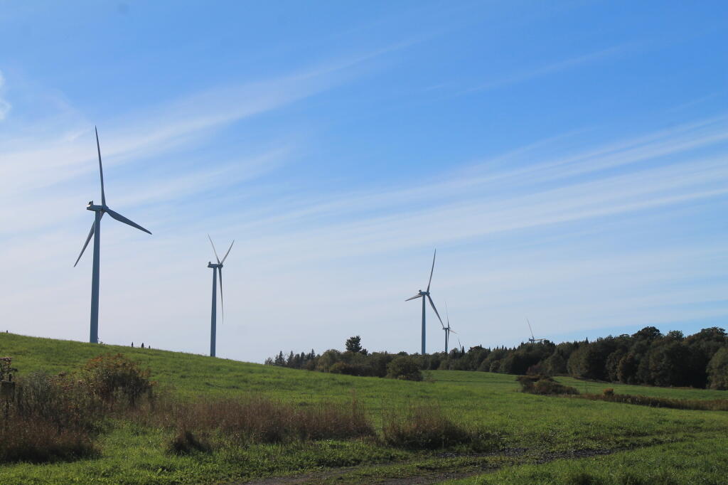
I don’t have much good to say about Garnet County, Maryland or the state of Maryland more generally. US 219 crosses more of Western Maryland then most other roads, cutting through the widest portion of Maryland between Pennsylvania and West Virgina. A lot of farms in this part of the state, perched up on hills. Evidence of coal mining was all over, and honestly the terrain didn’t differ that much from the Laurel Highlands of Pennsylvania. Farther south of I-69, past a town named Accident, the terrain became more rolling and you could see to the east the Blue Ridge Mountains. A lot of wind turbines on the mountains. Unlike Pennsylvania, no burn barrels in Maryland. Apparently they don’t like the smell of burnt plastic as much as Pennsyltuckians. A lot of traffic on US 219 near Silver Lake in Maryland and the city of Oakland was pokey. People must come from Baltimore to vacation in Western Marlyand. But then it opened up to farm country, and I was in West Virgina without warning except for a brief county sign and a very stern sounding sign warning against littering – a $25,000 fine, lost of license, and jail for littering. Didn’t stop people from leaving litter on the road though as seen driving down US 219.
Maryland is probably a state best known for Spiro Agnew, our country’s only Grecian Vice President. Too bad he had to resign as Nixon’s Vice President for graft as Governor of Maryland and failing to pay on taxes on that graft. Also Martin O’Mallary, the former Democratic Governor best known for his unpopular gun control laws. Of course the whole time driving through the commonwealth, I drove carefully with an eye for cops, because I vaguely remember that Maryland is a state where they are really strict about their fender law, and are known to ticket people driving jacked up pickup trucks with tires sticking out past the fenders, as is the case with my truck. Lot of people have lifted trucks in Western Maryland, but that may be a southern thing too. People in Western Maryland may be relatively wealthy, with money from Baltimore and Washington suburbs to pay for their jacked up truck addiction. Most had fenders but not all did. I am also not an expert on Maryland gun laws, but I figured I was probably okay just driving through the state with a cased, locked, and unloaded shotgun and 22 in back of my truck. I made it through the state, and took a deep breath once I realized I was in West Virigina. I have nothing good to say about Maryland, the state that is dominated by shitty Baltimore and Washington suburbs, with a neck following the Potomac River quite a ways out west. On the way back I will probably take US 220 through Maryland, which cuts through a lot narrower section of Western Maryland just to cover my fears of that god awful state that sticks between a lot of Pennsylvania and Virgina and West Virgina.
US 219 returns to being steep, windy, and narrow as you head into West Virigina and start climbing through the Blue Ridge Mountains. Actually, it gets narrow with sharp turns in Maryland before you quietly cross – almost unannounced in West Virgina. The road is incredibly narrow, curvey, and steep climbing through the mountains. You think you’d never make it there, and eventually your in Thomas, WV. It seems like Thomas was a really hoping touristy place this Columbus Day Weekend, but as far as I could tell it lacked most of the chain stores. They probably are in a more populated place. Just down the road is Davis, WV. Davis has a bit more of a main street, it reminds me a lot of Lake Placid minus of course the Olympic tracks. Bought gas in Davis, one of those stations you have to go inside. I was hoping to hear the clerk’s strong West Virgina accent, but she didn’t have much of one. One of the older people in the store certainly had a classic West Virgina/Southern accent though. From there I took West Virgina 32 to the first major forest road I saw on map – FR 13 which runs along the top of Canaan Mountain. It was farthest north forest road of significance along the way, so I figured it was worth a try.
Forest Road 13, besides the unlucky number is astoundingly beautiful with marshlands and the kind of marshy forest you would associate with Dolly Sods Wilderness to the east of this area. Not a lot of maples of deciduous trees up on the top of the Canaan Mountain, but as you head down Forest Road 13, it descends into a deep hollow, following along a creek. Lots of colors from the hardwoods in this valley. This portion of Forest Road 13 is a bit scary to drive, because it’s only one lane wide, and difficult if not impossible in many portion for two cars to pass. Get too far off the road, and you could roll your truck, and assuming you don’t hit a tree, fall 100 feet or more into the hollow. A good gravel road, but so narrow once you down by the stream.
Put the truck in 4×4 low on the way back up the hill in case I had to crawl past a car on the way back up. Fortunately, I did not. Of course, when I got to camp I wanted to take the truck out of 4×4 low. Almost had a heart attack when I couldn’t get the transfer case to switch back to high. I forgot to go from 4×4 low to 4×4 high (and two-wheel drive), you have to have the truck in neutral when you hit the lever, otherwise nothing happens. I thought I was going to get stuck only being able to crawl somewheres, and have to find out what kind of services I could get by flagging down some random person. Literally had to get out the manual to find the answer – I knew there was a procedure, and they recommended you have the truck rolling when you switched – but forgot you had to be in neutral before shifting the case.
A few miles up Forest Road 13 from where I was camping was a big military encampment – there are like 50 brown Silverado pickups with brushguards parked up there. I thought it was Forest Service personal trucks – a big group for sure – but the rear plates said US Army. The guys I saw appeared to be military too. I don’t know if it’s military training or maybe it’s one of the groups that comes up here searching for old unexploded bombs that are occassionally found in the forest (the US Army used this area for war games and testing bombs during World War II). They are tent camping. I guess this must be part of wilderness training of some sort. Not something you would think you would find in the forest for sure.
On the way down into the valley, I spotted two campsites that were definite possibility for camping. I ended up camping for the night at one of the campsites, under starry skies. I don’t think the stars are quite as good here as the southern Allegheny National Forest, because we get some light pollution from the Washington DC metro area out here, but still much better then most of Upstate NY. A fairly big open campsite, but that was fine as I had extension cords to reach the lights where they needed to be on the trees. Reheated pork roast from a previous trip on the grill then started a fire. It was delicous and a nice evening. The sunset here is similar to that of the Allegheny National Forest – while I am 250 miles farther south, on the whole I’m jut as far west. Before dusk, somebody from Virgina stopped by to ask for directions to an overlook. I was shocked somebody would ask me, a New Yorker for directions. I guess like I must look like I’m from West Virgina with my big jacked up truck.
Sorry this is a long post, but it was a long day with a lot of adventures and stories to tell. I’m sure I will have more for tomorrow. At least I don’t have to drive any long distances tomorrow, as that US 219 got tiring with all the winding narrow road. I won’t be taking US 219 back north to Pennsylvania. It’s one of these roads you want to take once to see what the countryside is like, then avoid it because it’s so pokey, narrow, twisty, and steep. I probably will take US 220 up to I-99 and then overnight next Saturday night in Wellsboro in Grand Canyon Country, assuming the weather is good. I guess I could drive all the way back in Albany via I-81 / I-88 but that’s a hell of a trip in one day. I want to stay over somewheres in Pennsylvania on the way back, and I’d prefer to avoid the cities that I-81 runs through (Harrisburg, Scranton, among others).
Yesterday